$3,700 / Month
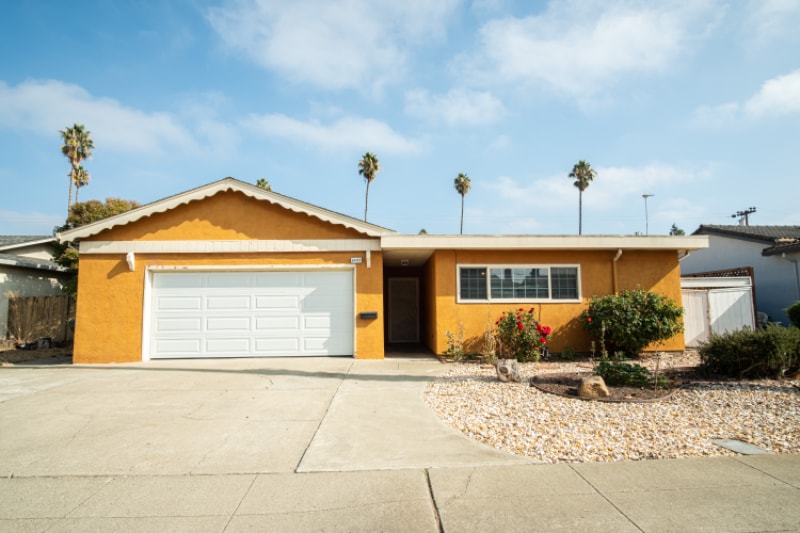
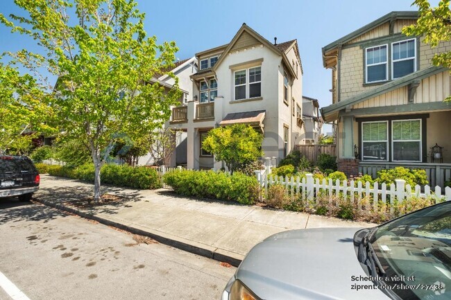
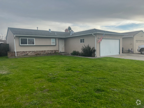
39466 Blue Fin Way
Fremont, CA 94538
2 Weeks Ago
Favorites
39466 Blue Fin Way

Favorites
Check Back Soon for Upcoming Availability
| Beds | Baths | Average SF |
|---|---|---|
| 4 Bedrooms 4 Bedrooms 4 Br | 3 Baths 3 Baths 3 Ba | 1,772 SF |
Fees and Policies
The fees below are based on community-supplied data and may exclude additional fees and utilities.
- Dogs Allowed
-
Fees not specified
-
Weight limit--
-
Pet Limit--
- Parking
-
Garage--
About This Property
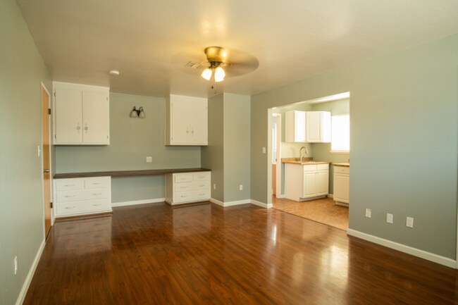
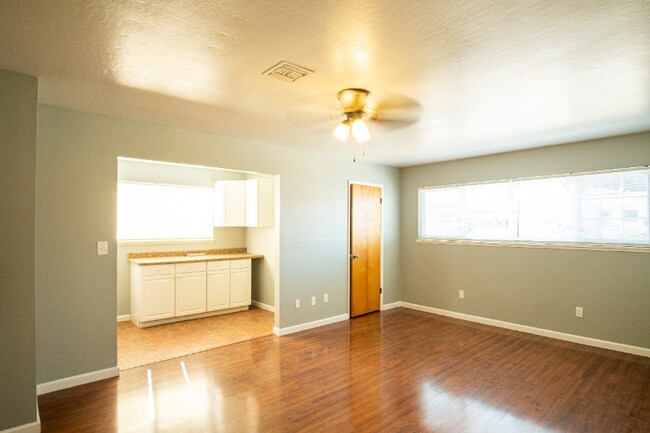
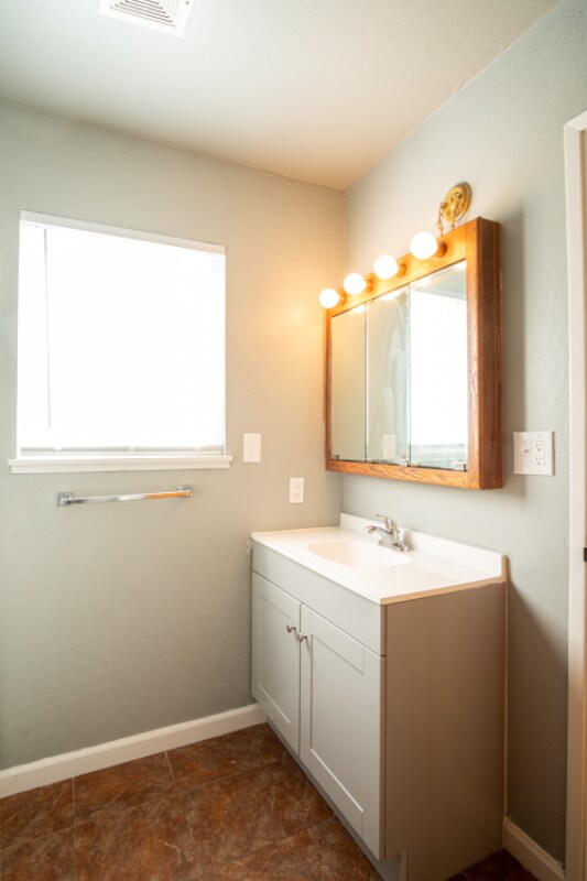
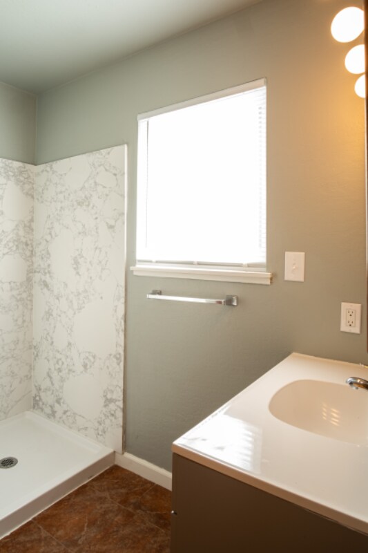
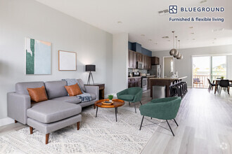
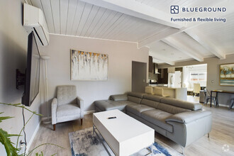
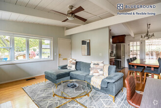
Property Id: 1017574 For rent is a spacious remodeled 4-bedroom, 3-bath home with dual paned windows and new laminate flooring throughout. Central heat and A/C. This home comes with 2 primary suites. One of the primary suites consists of a walk-in closet and a study area with cabinets for storage. Located in a quiet neighborhood and within 2 miles of Irvington Highschool. Easy access to Highway 84, Highway 880, and Fremont Bart. This home is close distances to Walmart, Target, Whole Foods, Bart Station, Costco, and more. Schedule a tour today!
39466 Blue Fin Way is a house located in Alameda County and the 94538 ZIP Code. This area is served by the Fremont Unified attendance zone.
House Features
Dishwasher
Hardwood Floors
Refrigerator
Disposal
- Fireplace
- Dishwasher
- Disposal
- Refrigerator
- Hardwood Floors
- Tile Floors
Location
Get Directions
Fremont is a charming city in the San Francisco Bay Area that sits across the Bay from the Silicon Valley. It is known as an ideal destination for families, offering kid-friendly attractions and excellent public schools like the Children’s Natural History Museum and Washington High School. The rapid expansion of the tech industry in recent years has boosted Fremont’s reputation as a commuter-friendly city for those working in the Silicon Valley. Fremont is located directly north of San Jose, and Palo Alto is a short drive across the Dumbarton Bridge on the Bay.
Fremont’s local culture incorporates the area’s rich history and thriving arts scene. Check out the Old Town Niles region that features a popular art walk, antique fair, and a museum celebrating the town’s role in the early days of motion picture production. Exquisite historic architecture is on display around the city, so be sure to explore Fremont’s picturesque streets that blend urban amenities and suburban neighborhoods.
Learn more about living in FremontBelow are rent ranges for similar nearby apartments
Amenities
- Fireplace
- Dishwasher
- Disposal
- Refrigerator
- Hardwood Floors
- Tile Floors
Education
| Colleges & Universities | Distance | ||
|---|---|---|---|
| Colleges & Universities | Distance | ||
| Drive: | 5 min | 2.1 mi | |
| Drive: | 13 min | 6.2 mi | |
| Drive: | 19 min | 12.5 mi | |
| Drive: | 19 min | 12.9 mi |
39466 Blue Fin Way is within 5 minutes or 2.1 miles from Ohlone College, Newark. It is also near Ohlone College, Fremont Campus and Palmer College of Chiropractic West Campus.
Schools


Public Elementary School
Grades K-5
343 Students
Nearby
Public Elementary School
Grades 1-5
336 Students
Attendance Zone
Public Middle School
Grades 6-8
1,071 Students
Attendance Zone
Public High School
Grades 9-12
1,347 Students
Attendance Zone
Private Elementary & Middle School
Grades K-8
411 Students
Nearby
Private Elementary School
Grades PK-K
Nearby
Private Middle & High School
Grades 7-12
27 Students
Nearby
School data provided by
 The GreatSchools Rating helps parents compare schools within a state based on a variety of school quality indicators and provides a helpful picture of how effectively each school serves all of its students. Ratings are on a scale of 1 (below average) to 10 (above average) and can include test scores, college readiness, academic progress, advanced courses, equity, discipline and attendance data. We also advise parents to visit schools, consider other information on school performance and programs, and consider family needs as part of the school selection process.
View GreatSchools Rating Methodology
View GreatSchools Rating Methodology
Transportation options available in Fremont include Fremont Station, located 2.7 miles from 39466 Blue Fin Way. 39466 Blue Fin Way is near Norman Y Mineta San Jose International, located 16.5 miles or 23 minutes away, and Metro Oakland International, located 20.8 miles or 28 minutes away.
| Transit / Subway | Distance | ||
|---|---|---|---|
| Transit / Subway | Distance | ||
|
|
Drive: | 7 min | 2.7 mi |
|
|
Drive: | 10 min | 4.6 mi |
|
|
Drive: | 12 min | 6.4 mi |
|
|
Drive: | 16 min | 10.8 mi |
|
|
Drive: | 22 min | 15.8 mi |
| Commuter Rail | Distance | ||
|---|---|---|---|
| Commuter Rail | Distance | ||
| Drive: | 7 min | 3.0 mi | |
| Drive: | 20 min | 14.1 mi | |
| Drive: | 25 min | 17.8 mi | |
| Drive: | 27 min | 19.2 mi | |
| Drive: | 29 min | 19.6 mi |
| Airports | Distance | ||
|---|---|---|---|
| Airports | Distance | ||
|
Norman Y Mineta San Jose International
|
Drive: | 23 min | 16.5 mi |
|
Metro Oakland International
|
Drive: | 28 min | 20.8 mi |
Time and distance from 39466 Blue Fin Way.
| Shopping Centers | Distance | ||
|---|---|---|---|
| Shopping Centers | Distance | ||
| Walk: | 12 min | 0.7 mi | |
| Walk: | 15 min | 0.8 mi | |
| Drive: | 5 min | 1.7 mi |
39466 Blue Fin Way has 3 shopping centers within 1.7 miles, which is about a 5-minute walk. The miles and minutes will be for the farthest away property.
| Parks and Recreation | Distance | ||
|---|---|---|---|
| Parks and Recreation | Distance | ||
|
Central Park (Lake Elizabeth)
|
Drive: | 8 min | 3.4 mi |
|
Quarry Lakes Regional Recreation Area
|
Drive: | 9 min | 4.6 mi |
|
Niles Canyon Railway
|
Drive: | 10 min | 4.8 mi |
|
Alameda Creek Regional Trail
|
Drive: | 9 min | 4.9 mi |
|
Niles Community Park
|
Drive: | 12 min | 5.3 mi |
39466 Blue Fin Way has 5 parks within 5.3 miles, including Central Park (Lake Elizabeth), Quarry Lakes Regional Recreation Area, and Alameda Creek Regional Trail.
| Hospitals | Distance | ||
|---|---|---|---|
| Hospitals | Distance | ||
| Drive: | 6 min | 2.6 mi | |
| Drive: | 6 min | 2.7 mi | |
| Drive: | 14 min | 9.8 mi |
39466 Blue Fin Way has 3 hospitals within 9.8 miles, the nearest is Washington Hospital which is 2.6 miles away and a 6 minute drive.
| Military Bases | Distance | ||
|---|---|---|---|
| Military Bases | Distance | ||
| Drive: | 28 min | 19.3 mi |
39466 Blue Fin Way is 19.3 miles and a 28 minute drive from Ames Research Center.
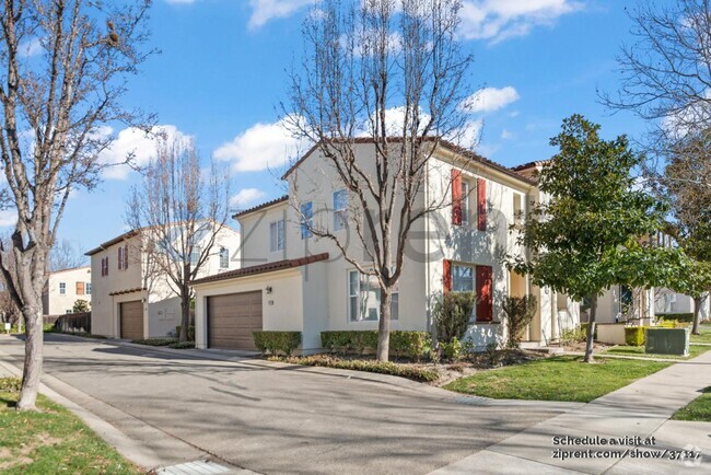
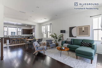
You May Also Like
Similar Rentals Nearby
What Are Walk Score®, Transit Score®, and Bike Score® Ratings?
Walk Score® measures the walkability of any address. Transit Score® measures access to public transit. Bike Score® measures the bikeability of any address.
What is a Sound Score Rating?
A Sound Score Rating aggregates noise caused by vehicle traffic, airplane traffic and local sources

39466 Blue Fin Way
Fremont, CA 94538