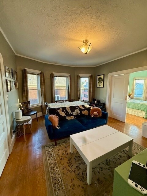
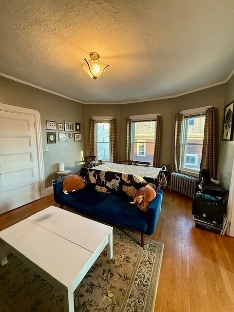
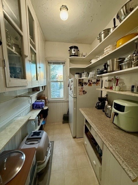
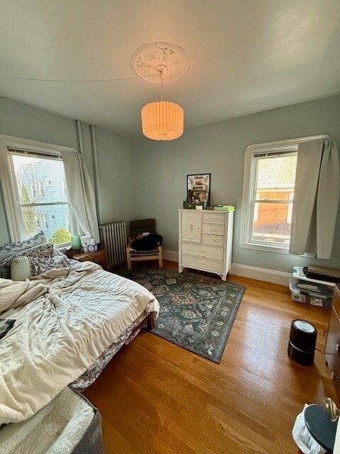
39 Wolcott St
Malden, MA 02148
-
Bedrooms
2
-
Bathrooms
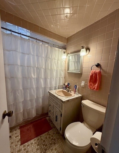
1
-
Square Feet
700 sq ft
-
Available
Available Now

Maplewood is a family-friendly community just one mile east of Downtown Malden and six miles north of Boston. Longstanding homes and upscale apartment communities available for rent line Maplewood’s very walkable streets. The city itself is home to an array of local restaurants and shops, particularly in Maplewood Square, which Maplewood residents have easy access to. Maplewood’s leafy surroundings make it a welcome retreat from city life, and locals enjoy living near sprawling parks like Pine Banks Park, offering wooded walking trails, sporting fields, and a playground. Families, commuters, and renters interested in small-town charm near a big city will appreciate living in Malden’s Maplewood.
Learn more about living in Maplewood| Colleges & Universities | Distance | ||
|---|---|---|---|
| Colleges & Universities | Distance | ||
| Drive: | 8 min | 4.0 mi | |
| Drive: | 9 min | 4.3 mi | |
| Drive: | 12 min | 5.7 mi | |
| Drive: | 12 min | 6.1 mi |


View GreatSchools Rating Methodology
Data provided by GreatSchools.org © 2025. All rights reserved.
Transportation options available in Malden include Malden Center Station, located 0.9 mile from 39 Wolcott St. 39 Wolcott St is near General Edward Lawrence Logan International, located 6.7 miles or 15 minutes away.
| Transit / Subway | Distance | ||
|---|---|---|---|
| Transit / Subway | Distance | ||
|
|
Walk: | 17 min | 0.9 mi |
|
|
Drive: | 3 min | 1.4 mi |
|
|
Drive: | 5 min | 2.5 mi |
| Drive: | 8 min | 3.9 mi | |
| Drive: | 8 min | 4.3 mi |
| Commuter Rail | Distance | ||
|---|---|---|---|
| Commuter Rail | Distance | ||
|
|
Walk: | 17 min | 0.9 mi |
|
|
Drive: | 5 min | 2.3 mi |
|
|
Drive: | 6 min | 2.9 mi |
| Drive: | 8 min | 3.5 mi | |
|
|
Drive: | 7 min | 3.7 mi |
| Airports | Distance | ||
|---|---|---|---|
| Airports | Distance | ||
|
General Edward Lawrence Logan International
|
Drive: | 15 min | 6.7 mi |
Time and distance from 39 Wolcott St.
| Shopping Centers | Distance | ||
|---|---|---|---|
| Shopping Centers | Distance | ||
| Walk: | 8 min | 0.4 mi | |
| Walk: | 12 min | 0.6 mi | |
| Walk: | 15 min | 0.8 mi |
| Parks and Recreation | Distance | ||
|---|---|---|---|
| Parks and Recreation | Distance | ||
|
Friends of Middlesex Fells Reservation
|
Drive: | 5 min | 2.7 mi |
|
Middlesex Fells Reservation
|
Drive: | 6 min | 3.3 mi |
|
Mystic River Reservation
|
Drive: | 7 min | 3.3 mi |
|
Walter D. Stone Memorial Zoo
|
Drive: | 7 min | 3.8 mi |
|
Saugus Ironworks National Historic Site
|
Drive: | 11 min | 5.0 mi |
| Hospitals | Distance | ||
|---|---|---|---|
| Hospitals | Distance | ||
| Drive: | 5 min | 2.9 mi | |
| Drive: | 11 min | 5.9 mi | |
| Drive: | 12 min | 5.9 mi |
| Military Bases | Distance | ||
|---|---|---|---|
| Military Bases | Distance | ||
| Drive: | 26 min | 14.1 mi | |
| Drive: | 27 min | 15.4 mi |
39 Wolcott St Photos
What Are Walk Score®, Transit Score®, and Bike Score® Ratings?
Walk Score® measures the walkability of any address. Transit Score® measures access to public transit. Bike Score® measures the bikeability of any address.
What is a Sound Score Rating?
A Sound Score Rating aggregates noise caused by vehicle traffic, airplane traffic and local sources

39 Wolcott St
Malden, MA 02148