


$1,895
/ Month
3848 Sherman Way
Sacramento, CA 95817
2 Weeks Ago
|
Edit
Favorites
3848 Sherman Way

Favorites
Check Back Soon for Upcoming Availability
| Beds | Baths | Average SF |
|---|---|---|
| 2 Bedrooms 2 Bedrooms 2 Br | 1 Bath 1 Bath 1 Ba | 1,027 SF |
Fees and Policies
The fees below are based on community-supplied data and may exclude additional fees and utilities.
- Parking
-
Garage--
Details
Utilities Included
-
Trash Removal
-
Sewer
About This Property
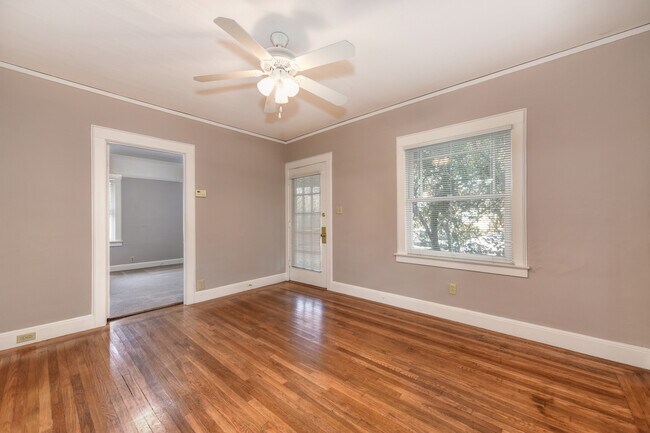
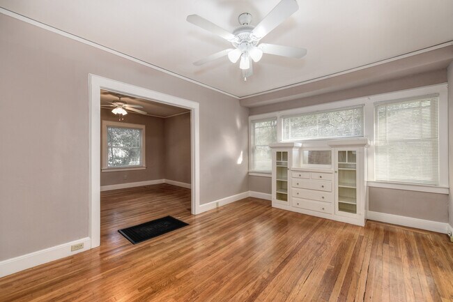
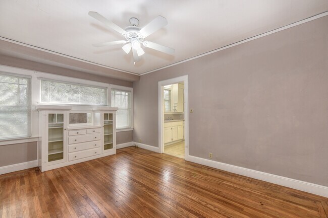
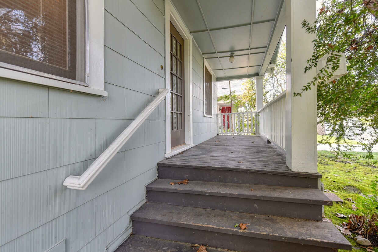
A tranquil bungalow located within walking distance to the UC Med Center. This home features two bedrooms and one bathroom, situated on a private lot in a highly sought after neighborhood. With hardwood floors throughout the main living area and several original built-ins, this home maintains its original vintage charm. One car garage and plenty of parking. ? Home is located less than 1/2 mile from UC Davis Med Center and Shriner's Hospital. Close to Oak Park's thriving Triangle District with many local coffee shops and eateries. If the home is still advertised it is still available. We ask that you view the property before submitting an application. Please see our website for detailed information. Thank you!
3848 Sherman Way is a house located in Sacramento County and the 95817 ZIP Code.
House Features
Washer/Dryer
Dishwasher
Hardwood Floors
Refrigerator
- Washer/Dryer
- Heating
- Smoke Free
- Dishwasher
- Disposal
- Eat-in Kitchen
- Kitchen
- Refrigerator
- Hardwood Floors
- Carpet
- Workshop
- Built-In Bookshelves
- Crown Molding
- Window Coverings
- Yard
- Lawn
Location
Get Directions
As its name implies, Med Center is home to several medical facilities. A Shriners Hospitals for Children, the University of California Davis Medical Center, the University of California Davis School of Medicine, and other medical facilities are in this neighborhood. Along with housing the Sacramento Charter High School, Med Center is convenient to several excellent schools including the Pacific McGeorge School of Law. A popular choice amongst families, graduate students, and medical professionals, Med Center features upscale rental options within or near the neighborhood. There are only a few small cafes in the community, but Midtown and Downtown Sacramento are less than five miles away, giving residents access to a wide variety of shopping, dining, and entertainment options.
Learn more about living in Med CenterBelow are rent ranges for similar nearby apartments
Amenities
- Washer/Dryer
- Heating
- Smoke Free
- Dishwasher
- Disposal
- Eat-in Kitchen
- Kitchen
- Refrigerator
- Hardwood Floors
- Carpet
- Workshop
- Built-In Bookshelves
- Crown Molding
- Window Coverings
- Yard
- Lawn
Expenses
Utilities Included
Trash Removal, Sewer
Included
Education
| Colleges & Universities | Distance | ||
|---|---|---|---|
| Colleges & Universities | Distance | ||
| Drive: | 7 min | 2.5 mi | |
| Drive: | 8 min | 4.2 mi | |
| Drive: | 16 min | 9.6 mi | |
| Drive: | 18 min | 11.2 mi |
3848 Sherman Way is within 7 minutes or 2.5 miles from Sacramento City College. It is also near Sacramento State and Cosumnes River College.
Transportation options available in Sacramento include 39Th Street, located 0.6 mile from 3848 Sherman Way. 3848 Sherman Way is near Sacramento International, located 15.2 miles or 22 minutes away.
| Transit / Subway | Distance | ||
|---|---|---|---|
| Transit / Subway | Distance | ||
|
|
Walk: | 11 min | 0.6 mi |
|
|
Drive: | 5 min | 1.6 mi |
|
|
Drive: | 4 min | 1.7 mi |
|
|
Drive: | 4 min | 1.9 mi |
|
|
Drive: | 5 min | 2.4 mi |
| Commuter Rail | Distance | ||
|---|---|---|---|
| Commuter Rail | Distance | ||
| Drive: | 8 min | 3.7 mi | |
|
|
Drive: | 21 min | 16.8 mi |
|
|
Drive: | 27 min | 19.8 mi |
|
|
Drive: | 28 min | 22.0 mi |
|
|
Drive: | 43 min | 33.7 mi |
| Airports | Distance | ||
|---|---|---|---|
| Airports | Distance | ||
|
Sacramento International
|
Drive: | 22 min | 15.2 mi |
Time and distance from 3848 Sherman Way.
| Shopping Centers | Distance | ||
|---|---|---|---|
| Shopping Centers | Distance | ||
| Walk: | 11 min | 0.6 mi | |
| Walk: | 16 min | 0.8 mi | |
| Walk: | 17 min | 0.9 mi |
3848 Sherman Way has 3 shopping centers within 0.9 mile, which is about a 17-minute walk. The miles and minutes will be for the farthest away property.
| Parks and Recreation | Distance | ||
|---|---|---|---|
| Parks and Recreation | Distance | ||
|
Sutter's Fort State Historical Monument
|
Drive: | 4 min | 1.7 mi |
|
California State Capitol Museum
|
Drive: | 5 min | 2.6 mi |
|
Leland Stanford Mansion State Historic Park
|
Drive: | 5 min | 2.6 mi |
|
Paradise Beach County Recreation Area
|
Drive: | 8 min | 2.9 mi |
|
California Native Plant Demonstration Garden
|
Drive: | 7 min | 3.3 mi |
3848 Sherman Way has 5 parks within 3.3 miles, including Sutter's Fort State Historical Monument, California Native Plant Demonstration Garden, and Leland Stanford Mansion State Historic Park.
| Hospitals | Distance | ||
|---|---|---|---|
| Hospitals | Distance | ||
| Walk: | 4 min | 0.3 mi | |
| Walk: | 7 min | 0.4 mi | |
| Drive: | 4 min | 1.3 mi |
3848 Sherman Way has 3 hospitals within 1.3 miles, the nearest is University of California Davis Medical Center which is 0.3 mile away and a 4 minute walk.
| Military Bases | Distance | ||
|---|---|---|---|
| Military Bases | Distance | ||
| Drive: | 25 min | 12.1 mi |
3848 Sherman Way is 12.1 miles and a 25 minute drive from McClellan Air Force Base.
You May Also Like
Similar Rentals Nearby


What Are Walk Score®, Transit Score®, and Bike Score® Ratings?
Walk Score® measures the walkability of any address. Transit Score® measures access to public transit. Bike Score® measures the bikeability of any address.
What is a Sound Score Rating?
A Sound Score Rating aggregates noise caused by vehicle traffic, airplane traffic and local sources
3848 Sherman Way
Sacramento, CA 95817