
$4,100 / Month
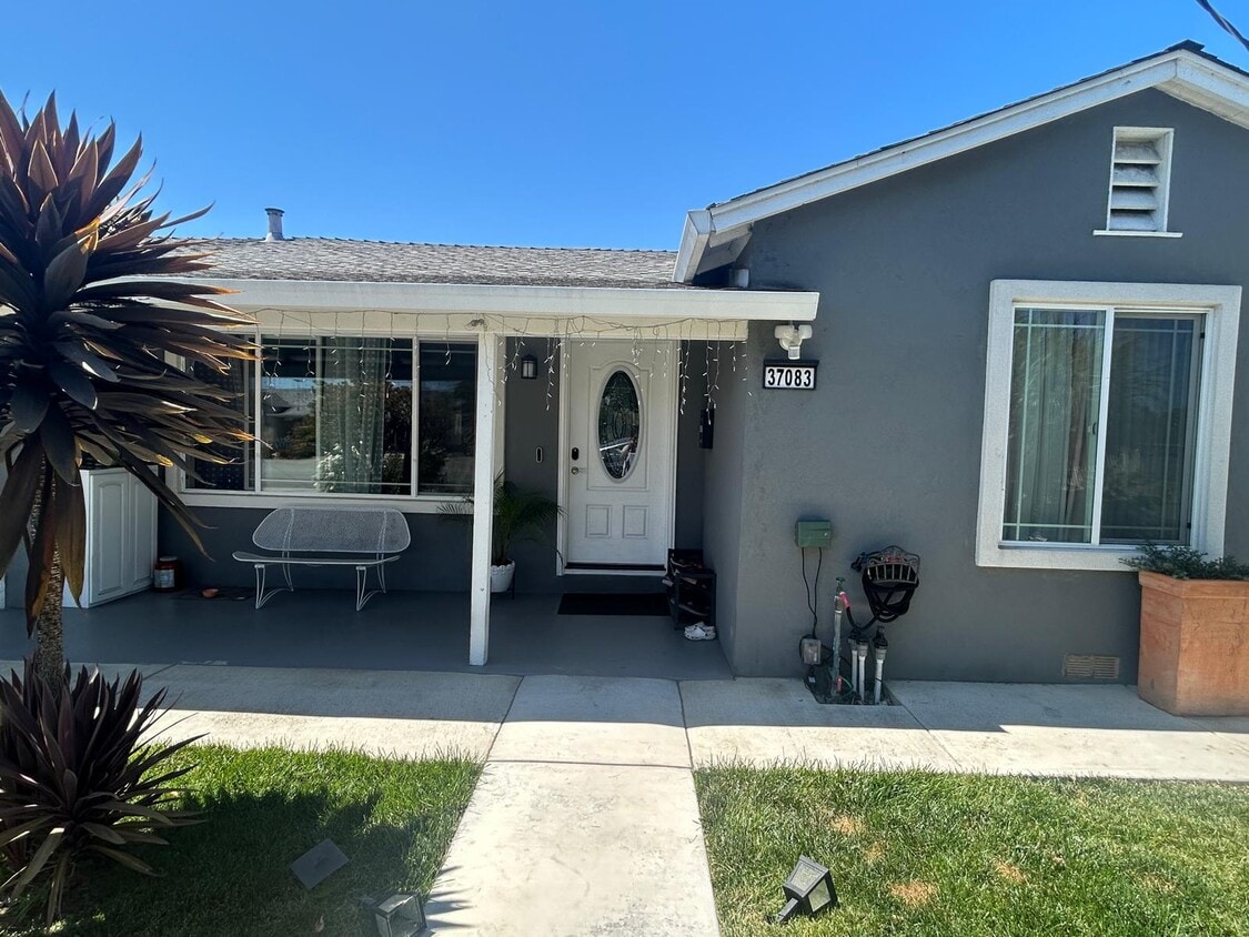
37083 Holly St
Fremont, CA 94536
Today
Favorites
925-307-9967
-
Bedrooms
3
-
Bathrooms
2
-
Square Feet
1,400 sq ft
-
Available
Available Sep 1
37083 Holly St

Favorites
About This Home
$4,100 deposit,
Available Sep 1
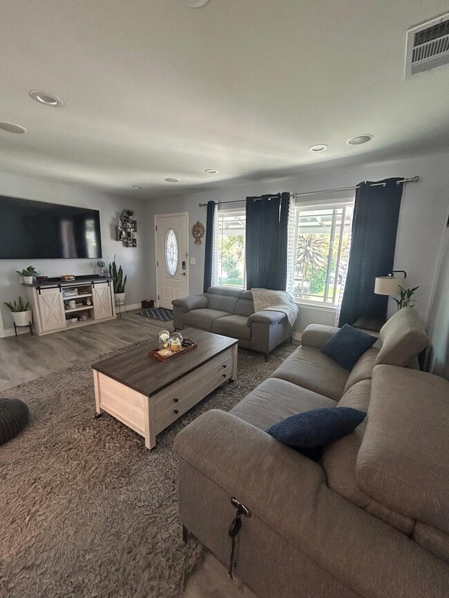
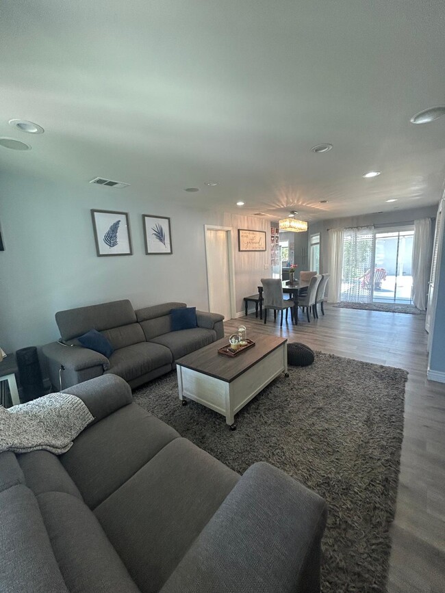
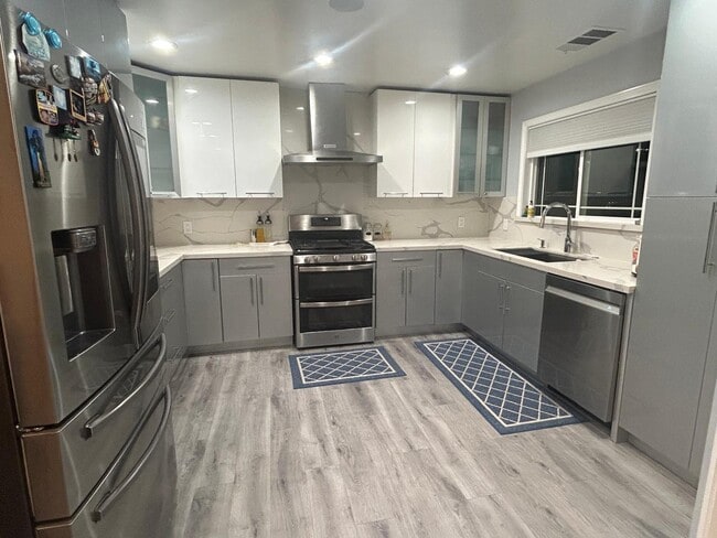
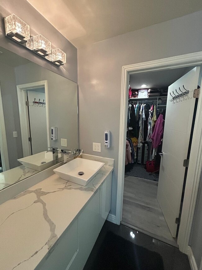
Welcome to this beautifully renovated 3-bedroom, 2-bathroom single-family residence, offering a perfect blend of comfort, style, and convenience. This home features a fully upgraded kitchen with modern appliances, sleek cabinetry, and updated bathrooms designed for today's lifestyle. Step outside to enjoy a private patio and a spacious backyard adorned with fruit trees and a thriving, well-maintained garden an ideal setting for relaxing or entertaining. Key Features: Fully upgraded kitchen and bathrooms Modern appliances included Private patio and landscaped backyard with fruit trees Walkable to elementary, middle, and high schools Just a 2-minute walk to the nearest bus stop and connectivity to Union City and Fremont BART station Easy access to I-880 for convenient commuting Restaurants and daily conveniences within walking distance Dusterberry Park is only 0.5 miles away Please Note: This property includes two additional units on the premises. One unit is attached to the main house with a shared wall.
37083 Holly St is a house located in Alameda County and the 94536 ZIP Code. This area is served by the Fremont Unified attendance zone.
* Price shown is base rent and may not include non-optional fees and utilities.
Price, availability, fees, and any applicable rent special are subject to change without notice.
* Square footage definitions vary. Displayed square footage is approximate.
House Features
- Washer/Dryer
- Washer/Dryer Hookup
- Dishwasher
Contact
- Listed by Nan
- Phone Number
- Contact
Location
Get Directions
Amenities
- Washer/Dryer
- Washer/Dryer Hookup
- Dishwasher
As its name implies, Centerville is a neighborhood located in central Fremont. Filled with tree-lined streets, Centerville has mid-range to upscale rentals available, including cozy single-family homes and luxury apartments. Centerville is family-friendly with several great schools and daycare centers located in the community. Renters from all walks of life enjoy Centerville’s amazing location. Along with bordering Downtown Fremont, Centerville is convenient to some of Fremont’s most popular parks and trailheads including Quarry Lakes Regional Recreation Area, a 471-acre local favorite for picnics, fishing, swimming, and boating.
Silicon Valley commuters enjoy having a train station in town, while Highway 84 and Interstate 880 are used by those who prefer to drive. Fremont Boulevard has a variety of restaurants, shops, event venues, and other businesses, providing residents with plenty of amenities not far from home.
Learn more about living in Centerville
Education
| Colleges & Universities | Distance | ||
|---|---|---|---|
| Colleges & Universities | Distance | ||
| Drive: | 7 min | 4.0 mi | |
| Drive: | 15 min | 6.7 mi | |
| Drive: | 15 min | 10.7 mi | |
| Drive: | 16 min | 11.5 mi |
37083 Holly St is within 7 minutes or 4.0 miles from Ohlone College, Newark. It is also near Ohlone College, Fremont Campus and Chabot College.
Schools


Public Elementary School
Grades 1-5
646 Students
Attendance Zone
Public Elementary School
Grades K-5
343 Students
Nearby
Public Middle School
Grades 6-8
1,302 Students
Attendance Zone
Public High School
Grades 9-12
2,501 Students
Attendance Zone
Private Elementary School
Grades K-3
Nearby
Private Elementary School
Grades PK-2
Nearby
Private Elementary & Middle School
Grades PK-8
285 Students
Nearby
Private Elementary, Middle & High School
Grades PK-12
691 Students
Nearby
School data provided by
 The GreatSchools Rating helps parents compare schools within a state based on a variety of school quality indicators and provides a helpful picture of how effectively each school serves all of its students. Ratings are on a scale of 1 (below average) to 10 (above average) and can include test scores, college readiness, academic progress, advanced courses, equity, discipline and attendance data. We also advise parents to visit schools, consider other information on school performance and programs, and consider family needs as part of the school selection process.
View GreatSchools Rating Methodology
Data provided by GreatSchools.org © 2025. All rights reserved.
View GreatSchools Rating Methodology
Data provided by GreatSchools.org © 2025. All rights reserved.
Transportation options available in Fremont include Fremont Station, located 2.8 miles from 37083 Holly St. 37083 Holly St is near Norman Y Mineta San Jose International, located 18.9 miles or 24 minutes away, and Metro Oakland International, located 19.4 miles or 25 minutes away.
| Transit / Subway | Distance | ||
|---|---|---|---|
| Transit / Subway | Distance | ||
|
|
Drive: | 6 min | 2.8 mi |
|
|
Drive: | 6 min | 2.9 mi |
|
|
Drive: | 7 min | 3.6 mi |
|
|
Drive: | 12 min | 7.7 mi |
|
|
Drive: | 14 min | 9.4 mi |
| Commuter Rail | Distance | ||
|---|---|---|---|
| Commuter Rail | Distance | ||
| Walk: | 11 min | 0.6 mi | |
| Walk: | 11 min | 0.6 mi | |
| Drive: | 15 min | 11.2 mi | |
|
|
Drive: | 15 min | 11.2 mi |
| Drive: | 26 min | 17.0 mi |
| Airports | Distance | ||
|---|---|---|---|
| Airports | Distance | ||
|
Norman Y Mineta San Jose International
|
Drive: | 24 min | 18.9 mi |
|
Metro Oakland International
|
Drive: | 25 min | 19.4 mi |
Time and distance from 37083 Holly St.
| Shopping Centers | Distance | ||
|---|---|---|---|
| Shopping Centers | Distance | ||
| Walk: | 9 min | 0.5 mi | |
| Walk: | 9 min | 0.5 mi | |
| Walk: | 9 min | 0.5 mi |
37083 Holly St has 3 shopping centers within 0.5 mile, which is about a 9-minute walk. The miles and minutes will be for the farthest away property.
| Parks and Recreation | Distance | ||
|---|---|---|---|
| Parks and Recreation | Distance | ||
|
Quarry Lakes Regional Recreation Area
|
Drive: | 3 min | 1.5 mi |
|
Alameda Creek Regional Trail
|
Drive: | 3 min | 1.7 mi |
|
Ardenwood Historic Farm
|
Drive: | 7 min | 3.6 mi |
|
Niles Canyon Railway
|
Drive: | 8 min | 4.4 mi |
|
Niles Community Park
|
Drive: | 10 min | 4.9 mi |
37083 Holly St has 5 parks within 4.9 miles, including Quarry Lakes Regional Recreation Area, Alameda Creek Regional Trail, and Niles Community Park.
| Hospitals | Distance | ||
|---|---|---|---|
| Hospitals | Distance | ||
| Drive: | 5 min | 2.8 mi | |
| Drive: | 5 min | 2.9 mi | |
| Drive: | 12 min | 8.4 mi |
37083 Holly St has 3 hospitals within 8.4 miles, the nearest is Kaiser Foundation Hospital - Fremont which is 2.8 miles away and a 5 minute drive.
| Military Bases | Distance | ||
|---|---|---|---|
| Military Bases | Distance | ||
| Drive: | 30 min | 21.6 mi |
37083 Holly St is 21.6 miles and a 30 minute drive from Ames Research Center.
You May Also Like
Similar Rentals Nearby


What Are Walk Score®, Transit Score®, and Bike Score® Ratings?
Walk Score® measures the walkability of any address. Transit Score® measures access to public transit. Bike Score® measures the bikeability of any address.
What is a Sound Score Rating?
A Sound Score Rating aggregates noise caused by vehicle traffic, airplane traffic and local sources

37083 Holly St
Fremont, CA 94536