$2,150 / Month
3701 Carol Ave
Fremont, CA 94538
2 Weeks Ago
Favorites
3701 Carol Ave

Favorites
Check Back Soon for Upcoming Availability
| Beds | Baths | Average SF |
|---|---|---|
| 2 Bedrooms 2 Bedrooms 2 Br | 1.5 Baths 1.5 Baths 1.5 Ba | 1,080 SF |
About This Property
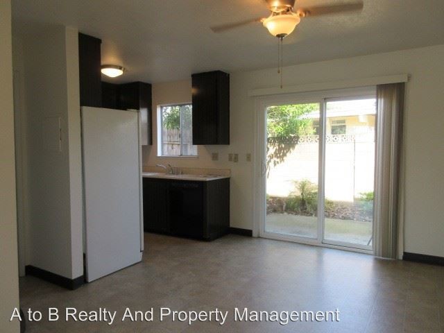
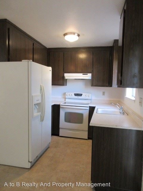
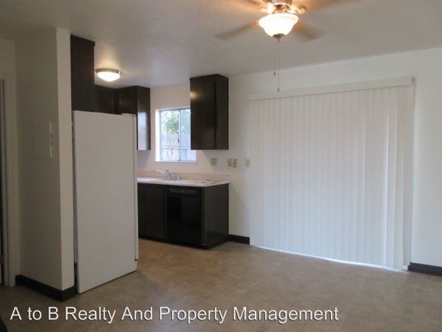
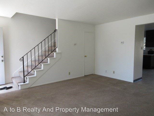
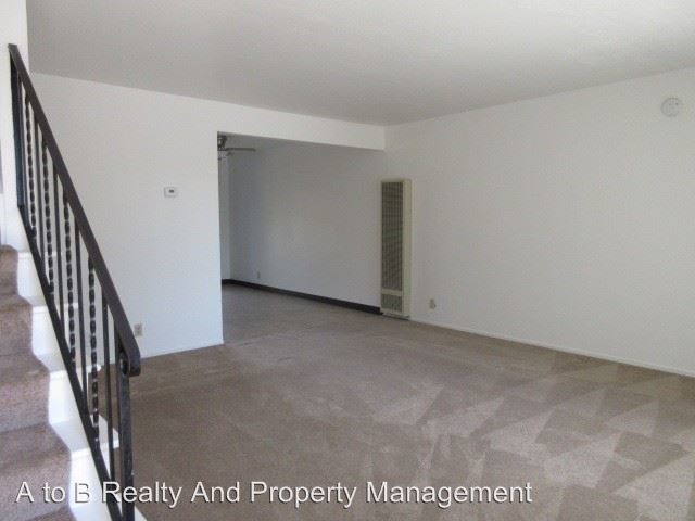
(408) 626-4800 - REDUCED! 2 bed 1.5 bath 2 story apartment available now! 3701 Carol Ave, #6, Fremont, CA 94538. - This property wont last! Close access to highway 680 and 238. This home is nearby Irvington Plaza, restaurants and coffee shops We have a 2 bedrooms, 1.5 bathroom apartment in Fremont available now. The property is equipped with a refrigerator, stove and dishwasher. No A/C New laminate flooring downstairs and carpet upstairs. A small back patio accompany this property. One assigned carport. Washer and dryer are on site. 12-month lease Tenant to pay for PG&E Rent $2,150 Deposit $2,150 NO PETS NO SMOKING NO SECTION 8 Unit will be shown by appointment only. Please email for showing or contact our office for application process or any general questions. Bob@atobpropertymanagement.com DRE # 01264949 (RLNE4787005)
3701 Carol Ave is an apartment community located in Alameda County and the 94538 ZIP Code.
Location
Get Directions
Irvington is a diverse, family-friendly suburb about two miles south of Downtown Fremont. Complemented by palm tree-lined streets, Irvington offers affordable to upscale rentals available in a variety of styles, including single-family homes and apartments. Great for families, Irvington is home to several excellent schools. Although residents certainly enjoy proximity to downtown’s abundant dining and shopping options, Irvington has a small commercial center in the middle of the neighborhood filled with authentic global eateries, boutiques, and grocery stores. This central area is also home to the Irvington Farmers Market and the Fremont Bay Saint Farmers Market. Irvington borders Central Park to the north, providing residents with a day of fun outdoors with its dynamic facilities that include a skate park, golf course, and water park.
Learn more about living in IrvingtonBelow are rent ranges for similar nearby apartments
| Beds | Average Size | Lowest | Typical | Premium |
|---|---|---|---|---|
| Studio Studio Studio | 541 Sq Ft | $2,318 | $2,446 | $2,573 |
| 1 Bed 1 Bed 1 Bed | 614-639 Sq Ft | $1,198 | $2,307 | $2,888 |
| 2 Beds 2 Beds 2 Beds | 975-976 Sq Ft | $1,343 | $3,021 | $3,926 |
| 3 Beds 3 Beds 3 Beds | 1322-1332 Sq Ft | $2,132 | $4,124 | $4,555 |
| 4 Beds 4 Beds 4 Beds | 1975 Sq Ft | $4,650 | — | — |
Education
| Colleges & Universities | Distance | ||
|---|---|---|---|
| Colleges & Universities | Distance | ||
| Drive: | 8 min | 3.2 mi | |
| Drive: | 8 min | 3.9 mi | |
| Drive: | 17 min | 10.9 mi | |
| Drive: | 23 min | 15.5 mi |
3701 Carol Ave is within 8 minutes or 3.2 miles from Ohlone College, Fremont Campus. It is also near Ohlone College, Newark and Palmer College of Chiropractic West Campus.
Transportation options available in Fremont include Warm Springs / South Fremont, located 2.8 miles from 3701 Carol Ave. 3701 Carol Ave is near Norman Y Mineta San Jose International, located 14.9 miles or 21 minutes away, and Metro Oakland International, located 23.4 miles or 32 minutes away.
| Transit / Subway | Distance | ||
|---|---|---|---|
| Transit / Subway | Distance | ||
|
|
Drive: | 5 min | 2.8 mi |
|
|
Drive: | 7 min | 2.9 mi |
|
|
Drive: | 8 min | 3.0 mi |
|
|
Drive: | 15 min | 7.3 mi |
|
|
Drive: | 14 min | 9.7 mi |
| Commuter Rail | Distance | ||
|---|---|---|---|
| Commuter Rail | Distance | ||
| Drive: | 8 min | 3.8 mi | |
| Drive: | 9 min | 3.8 mi | |
| Drive: | 18 min | 12.5 mi | |
| Drive: | 18 min | 13.4 mi | |
| Drive: | 19 min | 13.5 mi |
| Airports | Distance | ||
|---|---|---|---|
| Airports | Distance | ||
|
Norman Y Mineta San Jose International
|
Drive: | 21 min | 14.9 mi |
|
Metro Oakland International
|
Drive: | 32 min | 23.4 mi |
Time and distance from 3701 Carol Ave.
| Shopping Centers | Distance | ||
|---|---|---|---|
| Shopping Centers | Distance | ||
| Walk: | 7 min | 0.4 mi | |
| Walk: | 9 min | 0.5 mi | |
| Walk: | 11 min | 0.6 mi |
3701 Carol Ave has 3 shopping centers within 0.6 mile, which is about a 11-minute walk. The miles and minutes will be for the farthest away property.
| Parks and Recreation | Distance | ||
|---|---|---|---|
| Parks and Recreation | Distance | ||
|
Central Park (Lake Elizabeth)
|
Drive: | 7 min | 3.0 mi |
|
Quarry Lakes Regional Recreation Area
|
Drive: | 11 min | 5.2 mi |
|
Niles Canyon Railway
|
Drive: | 11 min | 5.4 mi |
|
Niles Community Park
|
Drive: | 12 min | 5.9 mi |
|
Mission Peak Regional Preserve
|
Drive: | 21 min | 6.7 mi |
3701 Carol Ave has 5 parks within 6.7 miles, including Central Park (Lake Elizabeth), Niles Canyon Railway, and Niles Community Park.
| Hospitals | Distance | ||
|---|---|---|---|
| Hospitals | Distance | ||
| Drive: | 5 min | 2.3 mi | |
| Drive: | 7 min | 3.2 mi |
3701 Carol Ave is 2.3 miles from Kaiser Foundation Hospital - Fremont, and is convenient to other hospitals, including Washington Hospital.
| Military Bases | Distance | ||
|---|---|---|---|
| Military Bases | Distance | ||
| Drive: | 26 min | 17.7 mi |
3701 Carol Ave is 17.7 miles and a 26 minute drive from Ames Research Center.
You May Also Like
Similar Rentals Nearby


What Are Walk Score®, Transit Score®, and Bike Score® Ratings?
Walk Score® measures the walkability of any address. Transit Score® measures access to public transit. Bike Score® measures the bikeability of any address.
What is a Sound Score Rating?
A Sound Score Rating aggregates noise caused by vehicle traffic, airplane traffic and local sources

3701 Carol Ave
Fremont, CA 94538