
$2,550 / Month
36996 Meadowbrook Common
Fremont, CA 94536
2 Weeks Ago
Favorites
36996 Meadowbrook Common

Favorites
Check Back Soon for Upcoming Availability
| Beds | Baths | Average SF |
|---|---|---|
| 2 Bedrooms 2 Bedrooms 2 Br | 2 Baths 2 Baths 2 Ba | 981 SF |
Fees and Policies
The fees below are based on community-supplied data and may exclude additional fees and utilities.
- Parking
-
Garage--
About This Property
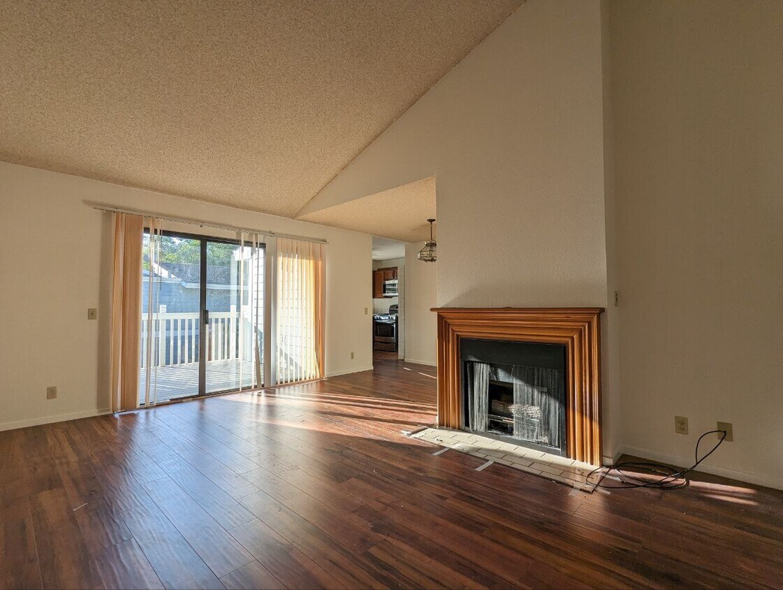
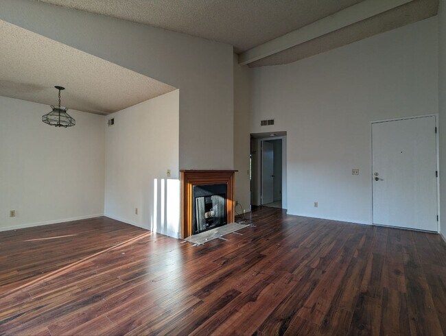
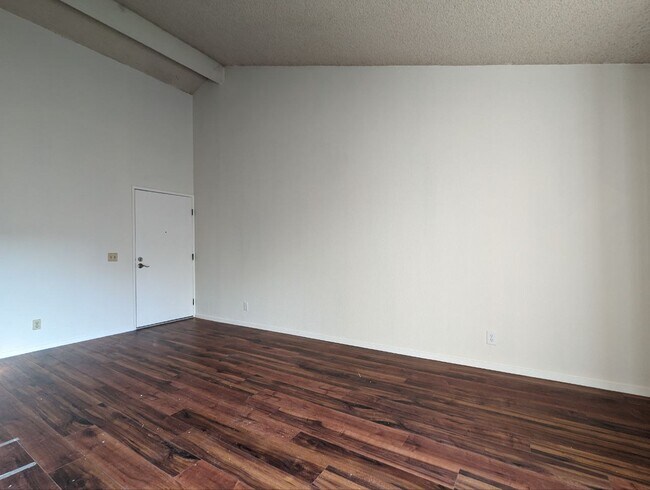
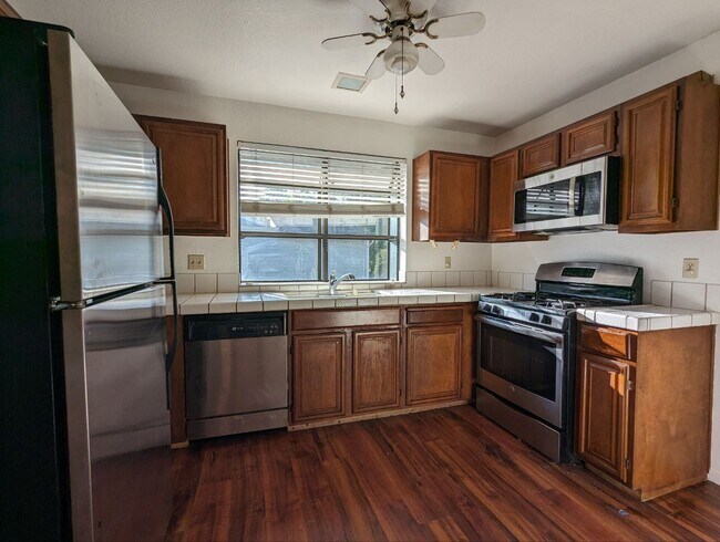
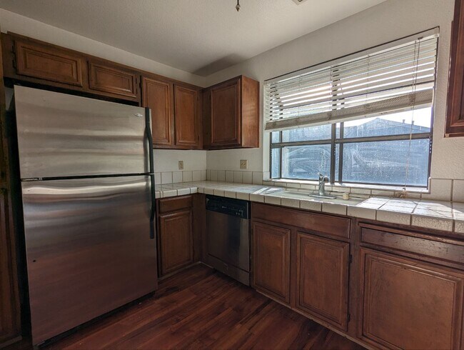
This beautiful 2nd floor condo off the corner of Paseo Padre and Thornton features a full set of stainless steel appliances, W/D hookups, off-street parking, and a lovely balcony with an additional storage room. Located in a gated community, the home is in close proximity to amenities along Fremont Blvd, recreational areas along Alameda creek, and schools such as American High, Oliveira Elementary, and Thornton Jr High. Tenants pay PG&E. Landlord pays water and garbage. Two assigned and covered parking spaces included in rent. Pet friendly with the possibility of pet rent based on type/size/breed. Please respond to the ad with the following: 1) Who is moving? 2) Why are you moving? 3) When are you willing to move?
36996 Meadowbrook Common is a townhome located in Alameda County and the 94536 ZIP Code. This area is served by the Fremont Unified attendance zone.
Townhome Features
Dishwasher
Microwave
Refrigerator
Range
- Dishwasher
- Microwave
- Range
- Refrigerator
Location
Get Directions
As its name implies, Centerville is a neighborhood located in central Fremont. Filled with tree-lined streets, Centerville has mid-range to upscale rentals available, including cozy single-family homes and luxury apartments. Centerville is family-friendly with several great schools and daycare centers located in the community. Renters from all walks of life enjoy Centerville’s amazing location. Along with bordering Downtown Fremont, Centerville is convenient to some of Fremont’s most popular parks and trailheads including Quarry Lakes Regional Recreation Area, a 471-acre local favorite for picnics, fishing, swimming, and boating.
Silicon Valley commuters enjoy having a train station in town, while Highway 84 and Interstate 880 are used by those who prefer to drive. Fremont Boulevard has a variety of restaurants, shops, event venues, and other businesses, providing residents with plenty of amenities not far from home.
Learn more about living in CentervilleBelow are rent ranges for similar nearby apartments
Amenities
- Dishwasher
- Microwave
- Range
- Refrigerator
Education
| Colleges & Universities | Distance | ||
|---|---|---|---|
| Colleges & Universities | Distance | ||
| Drive: | 9 min | 4.7 mi | |
| Drive: | 15 min | 6.6 mi | |
| Drive: | 17 min | 10.3 mi | |
| Drive: | 18 min | 11.1 mi |
36996 Meadowbrook Common is within 9 minutes or 4.7 miles from Ohlone College, Newark. It is also near Ohlone College, Fremont Campus and Cal State East Bay.
Schools


Public Elementary School
Grades K-5
343 Students
Nearby
Public Elementary School
Grades 1-5
646 Students
Attendance Zone
Public Middle School
Grades 6-8
1,302 Students
Attendance Zone
Public High School
Grades 9-12
2,501 Students
Attendance Zone
Private Elementary, Middle & High School
Grades PK-12
691 Students
Nearby
Private Elementary School
Grades PK-2
Nearby
Private Elementary & Middle School
Grades PK-8
285 Students
Nearby
School data provided by
 The GreatSchools Rating helps parents compare schools within a state based on a variety of school quality indicators and provides a helpful picture of how effectively each school serves all of its students. Ratings are on a scale of 1 (below average) to 10 (above average) and can include test scores, college readiness, academic progress, advanced courses, equity, discipline and attendance data. We also advise parents to visit schools, consider other information on school performance and programs, and consider family needs as part of the school selection process.
View GreatSchools Rating Methodology
Data provided by GreatSchools.org © 2025. All rights reserved.
View GreatSchools Rating Methodology
Data provided by GreatSchools.org © 2025. All rights reserved.
Transportation options available in Fremont include Fremont Station, located 2.2 miles from 36996 Meadowbrook Common. 36996 Meadowbrook Common is near Metro Oakland International, located 19.0 miles or 27 minutes away, and Norman Y Mineta San Jose International, located 19.5 miles or 26 minutes away.
| Transit / Subway | Distance | ||
|---|---|---|---|
| Transit / Subway | Distance | ||
|
|
Drive: | 5 min | 2.2 mi |
|
|
Drive: | 5 min | 2.3 mi |
|
|
Drive: | 7 min | 3.1 mi |
|
|
Drive: | 14 min | 6.6 mi |
|
|
Drive: | 15 min | 9.0 mi |
| Commuter Rail | Distance | ||
|---|---|---|---|
| Commuter Rail | Distance | ||
| Walk: | 14 min | 0.7 mi | |
| Walk: | 14 min | 0.7 mi | |
| Drive: | 17 min | 10.9 mi | |
|
|
Drive: | 17 min | 10.9 mi |
| Drive: | 26 min | 17.1 mi |
| Airports | Distance | ||
|---|---|---|---|
| Airports | Distance | ||
|
Metro Oakland International
|
Drive: | 27 min | 19.0 mi |
|
Norman Y Mineta San Jose International
|
Drive: | 26 min | 19.5 mi |
Time and distance from 36996 Meadowbrook Common.
| Shopping Centers | Distance | ||
|---|---|---|---|
| Shopping Centers | Distance | ||
| Walk: | 4 min | 0.2 mi | |
| Walk: | 4 min | 0.3 mi | |
| Walk: | 13 min | 0.7 mi |
36996 Meadowbrook Common has 3 shopping centers within 0.7 mile, which is about a 13-minute walk. The miles and minutes will be for the farthest away property.
| Parks and Recreation | Distance | ||
|---|---|---|---|
| Parks and Recreation | Distance | ||
|
Quarry Lakes Regional Recreation Area
|
Walk: | 16 min | 0.8 mi |
|
Alameda Creek Regional Trail
|
Drive: | 2 min | 1.2 mi |
|
Niles Canyon Railway
|
Drive: | 7 min | 3.7 mi |
|
Ardenwood Historic Farm
|
Drive: | 8 min | 4.2 mi |
|
Niles Community Park
|
Drive: | 9 min | 4.2 mi |
36996 Meadowbrook Common has 5 parks within 4.2 miles, including Quarry Lakes Regional Recreation Area, Alameda Creek Regional Trail, and Niles Community Park.
| Hospitals | Distance | ||
|---|---|---|---|
| Hospitals | Distance | ||
| Drive: | 4 min | 2.1 mi | |
| Drive: | 4 min | 2.2 mi | |
| Drive: | 13 min | 8.1 mi |
36996 Meadowbrook Common has 3 hospitals within 8.1 miles, the nearest is Kaiser Foundation Hospital - Fremont which is 2.1 miles away and a 4 minute drive.
| Military Bases | Distance | ||
|---|---|---|---|
| Military Bases | Distance | ||
| Drive: | 31 min | 20.5 mi |
36996 Meadowbrook Common is 20.5 miles and a 31 minute drive from Ames Research Center.
You May Also Like
Similar Rentals Nearby


What Are Walk Score®, Transit Score®, and Bike Score® Ratings?
Walk Score® measures the walkability of any address. Transit Score® measures access to public transit. Bike Score® measures the bikeability of any address.
What is a Sound Score Rating?
A Sound Score Rating aggregates noise caused by vehicle traffic, airplane traffic and local sources

36996 Meadowbrook Common
Fremont, CA 94536