$2,400 / Month
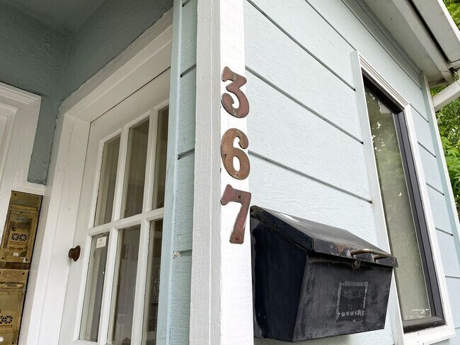
367 Alcatraz Ave
Oakland, CA 94618
2 Weeks Ago
Favorites
367 Alcatraz Ave

Favorites
Check Back Soon for Upcoming Availability
| Beds | Baths | Average SF |
|---|---|---|
| 1 Bedroom 1 Bedroom 1 Br | 1 Bath 1 Bath 1 Ba | 633 SF |
About This Property
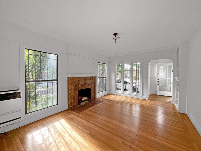
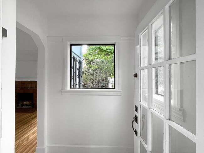
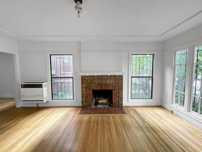
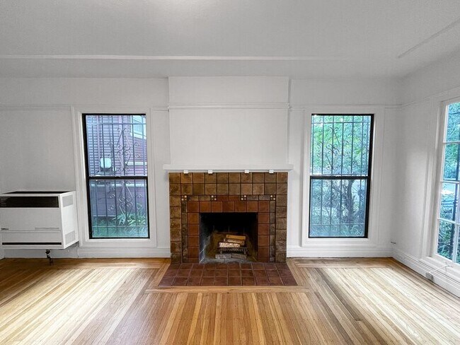
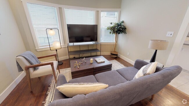
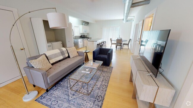
Flanked by three of the best neighborhoods Oakland has to offer - Rockridge, Claremont, and Temescal - this Fairmont park location is equipped with everything you need for a comfortable rental experience. The unit has an open kitchen with lots of cabinetry, ample closet space, and hardwood flooring. The apartment also comes with dedicated parking and on-site laundry. This is a fantastic opportunity to live in one of Oakland's most desirable neighborhoods close to all of the best shops & restaurants the city has to offer. Come see your new home today! Unit Details: -Separate Kitchen/Dining area -Hardwood floors -Charming built-in's -Soaking tub -Fireplace -On-site laundry Neighborhood details: -An array of shops, bars, and restaurants -Easy access to public transportation; 24hr buses and shuttle services -Walking distance to nearby Bart stations -Easy access to highway 24, and 580 & 880 freeways -Multiple grocery stores nearby (Safeway, Trader Joes, Sprouts, Whole Foods) -Short distance to UC Berkeley and some of the best schools Oakland has to offer Application Criteria: - 700+ credit score - 3X rent in gross monthly income - Rental and Employment verifications DRE# 01902745
367 Alcatraz Ave is a house located in Alameda County and the 94618 ZIP Code. This area is served by the Oakland Unified attendance zone.
Location
Get Directions
Upper Telegraph is a centrally located neighborhood in the city of Oakland. Upper Telegraph is home to numerous local staples like Bushrod Park and Community Garden, healthcare centers, and a busy commercial strip along Telegraph Avenue. Locals can easily shop in the neighborhood or head less than 10 miles south to Downtown Oakland for places like Jack London Square and the Uptown District. More great features offered by Downtown Oakland include scenic sites like the Bonsai Garden and Lake Merritt. While Downtown Oakland is Upper Telegraph’s southern neighbor, the city of Berkeley is the neighborhood’s northern neighbor. Downtown Berkeley, the University of California-Berkley, and several national and state parks sit just north of Upper Telegraph.
Learn more about living in Upper TelegraphBelow are rent ranges for similar nearby apartments
Education
| Colleges & Universities | Distance | ||
|---|---|---|---|
| Colleges & Universities | Distance | ||
| Drive: | 7 min | 2.2 mi | |
| Drive: | 8 min | 2.4 mi | |
| Drive: | 6 min | 2.5 mi | |
| Drive: | 8 min | 4.1 mi |
367 Alcatraz Ave is within 7 minutes or 2.2 miles from Berkeley City College. It is also near UC Berkeley and Samuel Merritt University.
Schools


Public Elementary School
Grades K-5
270 Students
Nearby
Public Elementary School
Grades K-5
334 Students
Attendance Zone
Public Elementary School
Grades K-5
352 Students
Attendance Zone
Public Middle School
Grades 6-8
487 Students
Attendance Zone
Public High School
Grades 9-12
1,796 Students
Attendance Zone
Private Elementary & Middle School
Grades PK-8
367 Students
Nearby
Private Middle & High School
Grades 8-12
30 Students
Nearby
School data provided by
 The GreatSchools Rating helps parents compare schools within a state based on a variety of school quality indicators and provides a helpful picture of how effectively each school serves all of its students. Ratings are on a scale of 1 (below average) to 10 (above average) and can include test scores, college readiness, academic progress, advanced courses, equity, discipline and attendance data. We also advise parents to visit schools, consider other information on school performance and programs, and consider family needs as part of the school selection process.
View GreatSchools Rating Methodology
View GreatSchools Rating Methodology
Transportation options available in Oakland include Rockridge Station, located 0.6 mile from 367 Alcatraz Ave. 367 Alcatraz Ave is near Metro Oakland International, located 13.2 miles or 20 minutes away, and San Francisco International, located 23.7 miles or 37 minutes away.
| Transit / Subway | Distance | ||
|---|---|---|---|
| Transit / Subway | Distance | ||
|
|
Walk: | 12 min | 0.6 mi |
|
|
Drive: | 3 min | 1.1 mi |
|
|
Drive: | 7 min | 2.2 mi |
|
|
Drive: | 9 min | 3.2 mi |
|
|
Drive: | 7 min | 3.7 mi |
| Commuter Rail | Distance | ||
|---|---|---|---|
| Commuter Rail | Distance | ||
|
|
Drive: | 7 min | 2.4 mi |
|
|
Drive: | 11 min | 3.7 mi |
|
|
Drive: | 8 min | 4.9 mi |
| Drive: | 18 min | 11.3 mi | |
| Drive: | 20 min | 12.5 mi |
| Airports | Distance | ||
|---|---|---|---|
| Airports | Distance | ||
|
Metro Oakland International
|
Drive: | 20 min | 13.2 mi |
|
San Francisco International
|
Drive: | 37 min | 23.7 mi |
Time and distance from 367 Alcatraz Ave.
| Shopping Centers | Distance | ||
|---|---|---|---|
| Shopping Centers | Distance | ||
| Walk: | 7 min | 0.4 mi | |
| Drive: | 3 min | 1.2 mi | |
| Drive: | 4 min | 1.4 mi |
367 Alcatraz Ave has 3 shopping centers within 1.4 miles, which is about a 4-minute walk. The miles and minutes will be for the farthest away property.
| Parks and Recreation | Distance | ||
|---|---|---|---|
| Parks and Recreation | Distance | ||
|
Willard Park
|
Walk: | 14 min | 0.7 mi |
|
People's Park
|
Drive: | 4 min | 1.4 mi |
|
Temescal Regional Park
|
Drive: | 4 min | 1.7 mi |
|
Habitot Children's Museum
|
Drive: | 6 min | 1.9 mi |
|
Essig Museum of Entomology
|
Drive: | 8 min | 2.4 mi |
367 Alcatraz Ave has 5 parks within 2.4 miles, including Willard Park, People's Park, and Temescal Regional Park.
| Hospitals | Distance | ||
|---|---|---|---|
| Hospitals | Distance | ||
| Walk: | 8 min | 0.4 mi | |
| Drive: | 4 min | 1.5 mi | |
| Drive: | 6 min | 2.4 mi |
367 Alcatraz Ave has 3 hospitals within 2.4 miles, the nearest is Alta Bates Summit Medical Center - Alta Bates Campus which is 0.4 mile away and a 8 minute walk.
| Military Bases | Distance | ||
|---|---|---|---|
| Military Bases | Distance | ||
| Drive: | 18 min | 5.9 mi | |
| Drive: | 15 min | 6.6 mi |
367 Alcatraz Ave is 5.9 miles from Military Reservation, and is convenient to other military bases, including Oakland Army Base.
You May Also Like
Similar Rentals Nearby


What Are Walk Score®, Transit Score®, and Bike Score® Ratings?
Walk Score® measures the walkability of any address. Transit Score® measures access to public transit. Bike Score® measures the bikeability of any address.
What is a Sound Score Rating?
A Sound Score Rating aggregates noise caused by vehicle traffic, airplane traffic and local sources

367 Alcatraz Ave
Oakland, CA 94618