$1,150
/ Month
366 State Hwy O
Highlandville, MO 65669
2 Weeks Ago
|
Edit
Favorites
366 State Hwy O

Favorites
Check Back Soon for Upcoming Availability
| Beds | Baths | Average SF |
|---|---|---|
| 3 Bedrooms 3 Bedrooms 3 Br | 2 Baths 2 Baths 2 Ba | 1,386 SF |
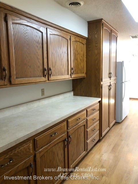
About This Property
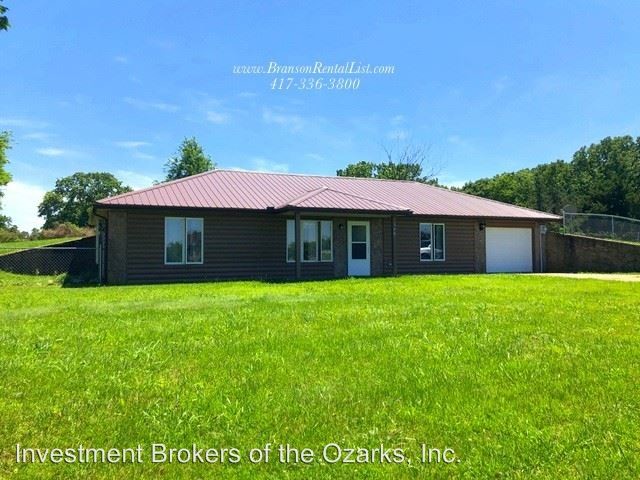
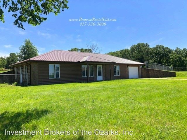
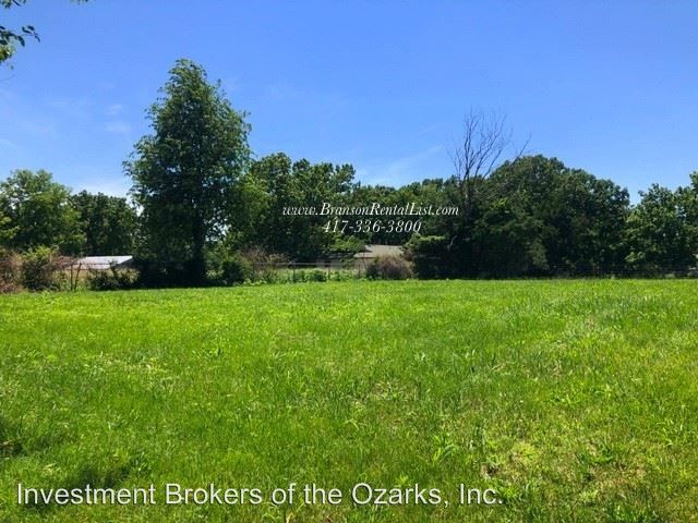
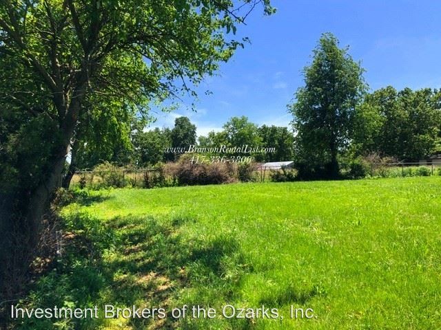
(417) 336-3800 - - We get requests all the time for a house "out in the country", and this home fits the bill! Plus it has a fully fenced in back yard as well as a nice patio area to enjoy the outdoors. It's located just far enough off the highway to cut out the traffic noise, but close enough that you're minutes from being on your way to Ozark, Springfield, or Branson! This is a cute home in a great location! Don't miss out, call today to schedule a showing. (RLNE4958869)
366 State Hwy O is a house located in Christian County and the 65669 ZIP Code. This area is served by the Spokane R-Vii School District attendance zone.
366 State Hwy O,
Highlandville,
MO
65669
Education
| Colleges & Universities | Distance | ||
|---|---|---|---|
| Colleges & Universities | Distance | ||
| Drive: | 33 min | 20.8 mi | |
| Drive: | 36 min | 21.9 mi | |
| Drive: | 37 min | 22.3 mi | |
| Drive: | 37 min | 25.2 mi |
366 State Hwy O is within 33 minutes or 20.8 miles from Missouri State University. It is also near Drury University and Ozarks Tech. C.C., Springfield.
Schools


Public Elementary School
Grades PK-5
Attendance Zone
Public Middle School
Grades 6-8
Attendance Zone
Public High School
Grades 9-12
Attendance Zone
Private Elementary School
Grades PK-6
Nearby
Private Elementary, Middle & High School
Grades K-12
Nearby
School data provided by
 The GreatSchools Rating helps parents compare schools within a state based on a variety of school quality indicators and provides a helpful picture of how effectively each school serves all of its students. Ratings are on a scale of 1 (below average) to 10 (above average) and can include test scores, college readiness, academic progress, advanced courses, equity, discipline and attendance data. We also advise parents to visit schools, consider other information on school performance and programs, and consider family needs as part of the school selection process.
View GreatSchools Rating Methodology
Data provided by GreatSchools.org © 2026. All rights reserved.
View GreatSchools Rating Methodology
Data provided by GreatSchools.org © 2026. All rights reserved.
Walkability Near 366 State Hwy O Highlandville, MO 65669
Getting Around
 What do Walkability, Transit, Drivability, and Bikeability mean?
Walkability measures the walking distance to day-to-day needs.
Transit measures access to public transportation.
Drivability measures congestion, parking availability, and access to major roads.
Bikeability measures the suitability for cycling.
How It Works
What do Walkability, Transit, Drivability, and Bikeability mean?
Walkability measures the walking distance to day-to-day needs.
Transit measures access to public transportation.
Drivability measures congestion, parking availability, and access to major roads.
Bikeability measures the suitability for cycling.
How It Works
Not Walkable
Walkability
10
/ 100
Exceptionally Drivable
Drivability
90
/ 100
Somewhat Bikeable
Bikeability
20
/ 100
Scores provided by
-
Soundscore™
-
/ 100
Traffic
-Airport
-Businesses
-Scores provided by
HowLoud What is a Sound Score Rating? A Sound Score Rating aggregates noise caused by vehicle traffic, airplane traffic and local sources. How It WorksYou May Also Like
Similar Rentals Nearby
-
-
3 Beds$1,895Total Monthly Price12 Month LeaseTotal Monthly Price NewPrices include all required monthly fees.
-
-
-

-
-

-

-

-


What Are Walk Score®, Transit Score®, and Bike Score® Ratings?
Walk Score® measures the walkability of any address. Transit Score® measures access to public transit. Bike Score® measures the bikeability of any address.
What is a Sound Score Rating?
A Sound Score Rating aggregates noise caused by vehicle traffic, airplane traffic and local sources.

366 State Hwy O
Highlandville, MO 65669