

$2,800 / Month
3610 Whiteside St
Los Angeles, CA 90063
Today
Favorites
626-216-3743
-
Bedrooms
3
-
Bathrooms
1
-
Square Feet
988 sq ft
-
Available
Available Now
3610 Whiteside St

Favorites
About This Home
12 Month Lease,
$2,800 deposit,
Available Now
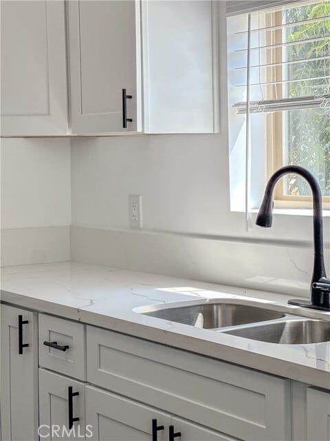
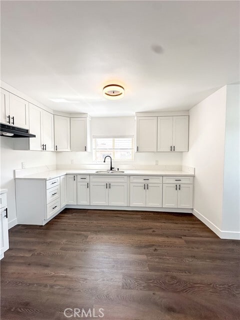
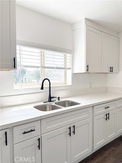
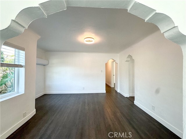
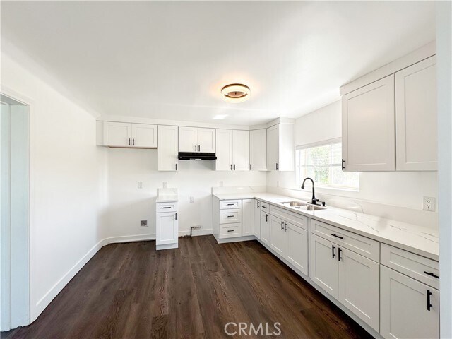
Welcome to your home at 3610 Whiteside St—a warm and welcoming rental tucked into the vibrant heart of East Los Angeles. Whether you're commuting to DTLA, enjoying local eats, or relaxing in the nearby parks, this home makes it all easy and enjoyable. Inside, you’ll find a thoughtfully designed and fully renovated 3 rooms and 1 bathroom gorgeous home that kept the character with its thoughtful renovation. The layout features a stylish kitchen, open-concept living area, in-unit laundry hook-ups, private outdoor space, and convenient off-street parking. It’s the kind of place that feels instantly like you're home. You'll be close to the 710 and 10 freeways, putting you minutes from Downtown L.A. Spend weekends at Hollenbeck Park, grab a bite at local favorite eateries, and soak up the culture around every corner—from colorful murals to the iconic Latino Walk of Fame. Families and students will also appreciate the proximity to Cal State L.A. This home is more than just a place to live—it’s a lifestyle. Let’s get you settled into the neighborhood! MLS# DW25154624
3610 Whiteside St is a townhome located in Los Angeles County and the 90063 ZIP Code.
* Price shown is base rent and may not include non-optional fees and utilities.
Price, availability, fees, and any applicable rent special are subject to change without notice.
* Square footage definitions vary. Displayed square footage is approximate.
Townhome Features
- Air Conditioning
Fees and Policies
The fees below are based on community-supplied data and may exclude additional fees and utilities.
Details
Utilities Included
-
Trash Removal
Lease Options
-
12 Months
Contact
- Listed by Bridgette Carrillo | House of Seven Gables RE Inc
- Phone Number
- Contact
-
Source
 California Regional Multiple Listing Service
Copyright 2025 © California Regional MLS. All rights reserved.
Location
Get Directions
Amenities
- Air Conditioning
Expenses
Utilities Included
Trash Removal
Included
Southeast Los Angeles is directly south of the Fashion District and east of the University of Southern California (USC). This large neighborhood is minutes from downtown Los Angeles, Hollywood, and Beverly Hills, with easy access to the 110 Freeway. This great location places you near sunny beaches, nature trails, and a bevy of leading employers. Students can access both USC and California State University Long Beach from their Southeast LA apartment.
This densely populated, diverse neighborhood features everything from food trucks and corner markets to wide sidewalks and residential areas filled with bungalows, ranch, and Spanish Colonial architecture. Southeast LA features palm trees and mountain views, tampered with gritty undertones to give it a cool, funky vibe.
As for outdoor fun, take your pick between Catalina Island, Venus Beach, or the Santa Monica Pier. Nearby, you’ll find more sunny beaches like White Point, Cabrillo, and Long Beach.
Learn more about living in Southeast Los Angeles
Education
| Colleges & Universities | Distance | ||
|---|---|---|---|
| Colleges & Universities | Distance | ||
| Drive: | 4 min | 1.5 mi | |
| Drive: | 4 min | 1.8 mi | |
| Drive: | 8 min | 3.6 mi | |
| Drive: | 8 min | 5.5 mi |
3610 Whiteside St is within 4 minutes or 1.5 miles from Cal State Los Angeles. It is also near USC, Health Sciences Campus and East Los Angeles College.
Transportation options available in Los Angeles include Soto, located 2.3 miles from 3610 Whiteside St. 3610 Whiteside St is near Bob Hope, located 18.2 miles or 25 minutes away, and Los Angeles International, located 19.7 miles or 31 minutes away.
| Transit / Subway | Distance | ||
|---|---|---|---|
| Transit / Subway | Distance | ||
|
|
Drive: | 4 min | 2.3 mi |
|
|
Drive: | 5 min | 2.3 mi |
|
|
Drive: | 5 min | 2.7 mi |
| Drive: | 6 min | 3.1 mi | |
|
|
Drive: | 7 min | 3.6 mi |
| Commuter Rail | Distance | ||
|---|---|---|---|
| Commuter Rail | Distance | ||
|
|
Drive: | 5 min | 3.6 mi |
|
|
Drive: | 8 min | 3.8 mi |
|
|
Drive: | 14 min | 6.7 mi |
| Drive: | 9 min | 7.5 mi | |
|
|
Drive: | 13 min | 8.3 mi |
| Airports | Distance | ||
|---|---|---|---|
| Airports | Distance | ||
|
Bob Hope
|
Drive: | 25 min | 18.2 mi |
|
Los Angeles International
|
Drive: | 31 min | 19.7 mi |
Time and distance from 3610 Whiteside St.
| Shopping Centers | Distance | ||
|---|---|---|---|
| Shopping Centers | Distance | ||
| Drive: | 5 min | 2.2 mi | |
| Drive: | 4 min | 2.3 mi | |
| Drive: | 5 min | 2.7 mi |
3610 Whiteside St has 3 shopping centers within 2.7 miles, which is about a 5-minute drive. The miles and minutes will be for the farthest away property.
| Parks and Recreation | Distance | ||
|---|---|---|---|
| Parks and Recreation | Distance | ||
|
Hollenbeck Lake
|
Drive: | 5 min | 2.9 mi |
|
Audubon Center at Debs Park
|
Drive: | 9 min | 5.7 mi |
|
Elysian Park
|
Drive: | 13 min | 5.7 mi |
|
Elyria Canyon Park
|
Drive: | 12 min | 6.5 mi |
|
Chavez Ravine Arboretum
|
Drive: | 10 min | 6.6 mi |
3610 Whiteside St has 5 parks within 6.6 miles, including Hollenbeck Lake, Audubon Center at Debs Park, and Elysian Park.
| Hospitals | Distance | ||
|---|---|---|---|
| Hospitals | Distance | ||
| Drive: | 3 min | 1.9 mi | |
| Drive: | 4 min | 2.0 mi | |
| Drive: | 7 min | 3.4 mi |
3610 Whiteside St has 3 hospitals within 3.4 miles, the nearest is Keck Hospital of USC which is 1.9 miles away and a 3 minute drive.
| Military Bases | Distance | ||
|---|---|---|---|
| Military Bases | Distance | ||
| Drive: | 28 min | 21.2 mi | |
| Drive: | 35 min | 24.3 mi |
3610 Whiteside St is 21.2 miles from Los Angeles Air Force Base, and is convenient to other military bases, including Los Alamitos Army Airfield.
You May Also Like
Similar Rentals Nearby
-
-

-
-
-
-
1 / 50

-
-
-
-


What Are Walk Score®, Transit Score®, and Bike Score® Ratings?
Walk Score® measures the walkability of any address. Transit Score® measures access to public transit. Bike Score® measures the bikeability of any address.
What is a Sound Score Rating?
A Sound Score Rating aggregates noise caused by vehicle traffic, airplane traffic and local sources
3610 Whiteside St
Los Angeles, CA 90063