

$1,099
Total Monthly Price
360 W Ave 26 Ave Unit 228
Los Angeles, CA 90031
Today
|
Edit
Favorites
732-410-6170
-
Bedrooms
1
-
Bathrooms
1
-
Square Feet
156 sq ft
-
Available
Available Now
Highlights
- Room for Rent
- Balcony
- Gated
- Smoke Free
- Fitness Center
- Wheelchair Accessible
360 W Ave 26 Ave Unit 228

Favorites
About This Home
12 Month Lease,
$1,099 deposit,
Available Now
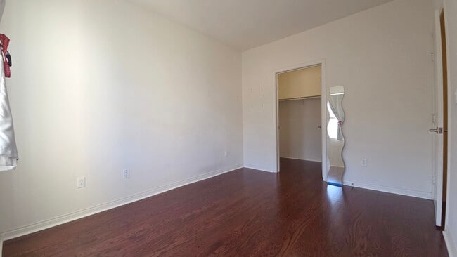
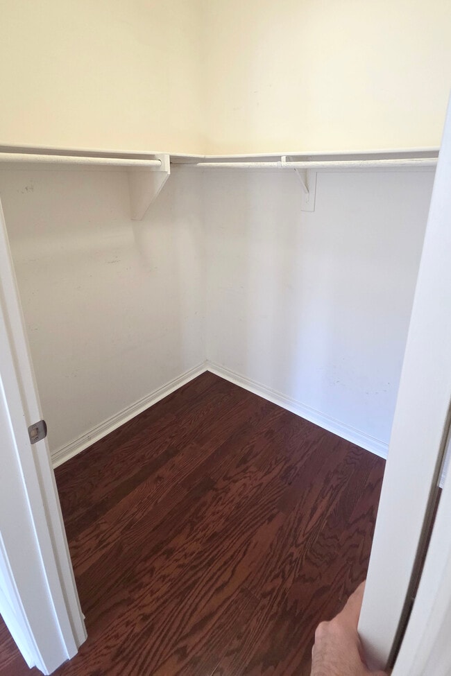
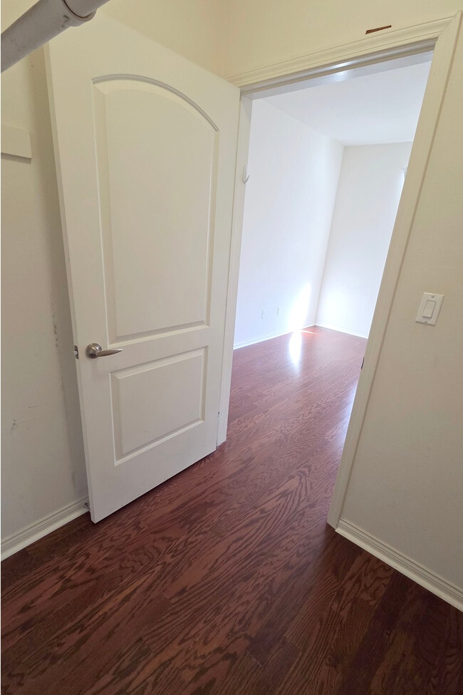
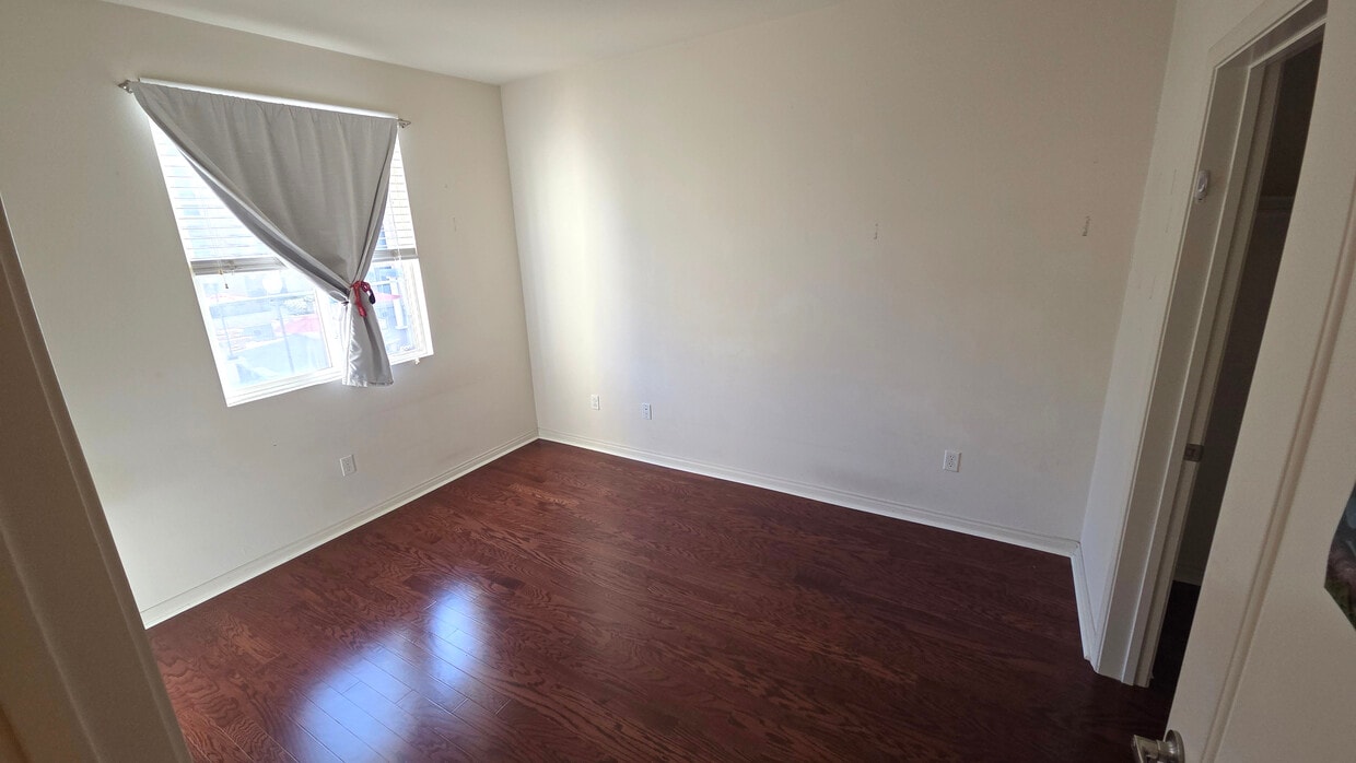
Available: NOW. Feb 1, 2026. * Next to Lincoln/Cypress A-Line LA Metro Train Station * Easy access to freeways. 1000 feet from both 110 N (or 110 S) and I-5 freeway entrances. * Washer and Dryer in unit free of charge. * Shared Living Room * Parking is Tandem Parking * 2nd Floor Unit facing Courtyard (facing south east). * Elevator accessible. * Parking underground. * No Freeway Noise. * Community Room w/ Kitchen * w/Fitness Room (Gym) * Gated Mail Room at Front Entrance * Amazon Hub for Packages * Balcony * Central A/C * Shared kitchen * Ethernet Internet jack in room (300Mbps). * Not furnished. Desk with shelf-available and currently sitting in that room. * Not furnished. Futon available in living room to help with a transition if needed. * EV Charging station in garage (usage fee applies). * Utilities Included: Water, Gas, Power, Internet, W/D.
360 W Ave 26 Ave is a condo located in Los Angeles County and the 90031 ZIP Code.
* Price shown is total price based on community-supplied monthly required fees. Excludes user-selected optional fees and variable or usage-based fees and required charges due at or prior to move-in or at move-out. Price, availability, fees, and any applicable rent special are subject to change without notice.
* Square footage definitions vary. Displayed square footage is approximate.
Condo Features
Washer/Dryer
Air Conditioning
Dishwasher
Smoke Free
- Washer/Dryer
- Air Conditioning
- Smoke Free
- Dishwasher
- Kitchen
- EV Charging
- Wheelchair Accessible
- Elevator
- Fitness Center
- Gated
- Courtyard
- Balcony
Fees and Policies
The fees listed below are community-provided and may exclude utilities or add-ons. All payments are made directly to the property and are non-refundable unless otherwise specified.
Details
Utilities Included
-
Gas
-
Water
-
Electricity
-
Heat
-
Trash Removal
-
Sewer
-
Cable
-
Air Conditioning
Property Information
-
Built in 2006
Contact
- Phone Number
- Contact
Location
Get Directions
Situated in northeast Los Angeles, just four miles from downtown, Montecito Heights sits atop a hilly landscape separating LA from the San Gabriel Valley. From the neighborhood’s steep hills, you can catch stunning views of downtown and the San Gabriel Valley in addition to the Arroyo Seco and even the Pacific Ocean (on a clear day).
Montecito Heights is known for its secluded feel despite being minutes away from Downtown LA. Natural beauty and lush parks abound in Montecito Heights. Ernest E. Debs Regional Park is one of the neighborhood’s defining features, touting 300 acres of scenic hiking trails, biking paths, picnic tables, a peaceful pond, and the striking panoramic views the neighborhood is revered for.
Montecito Heights is also home to the Heritage Square Museum, a living history museum that details life in 19th-century Southern California.
Learn more about living in Montecito Heights
Education
| Colleges & Universities | Distance | ||
|---|---|---|---|
| Colleges & Universities | Distance | ||
| Drive: | 4 min | 1.9 mi | |
| Drive: | 6 min | 3.7 mi | |
| Drive: | 9 min | 4.7 mi | |
| Drive: | 9 min | 4.9 mi |
360 W Ave 26 Ave Unit 228 is within 4 minutes or 1.9 miles from USC, Health Sciences Campus. It is also near Golden Gate Univ, Los Angeles and Occidental College.
Transportation options available in Los Angeles include Lincoln Heights/Cypress Park Station, located 0.1 mile from 360 W Ave 26 Ave Unit 228. 360 W Ave 26 Ave Unit 228 is near Bob Hope, located 14.8 miles or 20 minutes away, and Los Angeles International, located 17.8 miles or 28 minutes away.
| Transit / Subway | Distance | ||
|---|---|---|---|
| Transit / Subway | Distance | ||
|
|
Walk: | 1 min | 0.1 mi |
|
|
Drive: | 2 min | 1.2 mi |
|
|
Drive: | 3 min | 1.7 mi |
|
|
Drive: | 3 min | 2.1 mi |
|
|
Drive: | 7 min | 2.8 mi |
| Commuter Rail | Distance | ||
|---|---|---|---|
| Commuter Rail | Distance | ||
|
|
Drive: | 5 min | 2.7 mi |
|
|
Drive: | 7 min | 2.8 mi |
|
|
Drive: | 6 min | 4.0 mi |
| Drive: | 9 min | 6.8 mi | |
|
|
Drive: | 16 min | 10.6 mi |
| Airports | Distance | ||
|---|---|---|---|
| Airports | Distance | ||
|
Bob Hope
|
Drive: | 20 min | 14.8 mi |
|
Los Angeles International
|
Drive: | 28 min | 17.8 mi |
Time and distance from 360 W Ave 26 Ave Unit 228.
| Shopping Centers | Distance | ||
|---|---|---|---|
| Shopping Centers | Distance | ||
| Walk: | 8 min | 0.4 mi | |
| Walk: | 8 min | 0.4 mi | |
| Walk: | 9 min | 0.5 mi |
360 W Ave 26 Ave Unit 228 has 3 shopping centers within 0.5 mile, which is about a 9-minute walk. The miles and minutes will be for the farthest away property.
| Parks and Recreation | Distance | ||
|---|---|---|---|
| Parks and Recreation | Distance | ||
|
Audubon Center at Debs Park
|
Drive: | 3 min | 1.9 mi |
|
Chavez Ravine Arboretum
|
Drive: | 4 min | 2.4 mi |
|
Elysian Park
|
Drive: | 7 min | 2.5 mi |
|
Elyria Canyon Park
|
Drive: | 5 min | 2.7 mi |
|
Marsh Park
|
Drive: | 7 min | 3.1 mi |
360 W Ave 26 Ave Unit 228 has 5 parks within 3.1 miles, including Audubon Center at Debs Park, Elyria Canyon Park, and Elysian Park.
| Hospitals | Distance | ||
|---|---|---|---|
| Hospitals | Distance | ||
| Drive: | 4 min | 1.9 mi | |
| Drive: | 4 min | 2.1 mi | |
| Drive: | 7 min | 3.2 mi |
360 W Ave 26 Ave Unit 228 has 3 hospitals within 3.2 miles, the nearest is LAC + USC Medical Center which is 1.9 miles away and a 4 minute drive.
| Military Bases | Distance | ||
|---|---|---|---|
| Military Bases | Distance | ||
| Drive: | 25 min | 19.3 mi |
360 W Ave 26 Ave Unit 228 is 19.3 miles and a 25 minute drive from Los Angeles Air Force Base.
Amenities
- Washer/Dryer
- Air Conditioning
- Smoke Free
- Dishwasher
- Kitchen
- EV Charging
- Wheelchair Accessible
- Elevator
- Gated
- Courtyard
- Balcony
- Fitness Center
360 W Ave 26 Ave Unit 228 Photos
What Are Walk Score®, Transit Score®, and Bike Score® Ratings?
Walk Score® measures the walkability of any address. Transit Score® measures access to public transit. Bike Score® measures the bikeability of any address.
What is a Sound Score Rating?
A Sound Score Rating aggregates noise caused by vehicle traffic, airplane traffic and local sources
360 W Ave 26 Ave
Los Angeles, CA 90031