36 Normandy Rd
36 Normandy Rd,
Lexington,
MA
02421
2 Weeks Ago
Favorites
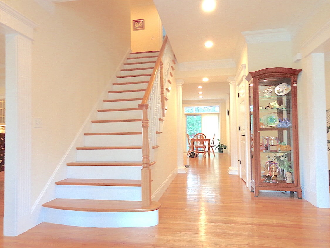
36 Normandy Rd

Favorites
Check Back Soon for Upcoming Availability
Fees and Policies
The fees below are based on community-supplied data and may exclude additional fees and utilities.
- Dogs Allowed
-
Fees not specified
-
Weight limit--
-
Pet Limit--
Details
Lease Options
-
12 Months
About 36 Normandy Rd Lexington, MA 02421
Small dogs are OK! 6 Garage Parking included!
36 Normandy Rd is an apartment community located in Middlesex County and the 02421 ZIP Code.
Location
Get Directions
Much of Lexington’s local culture is rooted in the town’s role in the American Revolution, but the community is much more than a historical landmark. Sitting only about 30 minutes outside downtown Boston, folks renting in Lexington are far enough removed from the urban core to enjoy a quiet lifestyle while close enough for an easy commute.
Dozens of public parks dot the community, offering endless opportunities for enjoying nature right in your own neighborhood. The Minuteman Bikeway connects Lexington to Bedford in the north and Arlington and Cambridge in the south. The schools in the area get excellent marks and the crime rate is among the lowest in the nation, so the community is highly desirable for families.
Learn more about living in LexingtonBelow are rent ranges for similar nearby apartments
Education
| Colleges & Universities | Distance | ||
|---|---|---|---|
| Colleges & Universities | Distance | ||
| Drive: | 11 min | 5.3 mi | |
| Drive: | 14 min | 6.4 mi | |
| Drive: | 14 min | 8.8 mi | |
| Drive: | 21 min | 8.9 mi |
36 Normandy Rd is within 11 minutes or 5.3 miles from Bentley University. It is also near Brandeis University and Tufts Univ., Medford.
Transportation options available in Lexington include Alewife Station, located 6.9 miles from 36 Normandy Rd. 36 Normandy Rd is near General Edward Lawrence Logan International, located 16.4 miles or 28 minutes away, and Worcester Regional, located 44.3 miles or 63 minutes away.
| Transit / Subway | Distance | ||
|---|---|---|---|
| Transit / Subway | Distance | ||
|
|
Drive: | 11 min | 6.9 mi |
| Drive: | 10 min | 7.0 mi | |
|
|
Drive: | 14 min | 8.3 mi |
|
|
Drive: | 14 min | 8.5 mi |
| Drive: | 15 min | 9.0 mi |
| Commuter Rail | Distance | ||
|---|---|---|---|
| Commuter Rail | Distance | ||
|
|
Drive: | 10 min | 4.7 mi |
|
|
Drive: | 10 min | 5.1 mi |
| Drive: | 10 min | 5.1 mi | |
|
|
Drive: | 10 min | 5.3 mi |
| Drive: | 13 min | 6.6 mi |
| Airports | Distance | ||
|---|---|---|---|
| Airports | Distance | ||
|
General Edward Lawrence Logan International
|
Drive: | 28 min | 16.4 mi |
|
Worcester Regional
|
Drive: | 63 min | 44.3 mi |
Time and distance from 36 Normandy Rd.
| Shopping Centers | Distance | ||
|---|---|---|---|
| Shopping Centers | Distance | ||
| Walk: | 17 min | 0.9 mi | |
| Drive: | 5 min | 2.3 mi | |
| Drive: | 6 min | 2.9 mi |
36 Normandy Rd has 3 shopping centers within 2.9 miles, which is about a 6-minute walk. The miles and minutes will be for the farthest away property.
| Parks and Recreation | Distance | ||
|---|---|---|---|
| Parks and Recreation | Distance | ||
|
Minute Man National Historical Park
|
Drive: | 7 min | 4.2 mi |
|
Beaver Brook Reservation
|
Drive: | 10 min | 5.3 mi |
|
Mass Audubon's Habitat Education Center and Wildlife Sanctuary
|
Drive: | 11 min | 5.6 mi |
|
Codman Community Farms
|
Drive: | 11 min | 5.8 mi |
|
Mass Audubon's Drumlin Farm Wildlife Sanctuary
|
Drive: | 11 min | 6.1 mi |
36 Normandy Rd has 5 parks within 6.1 miles, including Minute Man National Historical Park, Mass Audubon's Habitat Education Center and Wildlife Sanctuary, and Beaver Brook Reservation.
| Hospitals | Distance | ||
|---|---|---|---|
| Hospitals | Distance | ||
| Drive: | 8 min | 4.7 mi | |
| Drive: | 11 min | 5.5 mi | |
| Drive: | 12 min | 6.9 mi |
36 Normandy Rd has 3 hospitals within 6.9 miles, the nearest is McLean Hospital Corporation which is 4.7 miles away and a 8 minute drive.
| Military Bases | Distance | ||
|---|---|---|---|
| Military Bases | Distance | ||
| Drive: | 8 min | 3.3 mi | |
| Drive: | 25 min | 14.4 mi |
36 Normandy Rd is 3.3 miles from Hanscom Air Force Base, and is convenient to other military bases, including US Military Reservation.
You May Also Like
Similar Rentals Nearby


What Are Walk Score®, Transit Score®, and Bike Score® Ratings?
Walk Score® measures the walkability of any address. Transit Score® measures access to public transit. Bike Score® measures the bikeability of any address.
What is a Sound Score Rating?
A Sound Score Rating aggregates noise caused by vehicle traffic, airplane traffic and local sources