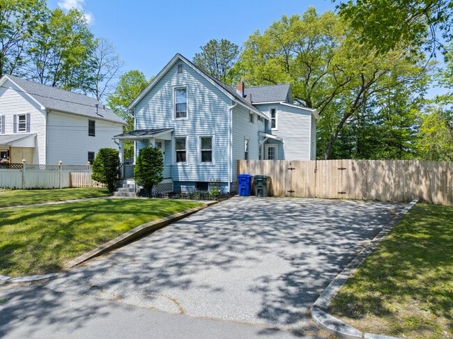

36 N Maple St

12 Month Lease

36 N Maple St

,

Hadley, MA 01035

Share Listing
Favorites
36 N Maple St
Share Listing
Favorites

Check Back Soon for Upcoming Availability

Beds Baths Average SF
5 Bedrooms 5 Bedrooms 5 Br 3 Baths 3 Baths 3 Ba
Location
36 N Maple St, Hadley,
MA 01035
Get Directions
| Edit

Under 30 minutes

Commute Time is calculated at rush hour.
City - Hadley

Nestled alongside the Connecticut River, Hadley is an agricultural town just west of Amherst in Central Massachusetts. Hadley exudes a small-town atmosphere, with vast stretches of green space and lots of fresh local produce shared between neighbors. Hadley offers a bevy of apartments and houses available for rent along peaceful, tree-lined roads.

Many residents are drawn to Hadley’s overall tranquil atmosphere. The community also sits within close proximity to numerous outdoor destinations, including Skinner State Park, Mount Holyoke Range State Park, and Mount Tom State Reservation. Hadley is also convenient to Smith College and the University of Massachusetts Amherst, making the community a top choice for students, faculty, and staff seeking a laidback lifestyle close to campus.

Learn more about living in Hadley 
Education
Colleges & Universities Distance
Drive: 5 min 2.6 mi
Drive: 6 min 2.7 mi
Drive: 10 min 4.4 mi
Drive: 16 min 6.3 mi
36 N Maple St is within 6 minutes or 2.7 miles from UMass Amherst. It is also near Amherst College and Hampshire College.
Transportation

36 N Maple St is near Bradley International, located 35.3 miles or 63 minutes away.

Commuter Rail Distance
Drive: 14 min 5.9 mi
Drive: 26 min 14.0 mi
Drive: 29 min 19.2 mi
Drive: 34 min 23.7 mi
Drive: 52 min 38.5 mi
Airports Distance
Airports Distance
Bradley International
Drive: 63 min 35.3 mi

Walkability Near 36 N Maple St Hadley, MA 01035

Getting Around
Fairly Walkable
Walkability
40 / 100
Minimal Public Transit
Transit
10 / 100
Exceptionally Drivable
Drivability
100 / 100
Fairly Bikeable
Bikeability
50 / 100

Scores provided by

What do Walkability, Transit, Drivability, and Bikeability mean? Walkability measures the walking distance to day-to-day needs. Transit measures access to public transportation. Drivability measures congestion, parking availability, and access to major roads. Bikeability measures the suitability for cycling. How It Works
-
Soundscore
- / 100

Traffic

-

Airport

-

Businesses

-

Scores provided by

HowLoud What is a Sound Score Rating? A Sound Score Rating aggregates noise caused by vehicle traffic, airplane traffic and local sources. How It Works
Points of Interest

Time and distance from 36 N Maple St.

Shopping Centers Distance
Walk: 10 min 0.5 mi
Walk: 17 min 0.9 mi
Walk: 17 min 0.9 mi
36 N Maple St has 3 shopping centers within 0.9 mile, which is about a 17-minute walk. The miles and minutes will be for the farthest away property.
Parks and Recreation Distance
Beneski Museum of Natural History
Drive: 5 min 2.7 mi
Massachusetts Natural History Museum
Drive: 7 min 3.1 mi
Hitchcock Center for the Environment
Drive: 6 min 3.3 mi
Orchard Hill Observatory
Drive: 8 min 3.6 mi
Norwottuck Rail Trail
Drive: 8 min 4.6 mi
36 N Maple St has 5 parks within 4.6 miles, including Hitchcock Center for the Environment, Beneski Museum of Natural History, and Massachusetts Natural History Museum.
Hospitals Distance
Hospitals Distance
Drive: 15 min 6.8 mi
36 N Maple St is 6.8 miles and a 15 minute drive from Cooley Dickinson Hospital.
Military Bases Distance
Drive: 30 min 15.2 mi
Drive: 36 min 21.1 mi
Drive: 71 min 51.4 mi
36 N Maple St has 3 military bases within 51.4 miles, the nearest is Westover Air Reserve Base which is 15.2 miles away and a 30 minute drive.

You May Also Like

Similar Rentals Nearby