$2,300 / Month
36 Bryon Rd Unit 5
Chestnut Hill, MA 02467
2 Weeks Ago
Favorites
36 Bryon Rd Unit 5

Favorites
Check Back Soon for Upcoming Availability
| Beds | Baths | Average SF |
|---|---|---|
| 2 Bedrooms 2 Bedrooms 2 Br | 1 Bath 1 Bath 1 Ba | 900 SF |
Fees and Policies
The fees below are based on community-supplied data and may exclude additional fees and utilities.
- Parking
-
Surface Lot--
Details
Utilities Included
-
Gas
-
Water
-
Heat
-
Trash Removal
-
Sewer
Property Information
-
Furnished Units Available
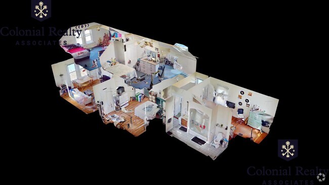
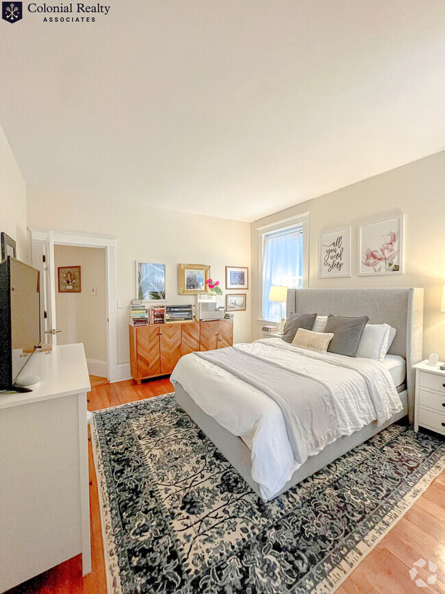
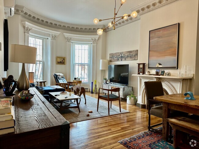
About This Property
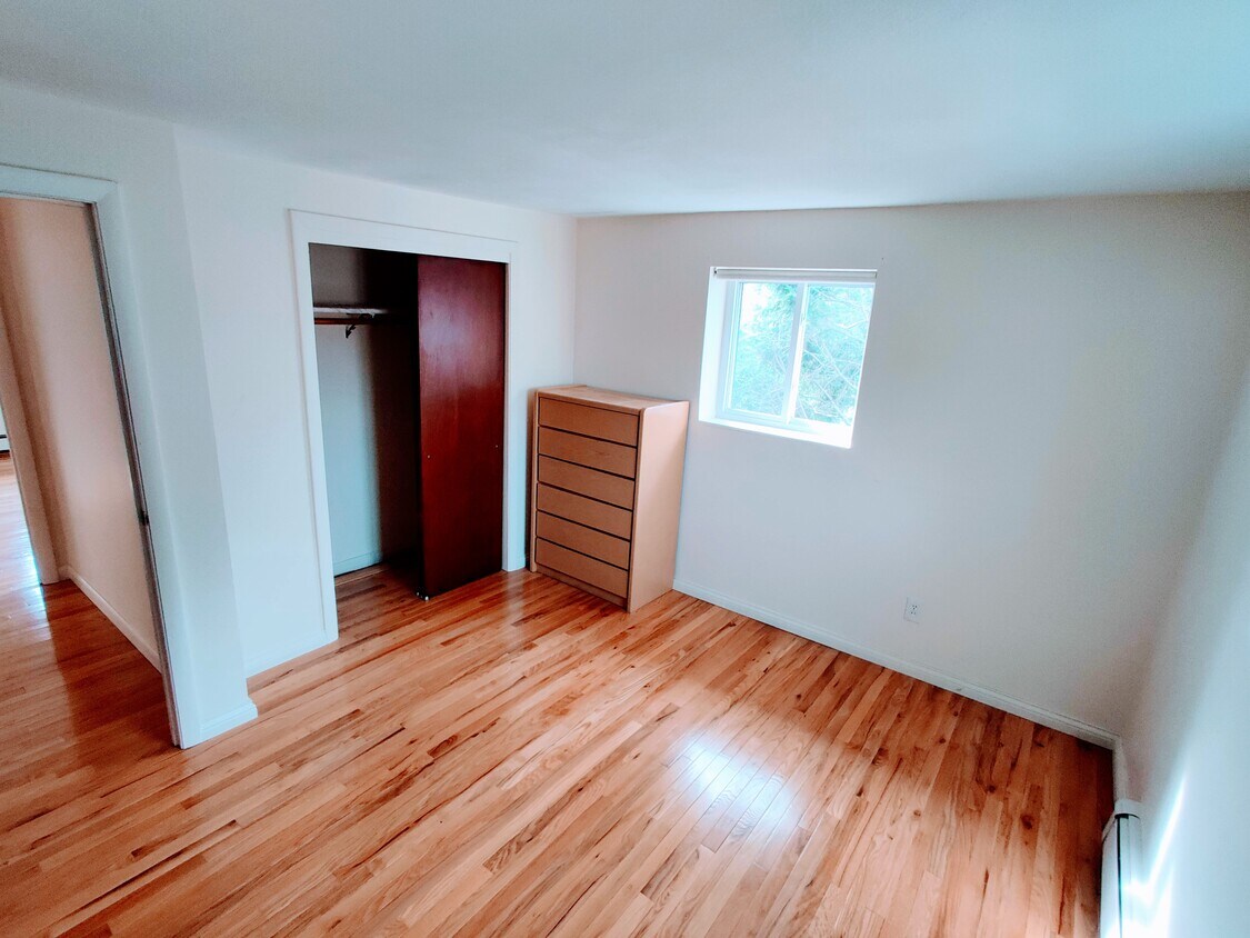
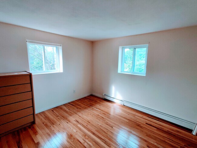
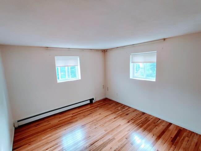
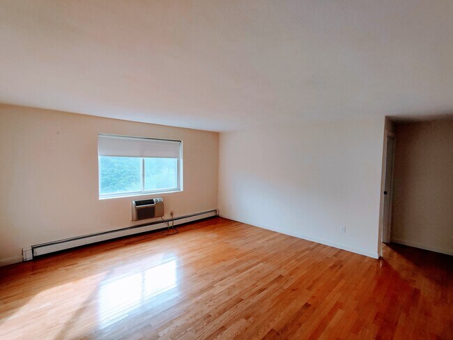
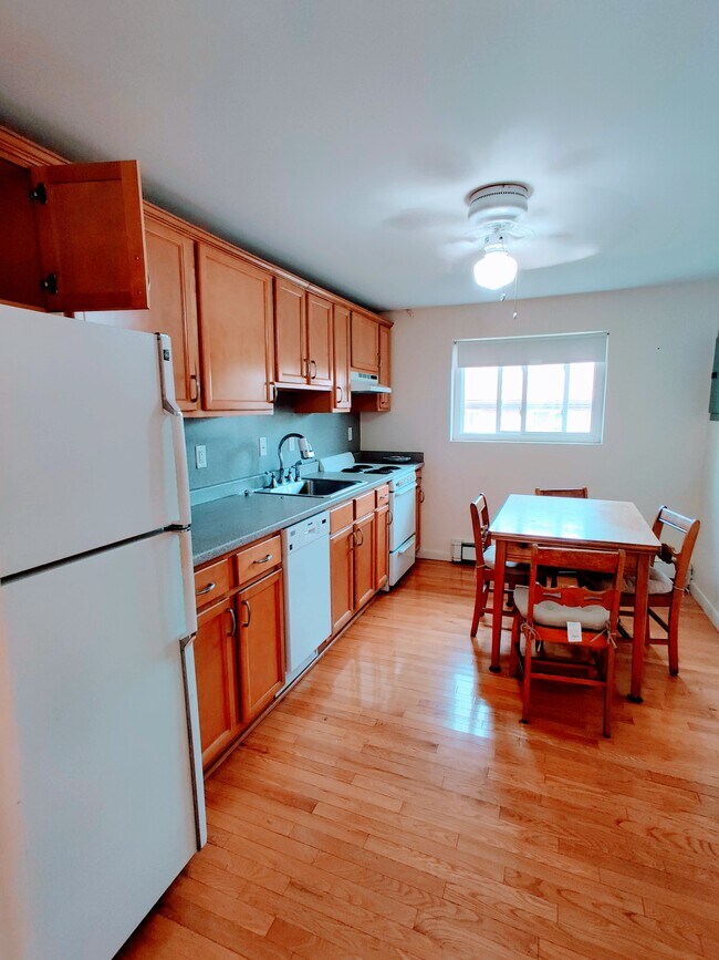
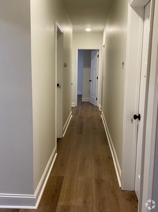
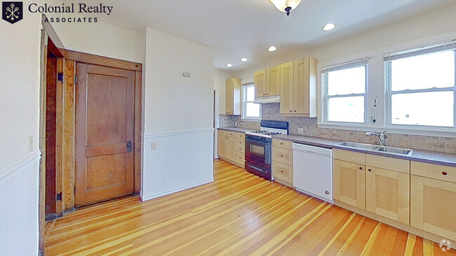
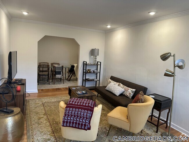
All landscaping and shoveling for the complex are covered by rent. Heat and hot/cold water covered by the rent. Includes 2 assigned and numbered parking spots. Amazing 2 bedroom unit with AC. Full kitchen with dishwasher, refrigerator, stove, garbage disposal, and kitchen cabinets. Private Pool and Tennis Courts for the condo complex! Easy access to major routes and highways. 5 min drive to hospitals (Beth Israel Deaconess HealthCare-Chestnut Hill, and Bournewood Hospital). 5 min drive to Chestnut Hill Mall, Wegmans, stores, and restaurants. Chestnut Hill is one of the safest and quietest neighborhoods in all of MA. All tenants will go through a criminal background and credit check. Please email me if you are interested.
36 Bryon Rd is a condo located in Middlesex County and the 02467 ZIP Code.
Condo Features
Air Conditioning
Dishwasher
Refrigerator
Disposal
- Air Conditioning
- Smoke Free
- Dishwasher
- Disposal
- Kitchen
- Refrigerator
- Furnished
- Laundry Facilities
- Pool
Location
Get Directions
One of the more upscale communities in the Boston area, Chestnut Hill apartments deliver a stylish lifestyle and a beautiful atmosphere. Boston College’s campus is the main landmark on the northeast corner of the village, and the school’s museums, libraries, and other resources add considerable intellectual capital to the broader community—of course, Eagles games are quite popular as well. The shopping center known as “The Street” on Boylston Street provides a trendy retail experience in a unique setting. The area is loaded with parks and green spaces, particularly Hancock Woods in the south, Webster Conservation Area in the west, and Chestnut Hill Reservoir in the north.
Learn more about living in Chestnut Hill
Amenities
- Air Conditioning
- Smoke Free
- Dishwasher
- Disposal
- Kitchen
- Refrigerator
- Furnished
- Laundry Facilities
- Pool
Expenses
Utilities Included
Gas, Water, Heat, Trash Removal, Sewer
Included
Education
| Colleges & Universities | Distance | ||
|---|---|---|---|
| Colleges & Universities | Distance | ||
| Drive: | 9 min | 4.2 mi | |
| Drive: | 11 min | 4.6 mi | |
| Drive: | 11 min | 5.3 mi | |
| Drive: | 12 min | 5.7 mi |
36 Bryon Rd Unit 5 is within 9 minutes or 4.2 miles from Boston College. It is also near Boston College, Brighton and MCPHS University, Boston.
Transportation options available in Chestnut Hill include Chestnut Hill Station, located 2.0 miles from 36 Bryon Rd Unit 5. 36 Bryon Rd Unit 5 is near General Edward Lawrence Logan International, located 11.9 miles or 24 minutes away.
| Transit / Subway | Distance | ||
|---|---|---|---|
| Transit / Subway | Distance | ||
|
|
Drive: | 5 min | 2.0 mi |
|
|
Drive: | 7 min | 3.5 mi |
|
|
Drive: | 8 min | 3.6 mi |
|
|
Drive: | 8 min | 3.6 mi |
|
|
Drive: | 8 min | 3.8 mi |
| Commuter Rail | Distance | ||
|---|---|---|---|
| Commuter Rail | Distance | ||
|
|
Drive: | 4 min | 1.6 mi |
|
|
Drive: | 5 min | 1.9 mi |
|
|
Drive: | 6 min | 2.1 mi |
|
|
Drive: | 8 min | 2.9 mi |
|
|
Drive: | 8 min | 4.3 mi |
| Airports | Distance | ||
|---|---|---|---|
| Airports | Distance | ||
|
General Edward Lawrence Logan International
|
Drive: | 24 min | 11.9 mi |
Time and distance from 36 Bryon Rd Unit 5.
| Shopping Centers | Distance | ||
|---|---|---|---|
| Shopping Centers | Distance | ||
| Drive: | 4 min | 1.4 mi | |
| Drive: | 5 min | 2.1 mi | |
| Drive: | 5 min | 2.1 mi |
36 Bryon Rd Unit 5 has 3 shopping centers within 2.1 miles, which is about a 5-minute drive. The miles and minutes will be for the farthest away property.
| Parks and Recreation | Distance | ||
|---|---|---|---|
| Parks and Recreation | Distance | ||
|
Brook Farm Historic Site
|
Drive: | 4 min | 1.6 mi |
|
Hammond Pond Reservation
|
Drive: | 5 min | 2.5 mi |
|
Cutler Park Reservation
|
Drive: | 6 min | 2.6 mi |
|
Arnold Arboretum of Harvard University
|
Drive: | 6 min | 2.7 mi |
|
Frederick Law Olmsted National Historic Site
|
Drive: | 8 min | 3.6 mi |
36 Bryon Rd Unit 5 has 5 parks within 3.6 miles, including Brook Farm Historic Site, Hammond Pond Reservation, and Cutler Park Reservation.
| Hospitals | Distance | ||
|---|---|---|---|
| Hospitals | Distance | ||
| Drive: | 4 min | 1.7 mi | |
| Drive: | 6 min | 3.1 mi | |
| Drive: | 9 min | 4.0 mi |
36 Bryon Rd Unit 5 has 3 hospitals within 4.0 miles, the nearest is Bournewood Hospital which is 1.7 miles away and a 4 minute drive.
| Military Bases | Distance | ||
|---|---|---|---|
| Military Bases | Distance | ||
| Drive: | 23 min | 12.6 mi | |
| Drive: | 29 min | 16.4 mi |
36 Bryon Rd Unit 5 is 12.6 miles from US Military Reservation, and is convenient to other military bases, including Hanscom Air Force Base.
You May Also Like
Similar Rentals Nearby

What Are Walk Score®, Transit Score®, and Bike Score® Ratings?
Walk Score® measures the walkability of any address. Transit Score® measures access to public transit. Bike Score® measures the bikeability of any address.
What is a Sound Score Rating?
A Sound Score Rating aggregates noise caused by vehicle traffic, airplane traffic and local sources

36 Bryon Rd
Chestnut Hill, MA 02467