
Nova by Gomes
1213-1221 Broad St,
Newark, NJ 07114
$2,054 - $3,000
Studio - 2 Beds
The West Side of Newark is a well-established, urban community. Situated just west of downtown, the historic West Side County Park anchors the community and draws in locals for baseball and other recreation in the city’s Central Ward. Residents of this community enjoy plentiful public transportation, an array of amenities along Springfield Avenue, and various apartments and condos for rent. West Side is very pedestrian friendly, with many residents walking from place to place. Great public schools, universities, and neighborhood parks can be found around the West Side of Newark.
Learn more about living in West SideCompare neighborhood and city base rent averages by bedroom.
| West Side | Newark, NJ | |
|---|---|---|
| Studio | - | $1,365 |
| 1 Bedroom | $1,765 | $1,611 |
| 2 Bedrooms | $2,083 | $2,024 |
| 3 Bedrooms | $2,188 | $2,121 |
| Colleges & Universities | Distance | ||
|---|---|---|---|
| Colleges & Universities | Distance | ||
| Drive: | 3 min | 1.5 mi | |
| Drive: | 2 min | 1.5 mi | |
| Drive: | 3 min | 1.9 mi | |
| Drive: | 6 min | 2.7 mi |
Transportation options available in Newark include Warren Street, located 1.4 miles from 358-360 S Orange Ave. 358-360 S Orange Ave is near Newark Liberty International, located 6.4 miles or 10 minutes away, and LaGuardia, located 28.6 miles or 43 minutes away.
| Transit / Subway | Distance | ||
|---|---|---|---|
| Transit / Subway | Distance | ||
|
|
Drive: | 2 min | 1.4 mi |
|
|
Drive: | 2 min | 1.4 mi |
|
|
Drive: | 3 min | 1.4 mi |
|
|
Drive: | 2 min | 1.6 mi |
|
|
Drive: | 3 min | 1.9 mi |
| Commuter Rail | Distance | ||
|---|---|---|---|
| Commuter Rail | Distance | ||
|
|
Drive: | 3 min | 2.0 mi |
|
|
Drive: | 4 min | 2.1 mi |
|
|
Drive: | 4 min | 2.1 mi |
|
|
Drive: | 5 min | 2.6 mi |
|
|
Drive: | 6 min | 3.0 mi |
| Airports | Distance | ||
|---|---|---|---|
| Airports | Distance | ||
|
Newark Liberty International
|
Drive: | 10 min | 6.4 mi |
|
LaGuardia
|
Drive: | 43 min | 28.6 mi |
Scores provided by
Traffic
-Airport
-Businesses
-Scores provided by
HowLoud What is a Sound Score Rating? A Sound Score Rating aggregates noise caused by vehicle traffic, airplane traffic and local sources. How It WorksTime and distance from 358-360 S Orange Ave.
| Shopping Centers | Distance | ||
|---|---|---|---|
| Shopping Centers | Distance | ||
| Walk: | 14 min | 0.7 mi | |
| Walk: | 17 min | 0.9 mi | |
| Drive: | 2 min | 1.3 mi |
| Parks and Recreation | Distance | ||
|---|---|---|---|
| Parks and Recreation | Distance | ||
|
Newark Museum and Dreyfuss Planetarium
|
Drive: | 3 min | 1.9 mi |
|
Branch Brook Park
|
Drive: | 6 min | 3.1 mi |
|
Edison National Historic Site
|
Drive: | 10 min | 4.8 mi |
|
Kearny Marsh
|
Drive: | 10 min | 5.1 mi |
|
Turtle Back Zoo
|
Drive: | 13 min | 6.5 mi |
| Hospitals | Distance | ||
|---|---|---|---|
| Hospitals | Distance | ||
| Walk: | 10 min | 0.5 mi | |
| Drive: | 2 min | 1.6 mi | |
| Drive: | 3 min | 1.8 mi |
| Military Bases | Distance | ||
|---|---|---|---|
| Military Bases | Distance | ||
| Drive: | 16 min | 10.2 mi | |
| Drive: | 27 min | 14.0 mi | |
| Drive: | 32 min | 18.5 mi |
What Are Walk Score®, Transit Score®, and Bike Score® Ratings?
Walk Score® measures the walkability of any address. Transit Score® measures access to public transit. Bike Score® measures the bikeability of any address.
What is a Sound Score Rating?
A Sound Score Rating aggregates noise caused by vehicle traffic, airplane traffic and local sources.

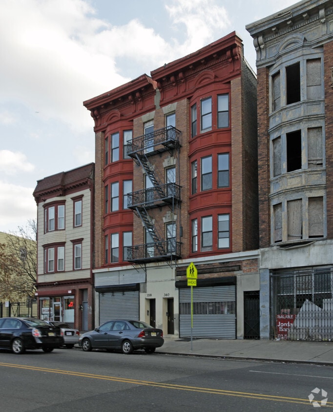
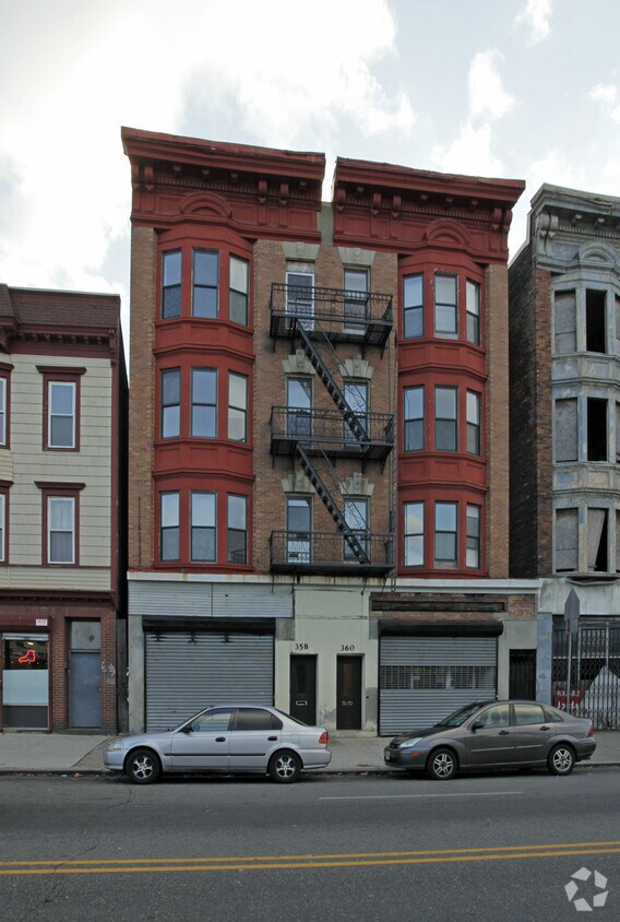
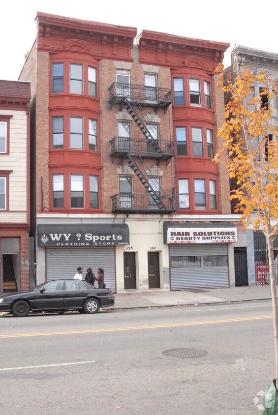
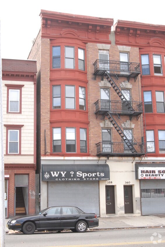
358-360 S Orange Ave
Newark, NJ 07103


