
Sevens
777 W Middlefield Rd,
Mountain View, CA 94043
Studio - 2 Beds $3,602 - $8,311


Locate at best neighbor of downtown Palo Alto, North 2 blocks of University Ave. cross street from Johnson Park, Drive 2 min to Stanford University campus & famous Stanford shopping center, 5 min to Stanford Hospital . Walk to Cal train catching free shuttle to Face Book campus, or Ggle campus or Marguerite shuttle to Stanford campus. Explore unlimited fun in this college town, walk few blocks to Cal Train take the ride go North to San Francisco city or go south to San Jose city.
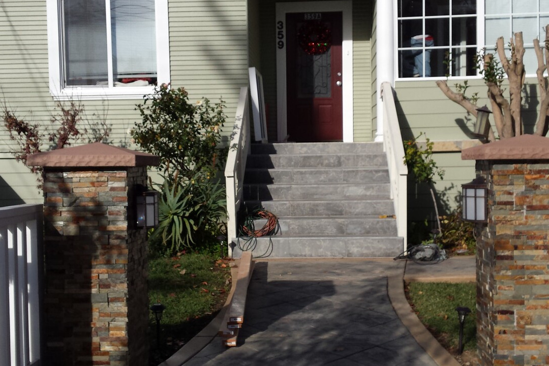
357-359 Hawthorne Ave is an apartment community located in Santa Clara County and the 94301 ZIP Code. This area is served by the Palo Alto Unified attendance zone.
Washer/Dryer
Air Conditioning
Dishwasher
High Speed Internet Access
Hardwood Floors
Granite Countertops
Microwave
Refrigerator
An outgoing vibe emanates from the Downtown North neighborhood. Downtown North provides an energy like no other in Palo Alto. Still, locals enjoy being part of a tight-knit community focused on safety, communication and most importantly: fun.
Palo Alto has one of the best public school systems in California, houses Stanford University, and has some of the most delicious dining and exciting shopping opportunities in the Bay Area. The placement of the city provides convenience for commuters to San Jose 24 miles to the Southeast or San Francisco 32 miles to the Northwest.
Learn more about living in Downtown Palo Alto| Colleges & Universities | Distance | ||
|---|---|---|---|
| Colleges & Universities | Distance | ||
| Drive: | 6 min | 2.2 mi | |
| Drive: | 8 min | 2.5 mi | |
| Drive: | 13 min | 6.0 mi | |
| Drive: | 17 min | 8.0 mi |


Transportation options available in Palo Alto include Mountain View Station, located 6.4 miles from 357-359 Hawthorne Ave. 357-359 Hawthorne Ave is near Norman Y Mineta San Jose International, located 15.9 miles or 24 minutes away, and San Francisco International, located 20.0 miles or 29 minutes away.
| Transit / Subway | Distance | ||
|---|---|---|---|
| Transit / Subway | Distance | ||
| Drive: | 14 min | 6.4 mi | |
|
|
Drive: | 14 min | 6.4 mi |
| Drive: | 14 min | 8.3 mi | |
|
|
Drive: | 14 min | 8.5 mi |
|
|
Drive: | 15 min | 8.9 mi |
| Commuter Rail | Distance | ||
|---|---|---|---|
| Commuter Rail | Distance | ||
| Walk: | 10 min | 0.6 mi | |
| Drive: | 4 min | 1.6 mi | |
| Drive: | 6 min | 2.2 mi | |
| Drive: | 8 min | 2.8 mi | |
| Drive: | 12 min | 5.0 mi |
| Airports | Distance | ||
|---|---|---|---|
| Airports | Distance | ||
|
Norman Y Mineta San Jose International
|
Drive: | 24 min | 15.9 mi |
|
San Francisco International
|
Drive: | 29 min | 20.0 mi |
Time and distance from 357-359 Hawthorne Ave.
| Shopping Centers | Distance | ||
|---|---|---|---|
| Shopping Centers | Distance | ||
| Walk: | 20 min | 1.1 mi | |
| Drive: | 4 min | 1.2 mi | |
| Drive: | 4 min | 1.4 mi |
| Parks and Recreation | Distance | ||
|---|---|---|---|
| Parks and Recreation | Distance | ||
|
Hopkins Creekside Park
|
Walk: | 12 min | 0.6 mi |
|
Seminary Oaks Park
|
Drive: | 4 min | 1.3 mi |
|
Jack W. Lyle Park
|
Drive: | 4 min | 1.4 mi |
|
El Palo Alto Park
|
Drive: | 5 min | 1.5 mi |
|
Burgess Park
|
Drive: | 5 min | 1.7 mi |
| Hospitals | Distance | ||
|---|---|---|---|
| Hospitals | Distance | ||
| Drive: | 5 min | 1.6 mi | |
| Drive: | 6 min | 2.3 mi | |
| Drive: | 12 min | 5.1 mi |
| Military Bases | Distance | ||
|---|---|---|---|
| Military Bases | Distance | ||
| Drive: | 17 min | 8.8 mi |
What Are Walk Score®, Transit Score®, and Bike Score® Ratings?
Walk Score® measures the walkability of any address. Transit Score® measures access to public transit. Bike Score® measures the bikeability of any address.
What is a Sound Score Rating?
A Sound Score Rating aggregates noise caused by vehicle traffic, airplane traffic and local sources
357-359 Hawthorne Ave
Palo Alto, CA 94301


