$4,090 / Month
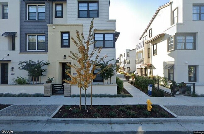
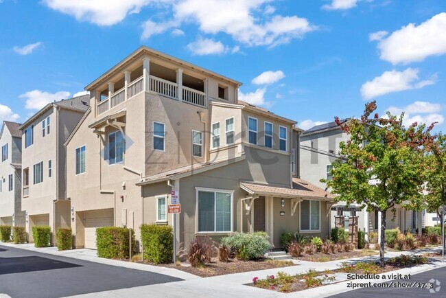
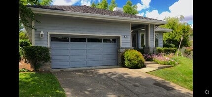
3560 Peralta Blvd
Fremont, CA 94536
2 Weeks Ago
Favorites
3560 Peralta Blvd

Favorites
Check Back Soon for Upcoming Availability
| Beds | Baths | Average SF |
|---|---|---|
| 3 Bedrooms 3 Bedrooms 3 Br | 3.5 Baths 3.5 Baths 3.5 Ba | 1,729 SF |
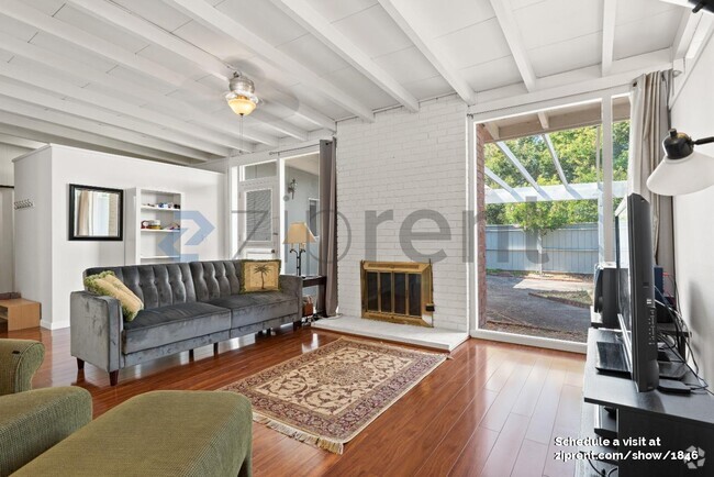
About This Property
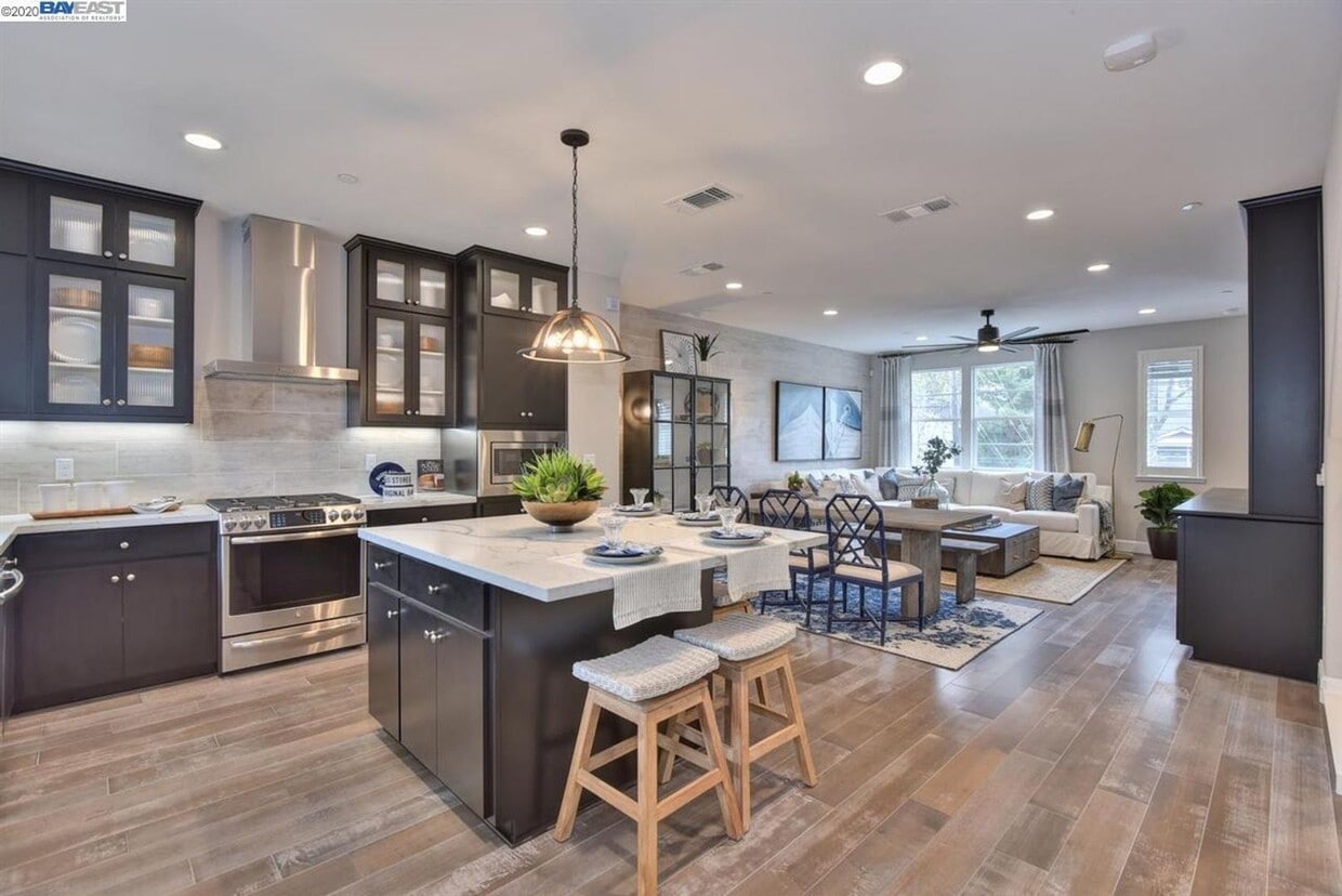
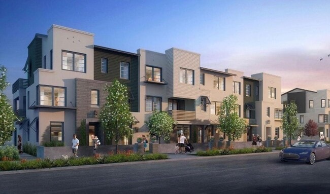
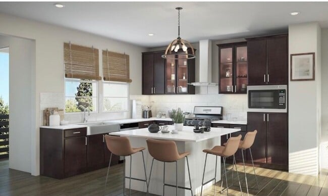
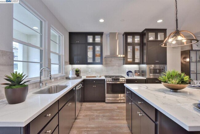
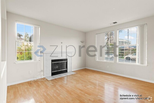
This new 3 bedroom model townhome is absolutely gorgeous! Nestled in the Parkmont school district, you'll enjoy a full bedroom and bathroom on the first floor. In addition, beautiful hardwood floors, gourmet kitchen with stainless appliances and gas stove, dual pane windows, recessed lighting, spacious balconies, beautiful fans, AC, and lovely bathrooms. You'll also enjoy the convenience of a two car garage and a washer/dryer. Gardening is provided by the HOA for common areas. Every bedroom has it's own attached bathroom. Close to schools, park, retail stores. GREAT FOR COMMUTERS...MINUTES TO 880, DUMBARTON, FACEBOOK KEY FEATURES: Address is 3560 Peralta Blvd. in central Fremont 1729 square feet Built in 2020 3 bedrooms 3.5 bathrooms 2 car garage Blue Ribbon schools including: Parkmont Elementary (917 API), Centerville Jr. High (927 API) and Washington High (812 API) Lease duration - 1 year Available: May 6th Deposit - $4090 Gardener provided MUST HAVE: Fico score of 700 or higher Minimum monthly income of $12,270 Excellent rental history Credit and back round check for each adult over 18 $30 application fee per adult CONTACT NAOMI AT EAST BAY PROPERTY MANAGEMENT TO VIEW
3560 Peralta Blvd is a house located in Alameda County and the 94536 ZIP Code. This area is served by the Fremont Unified attendance zone.
Location
Get Directions
As its name implies, Centerville is a neighborhood located in central Fremont. Filled with tree-lined streets, Centerville has mid-range to upscale rentals available, including cozy single-family homes and luxury apartments. Centerville is family-friendly with several great schools and daycare centers located in the community. Renters from all walks of life enjoy Centerville’s amazing location. Along with bordering Downtown Fremont, Centerville is convenient to some of Fremont’s most popular parks and trailheads including Quarry Lakes Regional Recreation Area, a 471-acre local favorite for picnics, fishing, swimming, and boating.
Silicon Valley commuters enjoy having a train station in town, while Highway 84 and Interstate 880 are used by those who prefer to drive. Fremont Boulevard has a variety of restaurants, shops, event venues, and other businesses, providing residents with plenty of amenities not far from home.
Learn more about living in CentervilleBelow are rent ranges for similar nearby apartments
Education
| Colleges & Universities | Distance | ||
|---|---|---|---|
| Colleges & Universities | Distance | ||
| Drive: | 8 min | 4.7 mi | |
| Drive: | 14 min | 6.2 mi | |
| Drive: | 17 min | 11.3 mi | |
| Drive: | 18 min | 12.1 mi |
3560 Peralta Blvd is within 8 minutes or 4.7 miles from Ohlone College, Newark. It is also near Ohlone College, Fremont Campus and Chabot College.
Schools


Public Elementary School
Grades K-5
343 Students
Nearby
Public Elementary School
Grades 1-5
890 Students
Attendance Zone
Public Middle School
Grades 6-8
946 Students
Attendance Zone
Public High School
Grades 9-12
1,931 Students
Attendance Zone
Private Elementary, Middle & High School
Grades PK-12
691 Students
Nearby
Private Elementary School
Grades PK-2
Nearby
Private Elementary & Middle School
Grades PK-8
285 Students
Nearby
School data provided by
 The GreatSchools Rating helps parents compare schools within a state based on a variety of school quality indicators and provides a helpful picture of how effectively each school serves all of its students. Ratings are on a scale of 1 (below average) to 10 (above average) and can include test scores, college readiness, academic progress, advanced courses, equity, discipline and attendance data. We also advise parents to visit schools, consider other information on school performance and programs, and consider family needs as part of the school selection process.
View GreatSchools Rating Methodology
View GreatSchools Rating Methodology
Transportation options available in Fremont include Fremont Station, located 1.7 miles from 3560 Peralta Blvd. 3560 Peralta Blvd is near Norman Y Mineta San Jose International, located 19.5 miles or 26 minutes away, and Metro Oakland International, located 20.1 miles or 27 minutes away.
| Transit / Subway | Distance | ||
|---|---|---|---|
| Transit / Subway | Distance | ||
|
|
Drive: | 4 min | 1.7 mi |
|
|
Drive: | 8 min | 4.2 mi |
|
|
Drive: | 13 min | 6.0 mi |
|
|
Drive: | 15 min | 10.0 mi |
|
|
Drive: | 17 min | 11.5 mi |
| Commuter Rail | Distance | ||
|---|---|---|---|
| Commuter Rail | Distance | ||
| Walk: | 10 min | 0.5 mi | |
| Drive: | 16 min | 11.9 mi | |
|
|
Drive: | 16 min | 11.9 mi |
| Drive: | 25 min | 16.5 mi | |
| Drive: | 22 min | 17.1 mi |
| Airports | Distance | ||
|---|---|---|---|
| Airports | Distance | ||
|
Norman Y Mineta San Jose International
|
Drive: | 26 min | 19.5 mi |
|
Metro Oakland International
|
Drive: | 27 min | 20.1 mi |
Time and distance from 3560 Peralta Blvd.
| Shopping Centers | Distance | ||
|---|---|---|---|
| Shopping Centers | Distance | ||
| Walk: | 3 min | 0.2 mi | |
| Walk: | 14 min | 0.8 mi | |
| Walk: | 15 min | 0.8 mi |
3560 Peralta Blvd has 3 shopping centers within 0.8 mile, which is about a 15-minute walk. The miles and minutes will be for the farthest away property.
| Parks and Recreation | Distance | ||
|---|---|---|---|
| Parks and Recreation | Distance | ||
|
Quarry Lakes Regional Recreation Area
|
Drive: | 4 min | 2.1 mi |
|
Alameda Creek Regional Trail
|
Drive: | 4 min | 2.3 mi |
|
Central Park (Lake Elizabeth)
|
Drive: | 7 min | 2.7 mi |
|
Niles Canyon Railway
|
Drive: | 6 min | 3.3 mi |
|
Niles Community Park
|
Drive: | 8 min | 3.8 mi |
3560 Peralta Blvd has 5 parks within 3.8 miles, including Quarry Lakes Regional Recreation Area, Alameda Creek Regional Trail, and Niles Community Park.
| Hospitals | Distance | ||
|---|---|---|---|
| Hospitals | Distance | ||
| Drive: | 3 min | 1.7 mi | |
| Drive: | 3 min | 1.8 mi | |
| Drive: | 13 min | 9.1 mi |
3560 Peralta Blvd has 3 hospitals within 9.1 miles, the nearest is Kaiser Foundation Hospital - Fremont which is 1.7 miles away and a 3 minute drive.
| Military Bases | Distance | ||
|---|---|---|---|
| Military Bases | Distance | ||
| Drive: | 31 min | 22.3 mi |
3560 Peralta Blvd is 22.3 miles and a 31 minute drive from Ames Research Center.
You May Also Like
Similar Rentals Nearby

What Are Walk Score®, Transit Score®, and Bike Score® Ratings?
Walk Score® measures the walkability of any address. Transit Score® measures access to public transit. Bike Score® measures the bikeability of any address.
What is a Sound Score Rating?
A Sound Score Rating aggregates noise caused by vehicle traffic, airplane traffic and local sources

3560 Peralta Blvd
Fremont, CA 94536