
$1,795
/ Month
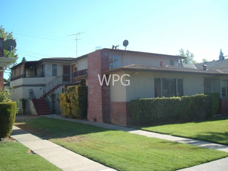
3518 Alden Way
San Jose, CA 95117
2 Weeks Ago
|
Edit
Favorites
3518 Alden Way

Favorites
Check Back Soon for Upcoming Availability
| Beds | Baths | Average SF |
|---|---|---|
| 1 Bedroom 1 Bedroom 1 Br | 1 Bath 1 Bath 1 Ba | 647 SF |
About This Property
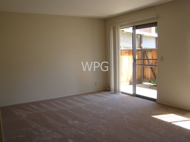
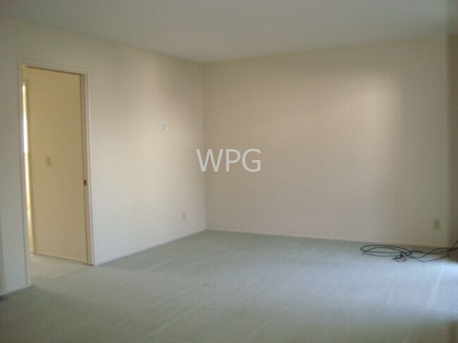
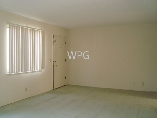
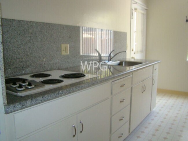
Light and bright large downstairs 1 bedroom corner unit with fenced in patio area offers: kitchen with eat-in area, refrigerator, granite counter tops, cook top and newer oven. Updated bathroom with tile floor. Carpet in living room and bedroom. 2 hallway closets. 1 covered carport parking. On-site laundry. Water and garbage paid. Conveniently located to Stevens Creek Blvd. and Santana Rd.
3518 Alden Way is a house located in Santa Clara County and the 95117 ZIP Code. This area is served by the Campbell Union High School District attendance zone.
3518 Alden Way,
San Jose,
CA
95117
San Jose is the largest city in the San Francisco Bay Area and the beating heart of Silicon Valley, where major tech companies including Adobe, Cisco, and PayPal have long called home. Spanning 182 square miles at the southern end of the bay, it carries real weight as both an economic engine and a cultural center, anchored further by San Jose State University, whose downtown campus shapes much of the city's creative and intellectual energy. Founded in 1777 as California's first city, San Jose balances deep historical roots with an unmistakably forward-facing identity.
Neighborhoods here vary considerably in character. Willow Glen draws renters with tree-lined streets and a walkable village atmosphere along Lincoln Avenue, while the SoFA District and downtown offer a denser, arts-forward setting near SAP Center and The Tech Interactive. Almaden Valley sits closer to open hillside terrain, and Japantown preserves a distinct historic identity just north of downtown.
Learn more about living in San JoseBelow are rent ranges for similar nearby apartments
Education
| Colleges & Universities | Distance | ||
|---|---|---|---|
| Colleges & Universities | Distance | ||
| Drive: | 6 min | 2.6 mi | |
| Drive: | 9 min | 3.7 mi | |
| Drive: | 13 min | 7.0 mi | |
| Drive: | 13 min | 7.6 mi |
3518 Alden Way is within 6 minutes or 2.6 miles from San Jose City College. It is also near Santa Clara University and San Jose State University.
Schools


Public Elementary School
Grades K-5
407 Students
Nearby
Public Elementary & Middle School
Grades K-8
491 Students
Nearby
Public Elementary School
Grades K-5
463 Students
Attendance Zone
Public Middle School
Grades 6-8
677 Students
Attendance Zone
Public High School
Grades 9-12
1,350 Students
Attendance Zone
Private Elementary & Middle School
Grades PK-8
345 Students
Nearby
Private Elementary, Middle & High School
Grades K-12
Nearby
School data provided by
 The GreatSchools Rating helps parents compare schools within a state based on a variety of school quality indicators and provides a helpful picture of how effectively each school serves all of its students. Ratings are on a scale of 1 (below average) to 10 (above average) and can include test scores, college readiness, academic progress, advanced courses, equity, discipline and attendance data. We also advise parents to visit schools, consider other information on school performance and programs, and consider family needs as part of the school selection process.
View GreatSchools Rating Methodology
Data provided by GreatSchools.org © 2026. All rights reserved.
View GreatSchools Rating Methodology
Data provided by GreatSchools.org © 2026. All rights reserved.
Transportation options available in San Jose include Fruitdale Station, located 3.3 miles from 3518 Alden Way. 3518 Alden Way is near Norman Y Mineta San Jose International, located 4.1 miles or 9 minutes away, and San Francisco International, located 35.6 miles or 45 minutes away.
| Transit / Subway | Distance | ||
|---|---|---|---|
| Transit / Subway | Distance | ||
| Drive: | 7 min | 3.3 mi | |
| Drive: | 6 min | 3.3 mi | |
|
|
Drive: | 7 min | 3.6 mi |
| Drive: | 8 min | 3.6 mi | |
| Drive: | 7 min | 3.6 mi |
| Commuter Rail | Distance | ||
|---|---|---|---|
| Commuter Rail | Distance | ||
| Drive: | 7 min | 3.5 mi | |
| Drive: | 8 min | 3.5 mi | |
| Drive: | 8 min | 3.5 mi | |
| Drive: | 9 min | 3.6 mi | |
| Drive: | 9 min | 4.1 mi |
| Airports | Distance | ||
|---|---|---|---|
| Airports | Distance | ||
|
Norman Y Mineta San Jose International
|
Drive: | 9 min | 4.1 mi |
|
San Francisco International
|
Drive: | 45 min | 35.6 mi |
Walkability Near 3518 Alden Way San Jose, CA 95117
Getting Around
 What do Walkability, Transit, Drivability, and Bikeability mean?
Walkability measures the walking distance to day-to-day needs.
Transit measures access to public transportation.
Drivability measures congestion, parking availability, and access to major roads.
Bikeability measures the suitability for cycling.
How It Works
What do Walkability, Transit, Drivability, and Bikeability mean?
Walkability measures the walking distance to day-to-day needs.
Transit measures access to public transportation.
Drivability measures congestion, parking availability, and access to major roads.
Bikeability measures the suitability for cycling.
How It Works
Moderately Walkable
Walkability
60
/ 100
Some Public Transit
Transit
40
/ 100
Very Drivable
Drivability
80
/ 100
Fairly Bikeable
Bikeability
50
/ 100
Scores provided by
Active
Soundscore™
71
/ 100
Traffic
BusyAirport
CalmBusinesses
ActiveScores provided by
HowLoud What is a Sound Score Rating? A Sound Score Rating aggregates noise caused by vehicle traffic, airplane traffic and local sources. How It WorksTime and distance from 3518 Alden Way.
| Shopping Centers | Distance | ||
|---|---|---|---|
| Shopping Centers | Distance | ||
| Walk: | 13 min | 0.7 mi | |
| Walk: | 15 min | 0.8 mi | |
| Walk: | 20 min | 1.0 mi |
3518 Alden Way has 3 shopping centers within 1.0 miles, which is about a 20-minute walk. The miles and minutes will be for the farthest away property.
| Parks and Recreation | Distance | ||
|---|---|---|---|
| Parks and Recreation | Distance | ||
|
John D. Morgan Park
|
Drive: | 7 min | 3.7 mi |
|
Orchard City Green
|
Drive: | 8 min | 3.8 mi |
|
McEnery Park
|
Drive: | 9 min | 5.2 mi |
|
Los Gatos Creek Trail
|
Drive: | 8 min | 5.2 mi |
|
Edith Morley Park
|
Drive: | 10 min | 5.3 mi |
3518 Alden Way has 5 parks within 5.3 miles, including Orchard City Green, John D. Morgan Park, and McEnery Park.
| Hospitals | Distance | ||
|---|---|---|---|
| Hospitals | Distance | ||
| Drive: | 4 min | 2.3 mi | |
| Drive: | 6 min | 3.1 mi | |
| Drive: | 7 min | 3.2 mi |
3518 Alden Way has 3 hospitals within 3.2 miles, the nearest is Santa Clara Valley Medical Center which is 2.3 miles away and a 4 minute drive.
| Military Bases | Distance | ||
|---|---|---|---|
| Military Bases | Distance | ||
| Drive: | 20 min | 12.5 mi |
3518 Alden Way is 12.5 miles and a 20 minute drive from Ames Research Center.
You May Also Like
Similar Rentals Nearby


What Are Walk Score®, Transit Score®, and Bike Score® Ratings?
Walk Score® measures the walkability of any address. Transit Score® measures access to public transit. Bike Score® measures the bikeability of any address.
What is a Sound Score Rating?
A Sound Score Rating aggregates noise caused by vehicle traffic, airplane traffic and local sources.
3518 Alden Way
San Jose, CA 95117