
Presidential Towers
555 W Madison St,
Chicago, IL 60661
$1,797 - $5,036
Studio - 2 Beds

Located west of Wrigleyville, you couldn't find a more perfect location! Addison Red/Brown/Purple line is just a 5 minute walk, which allows you to explore all of Chicago's finest. There is a Jewel, Whole Foods for groceries. For nighttime entertainment, you have Clark St is just a few blocks away to visit the famous Cubby bear, Diamonds, Murphy's Bleachers, John Barleycorn, Deuces, and the list goes on for nightlife.
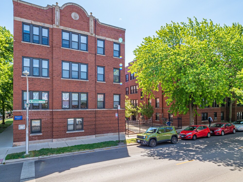
3517 N Racine Ave is an apartment community located in Cook County and the 60657 ZIP Code. This area is served by the Chicago Public Schools attendance zone.
Washer/Dryer
Air Conditioning
Dishwasher
High Speed Internet Access
Peanuts, Cracker Jacks, and rooting for the home team … if you love baseball -- and the Cubs –then you’ll love Wrigleyville! This neighborhood, of course, is home to historic Wrigley Field, where the legendary Chicago Cubs play ball. Wrigleyville is a small district in the larger Lakeview neighborhood, a popular northern Chicago community set along Lake Michigan with a beautiful stretch of beach.
Wondering what it’s like to rent in Wrigleyville? Renting apartments in Wrigleyville is a little different -- you may find some with rooftop bleachers known as "Wrigley Rooftops," but some apartments may not have them. A variety of bars and restaurants populate the neighborhood, especially around the field. During baseball season, the area fills up with Chicago residents for a lively, jovial atmosphere.
Learn more about living in WrigleyvilleCompare neighborhood and city base rent averages by bedroom.
| Wrigleyville | Chicago, IL | |
|---|---|---|
| Studio | $2,189 | $1,632 |
| 1 Bedroom | $1,974 | $2,023 |
| 2 Bedrooms | $2,838 | $2,543 |
| 3 Bedrooms | $2,964 | $3,064 |
| Colleges & Universities | Distance | ||
|---|---|---|---|
| Colleges & Universities | Distance | ||
| Drive: | 4 min | 1.7 mi | |
| Drive: | 4 min | 1.7 mi | |
| Drive: | 5 min | 2.3 mi | |
| Drive: | 9 min | 4.4 mi |


Transportation options available in Chicago include Addison Station (Red Line), located 0.3 mile from 3517 N Racine Ave. 3517 N Racine Ave is near Chicago O'Hare International, located 14.4 miles or 24 minutes away, and Chicago Midway International, located 15.1 miles or 27 minutes away.
| Transit / Subway | Distance | ||
|---|---|---|---|
| Transit / Subway | Distance | ||
|
|
Walk: | 6 min | 0.3 mi |
|
|
Walk: | 8 min | 0.4 mi |
|
|
Walk: | 12 min | 0.6 mi |
|
|
Walk: | 14 min | 0.8 mi |
|
|
Walk: | 15 min | 0.8 mi |
| Commuter Rail | Distance | ||
|---|---|---|---|
| Commuter Rail | Distance | ||
|
|
Drive: | 5 min | 2.2 mi |
|
|
Drive: | 6 min | 2.7 mi |
| Drive: | 7 min | 3.7 mi | |
|
|
Drive: | 8 min | 4.5 mi |
|
|
Drive: | 10 min | 5.1 mi |
| Airports | Distance | ||
|---|---|---|---|
| Airports | Distance | ||
|
Chicago O'Hare International
|
Drive: | 24 min | 14.4 mi |
|
Chicago Midway International
|
Drive: | 27 min | 15.1 mi |
Scores provided by
Traffic
ActiveAirport
CalmBusinesses
ActiveScores provided by
HowLoud What is a Sound Score Rating? A Sound Score Rating aggregates noise caused by vehicle traffic, airplane traffic and local sources. How It WorksTime and distance from 3517 N Racine Ave.
| Shopping Centers | Distance | ||
|---|---|---|---|
| Shopping Centers | Distance | ||
| Walk: | 8 min | 0.4 mi | |
| Walk: | 13 min | 0.7 mi | |
| Walk: | 17 min | 0.9 mi |
| Parks and Recreation | Distance | ||
|---|---|---|---|
| Parks and Recreation | Distance | ||
|
Wrightwood Park
|
Drive: | 5 min | 1.8 mi |
|
Chase Park
|
Drive: | 4 min | 1.9 mi |
|
Notebaert Nature Museum
|
Drive: | 5 min | 2.2 mi |
|
Lincoln Park
|
Drive: | 5 min | 2.3 mi |
|
Oz Park
|
Drive: | 5 min | 2.3 mi |
| Hospitals | Distance | ||
|---|---|---|---|
| Hospitals | Distance | ||
| Walk: | 18 min | 1.0 mi | |
| Drive: | 3 min | 1.1 mi | |
| Drive: | 4 min | 1.8 mi |
| Military Bases | Distance | ||
|---|---|---|---|
| Military Bases | Distance | ||
| Drive: | 32 min | 22.0 mi |
What Are Walk Score®, Transit Score®, and Bike Score® Ratings?
Walk Score® measures the walkability of any address. Transit Score® measures access to public transit. Bike Score® measures the bikeability of any address.
What is a Sound Score Rating?
A Sound Score Rating aggregates noise caused by vehicle traffic, airplane traffic and local sources.
3517 N Racine Ave
Chicago, IL 60657


