

$3,000
/ Month
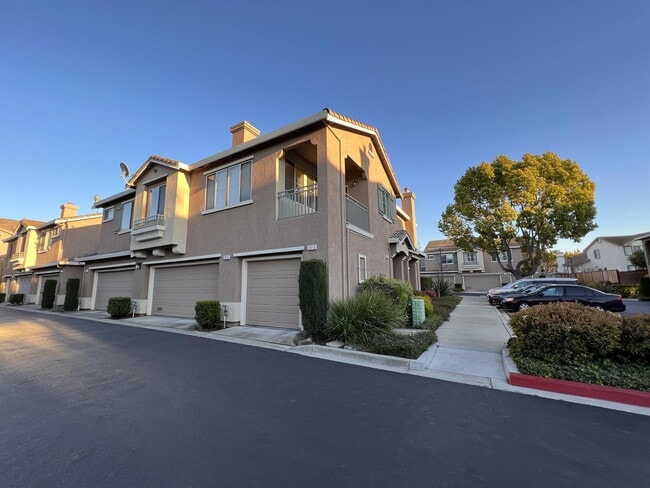
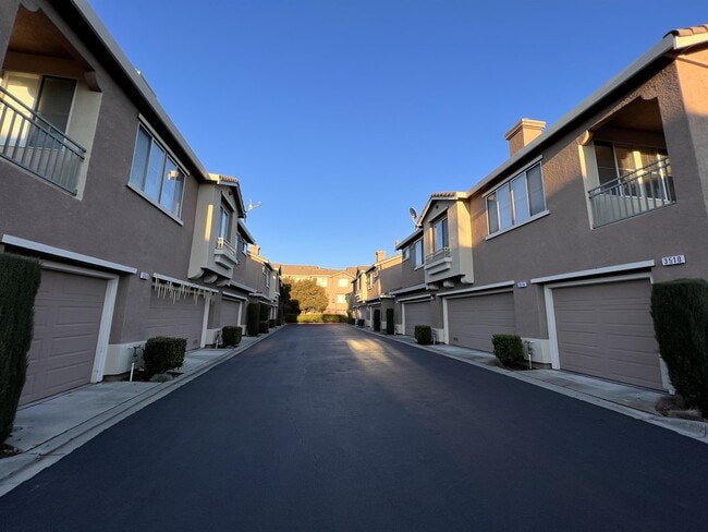
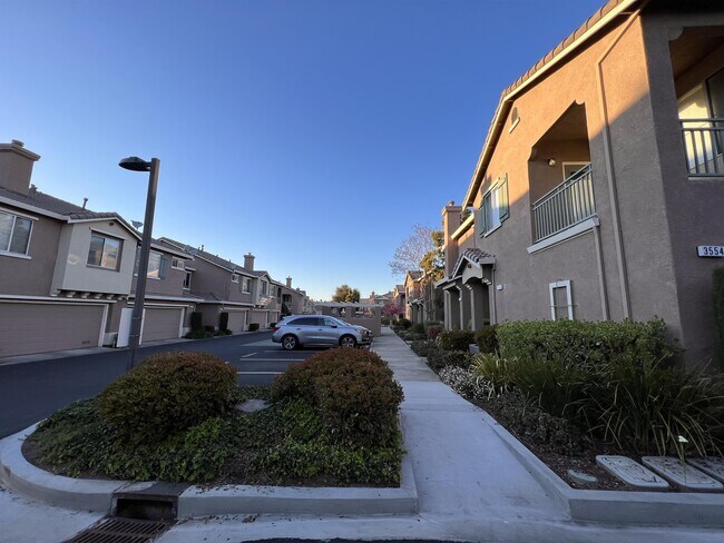
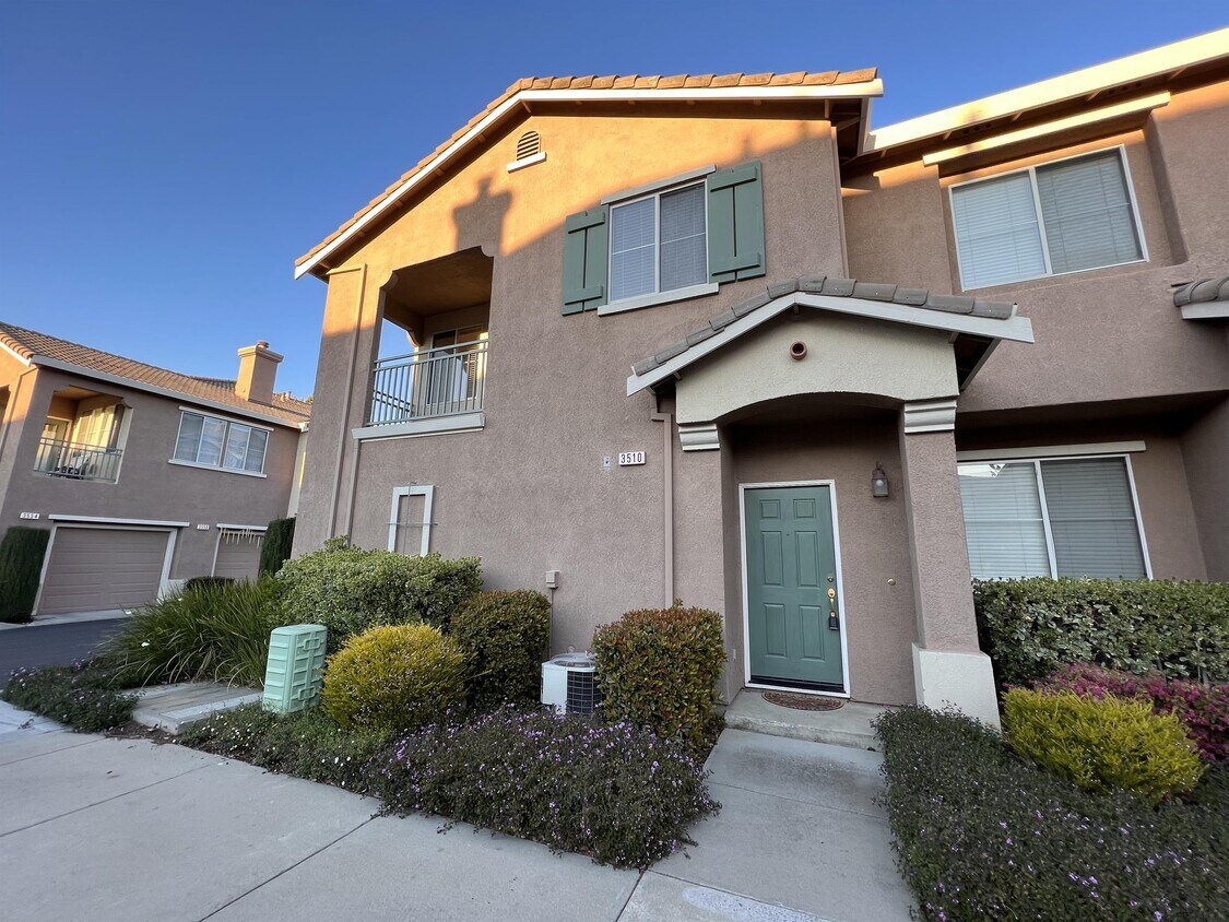
3510 Jasmine Cir
San Jose, CA 95135
Favorites
3510 Jasmine Cir

Favorites
Check Back Soon for Upcoming Availability
| Beds | Baths | Average SF |
|---|---|---|
| 2 Bedrooms 2 Bedrooms 2 Br | 2 Baths 2 Baths 2 Ba | 1,037 SF |
About This Property
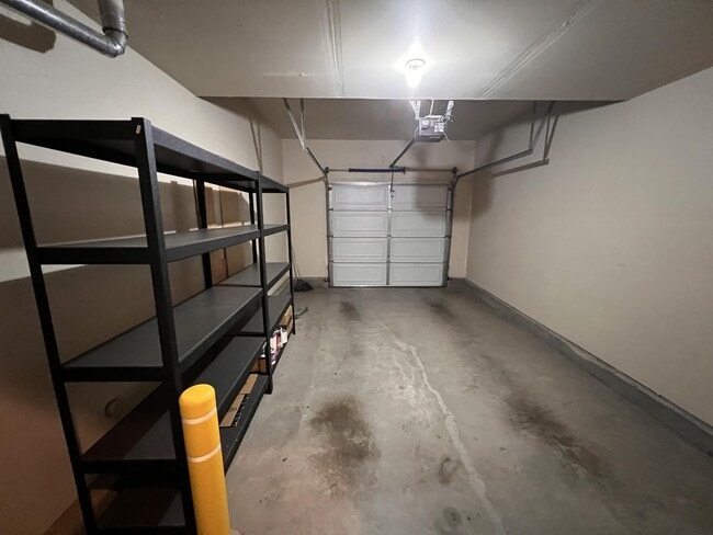
Amplios apartamentos de 2 habitaciones & 2 baños Plano de planta de estilo condominio en w/Open Bright Sala de estar con chimenea Gran suite principal c/vestidor & Tocador doble en el cuarto de baño Gabinetes de cocina de granito & w/Maple CountertopsDouble Ventanas de panel Lavandería en el edificio Air Condición Garaje adjunto para un auto Top Evergreen escuelas cercanas: Tom Matsumoto Elementary, Chaboya Middle & Evergreen Valley High*
3510 Jasmine Cir is a house located in Santa Clara County and the 95135 ZIP Code. This area is served by the Evergreen Elementary School District attendance zone.
3510 Jasmine Cir,
San Jose,
CA
95135
San Jose is the largest city in the San Francisco Bay Area and the beating heart of Silicon Valley, where major tech companies including Adobe, Cisco, and PayPal have long called home. Spanning 182 square miles at the southern end of the bay, it carries real weight as both an economic engine and a cultural center, anchored further by San Jose State University, whose downtown campus shapes much of the city's creative and intellectual energy. Founded in 1777 as California's first city, San Jose balances deep historical roots with an unmistakably forward-facing identity.
Neighborhoods here vary considerably in character. Willow Glen draws renters with tree-lined streets and a walkable village atmosphere along Lincoln Avenue, while the SoFA District and downtown offer a denser, arts-forward setting near SAP Center and The Tech Interactive. Almaden Valley sits closer to open hillside terrain, and Japantown preserves a distinct historic identity just north of downtown.
Learn more about living in San Jose
Education
| Colleges & Universities | Distance | ||
|---|---|---|---|
| Colleges & Universities | Distance | ||
| Drive: | 4 min | 1.4 mi | |
| Drive: | 18 min | 9.8 mi | |
| Drive: | 21 min | 12.2 mi | |
| Drive: | 23 min | 14.1 mi |
3510 Jasmine Cir is within 4 minutes or 1.4 miles from Evergreen Valley College. It is also near San Jose State University and San Jose City College.
Schools


Public Elementary School
Grades K-5
362 Students
Nearby
Public Elementary School
Grades K-5
727 Students
Attendance Zone
Public Middle School
Grades 6-8
815 Students
Attendance Zone
Public High School
Grades 9-12
2,703 Students
Attendance Zone
Private Elementary, Middle & High School
Grades PK-12
81 Students
Nearby
Private Elementary, Middle & High School
Grades K-12
Nearby
Private Elementary & Middle School
Grades K-8
116 Students
Nearby
School data provided by
 The GreatSchools Rating helps parents compare schools within a state based on a variety of school quality indicators and provides a helpful picture of how effectively each school serves all of its students. Ratings are on a scale of 1 (below average) to 10 (above average) and can include test scores, college readiness, academic progress, advanced courses, equity, discipline and attendance data. We also advise parents to visit schools, consider other information on school performance and programs, and consider family needs as part of the school selection process.
View GreatSchools Rating Methodology
Data provided by GreatSchools.org © 2026. All rights reserved.
View GreatSchools Rating Methodology
Data provided by GreatSchools.org © 2026. All rights reserved.
Transportation options available in San Jose include Alum Rock Station, located 6.5 miles from 3510 Jasmine Cir. 3510 Jasmine Cir is near Norman Y Mineta San Jose International, located 13.4 miles or 21 minutes away.
| Transit / Subway | Distance | ||
|---|---|---|---|
| Transit / Subway | Distance | ||
|
|
Drive: | 14 min | 6.5 mi |
|
|
Drive: | 16 min | 9.0 mi |
|
|
Drive: | 18 min | 9.5 mi |
|
|
Drive: | 17 min | 9.8 mi |
| Drive: | 18 min | 11.5 mi |
| Commuter Rail | Distance | ||
|---|---|---|---|
| Commuter Rail | Distance | ||
| Drive: | 13 min | 6.8 mi | |
| Drive: | 15 min | 8.6 mi | |
| Drive: | 19 min | 9.0 mi | |
| Drive: | 19 min | 10.7 mi | |
| Drive: | 19 min | 10.7 mi |
| Airports | Distance | ||
|---|---|---|---|
| Airports | Distance | ||
|
Norman Y Mineta San Jose International
|
Drive: | 21 min | 13.4 mi |
Walkability Near 3510 Jasmine Cir San Jose, CA 95135
Getting Around
 What do Walkability, Transit, Drivability, and Bikeability mean?
Walkability measures the walking distance to day-to-day needs.
Transit measures access to public transportation.
Drivability measures congestion, parking availability, and access to major roads.
Bikeability measures the suitability for cycling.
How It Works
What do Walkability, Transit, Drivability, and Bikeability mean?
Walkability measures the walking distance to day-to-day needs.
Transit measures access to public transportation.
Drivability measures congestion, parking availability, and access to major roads.
Bikeability measures the suitability for cycling.
How It Works
Somewhat Walkable
Walkability
30
/ 100
Minimal Public Transit
Transit
0
/ 100
Very Drivable
Drivability
80
/ 100
Moderately Bikeable
Bikeability
60
/ 100
Scores provided by
Active
Soundscore™
77
/ 100
Traffic
ActiveAirport
CalmBusinesses
CalmScores provided by
HowLoud What is a Sound Score Rating? A Sound Score Rating aggregates noise caused by vehicle traffic, airplane traffic and local sources. How It WorksTime and distance from 3510 Jasmine Cir.
| Shopping Centers | Distance | ||
|---|---|---|---|
| Shopping Centers | Distance | ||
| Drive: | 3 min | 1.2 mi | |
| Drive: | 4 min | 1.9 mi | |
| Drive: | 6 min | 2.7 mi |
3510 Jasmine Cir has 3 shopping centers within 2.7 miles, which is about a 6-minute drive. The miles and minutes will be for the farthest away property.
| Parks and Recreation | Distance | ||
|---|---|---|---|
| Parks and Recreation | Distance | ||
|
Lake Cunningham Park
|
Drive: | 9 min | 4.4 mi |
|
Hellyer County Park
|
Drive: | 11 min | 5.4 mi |
|
Joseph D. Grant County Park
|
Drive: | 18 min | 6.3 mi |
|
Emma Prusch Farm Park
|
Drive: | 14 min | 7.2 mi |
|
Coyote Creek Parkway
|
Drive: | 18 min | 9.7 mi |
3510 Jasmine Cir has 5 parks within 9.7 miles, including Lake Cunningham Park, Hellyer County Park, and Joseph D. Grant County Park.
| Hospitals | Distance | ||
|---|---|---|---|
| Hospitals | Distance | ||
| Drive: | 13 min | 7.0 mi | |
| Drive: | 15 min | 7.4 mi | |
| Drive: | 16 min | 8.6 mi |
3510 Jasmine Cir has 3 hospitals within 8.6 miles, the nearest is San Jose Behavioral Health which is 7.0 miles away and a 13 minute drive.
| Military Bases | Distance | ||
|---|---|---|---|
| Military Bases | Distance | ||
| Drive: | 32 min | 21.3 mi | |
| Drive: | 69 min | 51.4 mi | |
| Drive: | 69 min | 51.6 mi |
3510 Jasmine Cir has 3 military bases within 51.6 miles, the nearest is Ames Research Center which is 21.3 miles away and a 32 minute drive.
You May Also Like
Similar Rentals Nearby
-
-
 3 Beds$4,140Total Monthly PriceTotal Monthly Price NewPrices include all required monthly fees.House for Rent
 -
 3 Beds$4,120Total Monthly PriceTotal Monthly Price NewPrices include all required monthly fees.House for Rent
 -

-
 3 Beds$3,980Total Monthly PriceTotal Monthly Price NewPrices include all required monthly fees.House for Rent
 -
 3 Beds$4,900Total Monthly PriceTotal Monthly Price NewPrices include all required monthly fees.House for Rent
 -
 4 Beds$5,010Total Monthly PriceTotal Monthly Price NewPrices include all required monthly fees.House for Rent
 -
 3 Beds$5,510Total Monthly PriceTotal Monthly Price NewPrices include all required monthly fees.House for Rent
 -
 5 Beds$5,370Total Monthly PriceTotal Monthly Price NewPrices include all required monthly fees.House for Rent
 -
 3 Beds$4,160Total Monthly PriceTotal Monthly Price NewPrices include all required monthly fees.House for Rent
What Are Walk Score®, Transit Score®, and Bike Score® Ratings?
Walk Score® measures the walkability of any address. Transit Score® measures access to public transit. Bike Score® measures the bikeability of any address.
What is a Sound Score Rating?
A Sound Score Rating aggregates noise caused by vehicle traffic, airplane traffic and local sources.
3510 Jasmine Cir
San Jose, CA 95135