
$2,750
/ Month
3510 Castleleigh Rd
Beltsville, MD 20705
1 Day Ago
|
Edit
Favorites
301-254-3445
-
Bedrooms
3
-
Bathrooms
2
-
Square Feet
--
-
Available
Available Now
Highlights
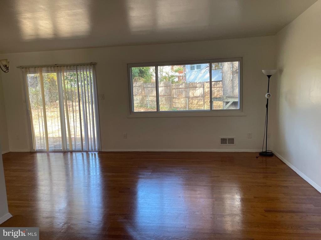
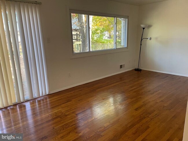
- Open Floorplan
- Solid Hardwood Flooring
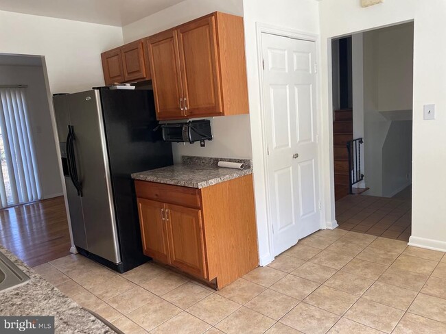
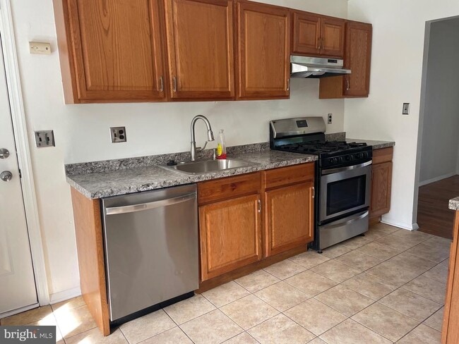
- Stainless Steel Appliances
- 1 Car Attached Garage
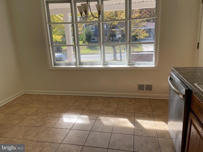
- Eat-In Kitchen
- Bathtub with Shower
3510 Castleleigh Rd

Favorites
About This Home
Available Now
Ready to move in, excellent location near 495 and route 200. Excellent price for a full house with garage. Cats and dogs accepted on a case by case basis and with a pet deposit. 3 bedrooms, 2 full baths, table space kitchen, large recreation room in basement, oversized one car garage may fit two small cars or one big car, leaving space for storage. Hardwood floors on first and second levels. Layout: Main level: Living room/dining combo, table space kitchen, foyer, oversized one car garage. Upper level: 3 bedrooms, 2 full baths. Lower level/basement: Large recreational room, laundry/utility room. The application fee for applicants is non-refundable since is the cost of getting a credit report. Applicants must have decent credit, above 650 preferred, also must prove enough income to cover the rent and expenses. Tenant pay for all utilities, yard maintenance and clean gutters and downspouts. The owner is a licensed broker in Maryland.
3510 Castleleigh Rd is a house located in Prince George's County and the 20705 ZIP Code. This area is served by the Prince George's County Public Schools attendance zone.
* Price shown is base rent. Excludes user-selected optional fees and variable or usage-based fees and required charges due at or prior to move-in or at move-out. Price, availability, fees, and any applicable rent special are subject to change without notice.
* Square footage definitions vary. Displayed square footage is approximate.
Home Details
Home Type
Single Family Detached Home
Year Built
Built in 1966
Basement
Basement with some natural light
Crawl Space
Bedrooms and Bathrooms
Bathtub with Shower
Walk-in Shower
2 Full Bathrooms
3 Bedrooms
Flooring
Solid Hardwood
Ceramic Tile
Heavy Duty
Laminate
Home Design
Split Level Home
Frame Construction
Interior Spaces
Open Floorplan
Combination Dining and Living Room
Ceiling Fan
1,778 Sq Ft Home
Property has 3 Levels
Kitchen
Stainless Steel Appliances
Eat-In Kitchen
Gas Oven or Range
Stove
Dishwasher
Range Hood
Disposal
Laundry
Laundry Room
Listing and Financial Details
Security Deposit $3,000
12-Month Min and 24-Month Max Lease Term
Available 10/26/25
$60 Application Fee
Assessor Parcel Number 17010070649
Tenant pays for cable TV, cooking fuel, electricity, exterior maintenance, frozen waterpipe damage, gas, heat, gutter cleaning, hot water, internet, lawn/tree/shrub care, light bulbs/filters/fuses/alarm care, minor interior maintenance, pest control, snow removal, sewer, all utilities, water
$150 Repair Deductible
No Smoking Allowed
Residential Lease
Lot Details
8,500 Sq Ft Lot
Property is zoned RSF95
Parking
1 Car Attached Garage
Parking Storage or Cabinetry
1 Driveway Space
Schools
Vansville Elementary School
Martin Luther King Jr. Middle School
High Point
Utilities
Central Heating and Cooling System
Cable TV Available
Natural Gas Water Heater
Vented Exhaust Fan
Community Details
Overview
No Home Owners Association
Calverton Subdivision
Pet Policy
Dogs and Cats Allowed
Breed Restrictions
Limit on the number of pets
Pet Size Limit
Pet Deposit Required
Contact
- Listed by Onix M Hernandez | Results Real Estate
- Phone Number
- Contact
-
Source
 Bright MLS, Inc.
Copyright © 2026 Bright MLS, Inc.
Location
Get Directions
Amenities
- Dishwasher
- Basement
Located roughly 20 miles north of Washington, DC, Calverton is a quaint community in Beltsville along Interstate 95. Shopping centers, movie theaters, and casual dining options are available in the neighborhood. Excellent public schools, a family-friendly environment, and easy access to the nation’s capital are among the neighborhood’s selling points. Residents enjoy living near Little Paint Branch Park and Fairland Recreational Park. Calverton-Galway Local Park features lighted tennis courts, athletic fields, a playground, and more. Because of the neighborhood’s central location, rent prices tend to be higher, but there are apartments and houses available for rent in the area.
Learn more about living in Calverton PG
Education
| Colleges & Universities | Distance | ||
|---|---|---|---|
| Colleges & Universities | Distance | ||
| Drive: | 16 min | 7.7 mi | |
| Drive: | 16 min | 9.4 mi | |
| Drive: | 23 min | 12.2 mi | |
| Drive: | 24 min | 13.4 mi |
3510 Castleleigh Rd is within 16 minutes or 7.7 miles from University of Maryland. It is also near Montgomery Coll., Takoma Park and Catholic University.
Schools


Public Elementary School
Grades PK-5
836 Students
Attendance Zone
Public Middle School
Grades 6-8
911 Students
Attendance Zone
Public High School
Grades 9-12
3,003 Students
Attendance Zone
Private Elementary & Middle School
Grades K-8
218 Students
Nearby
Private Elementary & Middle School
Grades PK-8
198 Students
Nearby
Private Elementary, Middle & High School
Grades 4-12
30 Students
Nearby
School data provided by
 The GreatSchools Rating helps parents compare schools within a state based on a variety of school quality indicators and provides a helpful picture of how effectively each school serves all of its students. Ratings are on a scale of 1 (below average) to 10 (above average) and can include test scores, college readiness, academic progress, advanced courses, equity, discipline and attendance data. We also advise parents to visit schools, consider other information on school performance and programs, and consider family needs as part of the school selection process.
View GreatSchools Rating Methodology
Data provided by GreatSchools.org © 2026. All rights reserved.
View GreatSchools Rating Methodology
Data provided by GreatSchools.org © 2026. All rights reserved.
Transportation options available in Beltsville include Greenbelt, Green/Yellow Line Center Platform, located 7.1 miles from 3510 Castleleigh Rd. 3510 Castleleigh Rd is near Ronald Reagan Washington Ntl, located 20.2 miles or 36 minutes away, and Baltimore/Washington International Thurgood Marshall, located 24.1 miles or 32 minutes away.
| Transit / Subway | Distance | ||
|---|---|---|---|
| Transit / Subway | Distance | ||
| Drive: | 11 min | 7.1 mi | |
| Drive: | 18 min | 7.9 mi | |
|
|
Drive: | 14 min | 7.9 mi |
|
|
Drive: | 17 min | 9.0 mi |
| Drive: | 20 min | 9.4 mi |
| Commuter Rail | Distance | ||
|---|---|---|---|
| Commuter Rail | Distance | ||
|
|
Drive: | 7 min | 3.8 mi |
|
|
Drive: | 11 min | 7.1 mi |
|
|
Drive: | 11 min | 7.1 mi |
| Drive: | 11 min | 7.2 mi | |
| Drive: | 18 min | 7.9 mi |
| Airports | Distance | ||
|---|---|---|---|
| Airports | Distance | ||
|
Ronald Reagan Washington Ntl
|
Drive: | 36 min | 20.2 mi |
|
Baltimore/Washington International Thurgood Marshall
|
Drive: | 32 min | 24.1 mi |
Time and distance from 3510 Castleleigh Rd.
| Shopping Centers | Distance | ||
|---|---|---|---|
| Shopping Centers | Distance | ||
| Drive: | 6 min | 1.8 mi | |
| Drive: | 5 min | 2.4 mi | |
| Drive: | 6 min | 3.1 mi |
3510 Castleleigh Rd has 3 shopping centers within 3.1 miles, which is about a 6-minute drive. The miles and minutes will be for the farthest away property.
| Parks and Recreation | Distance | ||
|---|---|---|---|
| Parks and Recreation | Distance | ||
|
Fairland Regional Park
|
Drive: | 4 min | 2.2 mi |
|
Maydale Conservation Park and Nature Center
|
Drive: | 9 min | 4.4 mi |
|
University of Maryland Observatory
|
Drive: | 14 min | 7.0 mi |
|
UMD Observatory
|
Drive: | 14 min | 7.1 mi |
|
Lake Artemisia Natural Area Park
|
Drive: | 15 min | 7.2 mi |
3510 Castleleigh Rd has 5 parks within 7.2 miles, including Fairland Regional Park, Maydale Conservation Park and Nature Center, and University of Maryland Observatory.
| Hospitals | Distance | ||
|---|---|---|---|
| Hospitals | Distance | ||
| Drive: | 6 min | 2.0 mi | |
| Drive: | 9 min | 5.3 mi | |
| Drive: | 15 min | 8.0 mi |
3510 Castleleigh Rd has 3 hospitals within 8.0 miles, the nearest is Adventist Healthcare White Oak Medical Center which is 2.0 miles away and a 6 minute drive.
You May Also Like
Similar Rentals Nearby


What Are Walk Score®, Transit Score®, and Bike Score® Ratings?
Walk Score® measures the walkability of any address. Transit Score® measures access to public transit. Bike Score® measures the bikeability of any address.
What is a Sound Score Rating?
A Sound Score Rating aggregates noise caused by vehicle traffic, airplane traffic and local sources

3510 Castleleigh Rd
Beltsville, MD 20705