1 / 26


| Beds | Baths | Average SF |
|---|---|---|
| 3 Bedrooms 3 Bedrooms 3 Br | 1 Bath 1 Bath 1 Ba | 900 SF |
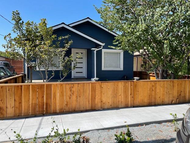
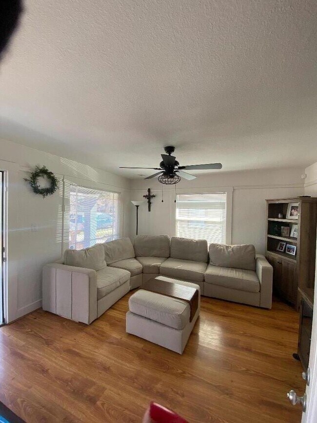
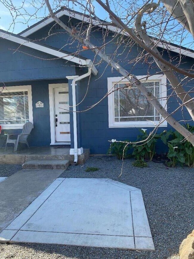
Cute, Cozy remodeled single family home with private backyard lined with fruit trees. The home offers plenty of privacy and pet friendly. Newer central A/C and heat, no maintenance backyard. New flooring throughout. This is a must-see jewel close to highway 101 with In unit washer/dryer/Refrigerator. Standalone separate home with no shared walls. Driveway parking with street parking also available. Perfect work-from-home setup.
351 West Ct is a house located in Santa Clara County and the 95116 ZIP Code. This area is served by the San Jose Unified School District attendance zone.
San Jose is the largest city in the San Francisco Bay Area and the beating heart of Silicon Valley, where major tech companies including Adobe, Cisco, and PayPal have long called home. Spanning 182 square miles at the southern end of the bay, it carries real weight as both an economic engine and a cultural center, anchored further by San Jose State University, whose downtown campus shapes much of the city's creative and intellectual energy. Founded in 1777 as California's first city, San Jose balances deep historical roots with an unmistakably forward-facing identity.
Neighborhoods here vary considerably in character. Willow Glen draws renters with tree-lined streets and a walkable village atmosphere along Lincoln Avenue, while the SoFA District and downtown offer a denser, arts-forward setting near SAP Center and The Tech Interactive. Almaden Valley sits closer to open hillside terrain, and Japantown preserves a distinct historic identity just north of downtown.
Learn more about living in San Jose| Colleges & Universities | Distance | ||
|---|---|---|---|
| Colleges & Universities | Distance | ||
| Drive: | 5 min | 2.1 mi | |
| Drive: | 11 min | 6.1 mi | |
| Drive: | 11 min | 6.3 mi | |
| Drive: | 11 min | 6.8 mi |


Transportation options available in San Jose include St. James Station Southbound, located 2.0 miles from 351 West Ct. 351 West Ct is near Norman Y Mineta San Jose International, located 5.4 miles or 9 minutes away, and Metro Oakland International, located 35.9 miles or 45 minutes away.
| Transit / Subway | Distance | ||
|---|---|---|---|
| Transit / Subway | Distance | ||
|
|
Drive: | 4 min | 2.0 mi |
|
|
Drive: | 5 min | 2.1 mi |
| Drive: | 5 min | 2.2 mi | |
| Drive: | 5 min | 2.5 mi | |
|
|
Drive: | 7 min | 2.6 mi |
| Commuter Rail | Distance | ||
|---|---|---|---|
| Commuter Rail | Distance | ||
| Drive: | 7 min | 3.0 mi | |
| Drive: | 7 min | 3.2 mi | |
| Drive: | 8 min | 3.2 mi | |
| Drive: | 8 min | 3.8 mi | |
| Drive: | 10 min | 4.6 mi |
| Airports | Distance | ||
|---|---|---|---|
| Airports | Distance | ||
|
Norman Y Mineta San Jose International
|
Drive: | 9 min | 5.4 mi |
|
Metro Oakland International
|
Drive: | 45 min | 35.9 mi |
Scores provided by
Traffic
-Airport
-Businesses
-Scores provided by
HowLoud What is a Sound Score Rating? A Sound Score Rating aggregates noise caused by vehicle traffic, airplane traffic and local sources. How It WorksTime and distance from 351 West Ct.
| Shopping Centers | Distance | ||
|---|---|---|---|
| Shopping Centers | Distance | ||
| Walk: | 10 min | 0.6 mi | |
| Walk: | 11 min | 0.6 mi | |
| Drive: | 3 min | 1.5 mi |
| Parks and Recreation | Distance | ||
|---|---|---|---|
| Parks and Recreation | Distance | ||
|
Japanese Friendship Garden Regional Park
|
Drive: | 4 min | 1.9 mi |
|
Emma Prusch Farm Park
|
Drive: | 5 min | 2.5 mi |
|
The Tech Museum of Innovation
|
Drive: | 5 min | 2.6 mi |
|
McEnery Park
|
Drive: | 6 min | 2.7 mi |
|
Happy Hollow Park & Zoo
|
Drive: | 6 min | 3.3 mi |
| Hospitals | Distance | ||
|---|---|---|---|
| Hospitals | Distance | ||
| Drive: | 3 min | 1.6 mi | |
| Drive: | 10 min | 6.5 mi | |
| Drive: | 16 min | 11.1 mi |
| Military Bases | Distance | ||
|---|---|---|---|
| Military Bases | Distance | ||
| Drive: | 7 min | 3.4 mi | |
| Drive: | 7 min | 3.9 mi | |
| Drive: | 20 min | 13.3 mi |


What Are Walk Score®, Transit Score®, and Bike Score® Ratings?
Walk Score® measures the walkability of any address. Transit Score® measures access to public transit. Bike Score® measures the bikeability of any address.
What is a Sound Score Rating?
A Sound Score Rating aggregates noise caused by vehicle traffic, airplane traffic and local sources.

351 West Ct
San Jose, CA 95116