
La Moraga Apartments
5822 Charlotte Dr,
San Jose, CA 95123
$2,529 - $2,979
1-2 Beds
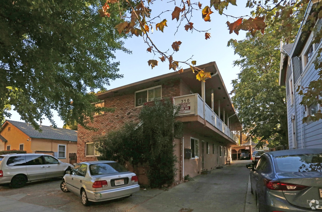
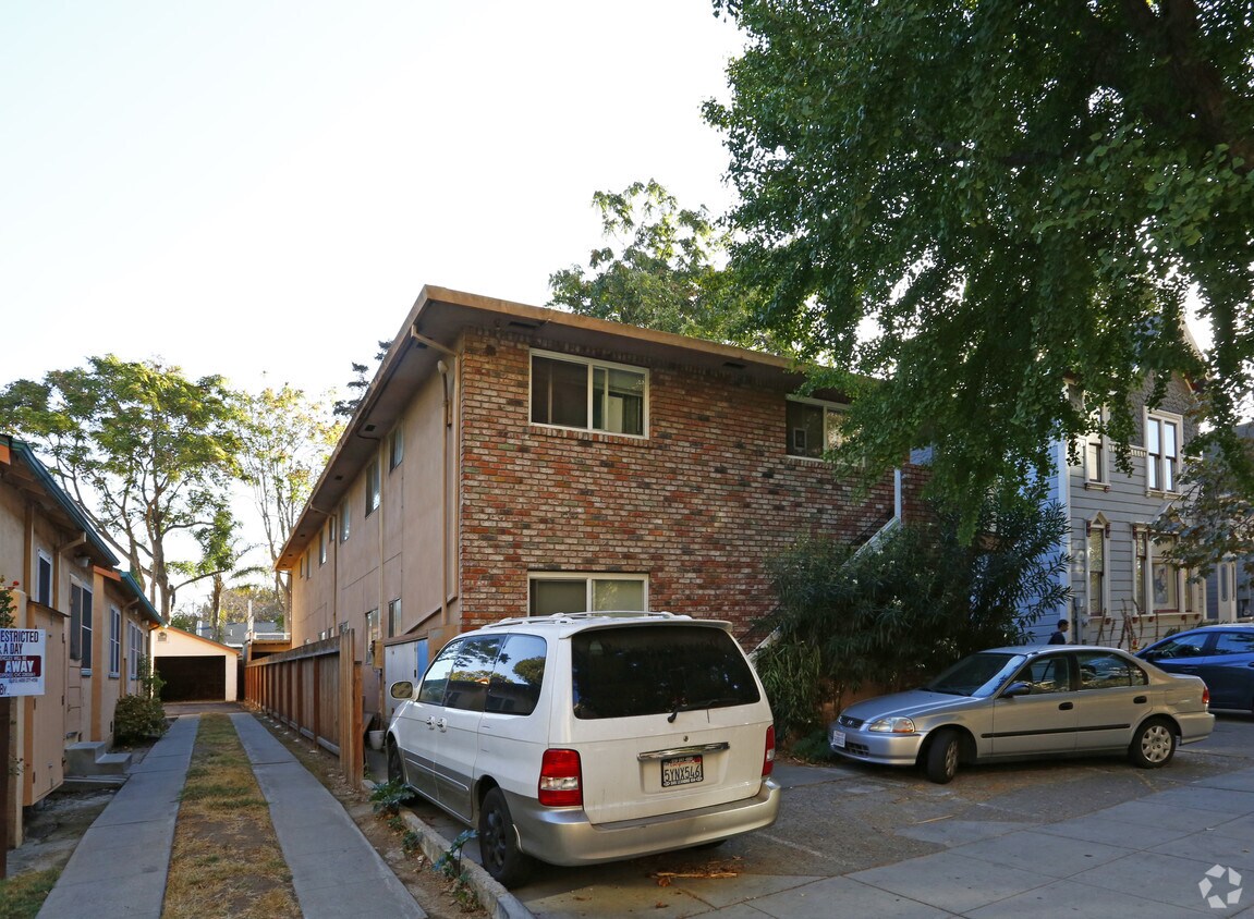
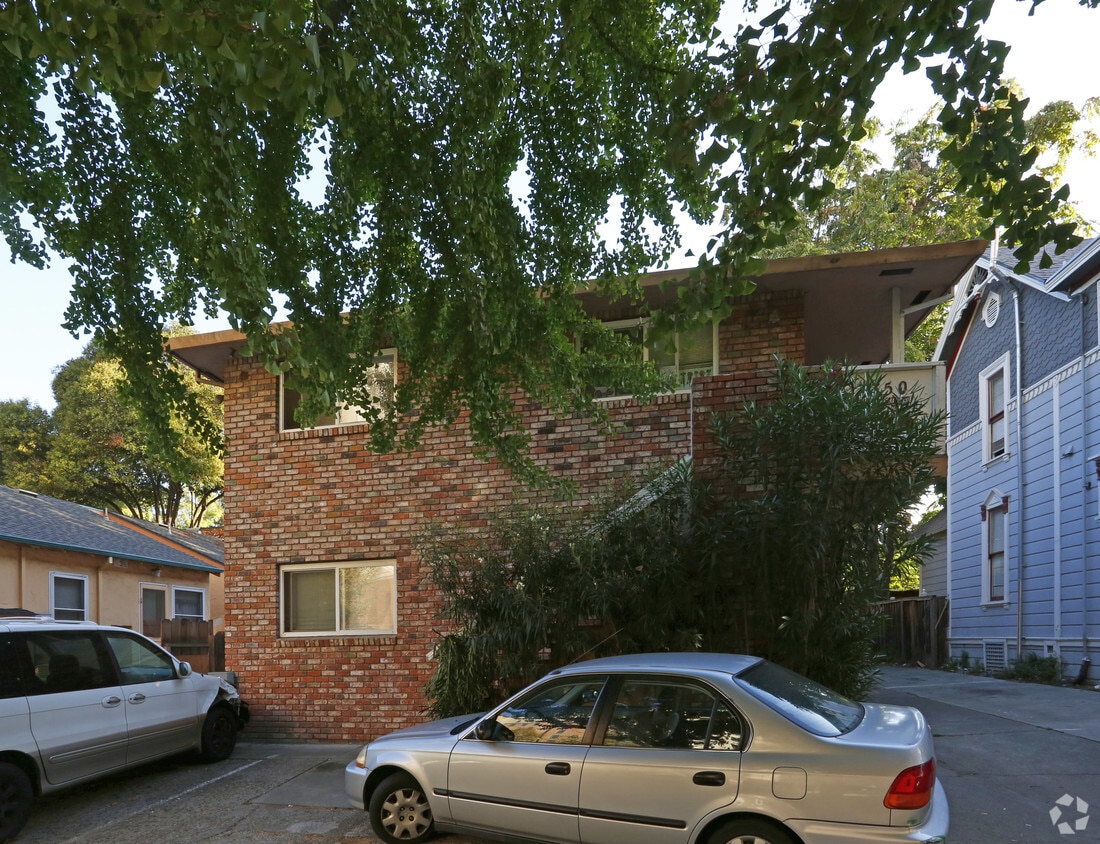

Explore 350 S 10th St in San Jose. The 350 S. 10th St. location in San Jose's 95112 area is an ideal place to live. Be sure to come for a visit to see the available floorplan options. The leasing staff is waiting to show you all that this community has to offer. At 350 S 10th St you're right at home.
350 S 10th St is an apartment community located in Santa Clara County and the 95112 ZIP Code. This area is served by the San Jose Unified School District attendance zone.
Located a few blocks east of San Jose State University, Naglee Park is a charming, quaint neighborhood with modern flair. Filled with historic homes, Naglee Park is considered to be the first modern subdivision in Santa Clara County and was home to many community leaders, business owners, and other significant figures. The area is extremely walkable with galleries, museums, coffee shops, restaurants, and outdoor events within walking distance from most homes.
Naglee Park is known for its tight-knit community. Residents here aren’t just neighbors, but close friends who participate in community events throughout the year including Coffee in the Park, the Fourth of July Parade, and Bark in the Park. Many of these events are held at the neighborhood green space, William Street Park, which has over 15 acres of open fields, trails, tennis courts, and more. The park also houses the Northside Theater Company.
Learn more about living in Naglee ParkCompare neighborhood and city base rent averages by bedroom.
| Naglee Park | San Jose, CA | |
|---|---|---|
| Studio | $1,055 | $2,342 |
| 1 Bedroom | $1,612 | $2,701 |
| 2 Bedrooms | $1,853 | $3,396 |
| 3 Bedrooms | $2,507 | $4,165 |
| Colleges & Universities | Distance | ||
|---|---|---|---|
| Colleges & Universities | Distance | ||
| Walk: | 6 min | 0.3 mi | |
| Drive: | 8 min | 4.2 mi | |
| Drive: | 13 min | 5.0 mi | |
| Drive: | 14 min | 7.8 mi |


Transportation options available in San Jose include Paseo De San Antonio Station Northbound, located 0.7 mile from 350 S 10th St. 350 S 10th St is near Norman Y Mineta San Jose International, located 4.4 miles or 10 minutes away, and Metro Oakland International, located 36.1 miles or 48 minutes away.
| Transit / Subway | Distance | ||
|---|---|---|---|
| Transit / Subway | Distance | ||
|
|
Walk: | 14 min | 0.7 mi |
| Walk: | 16 min | 0.9 mi | |
|
|
Drive: | 3 min | 1.2 mi |
| Drive: | 3 min | 1.3 mi | |
|
|
Drive: | 4 min | 1.8 mi |
| Commuter Rail | Distance | ||
|---|---|---|---|
| Commuter Rail | Distance | ||
| Drive: | 5 min | 2.0 mi | |
| Drive: | 5 min | 2.1 mi | |
| Drive: | 6 min | 2.5 mi | |
| Drive: | 6 min | 2.8 mi | |
| Drive: | 7 min | 2.9 mi |
| Airports | Distance | ||
|---|---|---|---|
| Airports | Distance | ||
|
Norman Y Mineta San Jose International
|
Drive: | 10 min | 4.4 mi |
|
Metro Oakland International
|
Drive: | 48 min | 36.1 mi |
Scores provided by
Traffic
-Airport
-Businesses
-Scores provided by
HowLoud What is a Sound Score Rating? A Sound Score Rating aggregates noise caused by vehicle traffic, airplane traffic and local sources. How It WorksTime and distance from 350 S 10th St.
| Shopping Centers | Distance | ||
|---|---|---|---|
| Shopping Centers | Distance | ||
| Drive: | 3 min | 1.1 mi | |
| Drive: | 3 min | 1.1 mi | |
| Drive: | 3 min | 1.1 mi |
| Parks and Recreation | Distance | ||
|---|---|---|---|
| Parks and Recreation | Distance | ||
|
Japanese Friendship Garden Regional Park
|
Walk: | 14 min | 0.8 mi |
|
The Tech Museum of Innovation
|
Drive: | 3 min | 1.1 mi |
|
Happy Hollow Park & Zoo
|
Drive: | 3 min | 1.4 mi |
|
McEnery Park
|
Drive: | 4 min | 1.5 mi |
|
Guadalupe River Park and Gardens
|
Drive: | 4 min | 1.6 mi |
| Hospitals | Distance | ||
|---|---|---|---|
| Hospitals | Distance | ||
| Drive: | 7 min | 3.5 mi | |
| Drive: | 7 min | 4.4 mi | |
| Drive: | 12 min | 9.0 mi |
| Military Bases | Distance | ||
|---|---|---|---|
| Military Bases | Distance | ||
| Drive: | 22 min | 13.9 mi |
Fitness Center Pool In Unit Washer & Dryer High-Speed Internet Stainless Steel Appliances Package Service
What Are Walk Score®, Transit Score®, and Bike Score® Ratings?
Walk Score® measures the walkability of any address. Transit Score® measures access to public transit. Bike Score® measures the bikeability of any address.
What is a Sound Score Rating?
A Sound Score Rating aggregates noise caused by vehicle traffic, airplane traffic and local sources.


