


$2,900 / Month
35 Pleasant St
Wellesley, MA 02482
2 Weeks Ago
Favorites
35 Pleasant St

Favorites
Check Back Soon for Upcoming Availability
| Beds | Baths | Average SF |
|---|---|---|
| 2 Bedrooms 2 Bedrooms 2 Br | 2 Baths 2 Baths 2 Ba | 1,000 SF |
Fees and Policies
The fees below are based on community-supplied data and may exclude additional fees and utilities.
- Dogs Allowed
-
Fees not specified
- Cats Allowed
-
Fees not specified
About This Property
Walk to Linden Square. 2 bedroom with bonus office 2 baths Living Room Family Room Six (6) month lease and then it will become a tenant at will lease. Either party may end the lease with a 30 day notice. Nearby schools include Sprague Elementary School, Wellesley Middle School and Learning Prep School. The closest grocery stores are Roche Bros, Tutto Italiano and Whole Foods Market. Nearby coffee shops include Starbucks, Peet's Coffee and J.P. Licks. Nearby restaurants include The Linden Store, Sweetgreen and Takara Japanese Restaurant. 21 Pleasant St is also near, Cold Spring Break Sanctuary, Post Office Square and Hunnewell Park.
35 Pleasant St is a townhome located in Norfolk County and the 02482 ZIP Code.
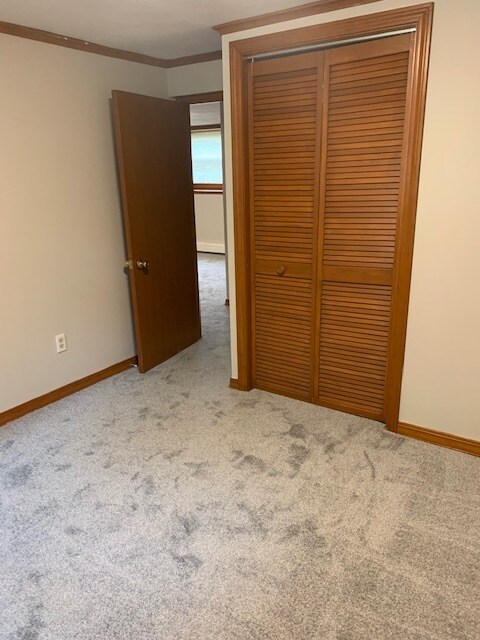
Townhome Features
Washer/Dryer
Air Conditioning
Dishwasher
Hardwood Floors
- Washer/Dryer
- Air Conditioning
- Heating
- Cable Ready
- Dishwasher
- Disposal
- Eat-in Kitchen
- Kitchen
- Oven
- Refrigerator
- Hardwood Floors
- Carpet
- Tile Floors
- Bay Window
- Yard
Location
Get Directions
Just west of Boston and East of Worcester sits Metro West, a region that houses a group of towns and cities with significant historical backgrounds. A total of 19 municipalities make up the core of this community, but other municipalities are considered to be a part of the Interstate 495/Metro West Corridor.
Learn more about living in Metro WestBelow are rent ranges for similar nearby apartments
| Beds | Average Size | Lowest | Typical | Premium |
|---|---|---|---|---|
| Studio Studio Studio | 526-529 Sq Ft | $1,400 | $2,464 | $8,050 |
| 1 Bed 1 Bed 1 Bed | 872-873 Sq Ft | $1,250 | $3,031 | $10,533 |
| 2 Beds 2 Beds 2 Beds | 1256-1259 Sq Ft | $1,900 | $3,690 | $13,181 |
| 3 Beds 3 Beds 3 Beds | 1677-1681 Sq Ft | $2,000 | $4,759 | $15,246 |
| 4 Beds 4 Beds 4 Beds | 3346 Sq Ft | $1,075 | $6,667 | $17,000 |
Amenities
- Washer/Dryer
- Air Conditioning
- Heating
- Cable Ready
- Dishwasher
- Disposal
- Eat-in Kitchen
- Kitchen
- Oven
- Refrigerator
- Hardwood Floors
- Carpet
- Tile Floors
- Bay Window
- Yard
Education
| Colleges & Universities | Distance | ||
|---|---|---|---|
| Colleges & Universities | Distance | ||
| Drive: | 6 min | 1.6 mi | |
| Drive: | 5 min | 2.2 mi | |
| Drive: | 15 min | 6.7 mi | |
| Drive: | 17 min | 8.9 mi |
35 Pleasant St is within 6 minutes or 1.6 miles from Wellesley College. It is also near Babson College and Brandeis University.
Transportation options available in Wellesley include Riverside, located 4.2 miles from 35 Pleasant St. 35 Pleasant St is near General Edward Lawrence Logan International, located 18.2 miles or 30 minutes away, and Worcester Regional, located 31.8 miles or 55 minutes away.
| Transit / Subway | Distance | ||
|---|---|---|---|
| Transit / Subway | Distance | ||
| Drive: | 10 min | 4.2 mi | |
| Drive: | 8 min | 4.2 mi | |
| Drive: | 10 min | 4.9 mi | |
| Drive: | 11 min | 5.5 mi | |
| Drive: | 11 min | 5.7 mi |
| Commuter Rail | Distance | ||
|---|---|---|---|
| Commuter Rail | Distance | ||
| Walk: | 9 min | 0.5 mi | |
| Drive: | 4 min | 1.5 mi | |
| Drive: | 7 min | 3.0 mi | |
| Drive: | 7 min | 3.5 mi | |
| Drive: | 9 min | 4.2 mi |
| Airports | Distance | ||
|---|---|---|---|
| Airports | Distance | ||
|
General Edward Lawrence Logan International
|
Drive: | 30 min | 18.2 mi |
|
Worcester Regional
|
Drive: | 55 min | 31.8 mi |
Time and distance from 35 Pleasant St.
| Shopping Centers | Distance | ||
|---|---|---|---|
| Shopping Centers | Distance | ||
| Walk: | 8 min | 0.4 mi | |
| Walk: | 10 min | 0.5 mi | |
| Walk: | 15 min | 0.8 mi |
35 Pleasant St has 3 shopping centers within 0.8 mile, which is about a 15-minute walk. The miles and minutes will be for the farthest away property.
| Parks and Recreation | Distance | ||
|---|---|---|---|
| Parks and Recreation | Distance | ||
|
Whitin Observatory
|
Walk: | 19 min | 1.0 mi |
|
Wellesley College Botanic Gardens
|
Drive: | 3 min | 1.2 mi |
|
Weezie's Garden for Children
|
Drive: | 8 min | 2.9 mi |
|
Elm Bank Reservation
|
Drive: | 8 min | 2.9 mi |
|
Horticultural Society at Elm Bank
|
Drive: | 10 min | 3.1 mi |
35 Pleasant St has 5 parks within 3.1 miles, including Whitin Observatory, Wellesley College Botanic Gardens, and Horticultural Society at Elm Bank.
| Hospitals | Distance | ||
|---|---|---|---|
| Hospitals | Distance | ||
| Drive: | 7 min | 3.9 mi | |
| Drive: | 8 min | 4.1 mi | |
| Drive: | 15 min | 7.1 mi |
35 Pleasant St has 3 hospitals within 7.1 miles, the nearest is Newton - Wellesley Hospital which is 3.9 miles away and a 7 minute drive.
| Military Bases | Distance | ||
|---|---|---|---|
| Military Bases | Distance | ||
| Drive: | 9 min | 4.1 mi | |
| Drive: | 26 min | 14.1 mi |
35 Pleasant St is 4.1 miles from US Military Reservation, and is convenient to other military bases, including Hanscom Air Force Base.
You May Also Like
Similar Rentals Nearby


What Are Walk Score®, Transit Score®, and Bike Score® Ratings?
Walk Score® measures the walkability of any address. Transit Score® measures access to public transit. Bike Score® measures the bikeability of any address.
What is a Sound Score Rating?
A Sound Score Rating aggregates noise caused by vehicle traffic, airplane traffic and local sources

35 Pleasant St
Wellesley, MA 02482