$1,500
/ Month
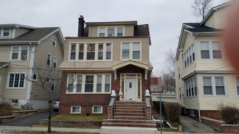
35 Monticello Ave
Newark, NJ 07106
2 Weeks Ago
|
Edit
Favorites
35 Monticello Ave

Favorites
Check Back Soon for Upcoming Availability
| Beds | Baths | Average SF |
|---|---|---|
| 3 Bedrooms 3 Bedrooms 3 Br | 1 Bath 1 Bath 1 Ba | — |
Fees and Policies
The fees listed below are community-provided and may exclude utilities or add-ons. All payments are made directly to the property and are non-refundable unless otherwise specified.
- Parking
-
Street--
About This Property
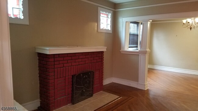
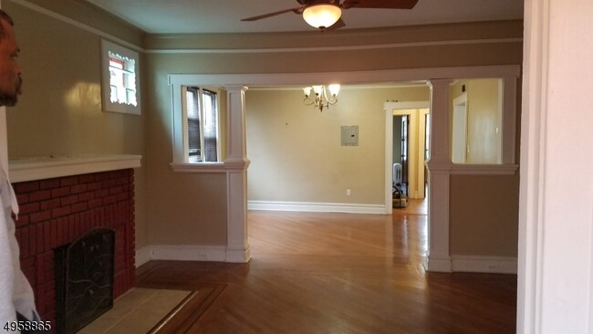
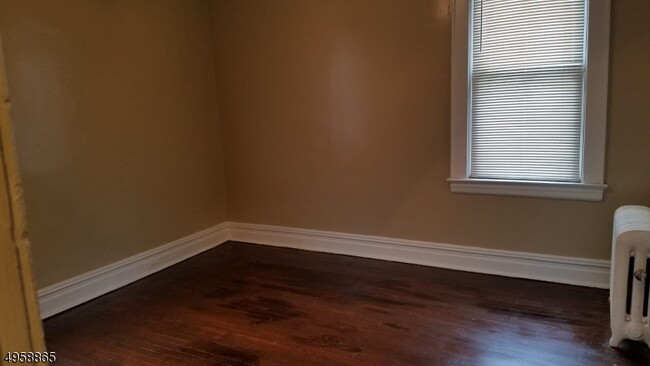
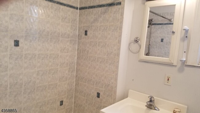
Nice clean large 2nd floor unit,2 nice size bedrooms, 1 smaller bedroom,Large living room with fireplace,updated kitchen,on street parking
35 Monticello Ave is an apartment community located in Essex County and the 07106 ZIP Code.
Features
- Tile Floors
35 Monticello Ave,
Newark,
NJ
07106
Upper Vailsburg is a hilltop neighborhood in the city of Newark that features Victorian and Dutch colonial-style homes and a variety of local shops. The peninsula-shaped area sits on the eastern border of the city and neighbors Maplewood, South Orange, and Irvington. The neighborhood is just minutes from Seton Hall University and various medical facilities. Upper Vailsburg is known for its close-knit community and suits renters looking for a quiet neighborhood with quick commutes to greater Newark destinations and beyond, like New York City.
Learn more about living in Upper VailsburgBelow are rent ranges for similar nearby apartments
Amenities
- Tile Floors
Education
| Colleges & Universities | Distance | ||
|---|---|---|---|
| Colleges & Universities | Distance | ||
| Walk: | 15 min | 0.8 mi | |
| Drive: | 7 min | 3.5 mi | |
| Drive: | 7 min | 3.6 mi | |
| Drive: | 7 min | 3.9 mi |
35 Monticello Ave is within 15 minutes or 0.8 mile from Seton Hall University. It is also near Essex County College and N.J. Inst. of Technology.
Transportation options available in Newark include Norfolk Street, located 3.3 miles from 35 Monticello Ave. 35 Monticello Ave is near Newark Liberty International, located 8.3 miles or 14 minutes away, and LaGuardia, located 31.0 miles or 47 minutes away.
| Transit / Subway | Distance | ||
|---|---|---|---|
| Transit / Subway | Distance | ||
|
|
Drive: | 7 min | 3.3 mi |
|
|
Drive: | 7 min | 3.4 mi |
|
|
Drive: | 7 min | 3.5 mi |
|
|
Drive: | 8 min | 4.0 mi |
|
|
Drive: | 9 min | 4.8 mi |
| Commuter Rail | Distance | ||
|---|---|---|---|
| Commuter Rail | Distance | ||
|
|
Drive: | 3 min | 1.4 mi |
|
|
Drive: | 6 min | 1.6 mi |
|
|
Drive: | 4 min | 1.9 mi |
|
|
Drive: | 5 min | 2.4 mi |
|
|
Drive: | 6 min | 2.8 mi |
| Airports | Distance | ||
|---|---|---|---|
| Airports | Distance | ||
|
Newark Liberty International
|
Drive: | 14 min | 8.3 mi |
|
LaGuardia
|
Drive: | 47 min | 31.0 mi |
Walkability Near 35 Monticello Ave Newark, NJ 07106
Getting Around
 What do Walkability, Transit, Drivability, and Bikeability mean?
Walkability measures the walking distance to day-to-day needs.
Transit measures access to public transportation.
Drivability measures congestion, parking availability, and access to major roads.
Bikeability measures the suitability for cycling.
How It Works
What do Walkability, Transit, Drivability, and Bikeability mean?
Walkability measures the walking distance to day-to-day needs.
Transit measures access to public transportation.
Drivability measures congestion, parking availability, and access to major roads.
Bikeability measures the suitability for cycling.
How It Works
Very Walkable
Walkability
80
/ 100
Good Public Transit
Transit
60
/ 100
Fairly Drivable
Drivability
50
/ 100
Fairly Bikeable
Bikeability
50
/ 100
Scores provided by
-
Soundscore™
-
/ 100
Traffic
-Airport
-Businesses
-Scores provided by
HowLoud What is a Sound Score Rating? A Sound Score Rating aggregates noise caused by vehicle traffic, airplane traffic and local sources. How It WorksTime and distance from 35 Monticello Ave.
| Shopping Centers | Distance | ||
|---|---|---|---|
| Shopping Centers | Distance | ||
| Drive: | 4 min | 1.5 mi | |
| Drive: | 5 min | 2.0 mi | |
| Drive: | 5 min | 2.2 mi |
35 Monticello Ave has 3 shopping centers within 2.2 miles, which is about a 5-minute drive. The miles and minutes will be for the farthest away property.
| Parks and Recreation | Distance | ||
|---|---|---|---|
| Parks and Recreation | Distance | ||
|
Newark Museum and Dreyfuss Planetarium
|
Drive: | 7 min | 3.9 mi |
|
Edison National Historic Site
|
Drive: | 9 min | 3.9 mi |
|
Greenwood Gardens
|
Drive: | 11 min | 5.1 mi |
|
Branch Brook Park
|
Drive: | 11 min | 5.2 mi |
|
Turtle Back Zoo
|
Drive: | 12 min | 5.4 mi |
35 Monticello Ave has 5 parks within 5.4 miles, including Edison National Historic Site, Newark Museum and Dreyfuss Planetarium, and Turtle Back Zoo.
| Hospitals | Distance | ||
|---|---|---|---|
| Hospitals | Distance | ||
| Drive: | 4 min | 2.0 mi | |
| Drive: | 5 min | 2.6 mi | |
| Drive: | 7 min | 3.7 mi |
35 Monticello Ave has 3 hospitals within 3.7 miles, the nearest is East Orange General Hospital which is 2.0 miles away and a 4 minute drive.
| Military Bases | Distance | ||
|---|---|---|---|
| Military Bases | Distance | ||
| Drive: | 19 min | 12.1 mi | |
| Drive: | 25 min | 13.2 mi | |
| Drive: | 22 min | 13.5 mi |
35 Monticello Ave has 3 military bases within 13.5 miles, the nearest is Military Ocean Terminal which is 12.1 miles away and a 19 minute drive.
You May Also Like
How do I access Social Services in New Jersey?
Statewide service is free, confidential, multilingual and always open. Three easy ways to reach Social Services in NJ: Dial 2-1-1; text your zip code to 898-211; or chat at https://www.nj211.org
Similar Rentals Nearby


What Are Walk Score®, Transit Score®, and Bike Score® Ratings?
Walk Score® measures the walkability of any address. Transit Score® measures access to public transit. Bike Score® measures the bikeability of any address.
What is a Sound Score Rating?
A Sound Score Rating aggregates noise caused by vehicle traffic, airplane traffic and local sources.

35 Monticello Ave
Newark, NJ 07106