$3,200 / Month
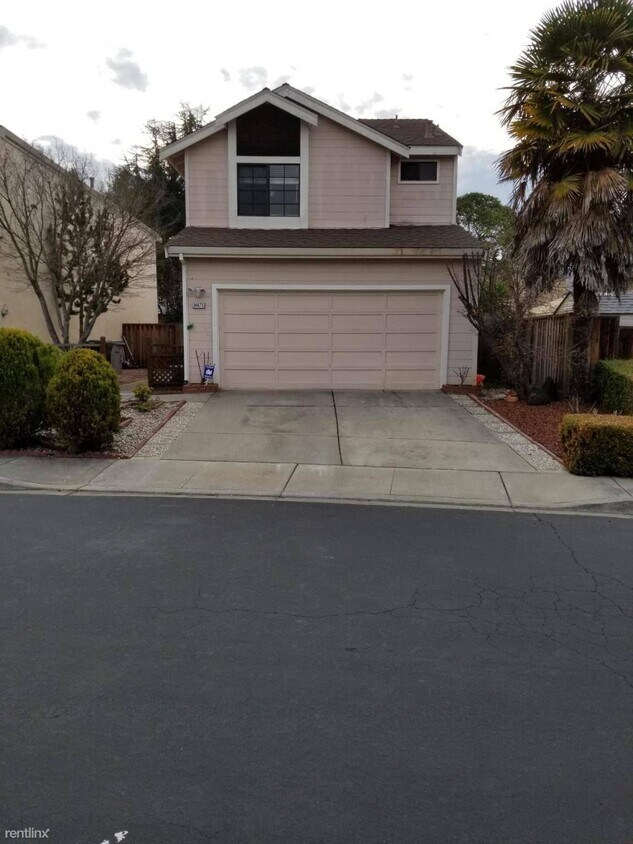
34675 Teal Common
Fremont, CA 94555
2 Weeks Ago
Favorites
34675 Teal Common

Favorites
Check Back Soon for Upcoming Availability
| Beds | Baths | Average SF |
|---|---|---|
| 3 Bedrooms 3 Bedrooms 3 Br | 2.5 Baths 2.5 Baths 2.5 Ba | 1,389 SF |
About This Property
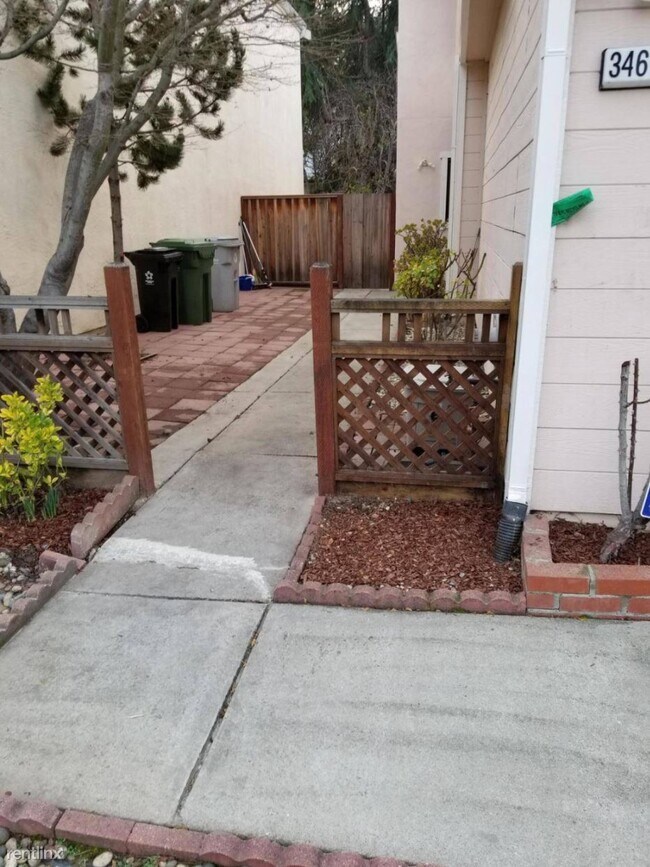
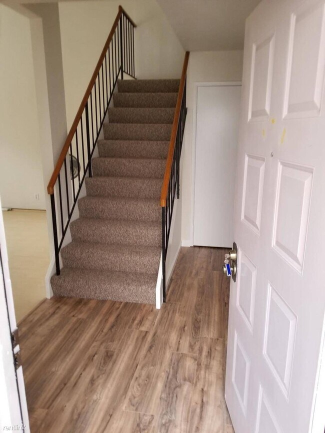
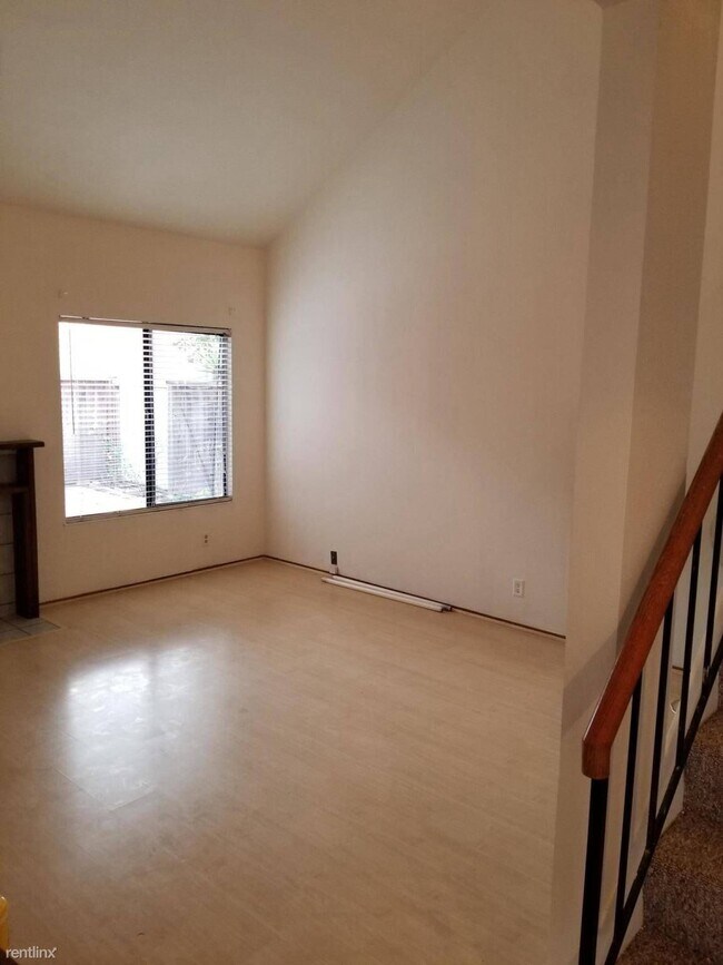
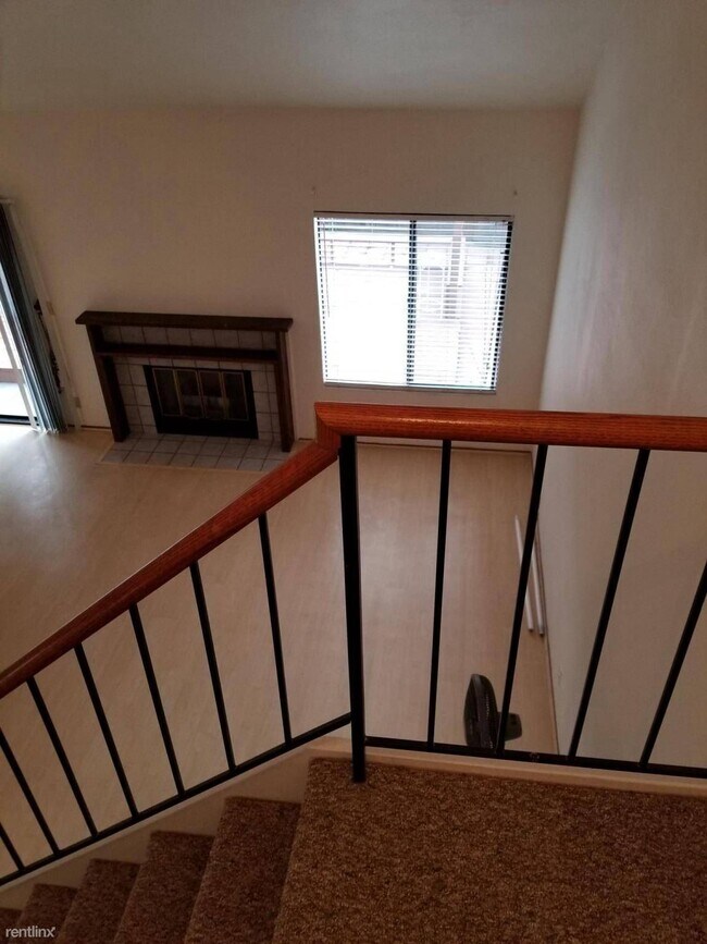
(650) 463-9203 - Click here to view the property on our page https://sandora.co/propertydetails/5eb46654956a8d028484af61 -- Beautiful Ardenwood area Home, living area 1389 sqft, with 3300 sqft lot --One bedroom and half bathroom downstairs, All laminate floor -- 2 large master bedrooms upstairs with bathroom in each -- Newer paint, downstairs all laminate , up-stairs all new carpet -- Appliances included ( washer,dryer,dishwasher,refrigerator...) -- Award winning school Forrest park, walk to school -- Nice backyard with Deck, Fruit trees -- Two cars Garage -- Close to Bus station, Freeway, Dumbarton Bridge, Grocery stores.... -- Will be available around Feb-15- 2019 -- No Pets -- Income proof required -- For more detail, email Pl. Lease Details: Renter pays Utility ( water, electricity and garbage ) (RLNE5780149)
34675 Teal Common is a house located in Alameda County and the 94555 ZIP Code. This area is served by the Fremont Unified attendance zone.
Location
Get Directions
Ardenwood is a family-friendly, suburban neighborhood about five miles northwest of Downtown Fremont. Similar to many Silicon Valley neighborhoods, Ardenwood is upscale with large, single-family homes and modern apartments and townhomes available for rent. Although renters from all walks of life can enjoy Ardenwood, families are attracted to the neighborhood for its excellent schools and abundance of childcare centers, while professionals enjoy easier commutes to some of Silicon Valley’s major tech companies.
Multiple neighborhood parks combined with proximity to the San Francisco Bay makes Ardenwood an ideal home for those who love to explore the outdoors. The 978-acre Coyote Hills Regional Park is located directly west of the Ardenwood, and the Quarry Lakes Regional Recreation Area and Central Park are both less than 20 minutes away.
Learn more about living in ArdenwoodBelow are rent ranges for similar nearby apartments
Education
| Colleges & Universities | Distance | ||
|---|---|---|---|
| Colleges & Universities | Distance | ||
| Drive: | 11 min | 6.2 mi | |
| Drive: | 14 min | 8.5 mi | |
| Drive: | 15 min | 9.3 mi | |
| Drive: | 19 min | 11.6 mi |
34675 Teal Common is within 11 minutes or 6.2 miles from Ohlone College, Newark. It is also near Chabot College and Cal State East Bay.
Schools


Charter Elementary School
Grades K-5
483 Students
Nearby
Public Elementary School
Grades K-5
883 Students
Attendance Zone
Public Middle School
Grades 6-8
1,302 Students
Attendance Zone
Public High School
Grades 9-12
2,501 Students
Attendance Zone
Private Elementary, Middle & High School
Grades PK-12
691 Students
Nearby
Private Elementary & Middle School
Grades PK-8
806 Students
Nearby
Private Elementary & Middle School
Grades PK-8
178 Students
Nearby
Private Elementary School
Grades K-6
91 Students
Nearby
School data provided by
 The GreatSchools Rating helps parents compare schools within a state based on a variety of school quality indicators and provides a helpful picture of how effectively each school serves all of its students. Ratings are on a scale of 1 (below average) to 10 (above average) and can include test scores, college readiness, academic progress, advanced courses, equity, discipline and attendance data. We also advise parents to visit schools, consider other information on school performance and programs, and consider family needs as part of the school selection process.
View GreatSchools Rating Methodology
Data provided by GreatSchools.org © 2025. All rights reserved.
View GreatSchools Rating Methodology
Data provided by GreatSchools.org © 2025. All rights reserved.
Transportation options available in Fremont include Union City Station, located 3.6 miles from 34675 Teal Common. 34675 Teal Common is near Metro Oakland International, located 17.2 miles or 24 minutes away, and Norman Y Mineta San Jose International, located 21.0 miles or 28 minutes away.
| Transit / Subway | Distance | ||
|---|---|---|---|
| Transit / Subway | Distance | ||
|
|
Drive: | 8 min | 3.6 mi |
|
|
Drive: | 11 min | 5.7 mi |
|
|
Drive: | 12 min | 5.8 mi |
|
|
Drive: | 12 min | 7.2 mi |
|
|
Drive: | 16 min | 9.8 mi |
| Commuter Rail | Distance | ||
|---|---|---|---|
| Commuter Rail | Distance | ||
| Drive: | 7 min | 3.1 mi | |
| Drive: | 7 min | 3.3 mi | |
| Drive: | 14 min | 9.1 mi | |
|
|
Drive: | 14 min | 9.1 mi |
| Drive: | 24 min | 12.3 mi |
| Airports | Distance | ||
|---|---|---|---|
| Airports | Distance | ||
|
Metro Oakland International
|
Drive: | 24 min | 17.2 mi |
|
Norman Y Mineta San Jose International
|
Drive: | 28 min | 21.0 mi |
Time and distance from 34675 Teal Common.
| Shopping Centers | Distance | ||
|---|---|---|---|
| Shopping Centers | Distance | ||
| Walk: | 10 min | 0.5 mi | |
| Walk: | 21 min | 1.1 mi | |
| Drive: | 3 min | 1.2 mi |
34675 Teal Common has 3 shopping centers within 1.2 miles, which is about a 3-minute walk. The miles and minutes will be for the farthest away property.
| Parks and Recreation | Distance | ||
|---|---|---|---|
| Parks and Recreation | Distance | ||
|
Quarry Lakes Regional Recreation Area
|
Drive: | 6 min | 3.0 mi |
|
Ardenwood Historic Farm
|
Walk: | 57 min | 3.0 mi |
|
Alameda Creek Regional Trail
|
Drive: | 6 min | 3.2 mi |
|
Coyote Hills Regional Park
|
Drive: | 7 min | 3.3 mi |
|
San Francisco Bay National Wildlife Refuge
|
Drive: | 10 min | 4.4 mi |
34675 Teal Common has 5 parks within 4.4 miles, including Ardenwood Historic Farm, Quarry Lakes Regional Recreation Area, and Alameda Creek Regional Trail.
| Hospitals | Distance | ||
|---|---|---|---|
| Hospitals | Distance | ||
| Drive: | 11 min | 5.6 mi | |
| Drive: | 11 min | 5.7 mi | |
| Drive: | 11 min | 6.3 mi |
34675 Teal Common has 3 hospitals within 6.3 miles, the nearest is Kaiser Foundation Hospital - Fremont which is 5.6 miles away and a 11 minute drive.
| Military Bases | Distance | ||
|---|---|---|---|
| Military Bases | Distance | ||
| Drive: | 30 min | 18.4 mi |
34675 Teal Common is 18.4 miles and a 30 minute drive from Ames Research Center.
You May Also Like
Similar Rentals Nearby


What Are Walk Score®, Transit Score®, and Bike Score® Ratings?
Walk Score® measures the walkability of any address. Transit Score® measures access to public transit. Bike Score® measures the bikeability of any address.
What is a Sound Score Rating?
A Sound Score Rating aggregates noise caused by vehicle traffic, airplane traffic and local sources

34675 Teal Common
Fremont, CA 94555