
Presidential Towers
555 W Madison St,
Chicago, IL 60661
$1,670 - $6,580
Studio - 2 Beds
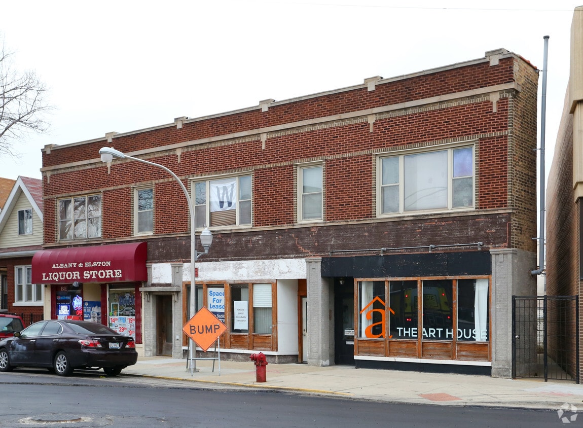
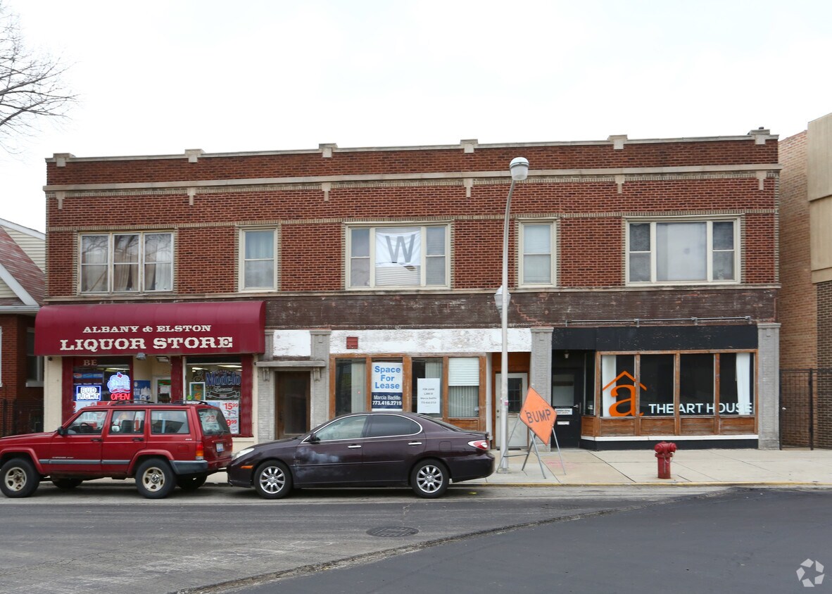
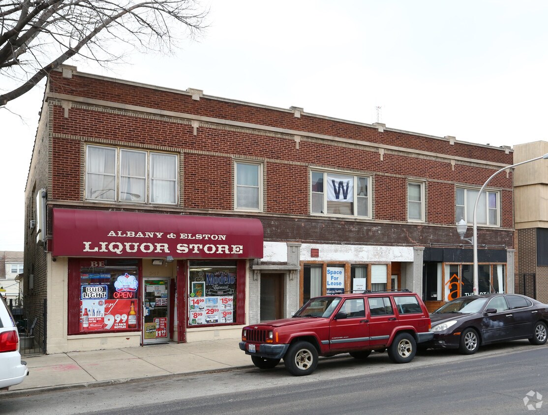
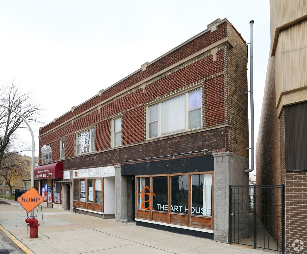

Explore your new place at 3453-3457 N Albany Ave in Chicago. This community can be found on N. Albany Ave in the 60618 area of Chicago. The leasing staff is waiting to show you all that this community has in store. Make sure you to see the available floorplan options. Contact us or drop by to find out current pricing and find your new place at 3453-3457 N Albany Ave.
3453-3457 N Albany Ave is an apartment community located in Cook County and the 60618 ZIP Code. This area is served by the Chicago Public Schools attendance zone.
Located on the Northwest Side of Chicago, Avondale is a charming neighborhood on the rise. Avondale offers a more down-to-earth vibe than its ultra-hip neighbor, Logan Square, along with an array of diverse eateries, revered beer bars, video arcades, and specialty shops largely clustered on Elston Avenue and Belmont Avenue. In addition to its food and bar scene, Avondale provides unique entertainment venues like Prop Thtr and the Factory Theater, which are known for their one-of-a-kind theatrical experiences.
Rentals in Avondale typically include renovated apartments and condos in historic buildings, although there are a few newer developments available as well. Commuting from Avondale is a breeze with convenience to Interstate 90 and the Blue Line.
Learn more about living in AvondaleCompare neighborhood and city base rent averages by bedroom.
| Avondale | Chicago, IL | |
|---|---|---|
| Studio | $970 | $1,657 |
| 1 Bedroom | $1,106 | $2,055 |
| 2 Bedrooms | $2,315 | $2,600 |
| 3 Bedrooms | $3,246 | $3,114 |
| Colleges & Universities | Distance | ||
|---|---|---|---|
| Colleges & Universities | Distance | ||
| Drive: | 2 min | 1.1 mi | |
| Drive: | 5 min | 2.3 mi | |
| Drive: | 8 min | 3.5 mi | |
| Drive: | 8 min | 3.9 mi |


Transportation options available in Chicago include Belmont Station (Blue Line), located 0.7 mile from 3453-3457 N Albany Ave. 3453-3457 N Albany Ave is near Chicago O'Hare International, located 11.6 miles or 18 minutes away, and Chicago Midway International, located 12.7 miles or 24 minutes away.
| Transit / Subway | Distance | ||
|---|---|---|---|
| Transit / Subway | Distance | ||
|
|
Walk: | 13 min | 0.7 mi |
|
|
Drive: | 3 min | 1.3 mi |
|
|
Drive: | 2 min | 1.4 mi |
|
|
Drive: | 2 min | 1.4 mi |
|
|
Drive: | 3 min | 1.6 mi |
| Commuter Rail | Distance | ||
|---|---|---|---|
| Commuter Rail | Distance | ||
|
|
Drive: | 3 min | 1.7 mi |
|
|
Drive: | 4 min | 2.0 mi |
|
|
Drive: | 5 min | 2.8 mi |
|
|
Drive: | 5 min | 2.8 mi |
|
|
Drive: | 7 min | 3.3 mi |
| Airports | Distance | ||
|---|---|---|---|
| Airports | Distance | ||
|
Chicago O'Hare International
|
Drive: | 18 min | 11.6 mi |
|
Chicago Midway International
|
Drive: | 24 min | 12.7 mi |
Scores provided by
Traffic
-Airport
-Businesses
-Scores provided by
HowLoud What is a Sound Score Rating? A Sound Score Rating aggregates noise caused by vehicle traffic, airplane traffic and local sources. How It WorksTime and distance from 3453-3457 N Albany Ave.
| Shopping Centers | Distance | ||
|---|---|---|---|
| Shopping Centers | Distance | ||
| Walk: | 5 min | 0.3 mi | |
| Walk: | 5 min | 0.3 mi | |
| Walk: | 13 min | 0.7 mi |
| Parks and Recreation | Distance | ||
|---|---|---|---|
| Parks and Recreation | Distance | ||
|
Kilbourn Park
|
Drive: | 5 min | 2.0 mi |
|
Wrightwood Park
|
Drive: | 6 min | 2.8 mi |
|
Gompers Park
|
Drive: | 6 min | 3.0 mi |
|
Winnemac Park
|
Drive: | 7 min | 3.2 mi |
|
Chase Park
|
Drive: | 7 min | 3.5 mi |
| Hospitals | Distance | ||
|---|---|---|---|
| Hospitals | Distance | ||
| Drive: | 5 min | 2.7 mi | |
| Drive: | 6 min | 3.2 mi | |
| Drive: | 6 min | 3.3 mi |
| Military Bases | Distance | ||
|---|---|---|---|
| Military Bases | Distance | ||
| Drive: | 27 min | 19.2 mi | |
| Drive: | 39 min | 30.2 mi | |
| Drive: | 46 min | 31.1 mi |
What Are Walk Score®, Transit Score®, and Bike Score® Ratings?
Walk Score® measures the walkability of any address. Transit Score® measures access to public transit. Bike Score® measures the bikeability of any address.
What is a Sound Score Rating?
A Sound Score Rating aggregates noise caused by vehicle traffic, airplane traffic and local sources.


