
$845
/ Month
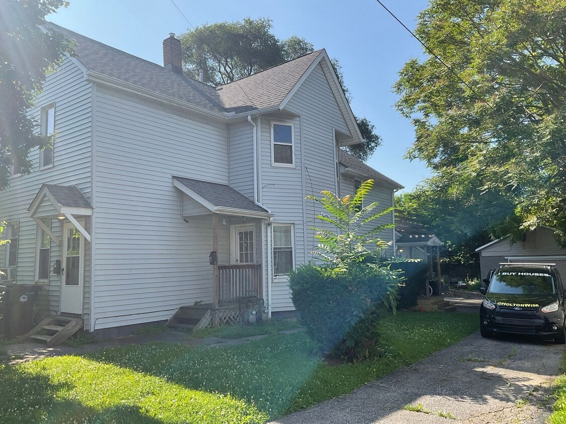
3449 Erin Ave Unit 3449 Erin Avenue Up
Cleveland, OH 44113
Today
|
Edit
Favorites
216-661-6633
-
Bedrooms
2
-
Bathrooms
1
-
Square Feet
--
-
Available
Available Now
3449 Erin Ave Unit 3449 Erin Avenue Up

Favorites
Contact
- Listed by Holton-Wise Property Group | Holton-Wise Property Group
- Phone Number
- Contact
Location
Get Directions
The Near West Side of Cleveland encompasses a stretch of tree-lined neighborhoods that are bordered by Interstate 90 to the north, Clark Avenue to the south, and Interstate 71 to the east. There are historic loft apartments and long-standing single-family homes for rent in the Near West Side, all on tree-lined, walkable streets. The real draw of the area is its proximity to destinations like the West Side Market and the trendy restaurants and breweries along Carnegie Avenue. Commuters can be in Downtown Cleveland in just 10 minutes, adding to the allure of this wooded neighborhood.
Learn more about living in Near West Side
Education
| Colleges & Universities | Distance | ||
|---|---|---|---|
| Colleges & Universities | Distance | ||
| Drive: | 8 min | 3.3 mi | |
| Drive: | 8 min | 4.4 mi | |
| Drive: | 15 min | 7.5 mi | |
| Drive: | 15 min | 7.8 mi |
3449 Erin Ave Unit 3449 Erin Avenue Up is within 8 minutes or 3.3 miles from Cleveland State University. It is also near Cuyahoga C.C., Metropolitan and Case Western Reserve.
Transportation options available in Cleveland include W 25Th St-Ohio City Station, located 1.2 miles from 3449 Erin Ave Unit 3449 Erin Avenue Up. 3449 Erin Ave Unit 3449 Erin Avenue Up is near Cleveland-Hopkins International, located 10.6 miles or 19 minutes away.
| Transit / Subway | Distance | ||
|---|---|---|---|
| Transit / Subway | Distance | ||
| Drive: | 3 min | 1.2 mi | |
| Drive: | 5 min | 1.7 mi | |
| Drive: | 6 min | 2.3 mi | |
|
|
Drive: | 6 min | 2.3 mi |
| Drive: | 6 min | 2.4 mi |
| Commuter Rail | Distance | ||
|---|---|---|---|
| Commuter Rail | Distance | ||
|
|
Drive: | 10 min | 4.0 mi |
| Drive: | 18 min | 10.4 mi | |
| Drive: | 21 min | 12.2 mi | |
| Drive: | 29 min | 18.1 mi | |
|
Boston Mill
|
Drive: | 36 min | 23.1 mi |
| Airports | Distance | ||
|---|---|---|---|
| Airports | Distance | ||
|
Cleveland-Hopkins International
|
Drive: | 19 min | 10.6 mi |
Time and distance from 3449 Erin Ave Unit 3449 Erin Avenue Up.
| Shopping Centers | Distance | ||
|---|---|---|---|
| Shopping Centers | Distance | ||
| Walk: | 6 min | 0.3 mi | |
| Walk: | 12 min | 0.6 mi | |
| Drive: | 3 min | 1.1 mi |
3449 Erin Ave Unit 3449 Erin Avenue Up has 3 shopping centers within 1.1 miles, which is about a 3-minute drive. The miles and minutes will be for the farthest away property.
| Parks and Recreation | Distance | ||
|---|---|---|---|
| Parks and Recreation | Distance | ||
|
Cleveland Metroparks Zoo
|
Drive: | 4 min | 2.0 mi |
|
Great Lakes Science Center
|
Drive: | 7 min | 3.2 mi |
|
Lakefront Reservation and Edgewater Park
|
Drive: | 8 min | 3.2 mi |
|
Ohio & Erie Canal Reservation
|
Drive: | 10 min | 5.8 mi |
|
CanalWay Center
|
Drive: | 14 min | 7.0 mi |
3449 Erin Ave Unit 3449 Erin Avenue Up has 5 parks within 7.0 miles, including Cleveland Metroparks Zoo, Lakefront Reservation and Edgewater Park, and Great Lakes Science Center.
| Hospitals | Distance | ||
|---|---|---|---|
| Hospitals | Distance | ||
| Drive: | 3 min | 1.2 mi | |
| Drive: | 3 min | 1.3 mi | |
| Drive: | 7 min | 3.0 mi |
3449 Erin Ave Unit 3449 Erin Avenue Up has 3 hospitals within 3.0 miles, the nearest is Metrohealth System which is 1.2 miles away and a 3 minute drive.
| Military Bases | Distance | ||
|---|---|---|---|
| Military Bases | Distance | ||
| Drive: | 93 min | 79.4 mi | |
| Drive: | 98 min | 81.1 mi |
3449 Erin Ave Unit 3449 Erin Avenue Up is 79.4 miles from Mansfield Lahm Airport Air Guard Station, and is convenient to other military bases, including Camp Perry Air Guard Station.
You May Also Like
Similar Rentals Nearby


What Are Walk Score®, Transit Score®, and Bike Score® Ratings?
Walk Score® measures the walkability of any address. Transit Score® measures access to public transit. Bike Score® measures the bikeability of any address.
What is a Sound Score Rating?
A Sound Score Rating aggregates noise caused by vehicle traffic, airplane traffic and local sources
3449 Erin Ave
Cleveland, OH 44113