

$695 / Month
3420 W Rose Ln
Phoenix, AZ 85017
2 Weeks Ago
Favorites
3420 W Rose Ln

Favorites
Check Back Soon for Upcoming Availability
| Beds | Baths | Average SF |
|---|---|---|
| 1 Bedroom 1 Bedroom 1 Br | 1 Bath 1 Bath 1 Ba | 695 SF |
About This Property
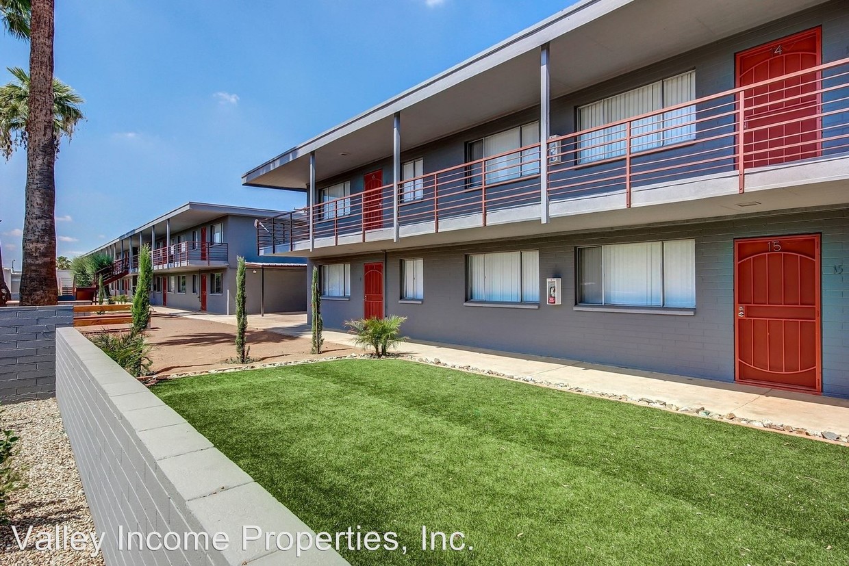
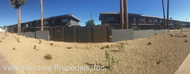
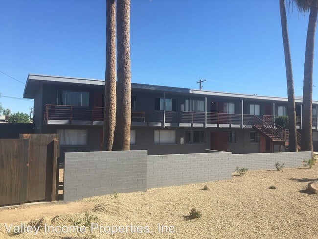
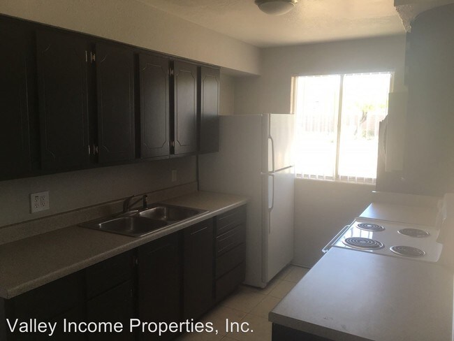
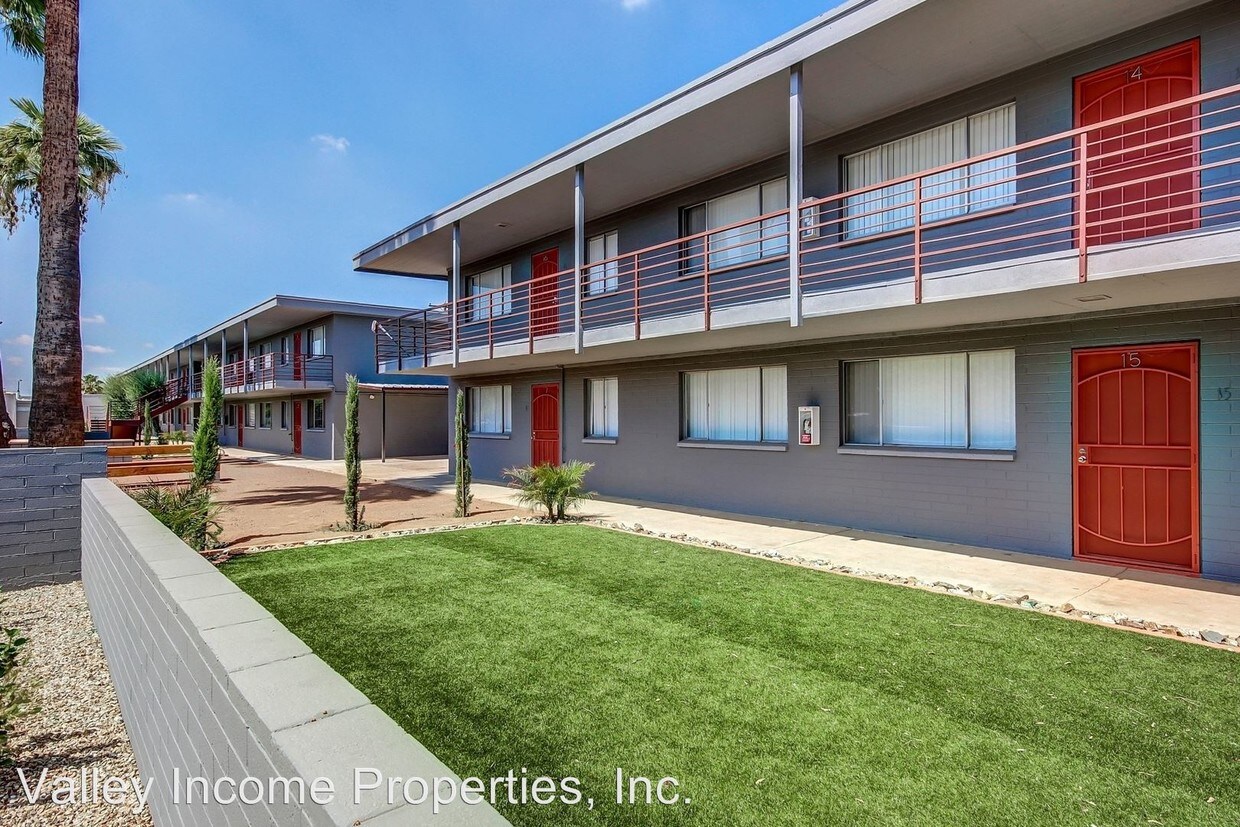
(602) 633-1350 - Beautifully remodeled 1/1 - Renovated Complex - New Units - This property enjoys a wide frontage along Rose Lane, a quiet neighborhood street one block north of Bethany Home Road, a major east-west thoroughfare running through Phoenix, and on into Glendale. This complex places residents within very close proximity to the metro Phoenix freeway system. The interchange with Interstate-17 freeway, which gives residents easy access to Downtown Phoenix and all points in the metropolitan area, is less then one mile east of the property. Downtown Phoenix is approximately nine miles to the southwest. Close-by employment opportunities are concentrated along Bethany Home Road, and continuing on into the entrance of the highly desirable Camel back Corridor two miles southeast of the Plaza West Apartments. Walmart Super center is located across the street from the property, and Phoenix Spectrum Mall is two miles east, providing residents with convenience and easy access to ample employment opportunities. Plaza West Apartments project is convenient to public transportation, with bus service provided along Bethany Home Road. 3420 W Rose Lane Phoenix, AZ 85017 Completely remodeled complex Grass picnic area Laundry room on site Covered and street parking Onsite professional management Upgraded remodeled units $40 application fee $400-$500 deposit on approved credit (RLNE3150270) Other Amenities - Parking, Other- bbq/ picnic area. Appliances - Washer & Dryer On-Site. Pet policies - Small Dogs Allowed, Cats Allowed.
3420 W Rose Ln is a condo located in Maricopa County and the 85017 ZIP Code. This area is served by the Washington Elementary attendance zone.
Location
Get Directions
Westside is a neighborhood within Glendale, which was voted “Arizona’s Antique Capital” by Sunset magazine and USA Today. Many higher education schools are located near Westside, including Glendale Community College, Carrington College, and Arizona State University West campus. You’ll discover numerous pocket parks in the area, plus larger ones like Glendale Heroes Regional Park and Grand Canal Linear Park. Shopping and dining destinations are plentiful, especially at Arrowhead Towne Center Mall.
Learn more about living in WestsideBelow are rent ranges for similar nearby apartments
| Beds | Average Size | Lowest | Typical | Premium |
|---|---|---|---|---|
| Studio Studio Studio | 496 Sq Ft | $663 | $1,075 | $2,745 |
| 1 Bed 1 Bed 1 Bed | 675 Sq Ft | $699 | $1,421 | $12,177 |
| 2 Beds 2 Beds 2 Beds | 987-988 Sq Ft | $799 | $1,712 | $14,154 |
| 3 Beds 3 Beds 3 Beds | 1385-1387 Sq Ft | $1,156 | $2,237 | $21,288 |
| 4 Beds 4 Beds 4 Beds | 2112 Sq Ft | $825 | $3,295 | $22,950 |
Education
| Colleges & Universities | Distance | ||
|---|---|---|---|
| Colleges & Universities | Distance | ||
| Drive: | 4 min | 1.3 mi | |
| Drive: | 9 min | 4.9 mi | |
| Drive: | 9 min | 5.0 mi | |
| Drive: | 12 min | 5.7 mi |
3420 W Rose Ln is within 4 minutes or 1.3 miles from Grand Canyon University. It is also near Argosy University and DeVry University, Arizona.
Schools


Public Elementary & Middle School
Grades PK-8
554 Students
Nearby
Public Middle School
Grades PK & 7-8
870 Students
Attendance Zone
Public Elementary School
Grades K-6
650 Students
Attendance Zone
Public High School
Grades 9-12
1,756 Students
Attendance Zone
Private Elementary & Middle School
Grades PK-8
480 Students
Nearby
Private Elementary, Middle & High School
Grades K-12
Nearby
School data provided by
 The GreatSchools Rating helps parents compare schools within a state based on a variety of school quality indicators and provides a helpful picture of how effectively each school serves all of its students. Ratings are on a scale of 1 (below average) to 10 (above average) and can include test scores, college readiness, academic progress, advanced courses, equity, discipline and attendance data. We also advise parents to visit schools, consider other information on school performance and programs, and consider family needs as part of the school selection process.
View GreatSchools Rating Methodology
Data provided by GreatSchools.org © 2025. All rights reserved.
View GreatSchools Rating Methodology
Data provided by GreatSchools.org © 2025. All rights reserved.
Transportation options available in Phoenix include Montebello/19Th Ave, located 2.4 miles from 3420 W Rose Ln. 3420 W Rose Ln is near Phoenix Sky Harbor International, located 13.9 miles or 22 minutes away, and Phoenix-Mesa Gateway, located 40.7 miles or 54 minutes away.
| Transit / Subway | Distance | ||
|---|---|---|---|
| Transit / Subway | Distance | ||
|
|
Drive: | 5 min | 2.4 mi |
|
|
Drive: | 6 min | 2.9 mi |
|
|
Drive: | 8 min | 3.6 mi |
|
|
Drive: | 7 min | 3.8 mi |
|
|
Drive: | 9 min | 4.8 mi |
| Commuter Rail | Distance | ||
|---|---|---|---|
| Commuter Rail | Distance | ||
|
|
Drive: | 54 min | 41.8 mi |
| Airports | Distance | ||
|---|---|---|---|
| Airports | Distance | ||
|
Phoenix Sky Harbor International
|
Drive: | 22 min | 13.9 mi |
|
Phoenix-Mesa Gateway
|
Drive: | 54 min | 40.7 mi |
Time and distance from 3420 W Rose Ln.
| Shopping Centers | Distance | ||
|---|---|---|---|
| Shopping Centers | Distance | ||
| Walk: | 5 min | 0.3 mi | |
| Walk: | 16 min | 0.9 mi | |
| Walk: | 19 min | 1.0 mi |
3420 W Rose Ln has 3 shopping centers within 1.0 miles, which is about a 19-minute walk. The miles and minutes will be for the farthest away property.
| Parks and Recreation | Distance | ||
|---|---|---|---|
| Parks and Recreation | Distance | ||
|
Maryvale Park
|
Drive: | 8 min | 4.1 mi |
|
Steele Indian School Park
|
Drive: | 12 min | 6.0 mi |
|
Desert Storm Park
|
Drive: | 12 min | 6.1 mi |
|
Granada Park
|
Drive: | 15 min | 7.0 mi |
|
North Mountain Park
|
Drive: | 15 min | 8.1 mi |
3420 W Rose Ln has 5 parks within 8.1 miles, including Maryvale Park, Steele Indian School Park, and Desert Storm Park.
| Hospitals | Distance | ||
|---|---|---|---|
| Hospitals | Distance | ||
| Drive: | 4 min | 2.0 mi | |
| Drive: | 6 min | 2.7 mi | |
| Drive: | 12 min | 6.4 mi |
3420 W Rose Ln has 3 hospitals within 6.4 miles, the nearest is Abrazo Central Campus which is 2.0 miles away and a 4 minute drive.
| Military Bases | Distance | ||
|---|---|---|---|
| Military Bases | Distance | ||
| Drive: | 26 min | 13.7 mi | |
| Drive: | 22 min | 13.8 mi | |
| Drive: | 101 min | 74.6 mi |
3420 W Rose Ln has 3 military bases within 74.6 miles, the nearest is Luke Air Force Base which is 13.7 miles away and a 26 minute drive.
You May Also Like
Similar Rentals Nearby


What Are Walk Score®, Transit Score®, and Bike Score® Ratings?
Walk Score® measures the walkability of any address. Transit Score® measures access to public transit. Bike Score® measures the bikeability of any address.
What is a Sound Score Rating?
A Sound Score Rating aggregates noise caused by vehicle traffic, airplane traffic and local sources
3420 W Rose Ln
Phoenix, AZ 85017