
Bay Terrace
3204 Casa De Campo Way,
San Mateo, CA 94403
$3,039 - $4,117
2-3 Beds
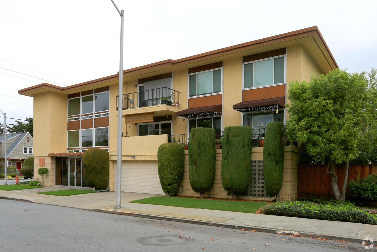
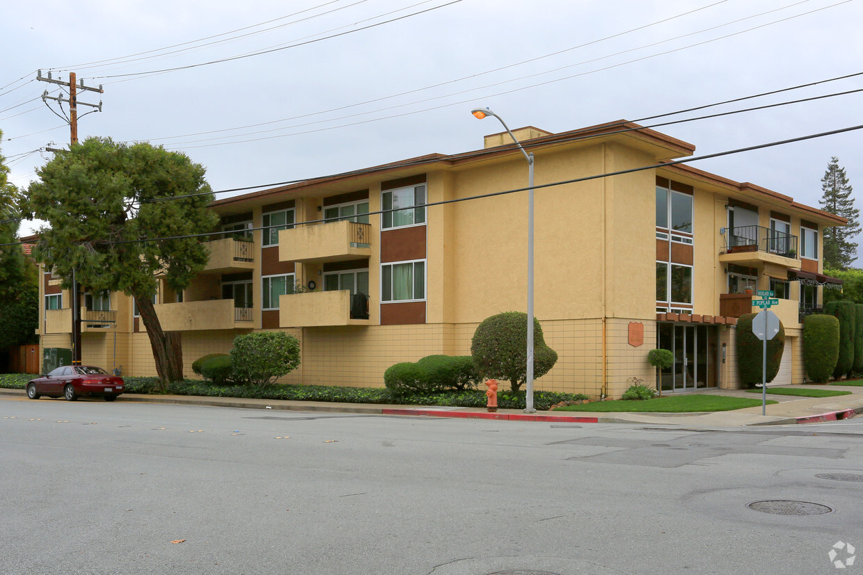
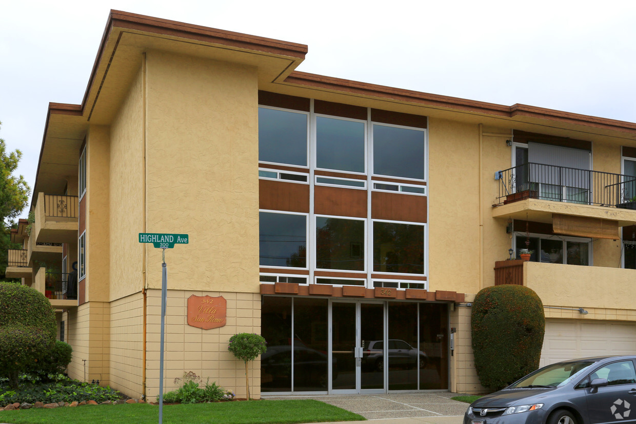
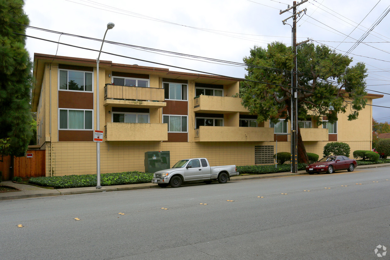
342 Highland Ave offers a blend of style, comfort, and livability. You'll find this community in the North Central area of San Mateo. The professional leasing staff is ready to help you find your ideal place. At 342 Highland Ave you'll feel right at home.
342 Highland Ave is an apartment community located in San Mateo County and the 94401 ZIP Code. This area is served by the San Mateo-Foster City attendance zone.
True to its name, North Central is a large neighborhood that offers residents easy access to the best of San Mateo and the Bay Area. This trendy neighborhood has a variety of rental options available including mid-rise apartments, luxury condos, and Mediterranean-style houses and townhomes. North Central is located directly north of Downtown San Mateo and the neighborhood’s southern border is part of the downtown area as well. Access to Highway 82, Route 101, and a rail station allows easy travel north into San Francisco and south towards San Jose.
Although North Central has its own amenities, residents enjoy living within walking distance of downtown’s restaurants, grocers, and retailers. North Central is also directly east of Downtown Burlingame, providing residents with even more options for shopping, dining, and entertainment.
Learn more about living in North CentralCompare neighborhood and city base rent averages by bedroom.
| North Central | San Mateo, CA | |
|---|---|---|
| Studio | $2,168 | $2,447 |
| 1 Bedroom | $2,631 | $2,939 |
| 2 Bedrooms | $3,299 | $3,785 |
| 3 Bedrooms | $3,813 | $5,287 |
| Colleges & Universities | Distance | ||
|---|---|---|---|
| Colleges & Universities | Distance | ||
| Drive: | 8 min | 4.4 mi | |
| Drive: | 17 min | 10.1 mi | |
| Drive: | 20 min | 13.1 mi | |
| Drive: | 20 min | 13.9 mi |


Transportation options available in San Mateo include Millbrae Bart Station, located 3.8 miles from 342 Highland Ave. 342 Highland Ave is near San Francisco International, located 5.9 miles or 11 minutes away, and Metro Oakland International, located 27.0 miles or 34 minutes away.
| Transit / Subway | Distance | ||
|---|---|---|---|
| Transit / Subway | Distance | ||
|
|
Drive: | 7 min | 3.8 mi |
|
|
Drive: | 7 min | 3.8 mi |
| Drive: | 10 min | 5.5 mi | |
|
|
Drive: | 11 min | 5.7 mi |
|
|
Drive: | 11 min | 5.9 mi |
| Commuter Rail | Distance | ||
|---|---|---|---|
| Commuter Rail | Distance | ||
| Walk: | 17 min | 0.9 mi | |
| Walk: | 17 min | 0.9 mi | |
| Drive: | 2 min | 1.2 mi | |
| Drive: | 5 min | 2.6 mi | |
| Drive: | 5 min | 2.6 mi |
| Airports | Distance | ||
|---|---|---|---|
| Airports | Distance | ||
|
San Francisco International
|
Drive: | 11 min | 5.9 mi |
|
Metro Oakland International
|
Drive: | 34 min | 27.0 mi |
Time and distance from 342 Highland Ave.
| Shopping Centers | Distance | ||
|---|---|---|---|
| Shopping Centers | Distance | ||
| Walk: | 16 min | 0.9 mi | |
| Walk: | 17 min | 0.9 mi | |
| Walk: | 19 min | 1.0 mi |
| Parks and Recreation | Distance | ||
|---|---|---|---|
| Parks and Recreation | Distance | ||
|
Japanese Tea Garden (San Mateo)
|
Walk: | 17 min | 0.9 mi |
|
San Mateo Arboretum
|
Drive: | 3 min | 1.3 mi |
|
Coyote Point Recreational Area
|
Drive: | 5 min | 2.0 mi |
|
CuriOdyssey
|
Drive: | 5 min | 2.1 mi |
|
Shoreline Parks
|
Drive: | 4 min | 2.9 mi |
| Hospitals | Distance | ||
|---|---|---|---|
| Hospitals | Distance | ||
| Drive: | 5 min | 3.3 mi | |
| Drive: | 9 min | 5.3 mi | |
| Drive: | 15 min | 10.0 mi |
| Military Bases | Distance | ||
|---|---|---|---|
| Military Bases | Distance | ||
| Drive: | 47 min | 34.7 mi |
What Are Walk Score®, Transit Score®, and Bike Score® Ratings?
Walk Score® measures the walkability of any address. Transit Score® measures access to public transit. Bike Score® measures the bikeability of any address.
What is a Sound Score Rating?
A Sound Score Rating aggregates noise caused by vehicle traffic, airplane traffic and local sources

342 Highland Ave
San Mateo, CA 94401


