

$1,000
/ Month
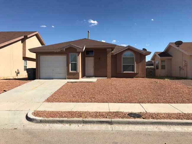
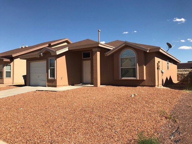
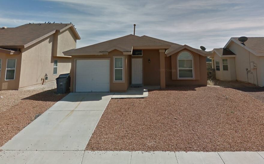
3412 Scarlet Point Dr
El Paso, TX 79938
2 Weeks Ago
|
Edit
Favorites
3412 Scarlet Point Dr

Favorites
Check Back Soon for Upcoming Availability
| Beds | Baths | Average SF |
|---|---|---|
| 4 Bedrooms 4 Bedrooms 4 Br | 1 Bath 1 Bath 1 Ba | 1,287 SF |
Fees and Policies
The fees listed below are community-provided and may exclude utilities or add-ons. All payments are made directly to the property and are non-refundable unless otherwise specified.
- Dogs Allowed
-
Fees not specified
- Cats Allowed
-
Fees not specified
About This Property
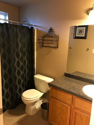
Backyard Haven: Charming, cozy 4 bedroom, 1.75 bathroom house with upgraded appliances in a quiet neighborhood. Close to Wal-Mart and shopping center, and walking distance to a daycare, park and other shops. Minutes away from Sierra Providence East Medical Center. Pet-friendly. 1000/month, 1-month security deposit. Utilities not included. Refrigerated A/C. ~20 minutes away from Fort Bliss. Washer and Dryer Hookups (including Gas). Schools: James P. Butler (Elementary), Sun Ridge Middle, Pebble Hills High School. $125 for first pet, $250 for each pet thereafter. $45 Application Fee. Convenient & Secure Payment Portal Online using Bank or Credit Card for your convenience. Call Cesar at 915-867-5130.
3412 Scarlet Point Dr is a house located in El Paso County and the 79938 ZIP Code. This area is served by the Socorro Independent School District attendance zone.
House Features
- Washer/Dryer
- Washer/Dryer Hookup
3412 Scarlet Point Dr,
El Paso,
TX
79938
El Paso sits where West Texas, New Mexico, and the Mexican state of Chihuahua converge, giving the city a cross-border identity that shapes everything from its architecture to its daily rhythm. With the Franklin Mountains rising inside city limits and the Rio Grande forming its southern edge, the geography alone sets it apart from anywhere else in Texas. Fort Bliss, one of the largest U.S. Army installations in the country, and the University of Texas at El Paso are two of the city's most significant economic and institutional anchors. The Chamizal National Memorial marks the site of a peacefully resolved international border dispute, a piece of history few American cities can claim.
Neighborhoods range widely in character. Manhattan Heights offers historic homes close to downtown, while Northeast El Paso spreads out with newer residential development near Fort Bliss. Kern Place, adjacent to UTEP's campus, has an established, walkable feel.
Learn more about living in El Paso
Amenities
- Washer/Dryer
- Washer/Dryer Hookup
Education
| Colleges & Universities | Distance | ||
|---|---|---|---|
| Colleges & Universities | Distance | ||
| Drive: | 18 min | 10.4 mi | |
| Drive: | 23 min | 11.1 mi | |
| Drive: | 28 min | 17.5 mi | |
| Drive: | 27 min | 19.0 mi |
3412 Scarlet Point Dr is within 18 minutes or 10.4 miles from El Paso C.C., Mission Del Paso. It is also near El Paso C.C., Valle Verde and El Paso C.C., Rio Grande.
Schools


Public Elementary School
Grades PK-5
985 Students
Attendance Zone
Public Elementary School
Grades PK-5
813 Students
Nearby
Public Middle School
Grades 6-8
1,082 Students
Attendance Zone
Public High School
Grades 9-12
2,888 Students
Nearby
Private Elementary, Middle & High School
Grades K-12
Nearby
Private Elementary, Middle & High School
Grades K-12
34 Students
Nearby
Private Elementary School
Grades PK-5
60 Students
Nearby
Private Elementary, Middle & High School
Grades K-12
Nearby
School data provided by
 The GreatSchools Rating helps parents compare schools within a state based on a variety of school quality indicators and provides a helpful picture of how effectively each school serves all of its students. Ratings are on a scale of 1 (below average) to 10 (above average) and can include test scores, college readiness, academic progress, advanced courses, equity, discipline and attendance data. We also advise parents to visit schools, consider other information on school performance and programs, and consider family needs as part of the school selection process.
View GreatSchools Rating Methodology
Data provided by GreatSchools.org © 2026. All rights reserved.
View GreatSchools Rating Methodology
Data provided by GreatSchools.org © 2026. All rights reserved.
Walkability Near 3412 Scarlet Point Dr El Paso, TX 79938
Getting Around
 What do Walkability, Transit, Drivability, and Bikeability mean?
Walkability measures the walking distance to day-to-day needs.
Transit measures access to public transportation.
Drivability measures congestion, parking availability, and access to major roads.
Bikeability measures the suitability for cycling.
How It Works
What do Walkability, Transit, Drivability, and Bikeability mean?
Walkability measures the walking distance to day-to-day needs.
Transit measures access to public transportation.
Drivability measures congestion, parking availability, and access to major roads.
Bikeability measures the suitability for cycling.
How It Works
Fairly Walkable
Walkability
50
/ 100
Limited Public Transit
Transit
20
/ 100
Very Drivable
Drivability
80
/ 100
Fairly Bikeable
Bikeability
40
/ 100
Scores provided by
-
Soundscore™
-
/ 100
Traffic
-Airport
-Businesses
-Scores provided by
HowLoud What is a Sound Score Rating? A Sound Score Rating aggregates noise caused by vehicle traffic, airplane traffic and local sources. How It WorksYou May Also Like
Similar Rentals Nearby
-
-

-

-

-

-

-

-
-

-
 4 Beds, 2 Baths, 1,568 sq ft$1,95013853 Summer Story Ave

What Are Walk Score®, Transit Score®, and Bike Score® Ratings?
Walk Score® measures the walkability of any address. Transit Score® measures access to public transit. Bike Score® measures the bikeability of any address.
What is a Sound Score Rating?
A Sound Score Rating aggregates noise caused by vehicle traffic, airplane traffic and local sources.
3412 Scarlet Point Dr
El Paso, TX 79938