

$2,450
Total Monthly Price
340 S Main St
Spring City, PA 19475
Favorites
484-666-3138
-
Bedrooms
4
-
Bathrooms
1.5
-
Square Feet
1,700 sq ft
-
Available
Available Jan 1, 2027
Highlights
- Yard
- Basement
340 S Main St

Favorites
About This Home
12 Month Lease,
$2,450 deposit,
Available Jan 1, 2027
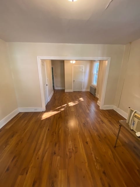
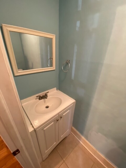
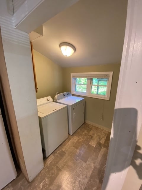
**Due to the high number of no-shows, kindly complete an application prior to scheduling a tour.** Recently renovated 4 bed/1.5 bath twin nestled on a quiet corner in Spring City. Large fenced in yard as well as a spacious basement for additional storage needs. Award winning Spring-Ford Schools, and easy access to major roadways. Laundry hookups on-site, Owner pays for sewer and trash service. Tennant takes care of landscaping and snow removal.
340 S Main St is a house located in Chester County and the 19475 ZIP Code. This area is served by the Spring-Ford Area School District attendance zone.
* Price shown is total price based on community-supplied monthly required fees. Excludes user-selected optional fees and variable or usage-based fees and required charges due at or prior to move-in or at move-out. Price, availability, fees, and any applicable rent special are subject to change without notice.
* Square footage definitions vary. Displayed square footage is approximate.
House Features
- Washer/Dryer Hookup
- Basement
- Yard
Fees and Policies
The fees listed below are community-provided and may exclude utilities or add-ons. All payments are made directly to the property and are non-refundable unless otherwise specified.
- Parking
-
Street--
Details
Utilities Included
-
Trash Removal
-
Sewer
Contact
- Phone Number
- Contact
Location
Get Directions
Sitting along the Schuylkill River about thirty miles northwest of Philadelphia, Spring City is a Chester County borough where small-town character and easy regional access go hand in hand. The surrounding landscape holds a mix of historic architecture and quiet residential streets, giving the area a grounded, unhurried feel that stands apart from busier suburban corridors nearby.
Spring City sits within the Spring-Ford Area School District, and its location near the Montgomery County border makes it a practical base for those working across the broader Philadelphia metro. The borough covers just one square mile, so the sense of a walkable, close-knit community is built right into its layout. Across the Schuylkill River, the neighboring borough of Royersford adds to the network of surrounding amenities and services.
Renters looking for character-rich spaces with historic details will find plenty of options here.
Learn more about living in Spring City
Education
| Colleges & Universities | Distance | ||
|---|---|---|---|
| Colleges & Universities | Distance | ||
| Drive: | 17 min | 6.7 mi | |
| Drive: | 15 min | 8.4 mi | |
| Drive: | 29 min | 14.1 mi | |
| Drive: | 34 min | 17.7 mi |
340 S Main St is within 17 minutes or 6.7 miles from Ursinus College. It is also near Montgomery Co. C.C., West and Immaculata University.
Schools


Public Elementary School
Grades K-5
166 Students
Attendance Zone
Public Elementary School
Grades K-5
1,307 Students
Attendance Zone
Public Elementary School
Grades PK-5
556 Students
Nearby
Public Middle School
Grades 6-8
666 Students
Nearby
Public Middle School
Grades 6-8
672 Students
Attendance Zone
Public High School
Grades 9-12
2,629 Students
Attendance Zone
Private Elementary & Middle School
Grades K-8
189 Students
Nearby
Private Elementary, Middle & High School
Grades K-12
194 Students
Nearby
School data provided by
 The GreatSchools Rating helps parents compare schools within a state based on a variety of school quality indicators and provides a helpful picture of how effectively each school serves all of its students. Ratings are on a scale of 1 (below average) to 10 (above average) and can include test scores, college readiness, academic progress, advanced courses, equity, discipline and attendance data. We also advise parents to visit schools, consider other information on school performance and programs, and consider family needs as part of the school selection process.
View GreatSchools Rating Methodology
Data provided by GreatSchools.org © 2026. All rights reserved.
The GreatSchools Rating helps parents compare schools within a state based on a variety of school quality indicators and provides a helpful picture of how effectively each school serves all of its students. Ratings are on a scale of 1 (below average) to 10 (above average) and can include test scores, college readiness, academic progress, advanced courses, equity, discipline and attendance data. We also advise parents to visit schools, consider other information on school performance and programs, and consider family needs as part of the school selection process.
View GreatSchools Rating Methodology
Data provided by GreatSchools.org © 2026. All rights reserved.
Getting Around
 What do Walkability, Transit, Drivability, and Bikeability mean?
Walkability measures the walking distance to day-to-day needs.
Transit measures access to public transportation.
Drivability measures congestion, parking availability, and access to major roads.
Bikeability measures the suitability for cycling.
How It Works
What do Walkability, Transit, Drivability, and Bikeability mean?
Walkability measures the walking distance to day-to-day needs.
Transit measures access to public transportation.
Drivability measures congestion, parking availability, and access to major roads.
Bikeability measures the suitability for cycling.
How It Works
Somewhat Walkable
Walkability
30
/ 100
Minimal Public Transit
Transit
10
/ 100
Very Drivable
Drivability
80
/ 100
Fairly Bikeable
Bikeability
50
/ 100
Scores provided by
What do Walkability, Transit, Drivability, and Bikeability mean?
Walkability measures the walking distance to day-to-day needs.
Transit measures access to public transportation.
Drivability measures congestion, parking availability, and access to major roads.
Bikeability measures the suitability for cycling.
How It Works
-
Soundscore™
-
/ 100
Traffic
-Airport
-Businesses
-Scores provided by
HowLoud What is a Sound Score Rating? A Sound Score Rating aggregates noise caused by vehicle traffic, airplane traffic and local sources. How It Works
Amenities
- Washer/Dryer Hookup
- Basement
- Yard
340 S Main St Photos
340 S Main St
Spring City, PA 19475