1 / 22


Bedrooms
3
Bathrooms
2
Square Feet
1,312 sq ft
Available
Available Now

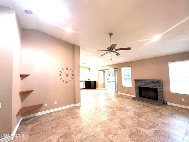
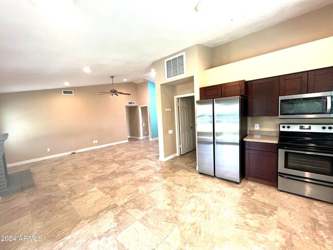
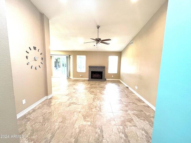
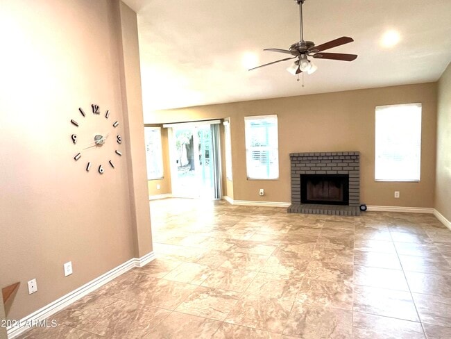
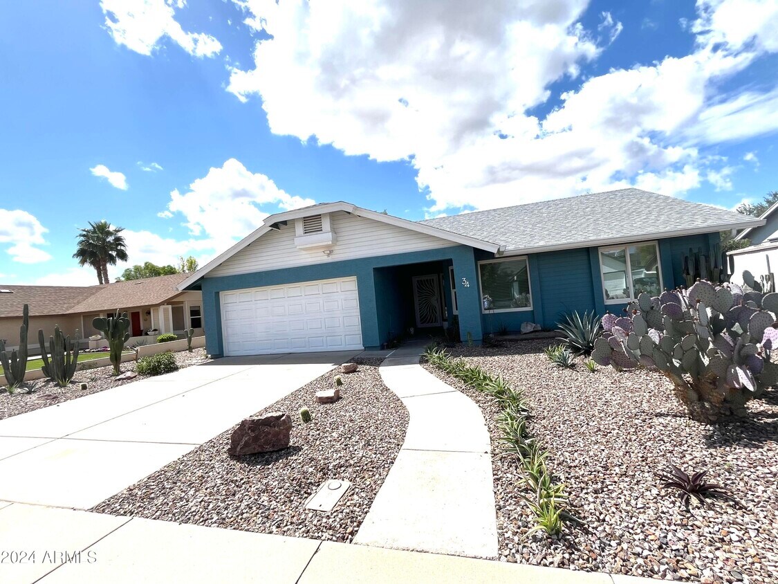
Beautiful move in ready home Close to Chandler Fashion Center,Intel,near 202 Santan,101,& I10,has been meticulously maintained by its owners. As soon as you arrive,you will want this home. Updated kitchen with cherry wood cabinets,granite counter top and premium stainless appliances. Brand new flooring in all the bedrooms and closets. Well-kept outdoor Zen garden. This is an energy saving home with new windows,new AC unit and water heater... with many more! please make this your home!
34 S Rita Ln is a house located in Maricopa County and the 85226 ZIP Code.
Situated about four miles west of Downtown Chandler, West Chandler is a scenic suburb brimming with recreation and retail. West Chandler residents enjoy access to an array of local parks, including Desert Breeze Park, Nozomi Park, and Hanger Park, as well as close proximity to the sprawling South Mountain Park.
Retail options in West Chandler provide a host of modern delights and everyday conveniences, with numerous shopping centers and plazas strewn throughout the area in addition to the upscale Chandler Fashion Center. West Chandler is also convenient to the popular Lone Butte Casino. Getting around from West Chandler is easy with access to the Santan Freeway, Maricopa Freeway, and the Price Freeway.
Learn more about living in West Chandler| Colleges & Universities | Distance | ||
|---|---|---|---|
| Colleges & Universities | Distance | ||
| Drive: | 16 min | 9.0 mi | |
| Drive: | 17 min | 9.9 mi | |
| Drive: | 18 min | 9.9 mi | |
| Drive: | 17 min | 10.1 mi |
Transportation options available in Chandler include Rural/Apache, located 8.2 miles from 34 S Rita Ln. 34 S Rita Ln is near Phoenix Sky Harbor International, located 14.6 miles or 23 minutes away, and Phoenix-Mesa Gateway, located 17.3 miles or 27 minutes away.
| Transit / Subway | Distance | ||
|---|---|---|---|
| Transit / Subway | Distance | ||
|
|
Drive: | 16 min | 8.2 mi |
|
|
Drive: | 17 min | 8.4 mi |
|
|
Drive: | 17 min | 8.6 mi |
|
|
Drive: | 17 min | 10.7 mi |
|
|
Drive: | 17 min | 11.2 mi |
| Commuter Rail | Distance | ||
|---|---|---|---|
| Commuter Rail | Distance | ||
|
|
Drive: | 31 min | 20.9 mi |
| Airports | Distance | ||
|---|---|---|---|
| Airports | Distance | ||
|
Phoenix Sky Harbor International
|
Drive: | 23 min | 14.6 mi |
|
Phoenix-Mesa Gateway
|
Drive: | 27 min | 17.3 mi |
Time and distance from 34 S Rita Ln.
| Shopping Centers | Distance | ||
|---|---|---|---|
| Shopping Centers | Distance | ||
| Walk: | 10 min | 0.5 mi | |
| Drive: | 3 min | 1.4 mi | |
| Drive: | 3 min | 1.4 mi |
| Parks and Recreation | Distance | ||
|---|---|---|---|
| Parks and Recreation | Distance | ||
|
Pecos Park
|
Drive: | 9 min | 4.4 mi |
|
South Mountain Park
|
Drive: | 17 min | 8.3 mi |
|
ASU Center for Meteorite Studies
|
Drive: | 18 min | 8.7 mi |
|
Desert Arboretum Park
|
Drive: | 19 min | 9.3 mi |
|
Camelback Mountain Park
|
Drive: | 30 min | 16.3 mi |
| Hospitals | Distance | ||
|---|---|---|---|
| Hospitals | Distance | ||
| Drive: | 7 min | 3.8 mi | |
| Drive: | 8 min | 4.2 mi | |
| Drive: | 10 min | 5.1 mi |
| Military Bases | Distance | ||
|---|---|---|---|
| Military Bases | Distance | ||
| Drive: | 23 min | 15.4 mi | |
| Drive: | 52 min | 39.9 mi | |
| Drive: | 99 min | 79.7 mi |
What Are Walk Score®, Transit Score®, and Bike Score® Ratings?
Walk Score® measures the walkability of any address. Transit Score® measures access to public transit. Bike Score® measures the bikeability of any address.
What is a Sound Score Rating?
A Sound Score Rating aggregates noise caused by vehicle traffic, airplane traffic and local sources
34 S Rita Ln
Chandler, AZ 85226


