
$750
/ Month
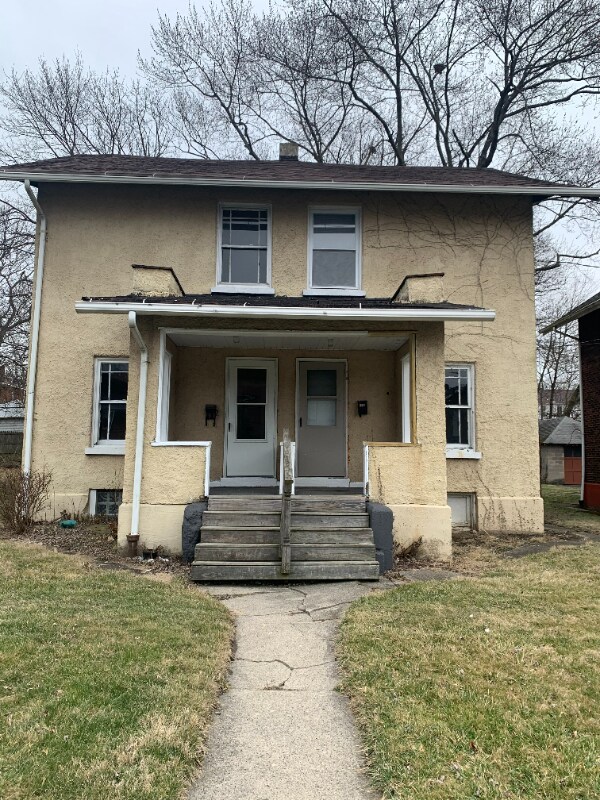
339 Shenango Blvd
Farrell, PA 16121
Favorites
339 Shenango Blvd

Favorites
Check Back Soon for Upcoming Availability
| Beds | Baths | Average SF |
|---|---|---|
| 2 Bedrooms 2 Bedrooms 2 Br | 1.5 Baths 1.5 Baths 1.5 Ba | — |
Fees and Policies
The fees listed below are community-provided and may exclude utilities or add-ons. All payments are made directly to the property and are non-refundable unless otherwise specified.
- Dogs Allowed
-
Fees not specified
- Cats Allowed
-
Fees not specified
About This Property
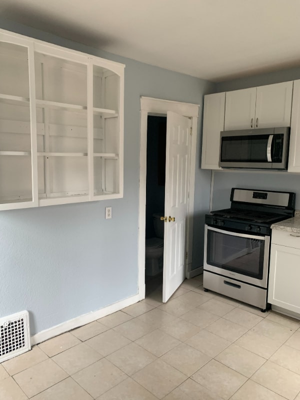
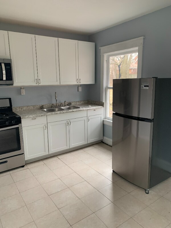
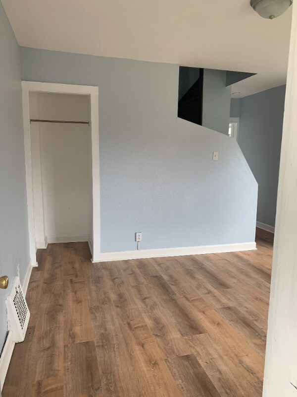
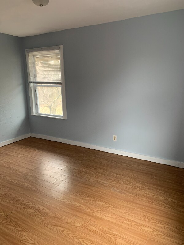
Property Id: 1115705 This Duplex with updates is a must see in a nice Farrell Neighborhood. Rent is $750 plus Utilities.
339 Shenango Blvd is an apartment community located in Mercer County and the 16121 ZIP Code.
339 Shenango Blvd,
Farrell,
PA
16121
Farrell, Pennsylvania, sits along the Shenango River in western Mercer County, just steps from the Ohio state line and about 15 miles from Youngstown. Once known as "The Magic City," Farrell grew rapidly after a steel mill was built along the river in 1901, and that industrial heritage still shapes the city's character today. Renters searching for apartments for rent in Farrell will find an affordable market in a close-knit city with easy access to the broader Shenango Valley region.
The rental housing stock in Farrell includes modest suburban-style houses, townhomes, and apartment communities that tend to offer competitive rates compared to larger nearby cities. The city's compact size means most daily needs are within a short drive. Shopping options expand quickly heading northeast into Hermitage, where the Shenango Valley Mall and a local movie theater anchor a stretch of retail and dining.
Learn more about living in Farrell
Education
| Colleges & Universities | Distance | ||
|---|---|---|---|
| Colleges & Universities | Distance | ||
| Drive: | 23 min | 15.1 mi | |
| Drive: | 30 min | 22.9 mi | |
| Drive: | 37 min | 28.2 mi | |
| Drive: | 45 min | 32.1 mi |
339 Shenango Blvd is within 23 minutes or 15.1 miles from Youngstown State University. It is also near Kent State Univ., Trumbull and Grove City College.
Walkability Near 339 Shenango Blvd Farrell, PA 16121
Getting Around
 What do Walkability, Transit, Drivability, and Bikeability mean?
Walkability measures the walking distance to day-to-day needs.
Transit measures access to public transportation.
Drivability measures congestion, parking availability, and access to major roads.
Bikeability measures the suitability for cycling.
How It Works
What do Walkability, Transit, Drivability, and Bikeability mean?
Walkability measures the walking distance to day-to-day needs.
Transit measures access to public transportation.
Drivability measures congestion, parking availability, and access to major roads.
Bikeability measures the suitability for cycling.
How It Works
Fairly Walkable
Walkability
40
/ 100
Exceptionally Drivable
Drivability
90
/ 100
Somewhat Bikeable
Bikeability
30
/ 100
Scores provided by
-
Soundscore™
-
/ 100
Traffic
-Airport
-Businesses
-Scores provided by
HowLoud What is a Sound Score Rating? A Sound Score Rating aggregates noise caused by vehicle traffic, airplane traffic and local sources. How It WorksYou May Also Like
Similar Rentals Nearby
-
-
-
2 Beds$1,450+3 Beds$1,699Total Monthly Price12 Month LeaseTotal Monthly Price NewPrices include all required monthly fees.Specials
-
2 Beds$1,625Total Monthly Price12 Month LeaseTotal Monthly Price NewPrices include all required monthly fees.Specials
-
-
-
-
-
-


What Are Walk Score®, Transit Score®, and Bike Score® Ratings?
Walk Score® measures the walkability of any address. Transit Score® measures access to public transit. Bike Score® measures the bikeability of any address.
What is a Sound Score Rating?
A Sound Score Rating aggregates noise caused by vehicle traffic, airplane traffic and local sources.
339 Shenango Blvd
Farrell, PA 16121