
Ellyn Crossing
440 Gregory Ave,
Glendale Heights, IL 60139
$1,351 - $1,888
1-2 Beds
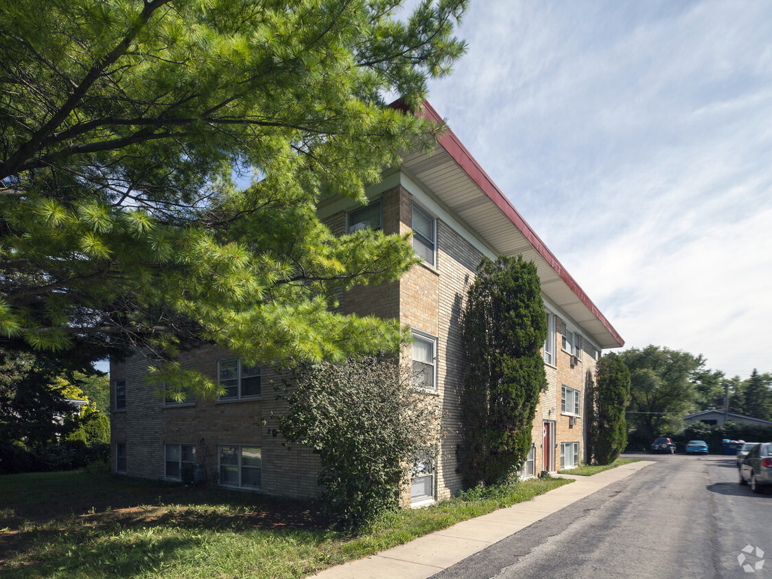
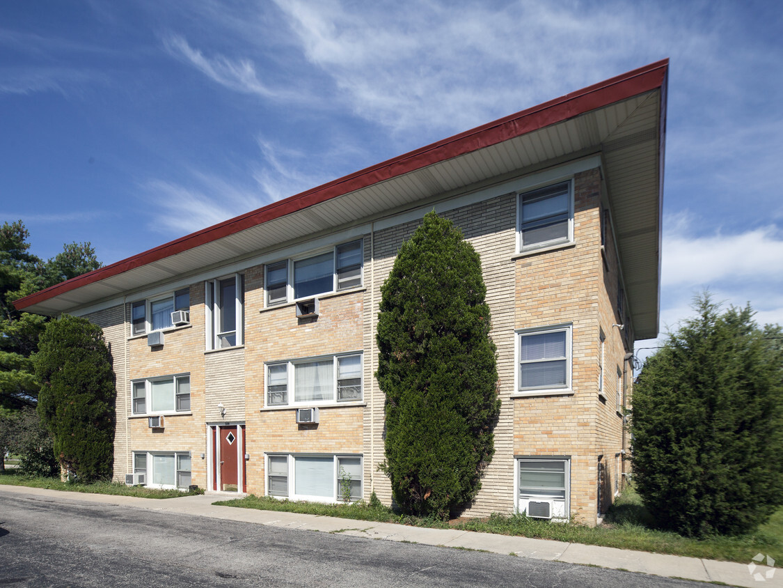
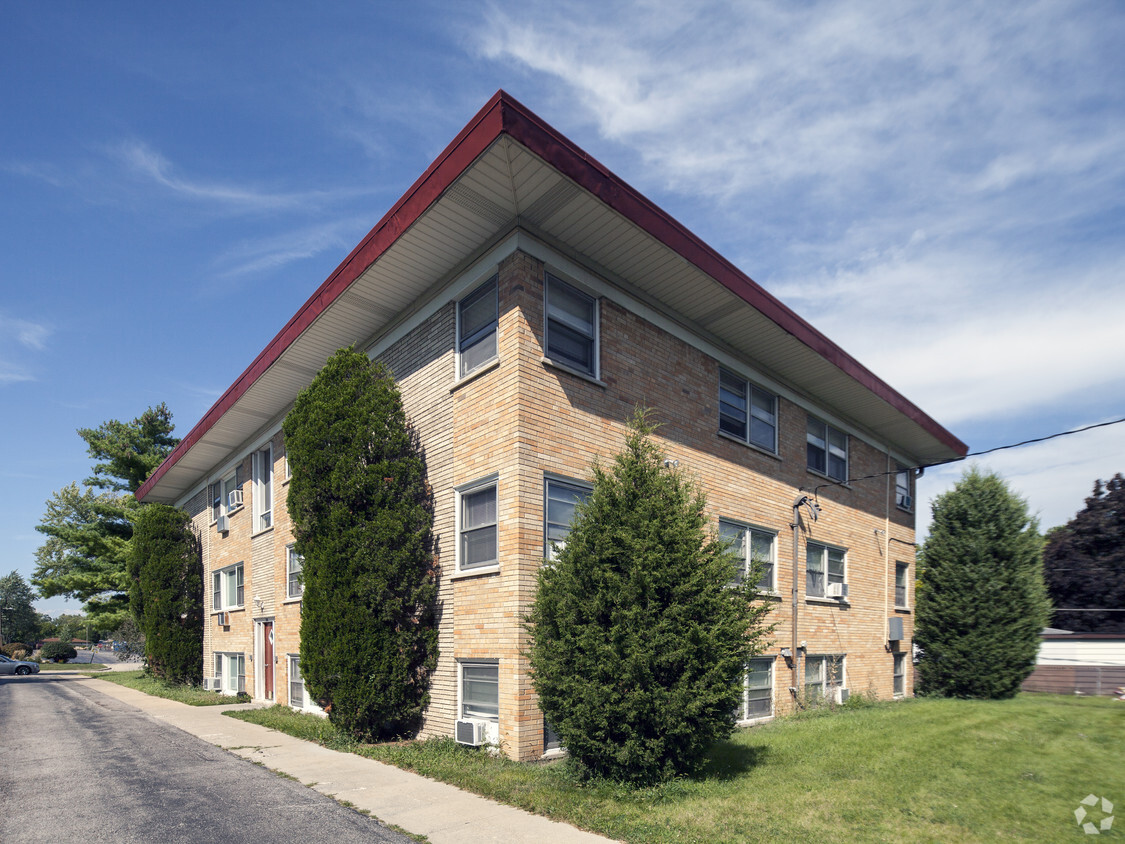

Experience your new place at 339 E Fullerton Ave. Situated in the 60101 area of Addison on E. Fullerton Ave, residents have easy connection to a mixture of great highlights and attractions. Be sure to see the available floorplan options. The community staff is ready to help you find your perfect new apartment. Drop by to talk about your next apartment.
339 E Fullerton Ave is an apartment community located in DuPage County and the 60101 ZIP Code. This area is served by the Addison School District 4 attendance zone.
Addison is a DuPage County village tucked about 20 miles west of Chicago's Loop, offering a quieter pace without giving up easy access to one of the country's largest metro areas. Incorporated in 1884, the community has grown into a well-established suburb of roughly 35,000 residents spread across 10 square miles. Its location along Interstates 290 and 355, plus proximity to O'Hare International Airport, makes it a practical base for anyone who needs to stay connected regionally or nationally.
The village has a grounded, settled character shaped by its DuPage County surroundings, with the Addison Center for the Arts adding a creative outlet to everyday life. Several forest preserves border the community, giving residents immediate access to open space. Nearby Elmhurst University and College of DuPage reinforce the area's educational presence and bring a steady intellectual current to the western suburbs.
Learn more about living in Addison| Colleges & Universities | Distance | ||
|---|---|---|---|
| Colleges & Universities | Distance | ||
| Drive: | 7 min | 3.1 mi | |
| Drive: | 16 min | 8.5 mi | |
| Drive: | 17 min | 8.8 mi | |
| Drive: | 18 min | 9.8 mi |


Transportation options available in Addison include Forest Park Station, located 11.5 miles from 339 E Fullerton Ave. 339 E Fullerton Ave is near Chicago O'Hare International, located 12.6 miles or 21 minutes away, and Chicago Midway International, located 18.8 miles or 31 minutes away.
| Transit / Subway | Distance | ||
|---|---|---|---|
| Transit / Subway | Distance | ||
|
|
Drive: | 18 min | 11.5 mi |
|
|
Drive: | 18 min | 11.5 mi |
|
|
Drive: | 19 min | 12.6 mi |
|
|
Drive: | 19 min | 12.7 mi |
|
|
Drive: | 23 min | 13.1 mi |
| Commuter Rail | Distance | ||
|---|---|---|---|
| Commuter Rail | Distance | ||
|
|
Drive: | 7 min | 2.8 mi |
|
|
Drive: | 7 min | 3.4 mi |
|
|
Drive: | 7 min | 3.7 mi |
|
|
Drive: | 9 min | 5.0 mi |
|
|
Drive: | 10 min | 5.2 mi |
| Airports | Distance | ||
|---|---|---|---|
| Airports | Distance | ||
|
Chicago O'Hare International
|
Drive: | 21 min | 12.6 mi |
|
Chicago Midway International
|
Drive: | 31 min | 18.8 mi |
Scores provided by
Traffic
-Airport
-Businesses
-Scores provided by
HowLoud What is a Sound Score Rating? A Sound Score Rating aggregates noise caused by vehicle traffic, airplane traffic and local sources. How It WorksTime and distance from 339 E Fullerton Ave.
| Shopping Centers | Distance | ||
|---|---|---|---|
| Shopping Centers | Distance | ||
| Walk: | 11 min | 0.6 mi | |
| Drive: | 5 min | 1.6 mi | |
| Drive: | 3 min | 1.7 mi |
| Parks and Recreation | Distance | ||
|---|---|---|---|
| Parks and Recreation | Distance | ||
|
Cricket Creek Forest Preserve
|
Walk: | 22 min | 1.0 mi |
|
Wood Dale Grove Forest Preserve
|
Drive: | 3 min | 1.8 mi |
|
Salt Creek Park Forest Preserve
|
Drive: | 6 min | 3.0 mi |
|
Wilder Park Conservatory
|
Drive: | 8 min | 3.5 mi |
|
Army Trail Nature Center
|
Drive: | 7 min | 3.6 mi |
| Hospitals | Distance | ||
|---|---|---|---|
| Hospitals | Distance | ||
| Drive: | 11 min | 5.9 mi | |
| Drive: | 13 min | 7.1 mi | |
| Drive: | 13 min | 8.6 mi |
| Military Bases | Distance | ||
|---|---|---|---|
| Military Bases | Distance | ||
| Drive: | 23 min | 14.2 mi | |
| Drive: | 29 min | 16.7 mi | |
| Drive: | 38 min | 20.4 mi |
What Are Walk Score®, Transit Score®, and Bike Score® Ratings?
Walk Score® measures the walkability of any address. Transit Score® measures access to public transit. Bike Score® measures the bikeability of any address.
What is a Sound Score Rating?
A Sound Score Rating aggregates noise caused by vehicle traffic, airplane traffic and local sources.


