
$2,000 / Month
338 S Pomelo Ave
Monterey Park, CA 91755
Today
Favorites
-
Bedrooms
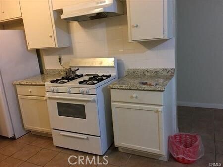
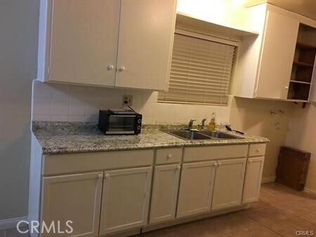
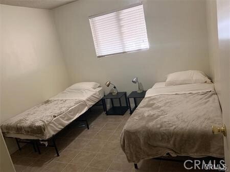
2
-
Bathrooms
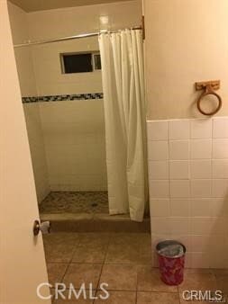
1
-
Square Feet
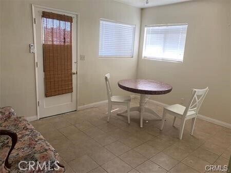
1,000 sq ft
338 S Pomelo Ave

Favorites
About This Home
---- SCHEDULE A SHOWING ONLINE AT: ----
338 S Pomelo Ave is a condo located in Los Angeles County and the 91755 ZIP Code.
* Price shown is base rent and may not include non-optional fees and utilities.
Price, availability, fees, and any applicable rent special are subject to change without notice.
* Square footage definitions vary. Displayed square footage is approximate.
Contact
- Listed by Locayt
Location
Get Directions
Garvey is a predominantly residential neighborhood located in the heart of San Gabriel Valley. Complemented by cacti and palm trees, a variety of moderately-priced to upscale Mediterranean-style houses, and apartments dot the neighborhood. Garvey has several schools, parks, stores, authentic restaurants, and international grocery stores. Residents enjoy access to several roadways including Interstate 710, Interstate 10, and Highway 60. Downtown Los Angeles, which is just 10 miles away, and other major destinations are convenient to Garvey. If you’re looking for a family-oriented neighborhood or a quiet place convenient for commuting, Garvey is a great choice.
Learn more about living in Garvey
Education
| Colleges & Universities | Distance | ||
|---|---|---|---|
| Colleges & Universities | Distance | ||
| Drive: | 8 min | 3.5 mi | |
| Drive: | 10 min | 5.3 mi | |
| Drive: | 13 min | 6.8 mi | |
| Drive: | 15 min | 7.3 mi |
338 S Pomelo Ave is within 8 minutes or 3.5 miles from East Los Angeles College. It is also near Cal State Los Angeles and Art Center College of Design.
Transportation options available in Monterey Park include Atlantic, located 3.8 miles from 338 S Pomelo Ave. 338 S Pomelo Ave is near Bob Hope, located 23.9 miles or 33 minutes away, and Long Beach (Daugherty Field), located 24.3 miles or 35 minutes away.
| Transit / Subway | Distance | ||
|---|---|---|---|
| Transit / Subway | Distance | ||
|
|
Drive: | 9 min | 3.8 mi |
|
|
Drive: | 9 min | 4.2 mi |
| Drive: | 11 min | 4.7 mi | |
|
|
Drive: | 11 min | 6.6 mi |
|
|
Drive: | 14 min | 6.9 mi |
| Commuter Rail | Distance | ||
|---|---|---|---|
| Commuter Rail | Distance | ||
|
|
Drive: | 11 min | 5.1 mi |
|
|
Drive: | 10 min | 5.8 mi |
|
|
Drive: | 16 min | 6.8 mi |
|
|
Drive: | 16 min | 9.5 mi |
| Drive: | 17 min | 13.2 mi |
| Airports | Distance | ||
|---|---|---|---|
| Airports | Distance | ||
|
Bob Hope
|
Drive: | 33 min | 23.9 mi |
|
Long Beach (Daugherty Field)
|
Drive: | 35 min | 24.3 mi |
Time and distance from 338 S Pomelo Ave.
| Shopping Centers | Distance | ||
|---|---|---|---|
| Shopping Centers | Distance | ||
| Walk: | 11 min | 0.6 mi | |
| Walk: | 14 min | 0.8 mi | |
| Walk: | 17 min | 0.9 mi |
338 S Pomelo Ave has 3 shopping centers within 0.9 mile, which is about a 17-minute walk. The miles and minutes will be for the farthest away property.
| Parks and Recreation | Distance | ||
|---|---|---|---|
| Parks and Recreation | Distance | ||
|
Whittier Narrows Recreation Area
|
Drive: | 12 min | 4.4 mi |
|
Whittier Narrows Nature Center
|
Drive: | 11 min | 5.7 mi |
|
Huntington Botanical Gardens
|
Drive: | 17 min | 6.0 mi |
|
Pio Pico State Historic Park
|
Drive: | 15 min | 6.7 mi |
|
Audubon Center at Debs Park
|
Drive: | 17 min | 11.4 mi |
338 S Pomelo Ave has 5 parks within 11.4 miles, including Whittier Narrows Recreation Area, Whittier Narrows Nature Center, and Huntington Botanical Gardens.
| Hospitals | Distance | ||
|---|---|---|---|
| Hospitals | Distance | ||
| Drive: | 4 min | 1.4 mi | |
| Drive: | 5 min | 2.2 mi | |
| Drive: | 8 min | 4.4 mi |
338 S Pomelo Ave has 3 hospitals within 4.4 miles, the nearest is Garfield Medical Center which is 1.4 miles away and a 4 minute drive.
| Military Bases | Distance | ||
|---|---|---|---|
| Military Bases | Distance | ||
| Drive: | 39 min | 25.8 mi | |
| Drive: | 36 min | 26.9 mi |
338 S Pomelo Ave is 25.8 miles from Los Alamitos Army Airfield, and is convenient to other military bases, including Los Angeles Air Force Base.
You May Also Like
Similar Rentals Nearby
-
-

-

-

-

-

-

-

-
1 / 7

-

What Are Walk Score®, Transit Score®, and Bike Score® Ratings?
Walk Score® measures the walkability of any address. Transit Score® measures access to public transit. Bike Score® measures the bikeability of any address.
What is a Sound Score Rating?
A Sound Score Rating aggregates noise caused by vehicle traffic, airplane traffic and local sources

338 S Pomelo Ave
Monterey Park, CA 91755