

$2,300
/ Month
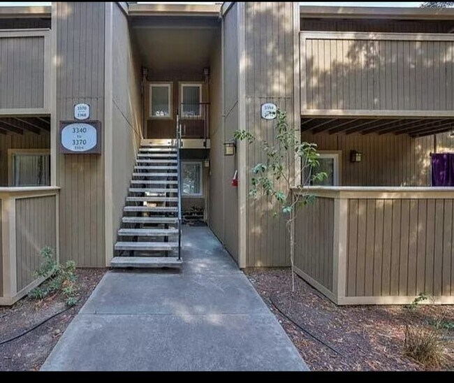
3354 Red Cedar Terrace
Fremont, CA 94536
2 Weeks Ago
|
Edit
Favorites
3354 Red Cedar Terrace

Favorites
Check Back Soon for Upcoming Availability
| Beds | Baths | Average SF |
|---|---|---|
| 2 Bedrooms 2 Bedrooms 2 Br | 1 Bath 1 Bath 1 Ba | 750 SF |
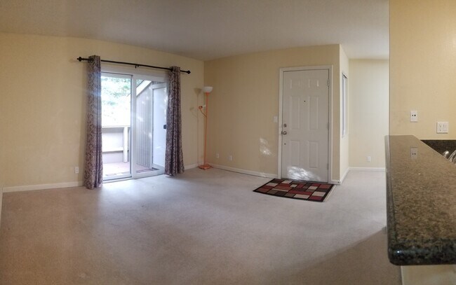
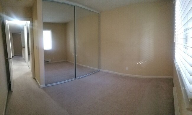
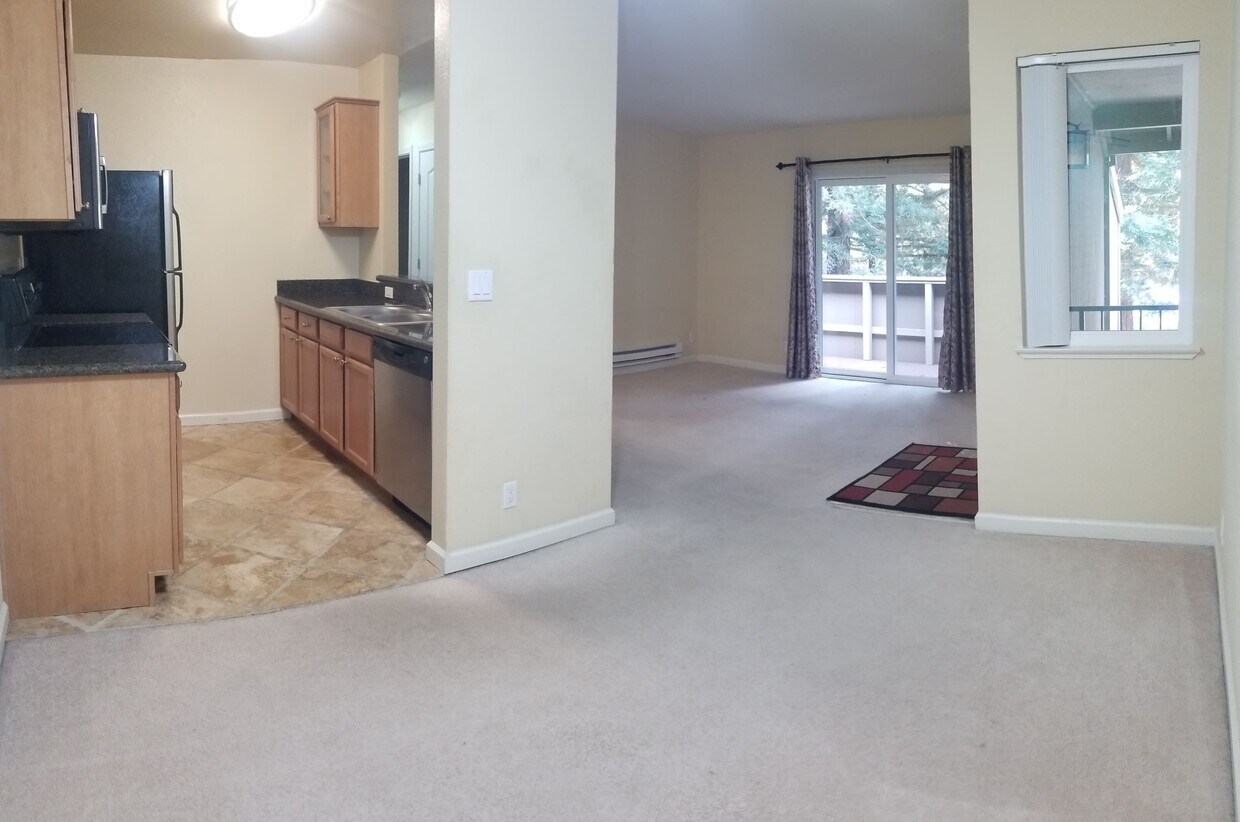
About This Property
Amazing 2 bedroom, 1 bathroom house in Fremont. Amenities included: balcony, pool, laundry in building, and fitness center. 5 minutes from the train station. Utilities included: water and garbage. Is not pet friendly. Date Available: Oct 18th 2021. $2,300/month rent. $2,300 security deposit required. This property is managed by a responsible landlord using Avail landlord software.
3354 Red Cedar Terrace is a house located in Alameda County and the 94536 ZIP Code. This area is served by the Fremont Unified School District attendance zone.
3354 Red Cedar Terrace,
Fremont,
CA
94536
As its name implies, Centerville is a neighborhood located in central Fremont. Filled with tree-lined streets, Centerville has mid-range to upscale rentals available, including cozy single-family homes and luxury apartments. Centerville is family-friendly with several great schools and daycare centers located in the community. Renters from all walks of life enjoy Centerville’s amazing location. Along with bordering Downtown Fremont, Centerville is convenient to some of Fremont’s most popular parks and trailheads including Quarry Lakes Regional Recreation Area, a 471-acre local favorite for picnics, fishing, swimming, and boating.
Silicon Valley commuters enjoy having a train station in town, while Highway 84 and Interstate 880 are used by those who prefer to drive. Fremont Boulevard has a variety of restaurants, shops, event venues, and other businesses, providing residents with plenty of amenities not far from home.
Learn more about living in CentervilleBelow are rent ranges for similar nearby apartments
Education
| Colleges & Universities | Distance | ||
|---|---|---|---|
| Colleges & Universities | Distance | ||
| Drive: | 9 min | 5.0 mi | |
| Drive: | 15 min | 6.4 mi | |
| Drive: | 17 min | 10.6 mi | |
| Drive: | 18 min | 11.4 mi |
3354 Red Cedar Terrace is within 9 minutes or 5.0 miles from Ohlone College, Newark. It is also near Ohlone College, Fremont Campus and Cal State East Bay.
Schools


Public Elementary School
Grades K-5
373 Students
Nearby
Public Elementary School
Grades PK-5
496 Students
Attendance Zone
Public Middle School
Grades 6-8
1,972 Students
Attendance Zone
Public High School
Grades 9-12
2,618 Students
Attendance Zone
Private Elementary, Middle & High School
Grades PK-12
547 Students
Nearby
Private Elementary School
Grades PK-2
8 Students
Nearby
Private Elementary & Middle School
Grades K-8
246 Students
Nearby
School data provided by
 The GreatSchools Rating helps parents compare schools within a state based on a variety of school quality indicators and provides a helpful picture of how effectively each school serves all of its students. Ratings are on a scale of 1 (below average) to 10 (above average) and can include test scores, college readiness, academic progress, advanced courses, equity, discipline and attendance data. We also advise parents to visit schools, consider other information on school performance and programs, and consider family needs as part of the school selection process.
View GreatSchools Rating Methodology
Data provided by GreatSchools.org © 2026. All rights reserved.
View GreatSchools Rating Methodology
Data provided by GreatSchools.org © 2026. All rights reserved.
Transportation options available in Fremont include Fremont, located 2.1 miles from 3354 Red Cedar Terrace. 3354 Red Cedar Terrace is near Metro Oakland International, located 19.3 miles or 27 minutes away, and Norman Y Mineta San Jose International, located 19.8 miles or 26 minutes away.
| Transit / Subway | Distance | ||
|---|---|---|---|
| Transit / Subway | Distance | ||
|
|
Drive: | 5 min | 2.1 mi |
|
|
Drive: | 7 min | 3.4 mi |
|
|
Drive: | 13 min | 6.5 mi |
|
|
Drive: | 16 min | 9.3 mi |
|
|
Drive: | 17 min | 10.8 mi |
| Commuter Rail | Distance | ||
|---|---|---|---|
| Commuter Rail | Distance | ||
| Drive: | 3 min | 1.1 mi | |
| Drive: | 3 min | 1.4 mi | |
| Drive: | 17 min | 11.1 mi | |
|
|
Drive: | 17 min | 11.1 mi |
| Drive: | 26 min | 16.8 mi |
| Airports | Distance | ||
|---|---|---|---|
| Airports | Distance | ||
|
Metro Oakland International
|
Drive: | 27 min | 19.3 mi |
|
Norman Y Mineta San Jose International
|
Drive: | 26 min | 19.8 mi |
Walkability Near 3354 Red Cedar Terrace Fremont, CA 94536
Getting Around
 What do Walkability, Transit, Drivability, and Bikeability mean?
Walkability measures the walking distance to day-to-day needs.
Transit measures access to public transportation.
Drivability measures congestion, parking availability, and access to major roads.
Bikeability measures the suitability for cycling.
How It Works
What do Walkability, Transit, Drivability, and Bikeability mean?
Walkability measures the walking distance to day-to-day needs.
Transit measures access to public transportation.
Drivability measures congestion, parking availability, and access to major roads.
Bikeability measures the suitability for cycling.
How It Works
Fairly Walkable
Walkability
50
/ 100
Some Public Transit
Transit
40
/ 100
Very Drivable
Drivability
80
/ 100
Moderately Bikeable
Bikeability
70
/ 100
Scores provided by
-
Soundscore™
-
/ 100
Traffic
-Airport
-Businesses
-Scores provided by
HowLoud What is a Sound Score Rating? A Sound Score Rating aggregates noise caused by vehicle traffic, airplane traffic and local sources. How It WorksTime and distance from 3354 Red Cedar Terrace.
| Shopping Centers | Distance | ||
|---|---|---|---|
| Shopping Centers | Distance | ||
| Walk: | 16 min | 0.8 mi | |
| Walk: | 16 min | 0.9 mi | |
| Drive: | 3 min | 1.1 mi |
3354 Red Cedar Terrace has 3 shopping centers within 1.1 miles, which is about a 3-minute drive. The miles and minutes will be for the farthest away property.
| Parks and Recreation | Distance | ||
|---|---|---|---|
| Parks and Recreation | Distance | ||
|
Quarry Lakes Regional Recreation Area
|
Drive: | 3 min | 1.3 mi |
|
Alameda Creek Regional Trail
|
Drive: | 3 min | 1.5 mi |
|
Niles Canyon Railway
|
Drive: | 7 min | 3.6 mi |
|
Niles Community Park
|
Drive: | 9 min | 4.1 mi |
|
Ardenwood Historic Farm
|
Drive: | 8 min | 4.5 mi |
3354 Red Cedar Terrace has 5 parks within 4.5 miles, including Quarry Lakes Regional Recreation Area, Alameda Creek Regional Trail, and Niles Community Park.
| Hospitals | Distance | ||
|---|---|---|---|
| Hospitals | Distance | ||
| Drive: | 4 min | 2.0 mi | |
| Drive: | 4 min | 2.1 mi | |
| Drive: | 14 min | 8.3 mi |
3354 Red Cedar Terrace has 3 hospitals within 8.3 miles, the nearest is Kaiser Foundation Hospital - Fremont which is 2.0 miles away and a 4 minute drive.
| Military Bases | Distance | ||
|---|---|---|---|
| Military Bases | Distance | ||
| Drive: | 32 min | 22.5 mi |
3354 Red Cedar Terrace is 22.5 miles and a 32 minute drive from Ames Research Center.
You May Also Like
Similar Rentals Nearby


What Are Walk Score®, Transit Score®, and Bike Score® Ratings?
Walk Score® measures the walkability of any address. Transit Score® measures access to public transit. Bike Score® measures the bikeability of any address.
What is a Sound Score Rating?
A Sound Score Rating aggregates noise caused by vehicle traffic, airplane traffic and local sources.
3354 Red Cedar Terrace
Fremont, CA 94536