
$1,500 / Month

3349 Marmary Ln

,

Saint Ann, MO 63074

Share Listing
Favorites
573-410-4857
  • Bedrooms

    3

  • Bathrooms

    1

  • Square Feet

    900 sq ft

  • Available

    Available Aug 11

3349 Marmary Ln
Share Listing
Favorites

About This Home

$1,500 deposit, Available Aug 11

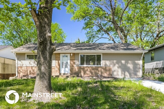
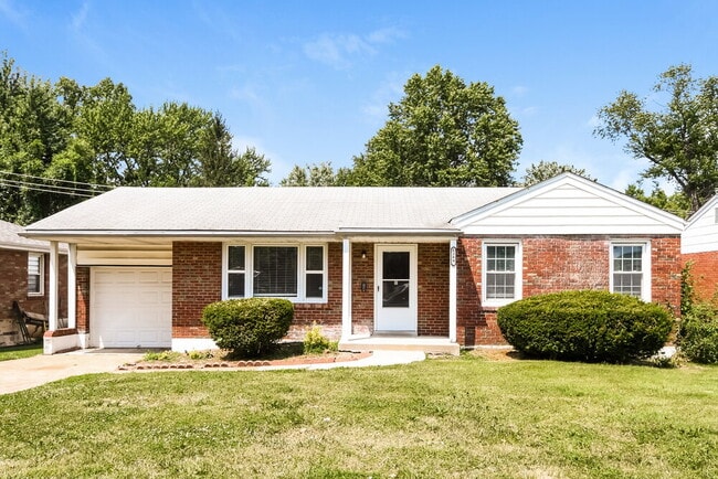
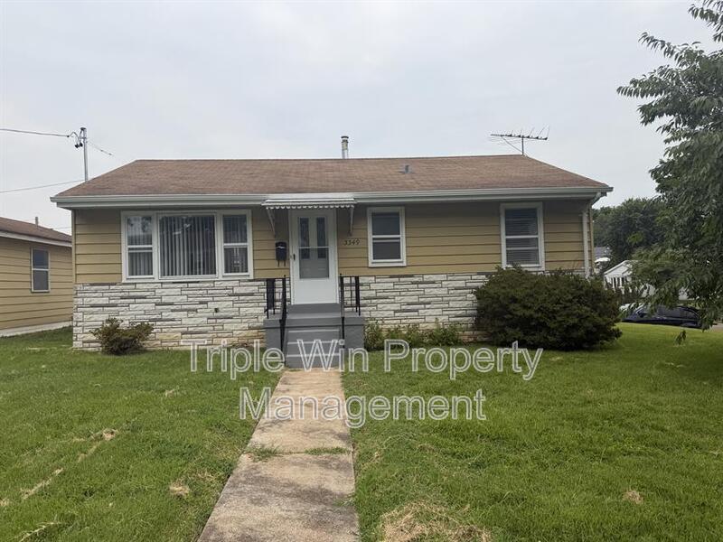
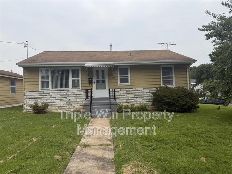
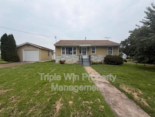
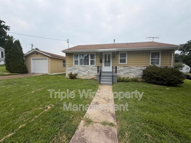
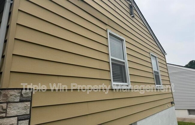
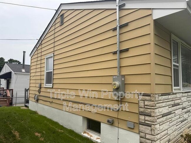
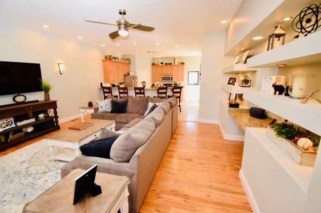
OPEN FOR VIEWINGS!! This single-family home at 3349 Marmary Ln, Saint Ann, MO 63074 offers 3 bedrooms and 1 bathroom with approximately 900 sq ft of living space. Built in 1952, the home features a single-story ranch-style layout situated on an approximately 8,625-sq-ft lot. Pet friendly! Breed restrictions subject to municipality laws. No pet deposit. $35 pet fee per month per pet. This property includes washer and dryer hookups, with connections available for electric dryer (requires a 3-Prong cord). No utility fees are included in the “rent” amount. Utilities include but are not limited to: Sewer (typically MSD & we add $75 to the monthly rent amount for this utility), Electric (typically Ameren UE), Natural gas (if applicable, typically Spire), Water (typically Missouri American Water), and Trash (your choice of provider typically). All utility fees will be the responsibility of the tenant.

3349 Marmary Ln is a house located in St. Louis County and the 63074 ZIP Code.

* Price shown is base rent. Excludes user-selected optional fees and variable or usage-based fees and required charges due at or prior to move-in or at move-out. Price, availability, fees, and any applicable rent special are subject to change without notice.
* Square footage definitions vary. Displayed square footage is approximate.

Fees and Policies

The fees listed below are community-provided and may exclude utilities or add-ons. All payments are made directly to the property and are non-refundable unless otherwise specified.

  • Dogs Allowed
  • Fees not specified
  • Cats Allowed
  • Fees not specified

Contact

  • Listed by Triple Win Property Management
  • Phone Number
  • Contact
| Edit

Under 30 minutes

Commute Time is calculated at rush hour.
City - Saint Ann

Saint Ann, Missouri sits just northwest of St. Louis, sharing a border with Lambert-St. Louis International Airport and offering straightforward access to the broader metro area via Interstates 70 and 170. Incorporated in 1948, this compact city spans about four square miles and carries a laid-back, close-knit energy that stands apart from the pace of urban St. Louis. St. Charles Rock Road serves as the city's commercial spine, lined with grocery stores, restaurants, and local businesses that keep daily errands within easy reach. For green space, Tiemeyer Park and McDonnell County Park give residents room to decompress, with trails, sports courts, and open fields spread across both locations. The Holocaust Museum and Learning Center at Millstone Campus Drive adds a note of cultural depth to the community.

The housing stock in Saint Ann leans toward garden-style apartment communities and smaller multi-unit buildings, with options ranging from studios to three-bedroom floor plans.

Learn more about living in Saint Ann 
Education
Colleges & Universities Distance
Drive: 10 min 4.9 mi
Drive: 13 min 5.9 mi
Drive: 17 min 8.8 mi
Drive: 20 min 11.2 mi
3349 Marmary Ln is within 10 minutes or 4.9 miles from Chamberlain Nursing, St. Louis. It is also near Univ. of Missouri, St. Louis and Wash. Univ. in St. Louis.
Transportation

3349 Marmary Ln is near St Louis Lambert International, located 7.5 miles or 14 minutes away, and Scott AFB/Midamerica St Louis, located 40.3 miles or 61 minutes away.

Commuter Rail Distance
Drive: 11 min 4.4 mi
Drive: 13 min 5.0 mi
Drive: 10 min 5.8 mi
Drive: 12 min 5.9 mi
Drive: 13 min 6.0 mi
Airports Distance
Airports Distance
St Louis Lambert International
Drive: 14 min 7.5 mi
Scott AFB/Midamerica St Louis
Drive: 61 min 40.3 mi
Getting Around
Fairly Walkable
Walkability
40 / 100
Minimal Public Transit
Transit
10 / 100
Very Drivable
Drivability
80 / 100
Fairly Bikeable
Bikeability
40 / 100

Scores provided by

What do Walkability, Transit, Drivability, and Bikeability mean? Walkability measures the walking distance to day-to-day needs. Transit measures access to public transportation. Drivability measures congestion, parking availability, and access to major roads. Bikeability measures the suitability for cycling. How It Works
-
Soundscore
- / 100

Traffic

-

Airport

-

Businesses

-

Scores provided by

HowLoud What is a Sound Score Rating? A Sound Score Rating aggregates noise caused by vehicle traffic, airplane traffic and local sources. How It Works
Points of Interest

Time and distance from 3349 Marmary Ln.

Shopping Centers Distance
Walk: 14 min 0.8 mi
Walk: 15 min 0.8 mi
Drive: 3 min 1.5 mi
3349 Marmary Ln has 3 shopping centers within 1.5 miles, which is about a 3-minute drive. The miles and minutes will be for the farthest away property.
Parks and Recreation Distance
McDonnell County Park
Drive: 6 min 1.6 mi
St. Vincent County Park
Drive: 10 min 5.2 mi
The Green Center
Drive: 13 min 6.3 mi
Lewis and Clark Boat House and Nature Center
Drive: 16 min 8.8 mi
Creve Coeur County Park
Drive: 19 min 11.0 mi
3349 Marmary Ln has 5 parks within 11.0 miles, including McDonnell County Park, St. Vincent County Park, and The Green Center.
Hospitals Distance
Hospitals Distance
Drive: 6 min 2.8 mi
Drive: 10 min 4.2 mi
Drive: 15 min 8.4 mi
3349 Marmary Ln has 3 hospitals within 8.4 miles, the nearest is Ranken Jordan Pediatric Bridge Hospital which is 2.8 miles away and a 6 minute drive.
Military Bases Distance
Drive: 30 min 17.7 mi
Drive: 61 min 40.4 mi
3349 Marmary Ln is 17.7 miles from Price Support Center, and is convenient to other military bases, including Scott Air Force Base.

You May Also Like

Similar Rentals Nearby