
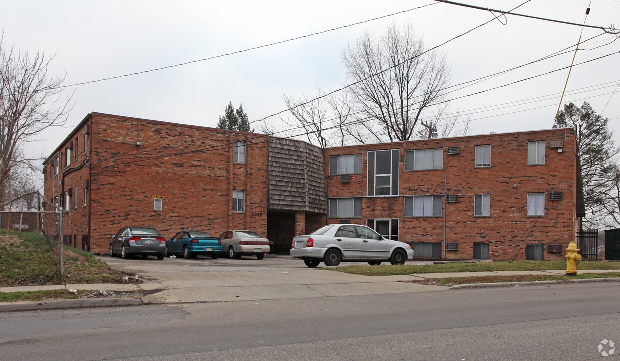
3344 McHenry Avenue
3344-3346 McHenry Ave,
Cincinnati,
OH
45225
-
Monthly Rent
$650
-
Bedrooms
1 bd
-
Bathrooms
1 ba
-
Square Feet
525 sq ft

Pricing & Floor Plans
Fees and Policies
The fees listed below are community-provided and may exclude utilities or add-ons. All payments are made directly to the property and are non-refundable unless otherwise specified.
-
One-Time Basics
-
Due at Application
-
Application Fee Per ApplicantCharged per applicant.$10
-
-
Due at Move-In
-
Additional Security Deposit - RefundableCharged per unit.$200
-
-
Due at Application
-
Surface Lot
Property Fee Disclaimer: Based on community-supplied data and independent market research. Subject to change without notice. May exclude fees for mandatory or optional services and usage-based utilities.
Details
Utilities Included
-
Gas
-
Water
-
Heat
-
Trash Removal
-
Sewer
Lease Options
-
12 meses
Property Information
-
Built in 1969
-
24 units/3 stories
About 3344 McHenry Avenue
Edificio para personas mayores - Mayores de 55 años. ¡Unidad recién remodelada! Alfombras y electrodomésticos nuevos. Calefacción, agua y basura incluidos (los residentes pagan su propia electricidad). Lavandería de monedas en el lugar. Estacionamiento privado. Ubicado en la línea de autobús.
3344 McHenry Avenue is an apartment community located in Hamilton County and the 45225 ZIP Code. This area is served by the Cincinnati Public Schools attendance zone.
Unique Features
- Estacionamiento en superficie
Contact
Community Amenities
- Instalaciones de lavandería
Apartment Features
Aire acondicionado
Nevera
Bañera/Ducha
Electrodomésticos de acero inoxidable
- Aire acondicionado
- Calefacción
- Bañera/Ducha
- Electrodomésticos de acero inoxidable
- Cocina
- Horno
- Fogón
- Nevera
- Alfombra
- Suelos de vinilo
- Comedor
East Westwood is a small but popular neighborhood roughly six miles northwest of Downtown Cincinnati. It is close to everything you love about the city – the Cincinnati Zoo and Botanical Garden, the University of Cincinnati, and the Duke Energy Convention Center – while still providing a somewhat quieter place to call home. East Westwood is directly south of Interstate 74, making this area popular with commuters. The vast Mt. Airy Forest borders East Westwood on its north end, providing a fantastic back yard filled with hiking trails, a disc golf course, a dog park, the Maple Ridge Lodge, and the Unnewehr House. Single-family homes make up the bulk of the rental scene here, but there’s charm to be found in every listing in East Westwood.
Learn more about living in East WestwoodCompare neighborhood and city base rent averages by bedroom.
| East Westwood | Cincinnati, OH | |
|---|---|---|
| Studio | $409 | $1,055 |
| 1 Bedroom | $683 | $1,130 |
| 2 Bedrooms | $697 | $1,406 |
| 3 Bedrooms | $589 | $1,700 |
- Instalaciones de lavandería
- Estacionamiento en superficie
- Aire acondicionado
- Calefacción
- Bañera/Ducha
- Electrodomésticos de acero inoxidable
- Cocina
- Horno
- Fogón
- Nevera
- Alfombra
- Suelos de vinilo
- Comedor
| Monday | By Appointment |
|---|---|
| Tuesday | By Appointment |
| Wednesday | By Appointment |
| Thursday | By Appointment |
| Friday | By Appointment |
| Saturday | Closed |
| Sunday | Closed |
| Colleges & Universities | Distance | ||
|---|---|---|---|
| Colleges & Universities | Distance | ||
| Drive: | 10 min | 3.6 mi | |
| Drive: | 8 min | 3.9 mi | |
| Drive: | 10 min | 4.3 mi | |
| Drive: | 16 min | 7.3 mi |


View GreatSchools Rating Methodology
Data provided by GreatSchools.org © 2026. All rights reserved.
Transportation options available in Cincinnati include Brewery District Station, Elm & Henry, located 4.6 miles from 3344 McHenry Avenue. 3344 McHenry Avenue is near Cincinnati/Northern Kentucky International, located 18.6 miles or 33 minutes away.
| Transit / Subway | Distance | ||
|---|---|---|---|
| Transit / Subway | Distance | ||
| Drive: | 10 min | 4.6 mi | |
| Drive: | 10 min | 4.7 mi | |
| Drive: | 10 min | 4.8 mi | |
| Drive: | 10 min | 4.8 mi | |
| Drive: | 10 min | 5.0 mi |
| Commuter Rail | Distance | ||
|---|---|---|---|
| Commuter Rail | Distance | ||
|
|
Drive: | 9 min | 4.6 mi |
| Airports | Distance | ||
|---|---|---|---|
| Airports | Distance | ||
|
Cincinnati/Northern Kentucky International
|
Drive: | 33 min | 18.6 mi |
Time and distance from 3344 McHenry Avenue.
| Shopping Centers | Distance | ||
|---|---|---|---|
| Shopping Centers | Distance | ||
| Drive: | 5 min | 2.3 mi | |
| Drive: | 8 min | 2.5 mi | |
| Drive: | 6 min | 2.9 mi |
| Parks and Recreation | Distance | ||
|---|---|---|---|
| Parks and Recreation | Distance | ||
|
Mt. Airy Forest
|
Drive: | 7 min | 2.9 mi |
|
Burnet Woods
|
Drive: | 8 min | 3.7 mi |
|
Buttercup Valley
|
Drive: | 9 min | 3.8 mi |
|
Trailside Nature Center
|
Drive: | 8 min | 3.8 mi |
|
Imago Earth Center
|
Drive: | 12 min | 5.2 mi |
| Hospitals | Distance | ||
|---|---|---|---|
| Hospitals | Distance | ||
| Drive: | 7 min | 3.2 mi | |
| Drive: | 9 min | 4.1 mi | |
| Drive: | 10 min | 4.4 mi |
| Military Bases | Distance | ||
|---|---|---|---|
| Military Bases | Distance | ||
| Drive: | 72 min | 54.3 mi | |
| Drive: | 78 min | 59.4 mi | |
| Drive: | 80 min | 62.6 mi |
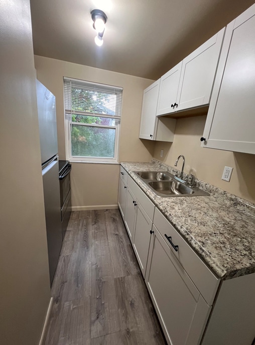
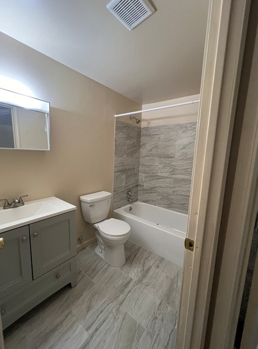
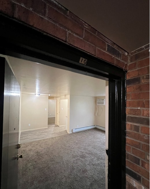
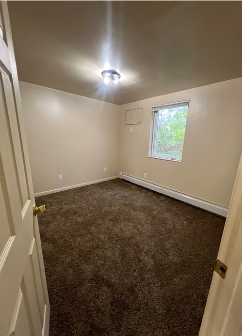
3344 McHenry Avenue Photos
-
3344 McHenry Avenue
-
-
-
-
-
-
Área de comedor de la sala de estar
-
Lavandería
-
While 3344 McHenry Avenue does not provide in‑unit laundry, on‑site laundry facilities are available for shared resident use.
Select utilities are included in rent at 3344 McHenry Avenue, including gas, water, heat, trash removal, and sewer. Residents are responsible for any other utilities not listed.
Parking is available at 3344 McHenry Avenue. Contact this property for details.
3344 McHenry Avenue has one-bedroom apartments renting for $650/mo.
3344 McHenry Avenue does not allow pets, though service animals are always welcome in accordance with applicable laws.
A good rule of thumb is to spend no more than 30% of your gross income on rent. Based on the lowest available rent of $650 for a one-bedroom, you would need to earn about $26,000 per year to qualify. Want to double-check your budget? Calculate how much rent you can afford with our Rent Affordability Calculator.
3344 McHenry Avenue is offering Especiales for eligible applicants, with rental rates starting at $650.
While 3344 McHenry Avenue does not offer Matterport 3D tours, renters can request a tour directly through our online platform.
What Are Walk Score®, Transit Score®, and Bike Score® Ratings?
Walk Score® measures the walkability of any address. Transit Score® measures access to public transit. Bike Score® measures the bikeability of any address.
What is a Sound Score Rating?
A Sound Score Rating aggregates noise caused by vehicle traffic, airplane traffic and local sources
3344-3346 McHenry Ave
Cincinnati, OH 45225
Property Manager Responded