
$1,000
/ Month
3315 Renfro Ave Unit #2
Cincinnati, OH 45211
Today
|
Edit
Favorites
-
Bedrooms
2
-
Bathrooms
1
-
Square Feet
950 sq ft
-
Available
Available Now
Highlights
- Walk-In Closets
- Hardwood Floors
- Smoke Free
3315 Renfro Ave Unit #2

Favorites
About This Home
12 Month Lease,
$1,000 deposit,
Available Now
*Property Details **Private entrance **1 - 2 bedroom/ 1 bath ** Full kitchen w/ pantry ** Living room and dinning room **Extra storage room **Street parking **No on-site Laundry * Location ** 1 miles from Kroger, Target, TJ Maxx, restaurants, banks, and Planet Fitness ** 6 miles from downtown *Rules ** No Smoking **No pets **If multiple people there is an additional fee for water Ideal for those seeking a clean, quiet, and practical space in a highly walkable neighborhood. The unit is suitable for one or two people. It is a great space for people working from home. No Laundry, Street Parking, Water fee /Fixed cost/month
*Property Details **Private entrance **1 - 2 bedroom/ 1 bath ** Full kitchen w/ pantry ** Living room and dinning room **Extra storage room **Street parking **No on-site Laundry * Location ** 1 miles from Kroger, Target, TJ Maxx, restaurants, banks, and Planet Fitness ** 6 miles from downtown *Rules ** No Smoking **No pets **If multiple people there is an additional fee for water Ideal for those seeking a clean, quiet, and practical space in a highly walkable neighborhood. The unit is suitable for one or two people. It is a great space for people working from home. No Laundry, Street Parking, Extra water fee if multiple people
3315 Renfro Ave is an apartment community located in Hamilton County and the 45211 ZIP Code.
* Price shown is base rent. Excludes user-selected optional fees and variable or usage-based fees and required charges due at or prior to move-in or at move-out. Price, availability, fees, and any applicable rent special are subject to change without notice.
* Square footage definitions vary. Displayed square footage is approximate.
Apartment Features
Air Conditioning
Dishwasher
Hardwood Floors
Walk-In Closets
- Air Conditioning
- Heating
- Ceiling Fans
- Smoke Free
- Storage Space
- Tub/Shower
- Framed Mirrors
- Dishwasher
- Pantry
- Kitchen
- Microwave
- Range
- Refrigerator
- Instant Hot Water
- Hardwood Floors
- Carpet
- Dining Room
- Family Room
- Walk-In Closets
- Storage Space
Fees and Policies
The fees below are based on community-supplied data and may exclude additional fees and utilities.
- Parking
-
Street--
Details
Utilities Included
-
Trash Removal
Property Information
-
2 units
Contact
- Contact
Location
Get Directions
Situated about five miles northwest of Downtown Cincinnati, Westwood is the largest neighborhood in the city. Residents flock to Westwood for its many affordable historic homes and modern apartments available for rent in addition to its close proximity to I-74, I-75, and all that Downtown Cincinnati has to offer.
While Westwood is a predominantly residential neighborhood, it is also home to a slew of convenient stores and restaurants. Shopping opportunities abound in Westwood, with plenty of national retailers in Western Hills Plaza and local shops in the growing Town Hall District. Numerous neighborhood parks provide ample space to enjoy the outdoors in town as well as the sprawling 1,400-acre Mount Airy Forest, which is partially located in Westwood.
Learn more about living in Westwood
Education
| Colleges & Universities | Distance | ||
|---|---|---|---|
| Colleges & Universities | Distance | ||
| Drive: | 10 min | 4.6 mi | |
| Drive: | 15 min | 6.3 mi | |
| Drive: | 14 min | 6.5 mi | |
| Drive: | 16 min | 7.0 mi |
3315 Renfro Ave Unit #2 is within 10 minutes or 4.6 miles from College of Mount St. Joseph. It is also near Cincinnati State and University of Cincinnati.
Transportation options available in Cincinnati include Brewery District Station, Elm & Henry, located 6.0 miles from 3315 Renfro Ave Unit #2. 3315 Renfro Ave Unit #2 is near Cincinnati/Northern Kentucky International, located 20.3 miles or 39 minutes away.
| Transit / Subway | Distance | ||
|---|---|---|---|
| Transit / Subway | Distance | ||
| Drive: | 14 min | 6.0 mi | |
| Drive: | 15 min | 6.2 mi | |
| Drive: | 15 min | 6.3 mi | |
| Drive: | 15 min | 6.4 mi | |
| Drive: | 15 min | 6.5 mi |
| Commuter Rail | Distance | ||
|---|---|---|---|
| Commuter Rail | Distance | ||
|
|
Drive: | 15 min | 6.3 mi |
| Airports | Distance | ||
|---|---|---|---|
| Airports | Distance | ||
|
Cincinnati/Northern Kentucky International
|
Drive: | 39 min | 20.3 mi |
Time and distance from 3315 Renfro Ave Unit #2.
| Shopping Centers | Distance | ||
|---|---|---|---|
| Shopping Centers | Distance | ||
| Walk: | 14 min | 0.8 mi | |
| Walk: | 14 min | 0.8 mi | |
| Walk: | 17 min | 0.9 mi |
3315 Renfro Ave Unit #2 has 3 shopping centers within 0.9 mile, which is about a 17-minute walk. The miles and minutes will be for the farthest away property.
| Parks and Recreation | Distance | ||
|---|---|---|---|
| Parks and Recreation | Distance | ||
|
Mt. Airy Forest
|
Drive: | 9 min | 3.7 mi |
|
Imago Earth Center
|
Drive: | 12 min | 4.3 mi |
|
Embshoff Woods
|
Drive: | 14 min | 4.8 mi |
|
Wilson Commons
|
Drive: | 14 min | 5.0 mi |
|
Buttercup Valley
|
Drive: | 12 min | 5.2 mi |
3315 Renfro Ave Unit #2 has 5 parks within 5.2 miles, including Mt. Airy Forest, Imago Earth Center, and Embshoff Woods.
| Hospitals | Distance | ||
|---|---|---|---|
| Hospitals | Distance | ||
| Drive: | 9 min | 3.8 mi | |
| Drive: | 12 min | 5.8 mi | |
| Drive: | 16 min | 7.0 mi |
3315 Renfro Ave Unit #2 has 3 hospitals within 7.0 miles, the nearest is Mercy Health - West Hospital which is 3.8 miles away and a 9 minute drive.
| Military Bases | Distance | ||
|---|---|---|---|
| Military Bases | Distance | ||
| Drive: | 75 min | 56.0 mi | |
| Drive: | 81 min | 61.1 mi | |
| Drive: | 83 min | 64.4 mi |
3315 Renfro Ave Unit #2 has 3 military bases within 64.4 miles, the nearest is Gentile Air Force Station which is 56.0 miles away and a 75 minute drive.
Amenities
- Air Conditioning
- Heating
- Ceiling Fans
- Smoke Free
- Storage Space
- Tub/Shower
- Framed Mirrors
- Dishwasher
- Pantry
- Kitchen
- Microwave
- Range
- Refrigerator
- Instant Hot Water
- Hardwood Floors
- Carpet
- Dining Room
- Family Room
- Walk-In Closets
- Storage Space
3315 Renfro Ave Unit #2 Photos
-
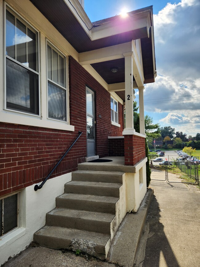
Private Entrance
-
Private Entrance
-
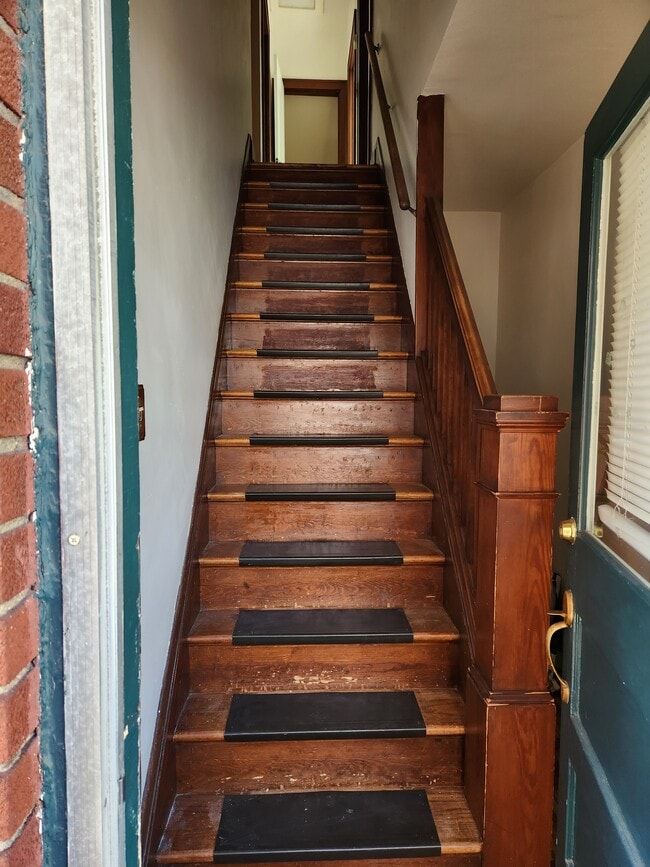
Hallway
-
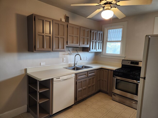
Refreshened kitchen
-
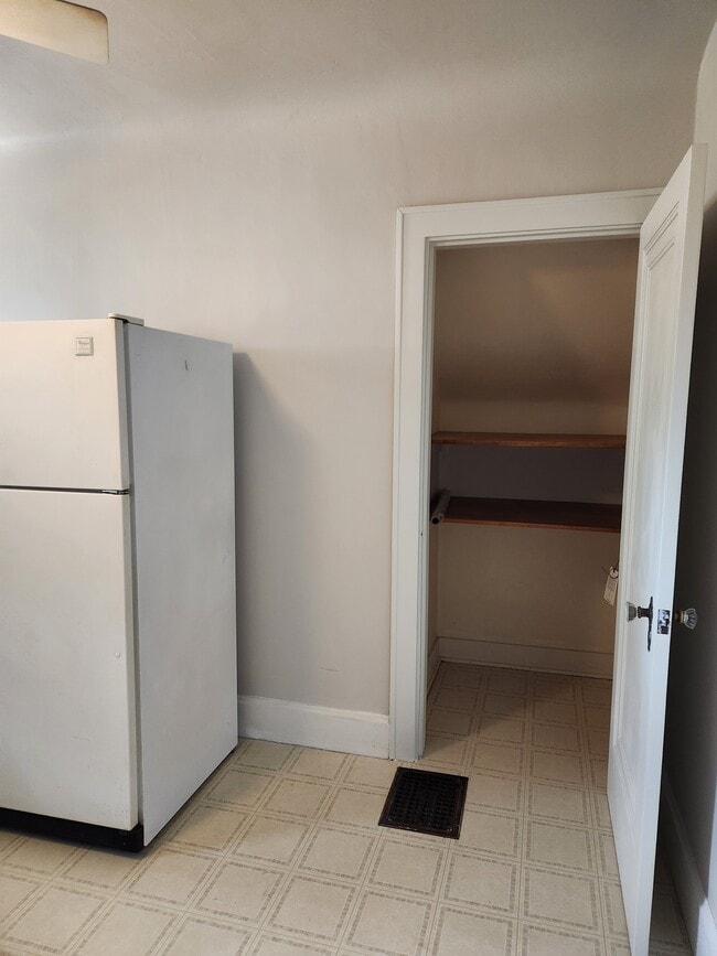
Kitchen Pantry
-
Dinning
-
Living Room
-
Spacious Room Closet
-
Spacious Room
What Are Walk Score®, Transit Score®, and Bike Score® Ratings?
Walk Score® measures the walkability of any address. Transit Score® measures access to public transit. Bike Score® measures the bikeability of any address.
What is a Sound Score Rating?
A Sound Score Rating aggregates noise caused by vehicle traffic, airplane traffic and local sources

3315 Renfro Ave
Cincinnati, OH 45211