
$3,000
/ Month
3313 6th St S
Arlington, VA 22204
Today
|
Edit
Favorites
571-238-1647
-
Bedrooms
3
-
Bathrooms
2
-
Square Feet
--
-
Available
Available Now
Highlights
- Colonial Architecture
- Recreation Room
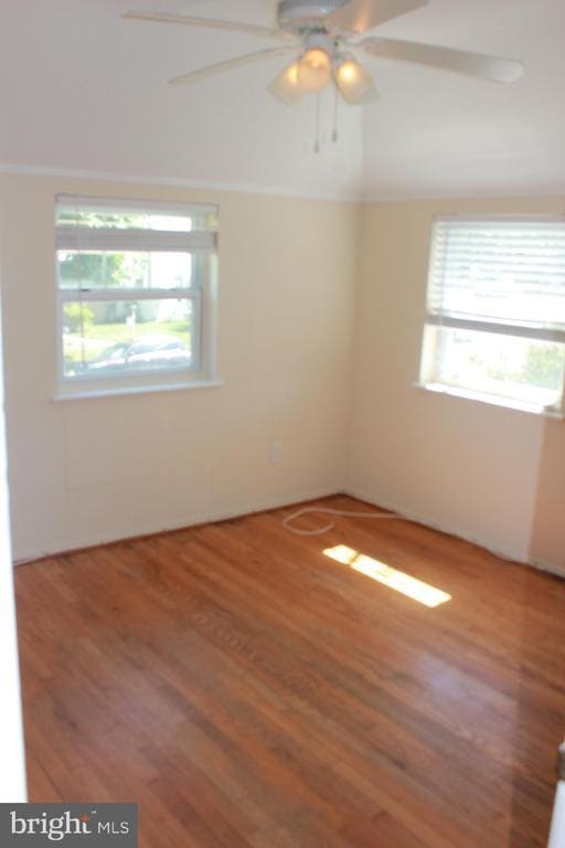
- Wood Flooring
- Living Room
- Ceramic Tile Flooring
- 90% Forced Air Heating and Cooling System
3313 6th St S

Favorites
About This Home
Available Now
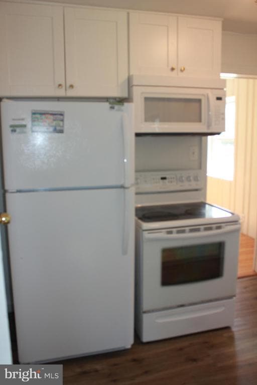
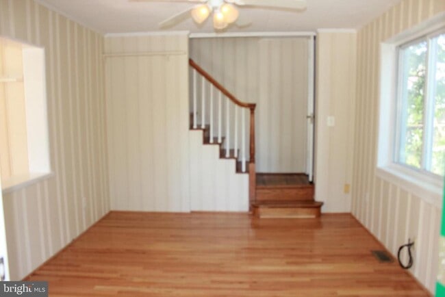
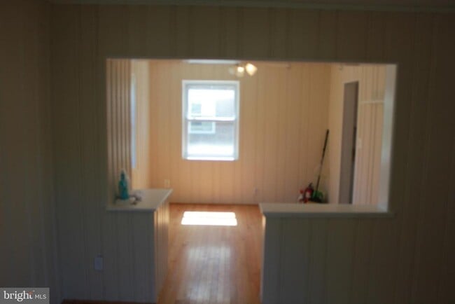
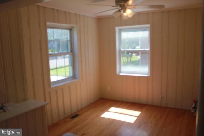
LOCATION-LOCATION-LOCATION. 2 BEDROOM, 2 BATHROOM 3 LEVELS WITH FENCED IN BACKYARD. UPDATED KITCHEN, HARDWOOD FLOORS MAIN LEVEL AND BEDROOM LEVEL. UPDATED BATHROOM UPSTAIRS. LAMINATE FLOORING IN REAR DEN. LAMINATE FLOORING IN BASEMENT RECREATION ROOM. CLOSE TO COLUMBIA PIKE, RT. 50 & D.C.
3313 6th St S is a house located in Arlington County and the 22204 ZIP Code. This area is served by the Arlington County Public Schools attendance zone.
* Price shown is base rent. Excludes user-selected optional fees and variable or usage-based fees and required charges due at or prior to move-in or at move-out. Price, availability, fees, and any applicable rent special are subject to change without notice.
* Square footage definitions vary. Displayed square footage is approximate.
Home Details
Home Type
Single Family Detached Home
Year Built
Built in 1938
Bedrooms and Bathrooms
3 Bedrooms | 1 Main Level Bedroom
2 Full Bathrooms
Flooring
Wood
Ceramic Tile
Laminate
Home Design
Colonial Architecture
Brick Exterior Construction
Brick Foundation
Permanent Foundation
Block Foundation
Interior Spaces
Recreation Room
Living Room
Dining Room
1,446 Sq Ft Home
Property has 3 Levels
Listing and Financial Details
Security Deposit $3,000
12-Month Min and 36-Month Max Lease Term
Available 11/1/25
Assessor Parcel Number 24-016-013
Tenant pays for all utilities
$150 Repair Deductible
No Smoking Allowed
Residential Lease
Lot Details
5,140 Sq Ft Lot
Property is in very good condition
Property is zoned R-6
Parking
On-Street Parking
Driveway
Partially Finished Basement
Basement Fills Entire Space Under The House
Connecting Stairway
Interior Basement Entry
Utilities
90% Forced Air Heating and Cooling System
Natural Gas Water Heater
Community Details
Overview
No Home Owners Association
Arlington Subdivision
Pet Policy
Pets allowed on a case-by-case basis
Contact
- Listed by Tasos Sgardelis | Samson Properties
- Phone Number
- Contact
-
Source
 Bright MLS, Inc.
Copyright © 2025 Bright MLS, Inc.
Location
Get Directions
Amenities
- Basement
With brick colonials along tree-lined streets, Arlington Heights is a popular historic neighborhood just south of Downtown Arlington. The picturesque neighborhood is listed on the National Register of Historic Places and contains more than 737 historic structures and sites.
Arlington Heights extends south from Arlington Boulevard to Columbia Pike. It is just west of Arlington National Cemetery between S. Walter Reed Drive and South Glebe Road. Located just over one mile from downtown, apartments in Arlington Heights offer easy access to Ballston Common Mall, the Pentagon, and Joint Base Myer-Henderson Hall.
Learn more about living in Arlington Heights
Education
| Colleges & Universities | Distance | ||
|---|---|---|---|
| Colleges & Universities | Distance | ||
| Drive: | 6 min | 2.0 mi | |
| Drive: | 7 min | 2.9 mi | |
| Drive: | 9 min | 3.5 mi | |
| Drive: | 11 min | 4.8 mi |
3313 6th St S is within 6 minutes or 2.0 miles from George Mason Univ., Arlington. It is also near NOVA, Alexandria Campus and Marymount University.
Schools


Public Elementary School
Grades PK-5
614 Students
Attendance Zone
Public Middle School
Grades 6-8
1,053 Students
Attendance Zone
Public High School
Grades 9-12
2,766 Students
Attendance Zone
Private Elementary, Middle & High School
Grades PK-12
Nearby
Private Elementary & Middle School
Grades PK-8
398 Students
Nearby
School data provided by
 The GreatSchools Rating helps parents compare schools within a state based on a variety of school quality indicators and provides a helpful picture of how effectively each school serves all of its students. Ratings are on a scale of 1 (below average) to 10 (above average) and can include test scores, college readiness, academic progress, advanced courses, equity, discipline and attendance data. We also advise parents to visit schools, consider other information on school performance and programs, and consider family needs as part of the school selection process.
View GreatSchools Rating Methodology
Data provided by GreatSchools.org © 2025. All rights reserved.
View GreatSchools Rating Methodology
Data provided by GreatSchools.org © 2025. All rights reserved.
Transportation options available in Arlington include Virginia Square-Gmu, located 1.6 miles from 3313 6th St S. 3313 6th St S is near Ronald Reagan Washington Ntl, located 4.8 miles or 11 minutes away, and Washington Dulles International, located 23.3 miles or 39 minutes away.
| Transit / Subway | Distance | ||
|---|---|---|---|
| Transit / Subway | Distance | ||
|
|
Drive: | 4 min | 1.6 mi |
|
|
Drive: | 4 min | 1.6 mi |
|
|
Drive: | 6 min | 2.0 mi |
|
|
Drive: | 6 min | 2.6 mi |
| Drive: | 5 min | 2.7 mi |
| Commuter Rail | Distance | ||
|---|---|---|---|
| Commuter Rail | Distance | ||
|
|
Drive: | 8 min | 3.3 mi |
|
|
Drive: | 11 min | 5.2 mi |
|
|
Drive: | 11 min | 5.2 mi |
|
|
Drive: | 13 min | 5.5 mi |
|
|
Drive: | 13 min | 5.5 mi |
| Airports | Distance | ||
|---|---|---|---|
| Airports | Distance | ||
|
Ronald Reagan Washington Ntl
|
Drive: | 11 min | 4.8 mi |
|
Washington Dulles International
|
Drive: | 39 min | 23.3 mi |
Time and distance from 3313 6th St S.
| Shopping Centers | Distance | ||
|---|---|---|---|
| Shopping Centers | Distance | ||
| Walk: | 14 min | 0.8 mi | |
| Walk: | 15 min | 0.8 mi | |
| Walk: | 16 min | 0.8 mi |
3313 6th St S has 3 shopping centers within 0.8 mile, which is about a 16-minute walk. The miles and minutes will be for the farthest away property.
| Parks and Recreation | Distance | ||
|---|---|---|---|
| Parks and Recreation | Distance | ||
|
Douglas Park
|
Drive: | 4 min | 1.3 mi |
|
Lubber Run Park
|
Drive: | 4 min | 1.7 mi |
|
Shirlington Park
|
Drive: | 5 min | 1.9 mi |
|
Glencarlyn Park
|
Drive: | 7 min | 2.8 mi |
|
Long Branch Nature Center
|
Drive: | 7 min | 2.9 mi |
3313 6th St S has 5 parks within 2.9 miles, including Douglas Park, Lubber Run Park, and Glencarlyn Park.
| Hospitals | Distance | ||
|---|---|---|---|
| Hospitals | Distance | ||
| Drive: | 6 min | 2.3 mi | |
| Drive: | 7 min | 2.7 mi | |
| Drive: | 9 min | 3.8 mi |
3313 6th St S has 3 hospitals within 3.8 miles, the nearest is Capital Hospice which is 2.3 miles away and a 6 minute drive.
| Military Bases | Distance | ||
|---|---|---|---|
| Military Bases | Distance | ||
| Drive: | 5 min | 1.6 mi |
3313 6th St S is 1.6 miles and a 5 minute drive from Fort Myer.
You May Also Like
Similar Rentals Nearby


What Are Walk Score®, Transit Score®, and Bike Score® Ratings?
Walk Score® measures the walkability of any address. Transit Score® measures access to public transit. Bike Score® measures the bikeability of any address.
What is a Sound Score Rating?
A Sound Score Rating aggregates noise caused by vehicle traffic, airplane traffic and local sources

3313 6th St S
Arlington, VA 22204