
$1,795
/ Month
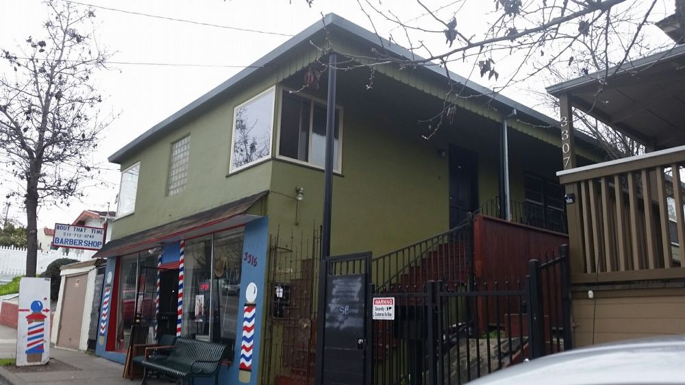
3311 Macarthur Blvd
Oakland, CA 94602
2 Weeks Ago
Favorites
3311 Macarthur Blvd

Favorites
Check Back Soon for Upcoming Availability
| Beds | Baths | Average SF |
|---|---|---|
| 2 Bedrooms 2 Bedrooms 2 Br | 1 Bath 1 Bath 1 Ba | — |
About This Property
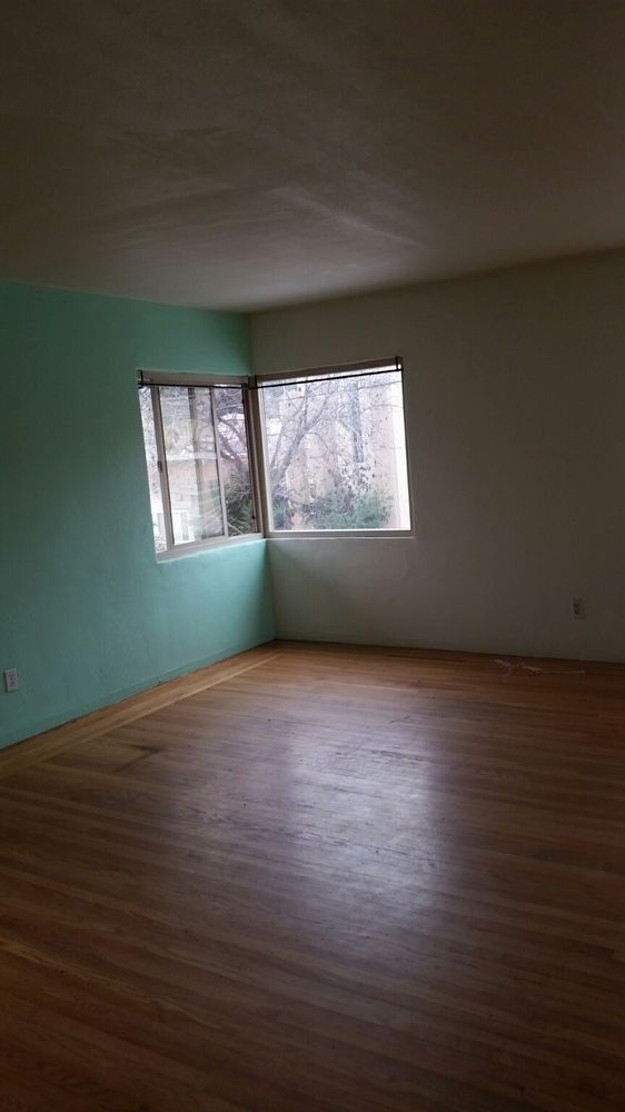
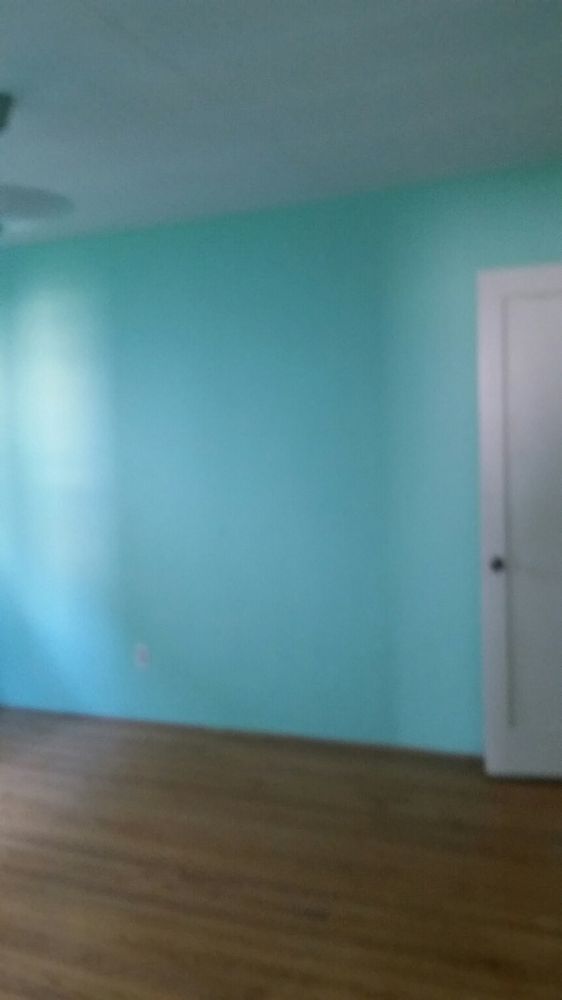
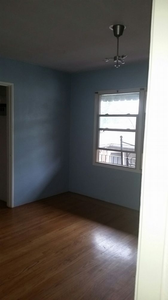
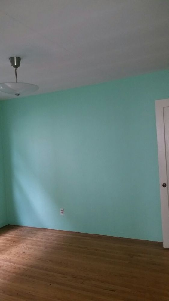
Gated entry hardwood floors dining area and laundry hookups Property Description 2nd floor locked entry walk-up. Fresh paint through out in cheerful decorator colors. Living room with hardwood floors decorative glass block window feature and built in decorative shelf area near hall. Dining area with hardwood and lots of light. Galley style kitchen with gas stove refrigerator and dishwasher. Laundry room for stackable machines. Spacious bedrooms with hardwood floors blinds and decent closet space. Hall with linen closet and bathroom with large walk in shower with bench and charming modern sink. Garbage included Walking distance to tons of Laurel District offerings. Kids NDance Farmer Joes House of Produce Cafe of the Bay Glenns Hot Dog Cafe Santa Peters Kettlecorn Fist of Flour Pizza Planet Fitness Sequoia Cafe World Ground Coffee Kellys Corner and much more. Minutes from 580 and 13 freeway entrances carpool areas and AC Transit.
3311 Macarthur Blvd is a house located in Alameda County and the 94602 ZIP Code. This area is served by the Oakland Unified attendance zone.
House Features
- Range
- Refrigerator
Location
Get Directions
The Lower Hills District of Oakland is made up of several small neighborhoods, including Piedmont, Crocker Heights, Oakmont, and Redwood Heights. Situated just seven miles to the east of Downtown Oakland on the north side of Interstate 580, the Lower Hills District maintains a small town feel despite its location among one of the Bay Area’s biggest communities. Windy, tree-lined streets house both new apartments and homes dating back to the '30s and '40s. Residents don’t have to travel far for everyday needs thanks to Oakland’s fast-growing economy. There is a plethora of shopping and dining options scattered around this sprawling community. You’ll find most of the amenities close to the MacArthur Freeway (Interstate 580) or near Park Boulevard. Access to the freeway and Bay Area Rapid Transit make getting around the rest of the Bay Area a breeze.
Learn more about living in Lower Hills DistrictBelow are rent ranges for similar nearby apartments
Amenities
- Range
- Refrigerator
Education
| Colleges & Universities | Distance | ||
|---|---|---|---|
| Colleges & Universities | Distance | ||
| Drive: | 6 min | 1.7 mi | |
| Drive: | 7 min | 4.2 mi | |
| Drive: | 9 min | 4.6 mi | |
| Drive: | 7 min | 4.7 mi |
3311 Macarthur Blvd is within 6 minutes or 1.7 miles from Mills College. It is also near Laney College and Lincoln University, Oakland.
Schools


Public Elementary & Middle School
Grades K-8
656 Students
Nearby
Public Elementary School
Grades K-5
362 Students
Attendance Zone
Public Elementary School
Grades K-5
424 Students
Attendance Zone
Public Middle School
Grades 6-8
370 Students
Attendance Zone
Public Middle School
Grades 6-9
446 Students
Attendance Zone
Public High School
Grades 9-12
1,590 Students
Attendance Zone
Public High School
Grades 9-12
1,531 Students
Attendance Zone
Private Elementary, Middle & High School
Grades 1-12
Nearby
Private Elementary, Middle & High School
Grades PK-10
Nearby
Private Elementary, Middle & High School
Grades K-10
Nearby
Private Elementary & Middle School
Grades 2-8
Nearby
School data provided by
 The GreatSchools Rating helps parents compare schools within a state based on a variety of school quality indicators and provides a helpful picture of how effectively each school serves all of its students. Ratings are on a scale of 1 (below average) to 10 (above average) and can include test scores, college readiness, academic progress, advanced courses, equity, discipline and attendance data. We also advise parents to visit schools, consider other information on school performance and programs, and consider family needs as part of the school selection process.
View GreatSchools Rating Methodology
Data provided by GreatSchools.org © 2025. All rights reserved.
View GreatSchools Rating Methodology
Data provided by GreatSchools.org © 2025. All rights reserved.
Transportation options available in Oakland include Fruitvale Station, located 2.0 miles from 3311 Macarthur Blvd. 3311 Macarthur Blvd is near Metro Oakland International, located 7.8 miles or 13 minutes away, and San Francisco International, located 26.3 miles or 38 minutes away.
| Transit / Subway | Distance | ||
|---|---|---|---|
| Transit / Subway | Distance | ||
|
|
Drive: | 3 min | 2.0 mi |
|
|
Drive: | 7 min | 4.2 mi |
|
|
Drive: | 8 min | 4.6 mi |
|
|
Drive: | 7 min | 4.8 mi |
|
|
Drive: | 8 min | 5.1 mi |
| Commuter Rail | Distance | ||
|---|---|---|---|
| Commuter Rail | Distance | ||
|
|
Drive: | 9 min | 5.4 mi |
|
|
Drive: | 10 min | 7.3 mi |
|
|
Drive: | 13 min | 9.4 mi |
|
|
Drive: | 19 min | 13.0 mi |
| Drive: | 19 min | 13.0 mi |
| Airports | Distance | ||
|---|---|---|---|
| Airports | Distance | ||
|
Metro Oakland International
|
Drive: | 13 min | 7.8 mi |
|
San Francisco International
|
Drive: | 38 min | 26.3 mi |
Time and distance from 3311 Macarthur Blvd.
| Shopping Centers | Distance | ||
|---|---|---|---|
| Shopping Centers | Distance | ||
| Walk: | 18 min | 1.0 mi | |
| Drive: | 3 min | 1.3 mi | |
| Drive: | 3 min | 2.1 mi |
3311 Macarthur Blvd has 3 shopping centers within 2.1 miles, which is about a 3-minute walk. The miles and minutes will be for the farthest away property.
| Parks and Recreation | Distance | ||
|---|---|---|---|
| Parks and Recreation | Distance | ||
|
Lakeside Park
|
Drive: | 5 min | 3.7 mi |
|
Roberts Regional Recreation Area
|
Drive: | 8 min | 3.8 mi |
|
Redwood Regional Park
|
Drive: | 8 min | 4.1 mi |
|
Chabot Space & Science Center
|
Drive: | 11 min | 4.5 mi |
|
Joaquin Miller Park
|
Drive: | 10 min | 4.6 mi |
3311 Macarthur Blvd has 5 parks within 4.6 miles, including Joaquin Miller Park, Roberts Regional Recreation Area, and Lakeside Park.
| Hospitals | Distance | ||
|---|---|---|---|
| Hospitals | Distance | ||
| Drive: | 3 min | 1.7 mi | |
| Drive: | 3 min | 2.1 mi | |
| Drive: | 6 min | 4.3 mi |
3311 Macarthur Blvd has 3 hospitals within 4.3 miles, the nearest is Telecare Heritage Psychiatric Health Facility which is 1.7 miles away and a 3 minute drive.
| Military Bases | Distance | ||
|---|---|---|---|
| Military Bases | Distance | ||
| Drive: | 17 min | 8.0 mi | |
| Drive: | 17 min | 9.8 mi |
3311 Macarthur Blvd is 8.0 miles from Alameda/US Naval Air Station Alameda, and is convenient to other military bases, including Oakland Army Base.
You May Also Like
Similar Rentals Nearby


What Are Walk Score®, Transit Score®, and Bike Score® Ratings?
Walk Score® measures the walkability of any address. Transit Score® measures access to public transit. Bike Score® measures the bikeability of any address.
What is a Sound Score Rating?
A Sound Score Rating aggregates noise caused by vehicle traffic, airplane traffic and local sources

3311 Macarthur Blvd
Oakland, CA 94602