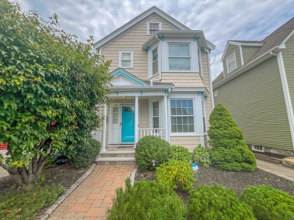

33 Winthrop St
33 Winthrop St
Waltham, MA 02453
2 Weeks Ago
Favorites
33 Winthrop St

Favorites
Check Back Soon for Upcoming Availability
| Beds | Baths | Average SF |
|---|---|---|
| 3 Bedrooms 3 Bedrooms 3 Br | 2 Baths 2 Baths 2 Ba | 1,549 SF |
About This Property
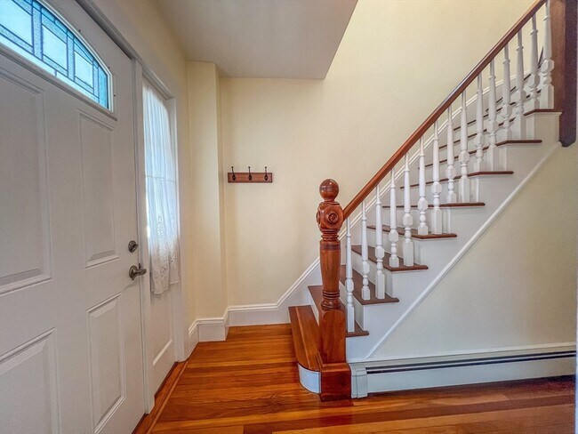
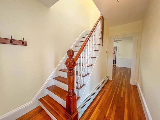
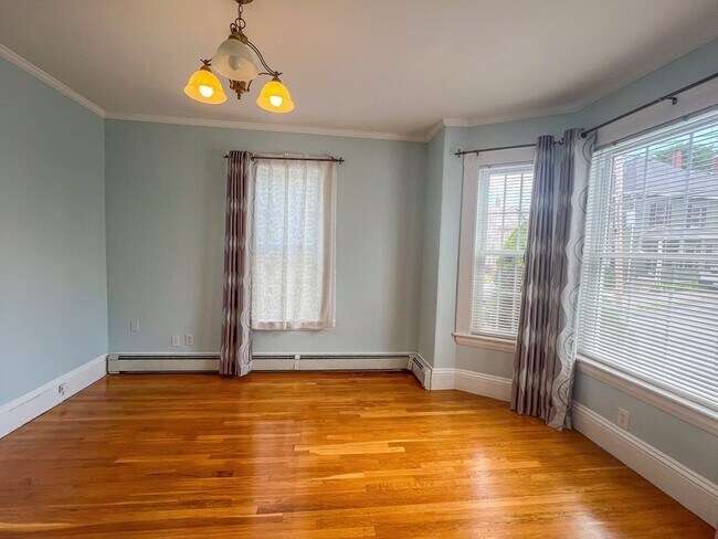
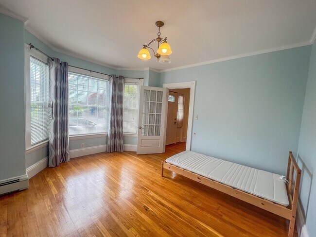
Available NOW!! Rare find SFH in the Lower Cedarwood neighborhood! This well-maintained 4B/2B single-family home features an updated kitchen with granite countertops,Medallion maple cabinets,a gas range,stainless steel appliances,and skylight window. The open floor plan seamlessly connects the dining room and living room. The first-floor full bath has been newly renovated. The 1st floor bedroom features with large bow windows. Charming hardwood floors run throughout the home (except for one bedroom on the second floor). 2 off-street parking spaces. It's unbeatable location offers easy access to all main roads (Routes 20,128/I-95,MA-90) and public transportation (MBTA buses,commuter rail). Enjoy shopping on Main Street and dining at the restaurants and bars on nearby Moody Street. The home is within walking distance to park and close to Brandeis and Bentley Universities,as well as Boston Children’s Hospital.
33 Winthrop St is a house located in Middlesex County and the 02453 ZIP Code. This area is served by the Waltham attendance zone.
Location
Get Directions
Bank Square is a quaint, family-friendly neighborhood in Waltham, Massachusetts with a variety of apartments and condos for rent. Just 11 miles west of downtown Boston and just seven miles from Harvard University, Bank Square is near a multitude of wonderful big city amenities. Residents enjoy the walkable downtown, local restaurants, and community parks.
Take a walk along the 18-acre Nipper Maher Park, or enjoy the playground, splash pad, open green space, woodlands, tennis and basketball courts, and baseball field. Take your canoe or kayak out onto the Charles River, or maybe explore Riverwalk Park. You can bike, walk your dog, or jog along the Charles River Greenway with beautiful river views.
Main Street is the best place to find local restaurants such as the Mad Raven, a quaint Irish Pub. Hannaford Supermarket is a massive place to get fresh groceries downtown with nearby banks, convenience stores, and more. Treat yourself or your whole family to a night out at The Chateau.
Learn more about living in Bank SquareBelow are rent ranges for similar nearby apartments
| Beds | Average Size | Lowest | Typical | Premium |
|---|---|---|---|---|
| Studio Studio Studio | 615 Sq Ft | $2,730 | $2,764 | $2,805 |
| 1 Bed 1 Bed 1 Bed | 762 Sq Ft | $1,850 | $3,109 | $4,845 |
| 2 Beds 2 Beds 2 Beds | 1238 Sq Ft | $2,000 | $3,707 | $5,805 |
| 3 Beds 3 Beds 3 Beds | 2068 Sq Ft | $2,700 | $4,367 | $7,300 |
| 4 Beds 4 Beds 4 Beds | 4369 Sq Ft | $3,500 | $5,324 | $7,500 |
Education
| Colleges & Universities | Distance | ||
|---|---|---|---|
| Colleges & Universities | Distance | ||
| Drive: | 4 min | 1.1 mi | |
| Drive: | 6 min | 2.6 mi | |
| Drive: | 15 min | 6.1 mi | |
| Drive: | 13 min | 6.5 mi |
33 Winthrop St is within 4 minutes or 1.1 miles from Brandeis University. It is also near Bentley University and Boston College.
Schools


Public Elementary School
Grades PK-5
383 Students
Attendance Zone
Public Middle School
Grades 6-8
595 Students
Attendance Zone
Public High School
Grades 9-12
1,751 Students
Attendance Zone
Private Elementary, Middle & High School
Grades 3-12
107 Students
Nearby
Private Elementary, Middle & High School
Grades 3-12
73 Students
Nearby
Private Elementary & Middle School
Grades PK-8
320 Students
Nearby
Private Middle & High School
Grades 7-12
180 Students
Nearby
School data provided by
 The GreatSchools Rating helps parents compare schools within a state based on a variety of school quality indicators and provides a helpful picture of how effectively each school serves all of its students. Ratings are on a scale of 1 (below average) to 10 (above average) and can include test scores, college readiness, academic progress, advanced courses, equity, discipline and attendance data. We also advise parents to visit schools, consider other information on school performance and programs, and consider family needs as part of the school selection process.
View GreatSchools Rating Methodology
Data provided by GreatSchools.org © 2025. All rights reserved.
View GreatSchools Rating Methodology
Data provided by GreatSchools.org © 2025. All rights reserved.
Transportation options available in Waltham include Riverside Station, located 3.3 miles from 33 Winthrop St. 33 Winthrop St is near General Edward Lawrence Logan International, located 14.5 miles or 26 minutes away, and Worcester Regional, located 39.9 miles or 57 minutes away.
| Transit / Subway | Distance | ||
|---|---|---|---|
| Transit / Subway | Distance | ||
|
|
Drive: | 8 min | 3.3 mi |
|
|
Drive: | 8 min | 3.8 mi |
|
|
Drive: | 10 min | 5.2 mi |
|
|
Drive: | 11 min | 5.2 mi |
|
|
Drive: | 12 min | 6.7 mi |
| Commuter Rail | Distance | ||
|---|---|---|---|
| Commuter Rail | Distance | ||
| Walk: | 15 min | 0.8 mi | |
|
|
Walk: | 18 min | 1.0 mi |
|
|
Walk: | 21 min | 1.1 mi |
|
|
Drive: | 4 min | 2.2 mi |
|
|
Drive: | 13 min | 7.8 mi |
| Airports | Distance | ||
|---|---|---|---|
| Airports | Distance | ||
|
General Edward Lawrence Logan International
|
Drive: | 26 min | 14.5 mi |
|
Worcester Regional
|
Drive: | 57 min | 39.9 mi |
Time and distance from 33 Winthrop St.
| Shopping Centers | Distance | ||
|---|---|---|---|
| Shopping Centers | Distance | ||
| Walk: | 5 min | 0.3 mi | |
| Drive: | 2 min | 1.2 mi | |
| Drive: | 4 min | 1.5 mi |
33 Winthrop St has 3 shopping centers within 1.5 miles, which is about a 4-minute walk. The miles and minutes will be for the farthest away property.
| Parks and Recreation | Distance | ||
|---|---|---|---|
| Parks and Recreation | Distance | ||
|
Land's Sake Farm
|
Drive: | 6 min | 2.9 mi |
|
Beaver Brook Reservation
|
Drive: | 6 min | 3.3 mi |
|
Mass Audubon's Habitat Education Center and Wildlife Sanctuary
|
Drive: | 11 min | 5.1 mi |
|
Mass Audubon's Drumlin Farm Wildlife Sanctuary
|
Drive: | 10 min | 5.7 mi |
|
Hemlock Gorge Reservation
|
Drive: | 12 min | 6.6 mi |
33 Winthrop St has 5 parks within 6.6 miles, including Land's Sake Farm, Beaver Brook Reservation, and Mass Audubon's Habitat Education Center and Wildlife Sanctuary.
| Hospitals | Distance | ||
|---|---|---|---|
| Hospitals | Distance | ||
| Walk: | 7 min | 0.4 mi | |
| Drive: | 7 min | 3.7 mi | |
| Drive: | 8 min | 4.2 mi |
33 Winthrop St has 3 hospitals within 4.2 miles, the nearest is Walden Behavioral Care which is 0.4 mile away and a 7 minute walk.
| Military Bases | Distance | ||
|---|---|---|---|
| Military Bases | Distance | ||
| Drive: | 15 min | 8.0 mi | |
| Drive: | 19 min | 10.7 mi |
33 Winthrop St is 8.0 miles from Hanscom Air Force Base, and is convenient to other military bases, including US Military Reservation.
You May Also Like
Similar Rentals Nearby
-
-

-

-

-
 $11,500Total Monthly Price12 Month Lease5 Beds, 4.5 Baths, 4,885 sq ftHouse for Rent
 -
 $4,850Total Monthly Price12 Month Lease4 Beds, 2.5 Baths, 2,100 sq ftHouse for Rent
 -
 $9,500Total Monthly Price12 Month Lease5 Beds, 3 Baths, 2,800 sq ftHouse for Rent
 -
 $8,800Total Monthly Price6 Month Lease4 Beds, 3.5 Baths, 3,878 sq ftHouse for Rent
 -
 $6,500Total Monthly Price12 Month Lease5 Beds, 3.5 Baths, 2,498 sq ftHouse for Rent
 -
 $4,000Total Monthly Price12 Month Lease3 Beds, 1.5 Baths, 1,900 sq ftHouse for Rent
What Are Walk Score®, Transit Score®, and Bike Score® Ratings?
Walk Score® measures the walkability of any address. Transit Score® measures access to public transit. Bike Score® measures the bikeability of any address.
What is a Sound Score Rating?
A Sound Score Rating aggregates noise caused by vehicle traffic, airplane traffic and local sources

33 Winthrop St
Waltham, MA 02453