$5,000
Total Monthly Price
33 Osborne St Unit 33 Osborne Street
White Plains, NY 10606
Favorites
33 Osborne St Unit 33 Osborne Street

Favorites
Check Back Soon for Upcoming Availability
| Beds | Baths | Average SF |
|---|---|---|
| 3 Bedrooms 3 Bedrooms 3 Br | 2 Baths 2 Baths 2 Ba | 1,200 SF |
Fees and Policies
The fees listed below are community-provided and may exclude utilities or add-ons. All payments are made directly to the property and are non-refundable unless otherwise specified.
About This Property
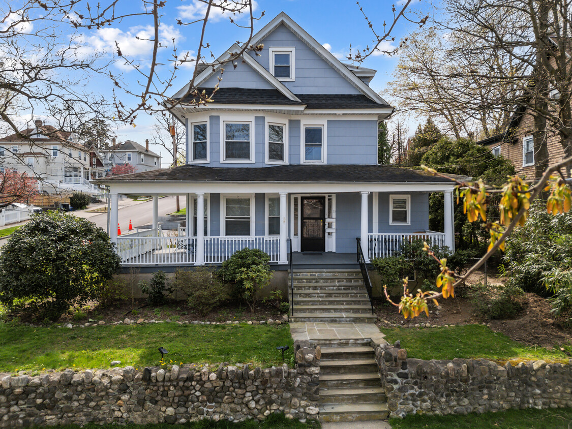
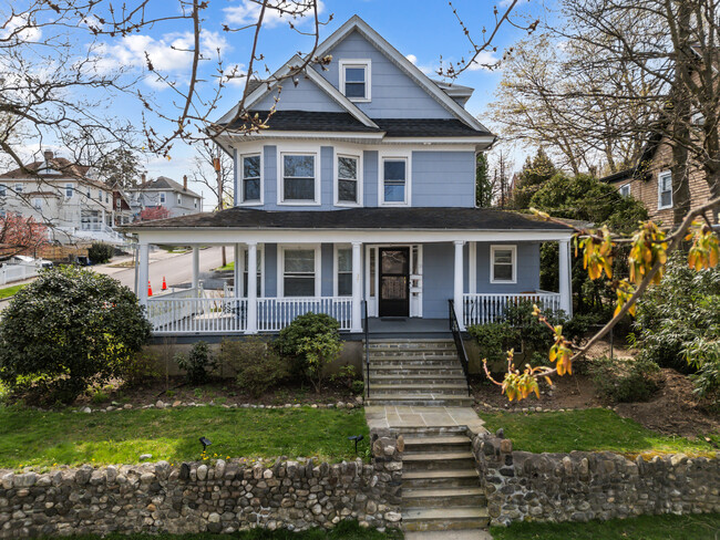
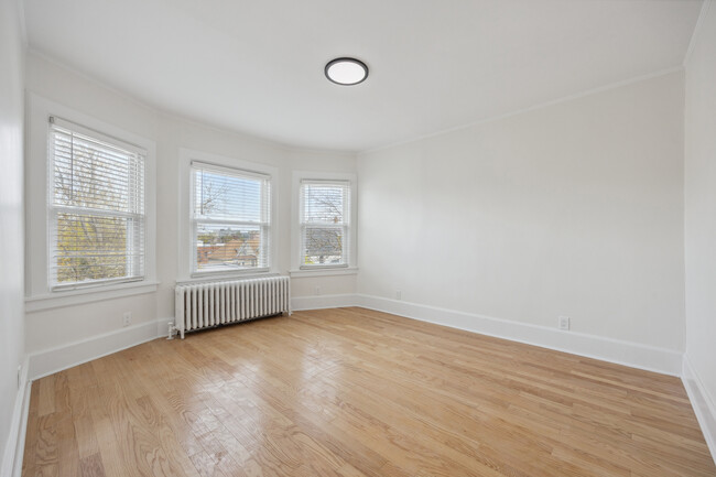
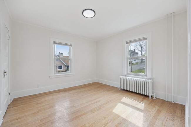
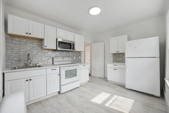
Centrally situated in White Plains, this two-unit home offers private off street parking & a garage. Easy access to a variety of dining and shopping options. Additionally, bus stops on W Post Road, White Plains Hospital, schools, and numerous parks are all within close reach. The property exudes charm, featuring a grand colonial façade with a picturesque porch that leads into a spacious foyer. The first-floor bedroom is bathed in natural light and boasts hardwood floors, a well-appointed kitchen with access to a rear patio, two additional bedrooms upstairs, and a full bathroom with a separate vanity area.
33 Osborne St is an apartment community located in Westchester County and the 10606 ZIP Code.
Apartment Features
- Air Conditioning
- Kitchen
- Hardwood Floors
- Patio
- Porch
33 Osborne St,
White Plains,
NY
10606
White Plains carries a lot of weight for a city of just 10 square miles — it serves as the county seat of Westchester County and functions as the commercial center for a county of roughly one million people. Sitting about 25 miles north of Midtown Manhattan, it draws corporate offices, law firms, and regional institutions to its downtown core. Pace University School of Law and Fordham University's Westchester Campus both maintain a presence here, reinforcing the city's role as an educational and professional hub. On July 9, 1776, the New York Provincial Congress met in White Plains and adopted a resolution approving the Declaration of Independence, making this small city the birthplace of New York State.
Neighborhoods range from the walkable blocks near the Mamaroneck Avenue corridor to quieter residential stretches in areas like Highlands, Fisher Hill, and Gedney Farms.
Learn more about living in White Plains
Amenities
- Air Conditioning
- Kitchen
- Hardwood Floors
- Patio
- Porch
Education
| Colleges & Universities | Distance | ||
|---|---|---|---|
| Colleges & Universities | Distance | ||
| Drive: | 4 min | 1.8 mi | |
| Drive: | 11 min | 4.7 mi | |
| Drive: | 12 min | 4.9 mi | |
| Drive: | 12 min | 5.5 mi |
33 Osborne St Unit 33 Osborne Street is within 4 minutes or 1.8 miles from Pace University, White Plains. It is also near Manhattanville College and SUNY Westchester.
Transportation options available in White Plains include Wakefield-241 Street, located 10.0 miles from 33 Osborne St Unit 33 Osborne Street. 33 Osborne St Unit 33 Osborne Street is near Westchester County, located 8.3 miles or 13 minutes away, and LaGuardia, located 23.1 miles or 40 minutes away.
| Transit / Subway | Distance | ||
|---|---|---|---|
| Transit / Subway | Distance | ||
|
|
Drive: | 19 min | 10.0 mi |
|
|
Drive: | 19 min | 10.5 mi |
|
|
Drive: | 19 min | 10.5 mi |
|
|
Drive: | 20 min | 10.8 mi |
| Commuter Rail | Distance | ||
|---|---|---|---|
| Commuter Rail | Distance | ||
|
|
Drive: | 3 min | 1.3 mi |
|
|
Drive: | 5 min | 2.1 mi |
|
|
Drive: | 5 min | 2.6 mi |
|
|
Drive: | 9 min | 3.7 mi |
|
|
Drive: | 10 min | 5.9 mi |
| Airports | Distance | ||
|---|---|---|---|
| Airports | Distance | ||
|
Westchester County
|
Drive: | 13 min | 8.3 mi |
|
LaGuardia
|
Drive: | 40 min | 23.1 mi |
Walkability Near 33 Osborne St White Plains, NY 10606
Getting Around
 What do Walkability, Transit, Drivability, and Bikeability mean?
Walkability measures the walking distance to day-to-day needs.
Transit measures access to public transportation.
Drivability measures congestion, parking availability, and access to major roads.
Bikeability measures the suitability for cycling.
How It Works
What do Walkability, Transit, Drivability, and Bikeability mean?
Walkability measures the walking distance to day-to-day needs.
Transit measures access to public transportation.
Drivability measures congestion, parking availability, and access to major roads.
Bikeability measures the suitability for cycling.
How It Works
Very Walkable
Walkability
80
/ 100
Good Public Transit
Transit
60
/ 100
Moderately Drivable
Drivability
60
/ 100
Fairly Bikeable
Bikeability
40
/ 100
Scores provided by
-
Soundscore™
-
/ 100
Traffic
-Airport
-Businesses
-Scores provided by
HowLoud What is a Sound Score Rating? A Sound Score Rating aggregates noise caused by vehicle traffic, airplane traffic and local sources. How It WorksTime and distance from 33 Osborne St Unit 33 Osborne Street.
| Shopping Centers | Distance | ||
|---|---|---|---|
| Shopping Centers | Distance | ||
| Walk: | 13 min | 0.7 mi | |
| Walk: | 15 min | 0.8 mi | |
| Drive: | 3 min | 1.3 mi |
33 Osborne St Unit 33 Osborne Street has 3 shopping centers within 1.3 miles, which is about a 3-minute drive. The miles and minutes will be for the farthest away property.
| Parks and Recreation | Distance | ||
|---|---|---|---|
| Parks and Recreation | Distance | ||
|
Weinberg Nature Center
|
Drive: | 9 min | 4.1 mi |
|
Greenburgh Nature Center
|
Drive: | 11 min | 4.4 mi |
|
Cranberry Lake Preserve
|
Drive: | 10 min | 5.4 mi |
|
Ward Acres
|
Drive: | 12 min | 5.7 mi |
|
Sheldrake Environmental Center
|
Drive: | 13 min | 5.9 mi |
33 Osborne St Unit 33 Osborne Street has 5 parks within 5.9 miles, including Greenburgh Nature Center, Weinberg Nature Center, and Cranberry Lake Preserve.
| Hospitals | Distance | ||
|---|---|---|---|
| Hospitals | Distance | ||
| Drive: | 11 min | 6.6 mi | |
| Drive: | 11 min | 6.7 mi | |
| Drive: | 18 min | 9.6 mi |
33 Osborne St Unit 33 Osborne Street has 3 hospitals within 9.6 miles, the nearest is Blythedale Children's Hospital which is 6.6 miles away and a 11 minute drive.
| Military Bases | Distance | ||
|---|---|---|---|
| Military Bases | Distance | ||
| Drive: | 37 min | 21.2 mi | |
| Drive: | 41 min | 26.0 mi | |
| Drive: | 95 min | 53.0 mi |
33 Osborne St Unit 33 Osborne Street has 3 military bases within 53.0 miles, the nearest is Fort Totten US Govt Reservation which is 21.2 miles away and a 37 minute drive.
You May Also Like
Similar Rentals Nearby
-
-
-
-
-
-
-
3 Beds$4,668+Total Monthly Price12 Month LeaseTotal Monthly Price NewPrices include base rent and required monthly fees of $103. Variable costs based on usage may apply.Base Rent:3 Beds$4,565+Specials
Pets Allowed Fitness Center Pool Dishwasher Refrigerator In Unit Washer & Dryer Walk-In Closets
-
3 Beds$4,275+Total Monthly PriceTotal Monthly Price NewPrices include required monthly fees of $75.Base Rent:3 Beds$4,200+
Pets Allowed Fitness Center Pool Dishwasher Refrigerator Kitchen
-
3 Beds$4,200+Total Monthly PriceTotal Monthly Price NewPrices include base rent and required monthly fees. Variable costs based on usage may apply.
Pets Allowed Fitness Center Pool Dishwasher In Unit Washer & Dryer Walk-In Closets
-
3 Beds$5,672+Total Monthly Price12 Month LeaseTotal Monthly Price NewPrices include required monthly fees of $100.Base Rent:3 Beds$5,572+
Pets Allowed Fitness Center Pool In Unit Washer & Dryer Walk-In Closets Package Service EV Charging


What Are Walk Score®, Transit Score®, and Bike Score® Ratings?
Walk Score® measures the walkability of any address. Transit Score® measures access to public transit. Bike Score® measures the bikeability of any address.
What is a Sound Score Rating?
A Sound Score Rating aggregates noise caused by vehicle traffic, airplane traffic and local sources.

33 Osborne St
White Plains, NY 10606