$1,800
/ Month
33 Falls Chapel Way
Reisterstown, MD 21136
2 Weeks Ago
|
Edit
Favorites
33 Falls Chapel Way

Favorites
Check Back Soon for Upcoming Availability
| Beds | Baths | Average SF |
|---|---|---|
| 2 Bedrooms 2 Bedrooms 2 Br | 2 Baths 2 Baths 2 Ba | — |
About This Property
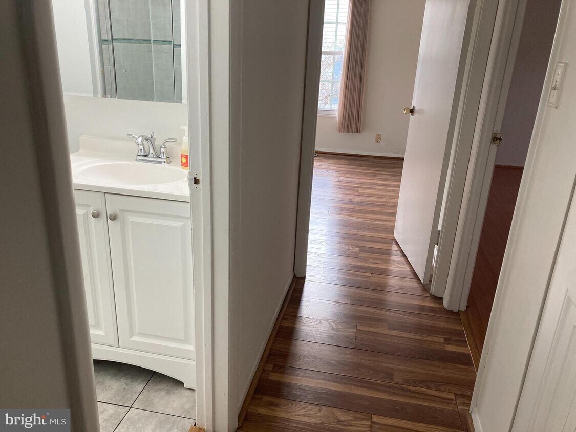
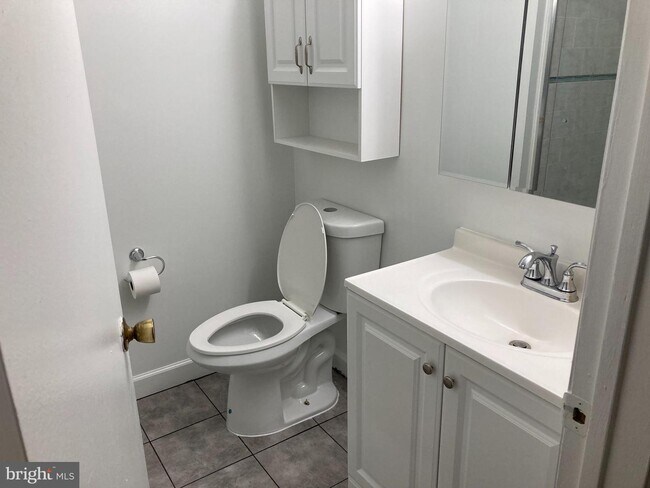
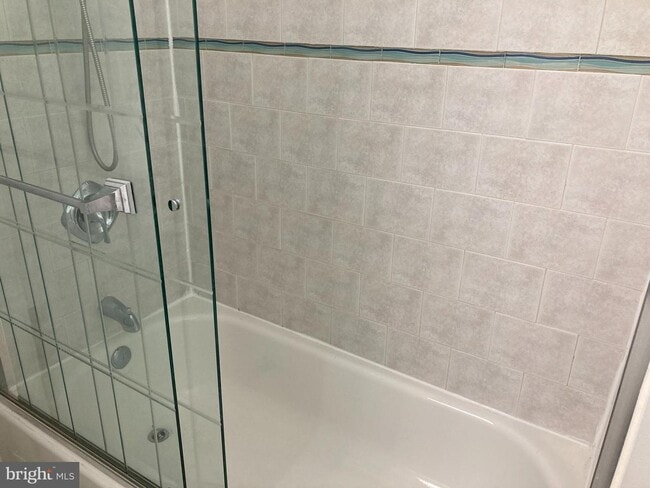
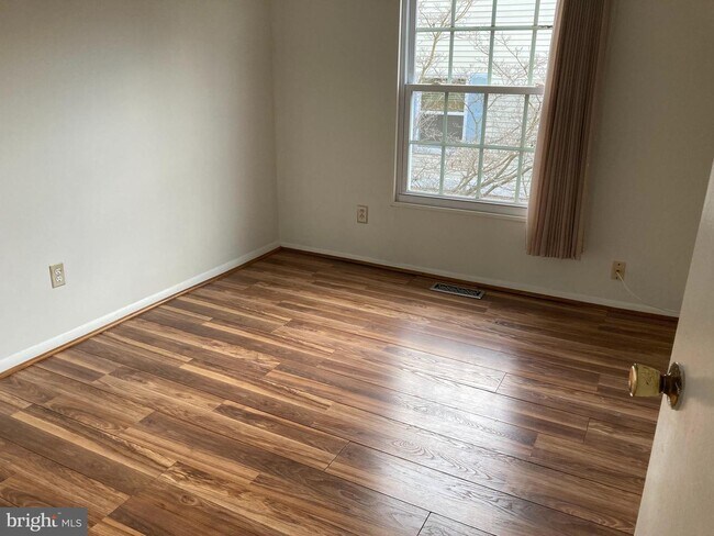
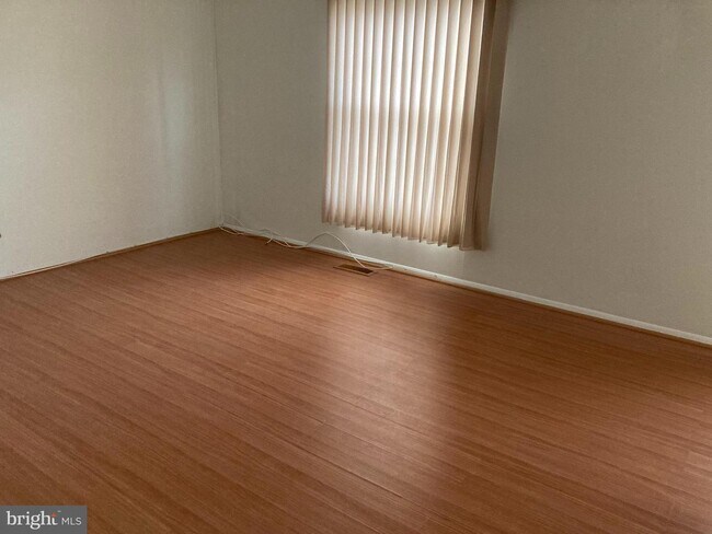
Open concept main level, with a galley Kitchen, a dining area with a full patio door that provides ample natural light. The upper level offers two oversized bedrooms and an updated Full Bath. The lower level is fully finished. Book your appointment today to see this gem of a rental!
33 Falls Chapel Way is a townhome located in Baltimore County and the 21136 ZIP Code. This area is served by the Baltimore County Public Schools attendance zone.
Townhome Features
- Basement
33 Falls Chapel Way,
Reisterstown,
MD
21136
Founded in 1758 by German immigrant John Reister, Reisterstown carries more than two and a half centuries of history while functioning today as a well-established residential suburb northwest of Baltimore. Its historic core, the Reisterstown Historic District, is listed on the National Register of Historic Places, giving the community a genuine sense of roots that newer suburbs simply cannot replicate. Interstate 795 traces the area's western edge, putting downtown Baltimore within easy reach for commuters who want a quieter home base without sacrificing access to a major city's job market and cultural scene.
Daily life here centers on Main Street, also known as Route 140, where local businesses, eateries, and services create a walkable commercial corridor. Hannah More Park anchors the heart of the community with green space, a playground, and a skate park, and it hosts the annual Reisterstown Festival each September.
Learn more about living in Reisterstown
Amenities
- Basement
Education
| Colleges & Universities | Distance | ||
|---|---|---|---|
| Colleges & Universities | Distance | ||
| Drive: | 8 min | 3.1 mi | |
| Drive: | 18 min | 8.2 mi | |
| Drive: | 27 min | 15.1 mi | |
| Drive: | 27 min | 15.2 mi |
33 Falls Chapel Way is within 8 minutes or 3.1 miles from Stevenson Univ., Owings Mills. It is also near Stevenson Univ., Greenspring and Towson University.
Schools


Public Elementary School
Grades PK-5
543 Students
Attendance Zone
Public Middle School
Grades 6-8
1,153 Students
Attendance Zone
Public High School
Grades 9-12
1,504 Students
Attendance Zone
Private Elementary & Middle School
Grades PK-8
444 Students
Nearby
Private Elementary, Middle & High School
Grades K-12
174 Students
Nearby
Private Elementary School
Grades K-5
5 Students
Nearby
Private Middle School
Grades 6-8
24 Students
Nearby
School data provided by
 The GreatSchools Rating helps parents compare schools within a state based on a variety of school quality indicators and provides a helpful picture of how effectively each school serves all of its students. Ratings are on a scale of 1 (below average) to 10 (above average) and can include test scores, college readiness, academic progress, advanced courses, equity, discipline and attendance data. We also advise parents to visit schools, consider other information on school performance and programs, and consider family needs as part of the school selection process.
View GreatSchools Rating Methodology
Data provided by GreatSchools.org © 2026. All rights reserved.
View GreatSchools Rating Methodology
Data provided by GreatSchools.org © 2026. All rights reserved.
Transportation options available in Reisterstown include Old Court, located 7.5 miles from 33 Falls Chapel Way. 33 Falls Chapel Way is near Baltimore/Washington International Thurgood Marshall, located 23.6 miles or 36 minutes away.
| Transit / Subway | Distance | ||
|---|---|---|---|
| Transit / Subway | Distance | ||
| Drive: | 15 min | 7.5 mi | |
| Drive: | 18 min | 8.2 mi | |
| Drive: | 17 min | 10.0 mi | |
|
|
Drive: | 25 min | 11.3 mi |
|
|
Drive: | 27 min | 12.6 mi |
| Commuter Rail | Distance | ||
|---|---|---|---|
| Commuter Rail | Distance | ||
|
|
Drive: | 31 min | 18.6 mi |
| Drive: | 28 min | 19.0 mi | |
| Drive: | 28 min | 19.0 mi | |
| Drive: | 33 min | 19.5 mi | |
| Drive: | 35 min | 20.6 mi |
| Airports | Distance | ||
|---|---|---|---|
| Airports | Distance | ||
|
Baltimore/Washington International Thurgood Marshall
|
Drive: | 36 min | 23.6 mi |
Walkability Near 33 Falls Chapel Way Reisterstown, MD 21136
Getting Around
 What do Walkability, Transit, Drivability, and Bikeability mean?
Walkability measures the walking distance to day-to-day needs.
Transit measures access to public transportation.
Drivability measures congestion, parking availability, and access to major roads.
Bikeability measures the suitability for cycling.
How It Works
What do Walkability, Transit, Drivability, and Bikeability mean?
Walkability measures the walking distance to day-to-day needs.
Transit measures access to public transportation.
Drivability measures congestion, parking availability, and access to major roads.
Bikeability measures the suitability for cycling.
How It Works
Fairly Walkable
Walkability
50
/ 100
Limited Public Transit
Transit
20
/ 100
Very Drivable
Drivability
80
/ 100
Somewhat Bikeable
Bikeability
30
/ 100
Scores provided by
-
Soundscore™
-
/ 100
Traffic
-Airport
-Businesses
-Scores provided by
HowLoud What is a Sound Score Rating? A Sound Score Rating aggregates noise caused by vehicle traffic, airplane traffic and local sources. How It WorksTime and distance from 33 Falls Chapel Way.
| Shopping Centers | Distance | ||
|---|---|---|---|
| Shopping Centers | Distance | ||
| Walk: | 8 min | 0.5 mi | |
| Walk: | 9 min | 0.5 mi | |
| Walk: | 10 min | 0.5 mi |
33 Falls Chapel Way has 3 shopping centers within 0.5 mile, which is about a 10-minute walk. The miles and minutes will be for the farthest away property.
| Parks and Recreation | Distance | ||
|---|---|---|---|
| Parks and Recreation | Distance | ||
|
Irvine Nature Center
|
Drive: | 10 min | 4.1 mi |
|
Soldiers Delight Natural Environment Area (NEA)
|
Drive: | 10 min | 4.4 mi |
|
Rodgers Farms
|
Drive: | 15 min | 7.5 mi |
|
Oregon Ridge Nature Center
|
Drive: | 22 min | 9.9 mi |
|
Oregon Ridge Park
|
Drive: | 22 min | 9.9 mi |
33 Falls Chapel Way has 5 parks within 9.9 miles, including Irvine Nature Center, Soldiers Delight Natural Environment Area (NEA), and Rodgers Farms.
| Hospitals | Distance | ||
|---|---|---|---|
| Hospitals | Distance | ||
| Drive: | 14 min | 7.6 mi | |
| Drive: | 24 min | 11.1 mi | |
| Drive: | 24 min | 11.1 mi |
33 Falls Chapel Way has 3 hospitals within 11.1 miles, the nearest is Northwest Hospital Center which is 7.6 miles away and a 14 minute drive.
| Military Bases | Distance | ||
|---|---|---|---|
| Military Bases | Distance | ||
| Drive: | 50 min | 31.5 mi |
33 Falls Chapel Way is 31.5 miles and a 50 minute drive from Fort George Meade.
You May Also Like
Similar Rentals Nearby


What Are Walk Score®, Transit Score®, and Bike Score® Ratings?
Walk Score® measures the walkability of any address. Transit Score® measures access to public transit. Bike Score® measures the bikeability of any address.
What is a Sound Score Rating?
A Sound Score Rating aggregates noise caused by vehicle traffic, airplane traffic and local sources.

33 Falls Chapel Way
Reisterstown, MD 21136