
$1,800
/ Month
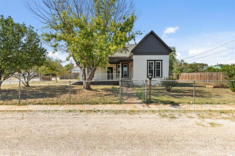
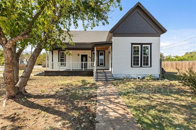
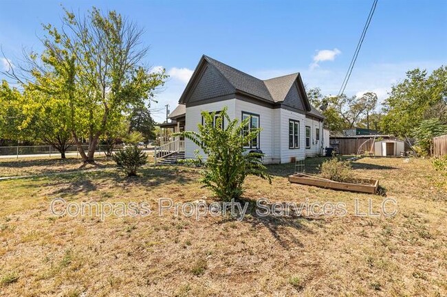
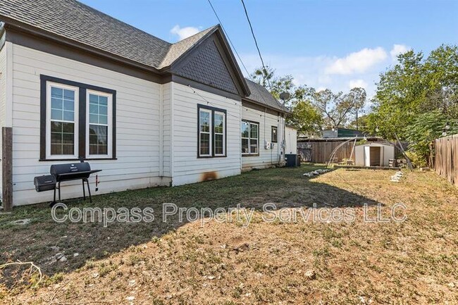
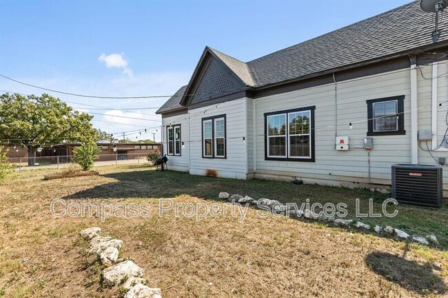
328 Taft St
McGregor, TX 76657
2 Weeks Ago
|
Edit
Favorites
328 Taft St

Favorites
Check Back Soon for Upcoming Availability
| Beds | Baths | Average SF |
|---|---|---|
| 3 Bedrooms 3 Bedrooms 3 Br | 2 Baths 2 Baths 2 Ba | 1,832 SF |
Fees and Policies
The fees listed below are community-provided and may exclude utilities or add-ons. All payments are made directly to the property and are non-refundable unless otherwise specified.
- Dogs Allowed
-
Fees not specified
- Cats Allowed
-
Fees not specified
About This Property
Welcome to your new rental in McGregor, TX. Located at 328 Taft St in McGregor, this single-family home is convenient to nearby destinations. With this great space, you'll feel right at home. Contact us to talk about this home.
328 Taft St is a house located in Mclennan County and the 76657 ZIP Code. This area is served by the Mcgregor Independent School District attendance zone.
328 Taft St,
McGregor,
TX
76657
Education
| Colleges & Universities | Distance | ||
|---|---|---|---|
| Colleges & Universities | Distance | ||
| Drive: | 29 min | 21.5 mi | |
| Drive: | 32 min | 22.3 mi | |
| Drive: | 37 min | 27.2 mi | |
| Drive: | 41 min | 28.5 mi |
328 Taft St is within 29 minutes or 21.5 miles from Baylor University. It is also near McLennan Community College and Texas State Technical College.
Schools


Public Elementary School
Grades PK-5
Attendance Zone
Public Elementary School
Grades K-5
Attendance Zone
Public Middle School
Grades 6-8
Attendance Zone
Public High School
Grades 9-12
Attendance Zone
Private Elementary & Middle School
Grades PK-8
Nearby
Private Middle & High School
Grades 6-12
Nearby
School data provided by
 The GreatSchools Rating helps parents compare schools within a state based on a variety of school quality indicators and provides a helpful picture of how effectively each school serves all of its students. Ratings are on a scale of 1 (below average) to 10 (above average) and can include test scores, college readiness, academic progress, advanced courses, equity, discipline and attendance data. We also advise parents to visit schools, consider other information on school performance and programs, and consider family needs as part of the school selection process.
View GreatSchools Rating Methodology
Data provided by GreatSchools.org © 2026. All rights reserved.
View GreatSchools Rating Methodology
Data provided by GreatSchools.org © 2026. All rights reserved.
Walkability Near 328 Taft St McGregor, TX 76657
Getting Around
 What do Walkability, Transit, Drivability, and Bikeability mean?
Walkability measures the walking distance to day-to-day needs.
Transit measures access to public transportation.
Drivability measures congestion, parking availability, and access to major roads.
Bikeability measures the suitability for cycling.
How It Works
What do Walkability, Transit, Drivability, and Bikeability mean?
Walkability measures the walking distance to day-to-day needs.
Transit measures access to public transportation.
Drivability measures congestion, parking availability, and access to major roads.
Bikeability measures the suitability for cycling.
How It Works
Fairly Walkable
Walkability
40
/ 100
Very Drivable
Drivability
80
/ 100
Somewhat Bikeable
Bikeability
30
/ 100
Scores provided by
-
Soundscore™
-
/ 100
Traffic
-Airport
-Businesses
-Scores provided by
HowLoud What is a Sound Score Rating? A Sound Score Rating aggregates noise caused by vehicle traffic, airplane traffic and local sources. How It WorksYou May Also Like
Similar Rentals Nearby


What Are Walk Score®, Transit Score®, and Bike Score® Ratings?
Walk Score® measures the walkability of any address. Transit Score® measures access to public transit. Bike Score® measures the bikeability of any address.
What is a Sound Score Rating?
A Sound Score Rating aggregates noise caused by vehicle traffic, airplane traffic and local sources.

328 Taft St
McGregor, TX 76657