

$975
Total Monthly Price
325 McGregor Ave Unit #2
Cincinnati, OH 45219
1 Day Ago
|
Edit
Favorites
513-253-0381
-
Bedrooms
1
-
Bathrooms
1
-
Square Feet
875 sq ft
-
Available
Available Mar 1
Highlights
- Balcony
- Patio
- Walk-In Closets
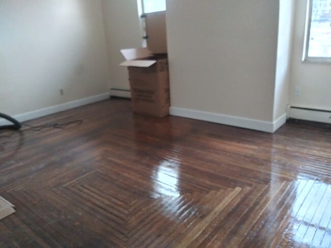
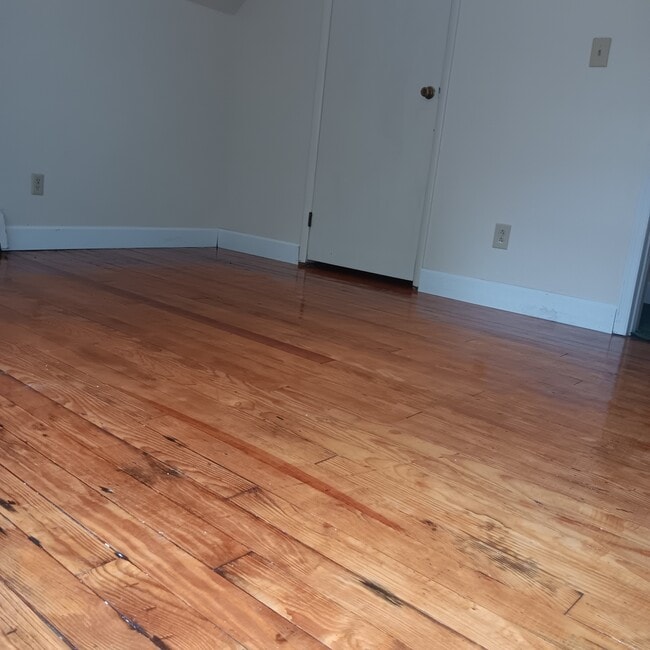
- Hardwood Floors
- Smoke Free
325 McGregor Ave Unit #2

Favorites
About This Home
12 Month Lease,
$975 deposit,
Available Mar 1
HEAT and GAS PAID BY OWNER!!!! Beautiful historic Tudor home! Private covered porch off bedroom. Original hardwood floors. On University of Cincinnati shuttle route - stop is one block away. Convenient access to I-71, I-471 to NKU, and downtown & OTR.
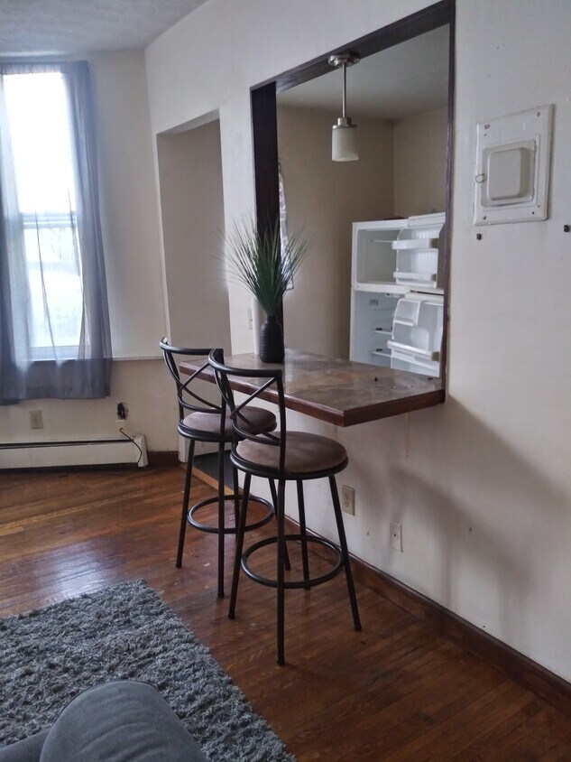
Wonderful private covered porch that is attached to your livingroom! New wood plank lvt flooring throughout! Nice view and space! Small business owned and operated! See the difference! We actually answer and return our phone calls! For a tour, please call or text us.
325 McGregor Ave is an apartment community located in Hamilton County and the 45219 ZIP Code. This area is served by the Cincinnati Public Schools attendance zone.
* Price shown is total price based on community-supplied monthly required fees. Excludes user-selected optional fees and variable or usage-based fees and required charges due at or prior to move-in or at move-out. Price, availability, fees, and any applicable rent special are subject to change without notice.
* Square footage definitions vary. Displayed square footage is approximate.
Apartment Features
Washer/Dryer
Air Conditioning
High Speed Internet Access
Hardwood Floors
- High Speed Internet Access
- Wi-Fi
- Washer/Dryer
- Air Conditioning
- Heating
- Smoke Free
- Cable Ready
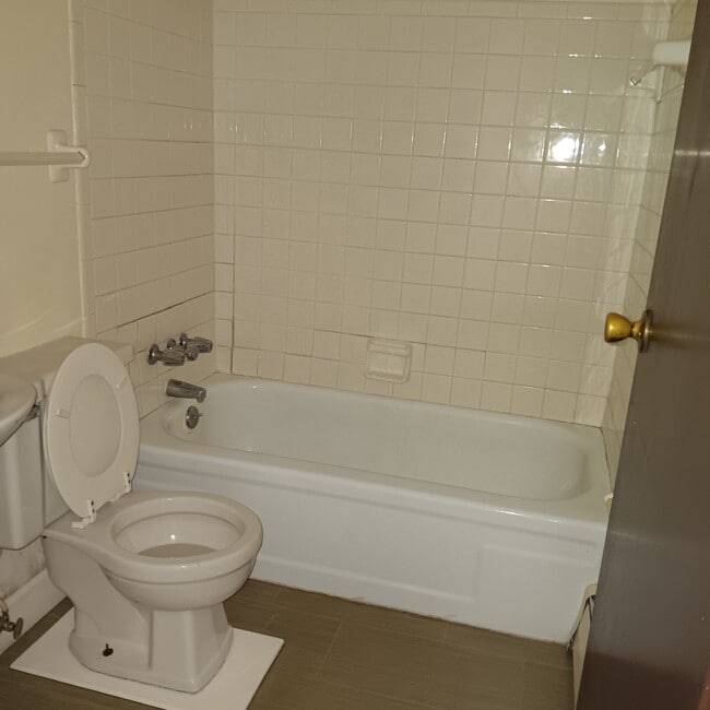
- Tub/Shower
- Kitchen
- Oven
- Refrigerator
- Hardwood Floors
- Vinyl Flooring
- Family Room
- Bay Window
- Walk-In Closets
- Laundry Facilities
- Balcony
- Patio
- Porch
Fees and Policies
The fees listed below are community-provided and may exclude utilities or add-ons. All payments are made directly to the property and are non-refundable unless otherwise specified.
- Parking
-
Surface Lot--
Details
Utilities Included
-
Gas
-
Heat
-
Trash Removal
-
Sewer
Property Information
-
4 units
Contact
- Phone Number
- Contact
Location
Get Directions
The Cincinnati neighborhood of Mount Auburn sits north of downtown and west of Interstate 71. The neighborhood, originally a hilltop escape from the crowded conditions of lower Downtown Cincinnati, gained national recognition as a historic district in 1973. The well-known community contains beautiful mansions dating back to 1819, including the home of former President William Howard Taft.
The community contains beautiful mansions formerly owned by a host of prominent residents. A number of historic buildings and sites dot the area, including the Mount Auburn Young Ladies Institute. The neighborhood also features the beloved ice cream parlor Graeter's Confectionary, as well as Christ Hospital.
Learn more about living in Mount Auburn
Education
| Colleges & Universities | Distance | ||
|---|---|---|---|
| Colleges & Universities | Distance | ||
| Drive: | 4 min | 1.3 mi | |
| Drive: | 4 min | 1.4 mi | |
| Drive: | 8 min | 2.9 mi | |
| Drive: | 12 min | 4.1 mi |
325 McGregor Ave Unit #2 is within 4 minutes or 1.4 miles from University of Cincinnati. It is also near Univ. of Cincinnati, Medical and Xavier University.
Schools


Public Elementary, Middle & High School
Grades 5-12
2,445 Students
Attendance Zone
Public Elementary School
Grades PK-6
237 Students
Attendance Zone
Public Middle & High School
Grades 7-12
1,144 Students
Attendance Zone
Private Elementary & Middle School
Grades PK-8
212 Students
Nearby
Private Elementary, Middle & High School
Grades K-12
209 Students
Nearby
School data provided by
 The GreatSchools Rating helps parents compare schools within a state based on a variety of school quality indicators and provides a helpful picture of how effectively each school serves all of its students. Ratings are on a scale of 1 (below average) to 10 (above average) and can include test scores, college readiness, academic progress, advanced courses, equity, discipline and attendance data. We also advise parents to visit schools, consider other information on school performance and programs, and consider family needs as part of the school selection process.
View GreatSchools Rating Methodology
Data provided by GreatSchools.org © 2026. All rights reserved.
View GreatSchools Rating Methodology
Data provided by GreatSchools.org © 2026. All rights reserved.
Transportation options available in Cincinnati include Hanke Exchange Station - 12Th & Main, located 1.5 miles from 325 McGregor Ave Unit #2. 325 McGregor Ave Unit #2 is near Cincinnati/Northern Kentucky International, located 16.0 miles or 29 minutes away.
| Transit / Subway | Distance | ||
|---|---|---|---|
| Transit / Subway | Distance | ||
| Drive: | 3 min | 1.5 mi | |
| Drive: | 5 min | 1.6 mi | |
| Drive: | 4 min | 1.7 mi | |
| Drive: | 5 min | 1.7 mi | |
| Drive: | 5 min | 1.9 mi |
| Commuter Rail | Distance | ||
|---|---|---|---|
| Commuter Rail | Distance | ||
|
|
Drive: | 8 min | 4.0 mi |
| Airports | Distance | ||
|---|---|---|---|
| Airports | Distance | ||
|
Cincinnati/Northern Kentucky International
|
Drive: | 29 min | 16.0 mi |
Time and distance from 325 McGregor Ave Unit #2.
| Shopping Centers | Distance | ||
|---|---|---|---|
| Shopping Centers | Distance | ||
| Drive: | 6 min | 2.1 mi | |
| Drive: | 6 min | 2.3 mi | |
| Drive: | 5 min | 2.8 mi |
325 McGregor Ave Unit #2 has 3 shopping centers within 2.8 miles, which is about a 5-minute drive. The miles and minutes will be for the farthest away property.
| Parks and Recreation | Distance | ||
|---|---|---|---|
| Parks and Recreation | Distance | ||
|
William H. Taft National Historic Site
|
Walk: | 11 min | 0.6 mi |
|
Krohn Conservatory
|
Drive: | 3 min | 1.3 mi |
|
Eden Park
|
Drive: | 4 min | 1.4 mi |
|
Trailside Nature Center
|
Drive: | 5 min | 1.8 mi |
|
Theodore M. Berry Friendship Park
|
Drive: | 6 min | 2.5 mi |
325 McGregor Ave Unit #2 has 5 parks within 2.5 miles, including William H. Taft National Historic Site, Eden Park, and Krohn Conservatory.
| Hospitals | Distance | ||
|---|---|---|---|
| Hospitals | Distance | ||
| Walk: | 9 min | 0.5 mi | |
| Walk: | 20 min | 1.0 mi | |
| Drive: | 3 min | 1.1 mi |
325 McGregor Ave Unit #2 has 3 hospitals within 1.1 miles, the nearest is Christ Hospital which is 0.5 mile away and a 9 minute walk.
| Military Bases | Distance | ||
|---|---|---|---|
| Military Bases | Distance | ||
| Drive: | 71 min | 52.1 mi | |
| Drive: | 77 min | 57.2 mi | |
| Drive: | 79 min | 60.4 mi |
325 McGregor Ave Unit #2 has 3 military bases within 60.4 miles, the nearest is Gentile Air Force Station which is 52.1 miles away and a 71 minute drive.
Amenities
- High Speed Internet Access
- Wi-Fi
- Washer/Dryer
- Air Conditioning
- Heating
- Smoke Free
- Cable Ready
- Tub/Shower
- Kitchen
- Oven
- Refrigerator
- Hardwood Floors
- Vinyl Flooring
- Family Room
- Bay Window
- Walk-In Closets
- Laundry Facilities
- Balcony
- Patio
- Porch
325 McGregor Ave Unit #2 Photos
What Are Walk Score®, Transit Score®, and Bike Score® Ratings?
Walk Score® measures the walkability of any address. Transit Score® measures access to public transit. Bike Score® measures the bikeability of any address.
What is a Sound Score Rating?
A Sound Score Rating aggregates noise caused by vehicle traffic, airplane traffic and local sources
325 McGregor Ave
Cincinnati, OH 45219