
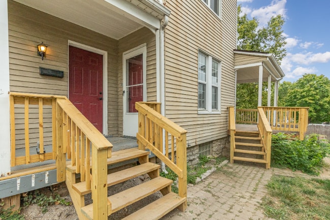
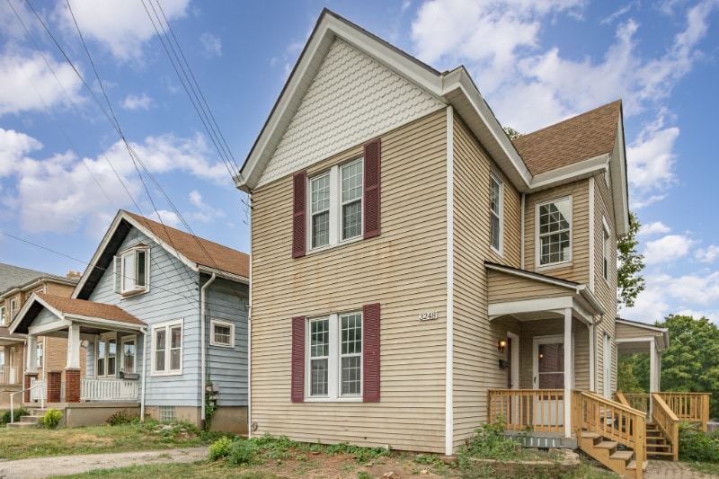
3248 Glenmore Ave
Cincinnati, OH 45211
-
Bedrooms
4
-
Bathrooms
1
-
Square Feet
1,282 sq ft
-
Available
Available Now
Highlight
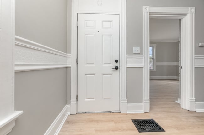
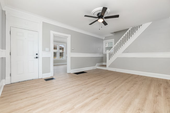
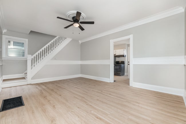
- Hardwood Floors

About This Home
Property Id: 1619650 This completely renovated 4 bed 1 bth home is the perfect location. Close to downtown, just grogeous ready to move in. Reay to make this your new home - give us a call for an appointment. NO Section 8 . No smokers
3248 Glenmore Ave is a house located in Hamilton County and the 45211 ZIP Code. This area is served by the Cincinnati Public Schools attendance zone.
House Features
- Oven
- Refrigerator
- Hardwood Floors
Fees and Policies
The fees below are based on community-supplied data and may exclude additional fees and utilities.
- Dogs Allowed
-
Fees not specified
-
Weight limit--
-
Pet Limit--
Contact
- Phone Number
- Contact
-
Source

- Oven
- Refrigerator
- Hardwood Floors
Situated about five miles northwest of Downtown Cincinnati, Westwood is the largest neighborhood in the city. Residents flock to Westwood for its many affordable historic homes and modern apartments available for rent in addition to its close proximity to I-74, I-75, and all that Downtown Cincinnati has to offer.
While Westwood is a predominantly residential neighborhood, it is also home to a slew of convenient stores and restaurants. Shopping opportunities abound in Westwood, with plenty of national retailers in Western Hills Plaza and local shops in the growing Town Hall District. Numerous neighborhood parks provide ample space to enjoy the outdoors in town as well as the sprawling 1,400-acre Mount Airy Forest, which is partially located in Westwood.
Learn more about living in Westwood| Colleges & Universities | Distance | ||
|---|---|---|---|
| Colleges & Universities | Distance | ||
| Drive: | 10 min | 4.7 mi | |
| Drive: | 15 min | 6.1 mi | |
| Drive: | 13 min | 6.4 mi | |
| Drive: | 15 min | 6.8 mi |


View GreatSchools Rating Methodology
Data provided by GreatSchools.org © 2025. All rights reserved.
Transportation options available in Cincinnati include Brewery District Station, Elm & Henry, located 6.2 miles from 3248 Glenmore Ave. 3248 Glenmore Ave is near Cincinnati/Northern Kentucky International, located 21.1 miles or 39 minutes away.
| Transit / Subway | Distance | ||
|---|---|---|---|
| Transit / Subway | Distance | ||
| Drive: | 14 min | 6.2 mi | |
| Drive: | 14 min | 6.4 mi | |
| Drive: | 15 min | 6.5 mi | |
| Drive: | 15 min | 6.6 mi | |
| Drive: | 15 min | 6.7 mi |
| Commuter Rail | Distance | ||
|---|---|---|---|
| Commuter Rail | Distance | ||
|
|
Drive: | 14 min | 7.1 mi |
| Airports | Distance | ||
|---|---|---|---|
| Airports | Distance | ||
|
Cincinnati/Northern Kentucky International
|
Drive: | 39 min | 21.1 mi |
Time and distance from 3248 Glenmore Ave.
| Shopping Centers | Distance | ||
|---|---|---|---|
| Shopping Centers | Distance | ||
| Walk: | 12 min | 0.6 mi | |
| Walk: | 13 min | 0.7 mi | |
| Walk: | 17 min | 0.9 mi |
| Parks and Recreation | Distance | ||
|---|---|---|---|
| Parks and Recreation | Distance | ||
|
Mt. Airy Forest
|
Drive: | 8 min | 3.5 mi |
|
Imago Earth Center
|
Drive: | 12 min | 4.3 mi |
|
Embshoff Woods
|
Drive: | 14 min | 4.9 mi |
|
Buttercup Valley
|
Drive: | 12 min | 5.0 mi |
|
Wilson Commons
|
Drive: | 14 min | 5.1 mi |
| Hospitals | Distance | ||
|---|---|---|---|
| Hospitals | Distance | ||
| Drive: | 9 min | 3.6 mi | |
| Drive: | 12 min | 5.6 mi | |
| Drive: | 15 min | 6.9 mi |
| Military Bases | Distance | ||
|---|---|---|---|
| Military Bases | Distance | ||
| Drive: | 74 min | 55.9 mi | |
| Drive: | 81 min | 60.9 mi | |
| Drive: | 83 min | 64.2 mi |
3248 Glenmore Ave Photos
Nearby Apartments
Within 50 Miles of 3248 Glenmore Ave Cincinnati, OH 45211
-
3037 Worthington Ave
Cincinnati, OH 45211
$1,600
4 Br 1.7 mi
-
4397 Virginia Ave
Cincinnati, OH 45223
$2,000
5 Br 3.9 mi
-
5589 Goldenrod Dr
Cincinnati, OH 45239
$2,200
4 Br 4.1 mi
-
611 Tafel St
Cincinnati, OH 45225
$2,100
4 Br 4.7 mi
-
432 Southview Ave
Cincinnati, OH 45219
$2,900
4 Br 4.7 mi
-
431 Ada St
Cincinnati, OH 45219
$2,800
4 Br 4.8 mi
What Are Walk Score®, Transit Score®, and Bike Score® Ratings?
Walk Score® measures the walkability of any address. Transit Score® measures access to public transit. Bike Score® measures the bikeability of any address.
What is a Sound Score Rating?
A Sound Score Rating aggregates noise caused by vehicle traffic, airplane traffic and local sources
3248 Glenmore Ave
Cincinnati, OH 45211