$1,545 / Month
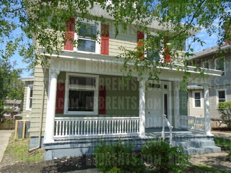
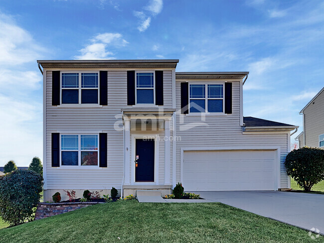
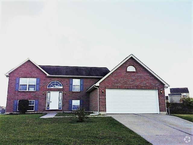
3219 Glenmore Ave
Cincinnati, OH 45211
2 Weeks Ago
Favorites
3219 Glenmore Ave

Favorites
Check Back Soon for Upcoming Availability
| Beds | Baths | Average SF |
|---|---|---|
| 4 Bedrooms 4 Bedrooms 4 Br | 1.5 Baths 1.5 Baths 1.5 Ba | 1,976 SF |
About This Property
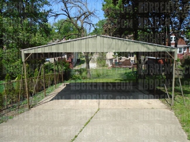
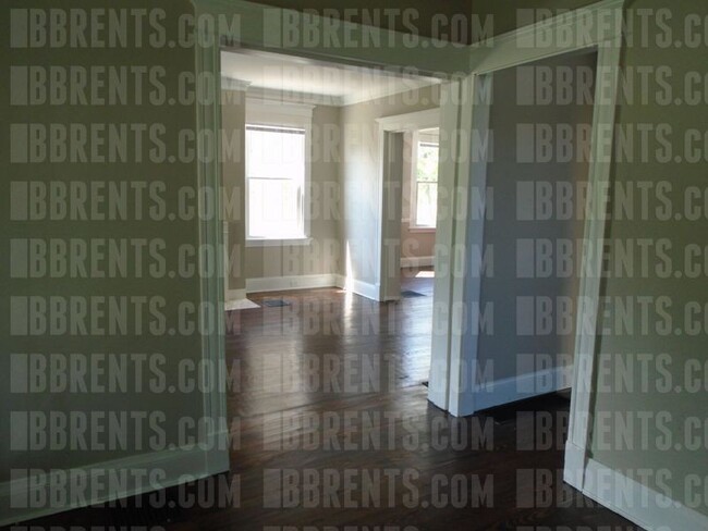
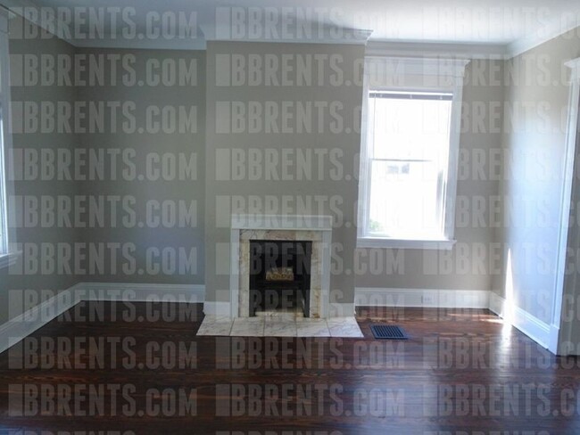
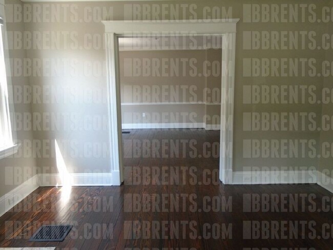
**Coming Soon** Welcome to 3219 Glenmore Ave, a beautifully updated 4 bedroom, 1.5 bathroom home in Cincinnati, OH. Managed by Dix Road Property Management LLC, this property boasts a newly renovated kitchen and bathrooms, as well as updated electrical and plumbing. With a convenient W/D hookup, carport, and off-street parking, this home offers both style and practicality. Enjoy meals in the spacious eat-in kitchen or host gatherings in the separate dining area. The bedrooms are generously sized, and the full basement provides extra storage space. With a new roof and flooring, this home is move-in ready and waiting for you to make it your own. Experience the best of Cincinnati living in this charming and updated property. **Appliances are not included, but can be for an additional cost.** **DEPOSIT PENDING**
3219 Glenmore Ave is a house located in Hamilton County and the 45211 ZIP Code. This area is served by the Cincinnati Public Schools attendance zone.
Location
Get Directions
Situated about five miles northwest of Downtown Cincinnati, Westwood is the largest neighborhood in the city. Residents flock to Westwood for its many affordable historic homes and modern apartments available for rent in addition to its close proximity to I-74, I-75, and all that Downtown Cincinnati has to offer.
While Westwood is a predominantly residential neighborhood, it is also home to a slew of convenient stores and restaurants. Shopping opportunities abound in Westwood, with plenty of national retailers in Western Hills Plaza and local shops in the growing Town Hall District. Numerous neighborhood parks provide ample space to enjoy the outdoors in town as well as the sprawling 1,400-acre Mount Airy Forest, which is partially located in Westwood.
Learn more about living in WestwoodBelow are rent ranges for similar nearby apartments
| Beds | Average Size | Lowest | Typical | Premium |
|---|---|---|---|---|
| Studio Studio Studio | 438 Sq Ft | $695 | $741 | $795 |
| 1 Bed 1 Bed 1 Bed | 635-642 Sq Ft | $600 | $828 | $1,300 |
| 2 Beds 2 Beds 2 Beds | 843-844 Sq Ft | $775 | $1,128 | $1,665 |
| 3 Beds 3 Beds 3 Beds | 1489-1494 Sq Ft | $1,250 | $1,620 | $2,125 |
| 4 Beds 4 Beds 4 Beds | 1398 Sq Ft | $1,515 | $1,673 | $2,000 |
Education
| Colleges & Universities | Distance | ||
|---|---|---|---|
| Colleges & Universities | Distance | ||
| Drive: | 10 min | 4.6 mi | |
| Drive: | 15 min | 6.2 mi | |
| Drive: | 14 min | 6.5 mi | |
| Drive: | 15 min | 6.9 mi |
3219 Glenmore Ave is within 10 minutes or 4.6 miles from College of Mount St. Joseph. It is also near Cincinnati State and University of Cincinnati.
Schools


Public Elementary & Middle School
Grades PK-7 & 9
561 Students
Attendance Zone
Public Middle & High School
Grades 7-12
760 Students
Attendance Zone
Public Middle & High School
Grades 7-12
897 Students
Attendance Zone
Private Elementary & Middle School
Grades PK-8
381 Students
Nearby
Private Elementary & Middle School
Grades K-8
308 Students
Nearby
Private High School
Grades 9-12
495 Students
Nearby
School data provided by
 The GreatSchools Rating helps parents compare schools within a state based on a variety of school quality indicators and provides a helpful picture of how effectively each school serves all of its students. Ratings are on a scale of 1 (below average) to 10 (above average) and can include test scores, college readiness, academic progress, advanced courses, equity, discipline and attendance data. We also advise parents to visit schools, consider other information on school performance and programs, and consider family needs as part of the school selection process.
View GreatSchools Rating Methodology
View GreatSchools Rating Methodology
Transportation options available in Cincinnati include Brewery District Station, Elm & Henry, located 6.0 miles from 3219 Glenmore Ave. 3219 Glenmore Ave is near Cincinnati/Northern Kentucky International, located 20.3 miles or 39 minutes away.
| Transit / Subway | Distance | ||
|---|---|---|---|
| Transit / Subway | Distance | ||
| Drive: | 14 min | 6.0 mi | |
| Drive: | 14 min | 6.2 mi | |
| Drive: | 15 min | 6.2 mi | |
| Drive: | 15 min | 6.3 mi | |
| Drive: | 15 min | 6.5 mi |
| Commuter Rail | Distance | ||
|---|---|---|---|
| Commuter Rail | Distance | ||
|
|
Drive: | 14 min | 6.2 mi |
| Airports | Distance | ||
|---|---|---|---|
| Airports | Distance | ||
|
Cincinnati/Northern Kentucky International
|
Drive: | 39 min | 20.3 mi |
Time and distance from 3219 Glenmore Ave.
| Shopping Centers | Distance | ||
|---|---|---|---|
| Shopping Centers | Distance | ||
| Walk: | 13 min | 0.7 mi | |
| Walk: | 13 min | 0.7 mi | |
| Walk: | 16 min | 0.9 mi |
3219 Glenmore Ave has 3 shopping centers within 0.9 mile, which is about a 16-minute walk. The miles and minutes will be for the farthest away property.
| Parks and Recreation | Distance | ||
|---|---|---|---|
| Parks and Recreation | Distance | ||
|
Mt. Airy Forest
|
Drive: | 9 min | 3.6 mi |
|
Imago Earth Center
|
Drive: | 11 min | 4.2 mi |
|
Embshoff Woods
|
Drive: | 14 min | 4.8 mi |
|
Wilson Commons
|
Drive: | 13 min | 5.0 mi |
|
Buttercup Valley
|
Drive: | 12 min | 5.1 mi |
3219 Glenmore Ave has 5 parks within 5.1 miles, including Mt. Airy Forest, Imago Earth Center, and Embshoff Woods.
| Hospitals | Distance | ||
|---|---|---|---|
| Hospitals | Distance | ||
| Drive: | 9 min | 3.7 mi | |
| Drive: | 12 min | 5.7 mi | |
| Drive: | 15 min | 7.0 mi |
3219 Glenmore Ave has 3 hospitals within 7.0 miles, the nearest is Mercy Health - West Hospital which is 3.7 miles away and a 9 minute drive.
| Military Bases | Distance | ||
|---|---|---|---|
| Military Bases | Distance | ||
| Drive: | 75 min | 56.0 mi | |
| Drive: | 81 min | 61.0 mi | |
| Drive: | 83 min | 64.3 mi |
3219 Glenmore Ave has 3 military bases within 64.3 miles, the nearest is Gentile Air Force Station which is 56.0 miles away and a 75 minute drive.
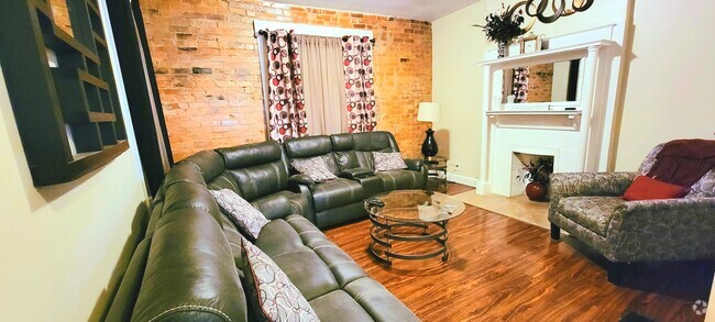
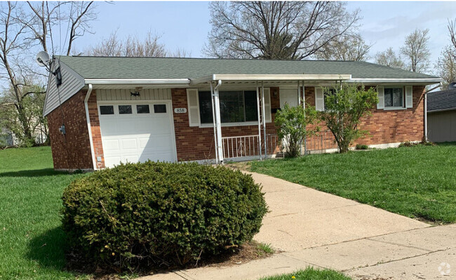
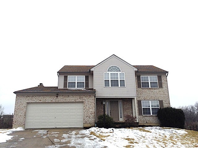
You May Also Like
Similar Rentals Nearby

What Are Walk Score®, Transit Score®, and Bike Score® Ratings?
Walk Score® measures the walkability of any address. Transit Score® measures access to public transit. Bike Score® measures the bikeability of any address.
What is a Sound Score Rating?
A Sound Score Rating aggregates noise caused by vehicle traffic, airplane traffic and local sources

3219 Glenmore Ave
Cincinnati, OH 45211