3211 School St
Oakland, CA 94602

Check Back Soon for Upcoming Availability
| Beds | Baths | Average SF |
|---|---|---|
| 1 Bedroom 1 Bedroom 1 Br | 1 Bath 1 Bath 1 Ba | 525 SF |
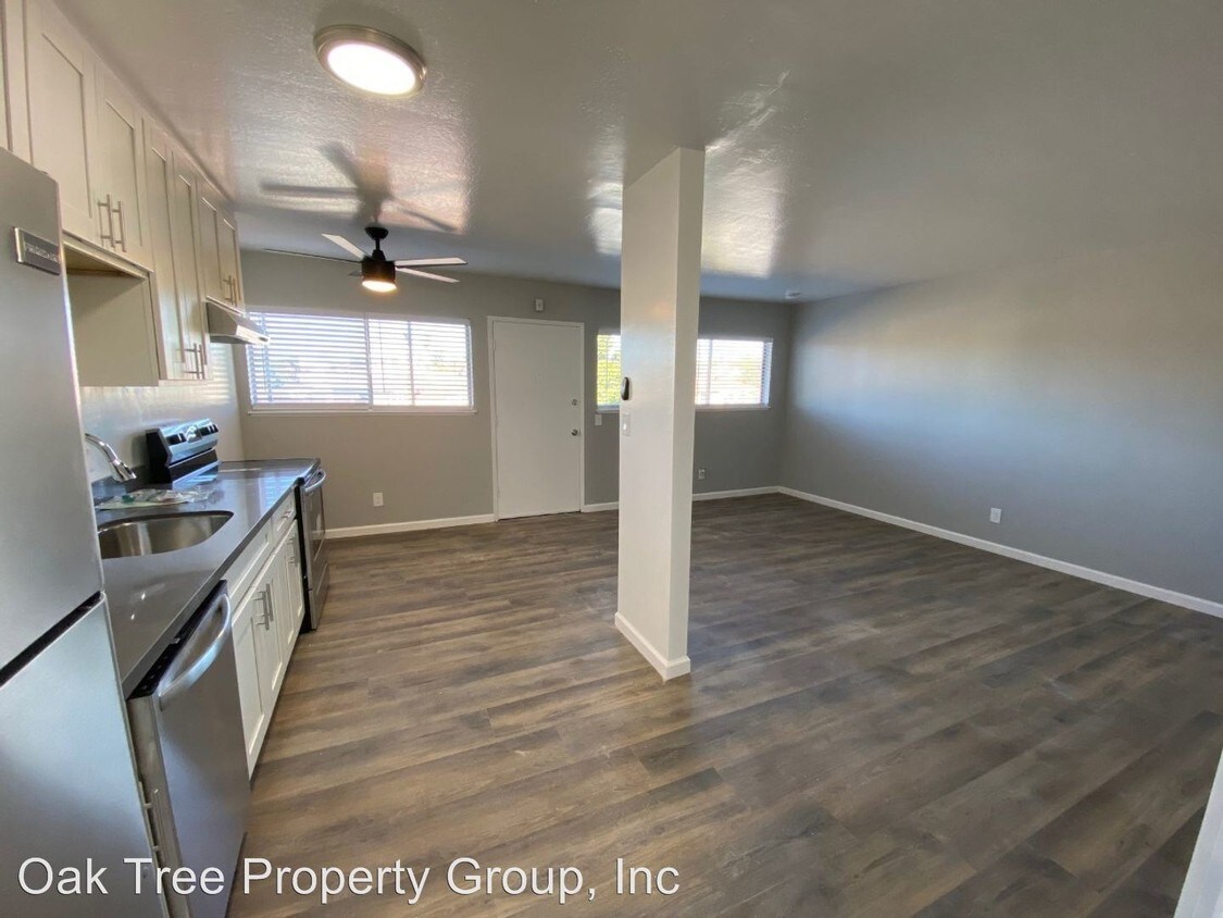
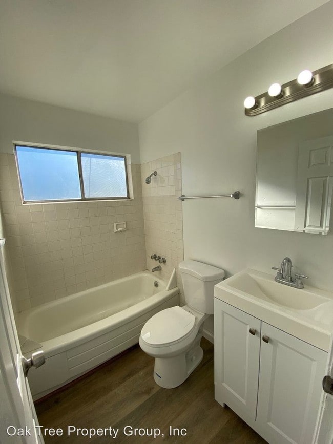
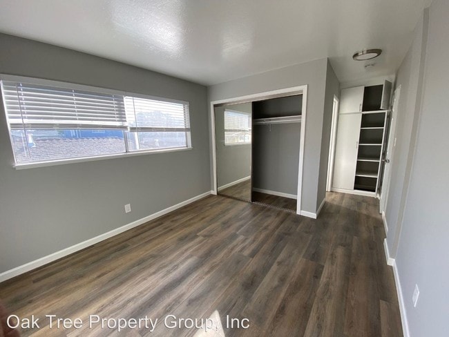
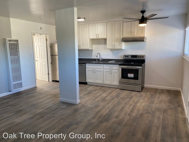
About This Property
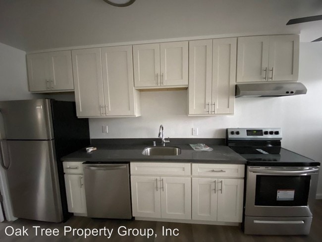
(510) 470-9281 - Brand New/full renovation - 1bdr. - Brand new! Completely Renovated! Nearby schools include Fruitvale Elementary School, St Jarlath Elementary School and Allendale Elementary School. Grocery stores are School Market, East Town Liquor Store and The Food Mill. Nearby coffee shops include Kasper's Hot Dogs, Peet's Coffee and Tea and Peet's Coffee. Nearby restaurants include China Pack Kitchen, Diamond Market and Tongan Kitchen. near Allendale Park, West D Wood Park and Peralta Hacienda Park. minimal bike lanes and the terrain is flat *Pet Deposit (2 pets max) - Pet Deposit/Pet Fee ** Parking/Storage (if available) - $50-$75 (monthly) ***Credit Scores below 620 may require co-sign and/or higher security deposit. **** As property owner or manager we do not discriminate in the rental of property on the basis of race, color, religion, sex, sexual orientation, disability, familial status, or national origin.” (RLNE5431152)
3211 School St is an apartment community located in Alameda County and the 94602 ZIP Code.
Upper Peralta Creek is a residential neighborhood comprised of colorful California bungalows, churches, and markets. Curtis Flood Field and Nicol Park rest just outside of Upper Peralta Creek. Farther down the Peralta Creek, the nearby Peralta Hacienda Historical Park pays homage to Native and Mexican American culture and history.
Peralta Creek and multiple bus routes are accessible from Upper Peralta Creek. About five miles from Downtown Oakland and all of its amenities, commuting from Upper Peralta Creek is simple with convenient access to I-580. Oakland International Airport is a mere eight miles south of the neighborhood, allowing for easy travels.
Learn more about living in Upper Peralta CreekBelow are rent ranges for similar nearby apartments
| Colleges & Universities | Distance | ||
|---|---|---|---|
| Colleges & Universities | Distance | ||
| Drive: | 7 min | 2.4 mi | |
| Drive: | 7 min | 3.7 mi | |
| Drive: | 9 min | 4.1 mi | |
| Drive: | 8 min | 4.2 mi |
Transportation options available in Oakland include Fruitvale Station, located 1.9 miles from 3211 School St. 3211 School St is near Metro Oakland International, located 7.7 miles or 13 minutes away, and San Francisco International, located 25.9 miles or 38 minutes away.
| Transit / Subway | Distance | ||
|---|---|---|---|
| Transit / Subway | Distance | ||
|
|
Drive: | 3 min | 1.9 mi |
|
|
Drive: | 8 min | 4.1 mi |
|
|
Drive: | 9 min | 4.1 mi |
|
|
Drive: | 8 min | 4.4 mi |
|
|
Drive: | 9 min | 4.7 mi |
| Commuter Rail | Distance | ||
|---|---|---|---|
| Commuter Rail | Distance | ||
|
|
Drive: | 9 min | 5.3 mi |
|
|
Drive: | 10 min | 6.9 mi |
|
|
Drive: | 13 min | 8.9 mi |
| Drive: | 20 min | 13.4 mi | |
| Drive: | 20 min | 13.5 mi |
| Airports | Distance | ||
|---|---|---|---|
| Airports | Distance | ||
|
Metro Oakland International
|
Drive: | 13 min | 7.7 mi |
|
San Francisco International
|
Drive: | 38 min | 25.9 mi |
Time and distance from 3211 School St.
| Shopping Centers | Distance | ||
|---|---|---|---|
| Shopping Centers | Distance | ||
| Walk: | 15 min | 0.8 mi | |
| Drive: | 3 min | 1.9 mi | |
| Drive: | 3 min | 1.9 mi |
| Parks and Recreation | Distance | ||
|---|---|---|---|
| Parks and Recreation | Distance | ||
|
Lakeside Park
|
Drive: | 5 min | 3.2 mi |
|
Rotary Nature Center
|
Drive: | 6 min | 3.6 mi |
|
Roberts Regional Recreation Area
|
Drive: | 9 min | 4.4 mi |
|
Chabot Space & Science Center
|
Drive: | 12 min | 5.0 mi |
|
Joaquin Miller Park
|
Drive: | 12 min | 5.2 mi |
| Hospitals | Distance | ||
|---|---|---|---|
| Hospitals | Distance | ||
| Walk: | 17 min | 0.9 mi | |
| Drive: | 4 min | 1.6 mi | |
| Drive: | 6 min | 3.9 mi |
| Military Bases | Distance | ||
|---|---|---|---|
| Military Bases | Distance | ||
| Drive: | 17 min | 7.5 mi | |
| Drive: | 17 min | 9.3 mi |
What Are Walk Score®, Transit Score®, and Bike Score® Ratings?
Walk Score® measures the walkability of any address. Transit Score® measures access to public transit. Bike Score® measures the bikeability of any address.
What is a Sound Score Rating?
A Sound Score Rating aggregates noise caused by vehicle traffic, airplane traffic and local sources

3211 School St
Oakland, CA 94602