
$1,295 / Month
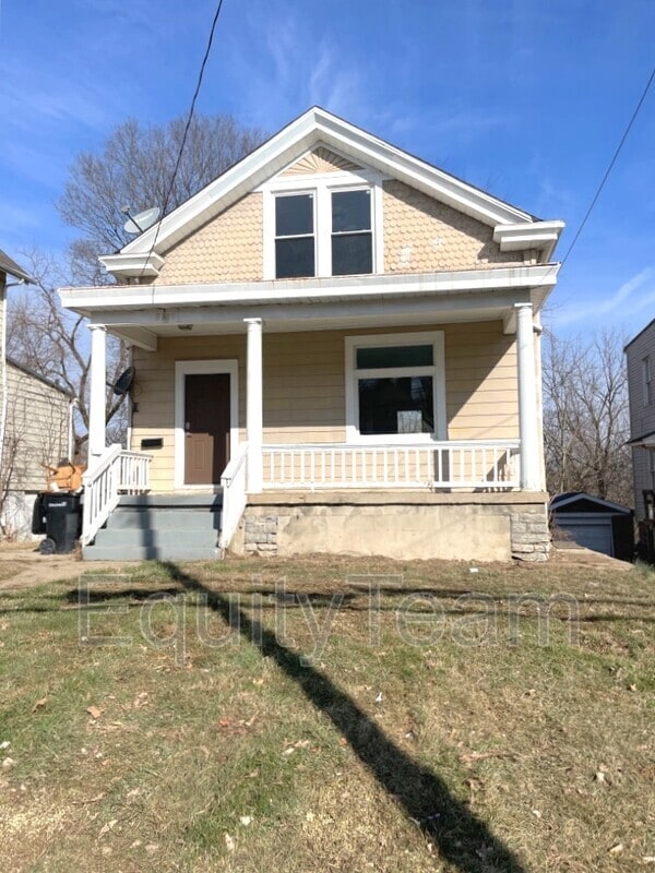
3185 McHenry Ave
Cincinnati, OH 45211
2 Weeks Ago
Favorites
3185 McHenry Ave

Favorites
Check Back Soon for Upcoming Availability
| Beds | Baths | Average SF |
|---|---|---|
| 3 Bedrooms 3 Bedrooms 3 Br | 1 Bath 1 Bath 1 Ba | 1,616 SF |
About This Property
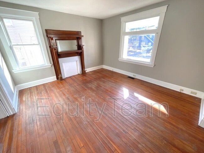
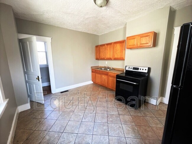
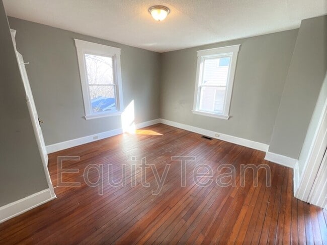
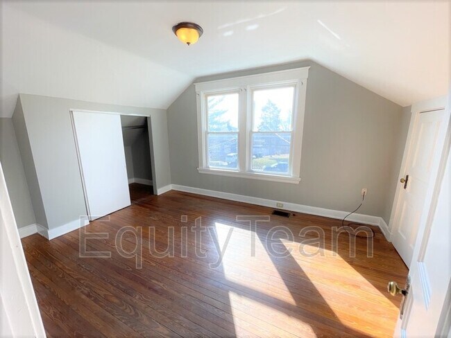
Conveniently located in Westwood, close to schools, parks, shopping and restaurants. Features include: fresh paint; original HW flooring throughout; kitchen w/walk-in pantry, spacious living room and dining area. Updated BA; full basement for extra storage; front porch, and more! *No Pets* *Deposit-Free option if Qualified* *For a 360 view, copy and paste this link: *For more information or to schedule a showing, please visit our website at * Tenant Onboarding Fee Tenant Benefits Package
3185 McHenry Ave is a house located in Hamilton County and the 45211 ZIP Code. This area is served by the Cincinnati Public Schools attendance zone.
Location
Get Directions
Situated about five miles northwest of Downtown Cincinnati, Westwood is the largest neighborhood in the city. Residents flock to Westwood for its many affordable historic homes and modern apartments available for rent in addition to its close proximity to I-74, I-75, and all that Downtown Cincinnati has to offer.
While Westwood is a predominantly residential neighborhood, it is also home to a slew of convenient stores and restaurants. Shopping opportunities abound in Westwood, with plenty of national retailers in Western Hills Plaza and local shops in the growing Town Hall District. Numerous neighborhood parks provide ample space to enjoy the outdoors in town as well as the sprawling 1,400-acre Mount Airy Forest, which is partially located in Westwood.
Learn more about living in WestwoodBelow are rent ranges for similar nearby apartments
| Beds | Average Size | Lowest | Typical | Premium |
|---|---|---|---|---|
| Studio Studio Studio | 440 Sq Ft | $725 | $764 | $875 |
| 1 Bed 1 Bed 1 Bed | 645-777 Sq Ft | $600 | $844 | $1,300 |
| 2 Beds 2 Beds 2 Beds | 883-884 Sq Ft | $775 | $1,172 | $1,695 |
| 3 Beds 3 Beds 3 Beds | 1311-1319 Sq Ft | $1,250 | $1,622 | $2,000 |
| 4 Beds 4 Beds 4 Beds | 1535 Sq Ft | $1,600 | $1,734 | $2,020 |
Education
| Colleges & Universities | Distance | ||
|---|---|---|---|
| Colleges & Universities | Distance | ||
| Drive: | 10 min | 3.8 mi | |
| Drive: | 9 min | 4.1 mi | |
| Drive: | 10 min | 4.5 mi | |
| Drive: | 16 min | 6.6 mi |
3185 McHenry Ave is within 10 minutes or 3.8 miles from Cincinnati State. It is also near University of Cincinnati and Univ. of Cincinnati, Medical.
Schools


Public Elementary School
Grades PK-6
409 Students
Attendance Zone
Public Middle & High School
Grades 7-12
897 Students
Attendance Zone
Public Middle & High School
Grades 6-12
1,418 Students
Attendance Zone
Private Elementary & Middle School
Grades K-8
189 Students
Nearby
Private Elementary & Middle School
Grades K-8
164 Students
Nearby
Private High School
Grades 9-12
495 Students
Nearby
School data provided by
 The GreatSchools Rating helps parents compare schools within a state based on a variety of school quality indicators and provides a helpful picture of how effectively each school serves all of its students. Ratings are on a scale of 1 (below average) to 10 (above average) and can include test scores, college readiness, academic progress, advanced courses, equity, discipline and attendance data. We also advise parents to visit schools, consider other information on school performance and programs, and consider family needs as part of the school selection process.
View GreatSchools Rating Methodology
Data provided by GreatSchools.org © 2025. All rights reserved.
View GreatSchools Rating Methodology
Data provided by GreatSchools.org © 2025. All rights reserved.
Transportation options available in Cincinnati include Brewery District Station, Elm & Henry, located 4.8 miles from 3185 McHenry Ave. 3185 McHenry Ave is near Cincinnati/Northern Kentucky International, located 18.8 miles or 34 minutes away.
| Transit / Subway | Distance | ||
|---|---|---|---|
| Transit / Subway | Distance | ||
| Drive: | 10 min | 4.8 mi | |
| Drive: | 11 min | 4.9 mi | |
| Drive: | 11 min | 5.0 mi | |
| Drive: | 11 min | 5.0 mi | |
| Drive: | 11 min | 5.1 mi |
| Commuter Rail | Distance | ||
|---|---|---|---|
| Commuter Rail | Distance | ||
|
|
Drive: | 10 min | 4.8 mi |
| Airports | Distance | ||
|---|---|---|---|
| Airports | Distance | ||
|
Cincinnati/Northern Kentucky International
|
Drive: | 34 min | 18.8 mi |
Time and distance from 3185 McHenry Ave.
| Shopping Centers | Distance | ||
|---|---|---|---|
| Shopping Centers | Distance | ||
| Drive: | 7 min | 2.5 mi | |
| Drive: | 7 min | 2.6 mi | |
| Drive: | 7 min | 3.0 mi |
3185 McHenry Ave has 3 shopping centers within 3.0 miles, which is about a 7-minute drive. The miles and minutes will be for the farthest away property.
| Parks and Recreation | Distance | ||
|---|---|---|---|
| Parks and Recreation | Distance | ||
|
Mt. Airy Forest
|
Drive: | 8 min | 3.1 mi |
|
Buttercup Valley
|
Drive: | 10 min | 4.0 mi |
|
Imago Earth Center
|
Drive: | 12 min | 4.3 mi |
|
Museum of Natural History and Science
|
Drive: | 10 min | 4.8 mi |
|
Wilson Commons
|
Drive: | 12 min | 4.8 mi |
3185 McHenry Ave has 5 parks within 4.8 miles, including Mt. Airy Forest, Buttercup Valley, and Imago Earth Center.
| Hospitals | Distance | ||
|---|---|---|---|
| Hospitals | Distance | ||
| Drive: | 7 min | 3.3 mi | |
| Drive: | 10 min | 4.1 mi | |
| Drive: | 10 min | 4.6 mi |
3185 McHenry Ave has 3 hospitals within 4.6 miles, the nearest is Good Samaritan Hospital which is 3.3 miles away and a 7 minute drive.
| Military Bases | Distance | ||
|---|---|---|---|
| Military Bases | Distance | ||
| Drive: | 72 min | 54.5 mi | |
| Drive: | 78 min | 59.5 mi | |
| Drive: | 81 min | 62.8 mi |
3185 McHenry Ave has 3 military bases within 62.8 miles, the nearest is Gentile Air Force Station which is 54.5 miles away and a 72 minute drive.
You May Also Like
Similar Rentals Nearby


What Are Walk Score®, Transit Score®, and Bike Score® Ratings?
Walk Score® measures the walkability of any address. Transit Score® measures access to public transit. Bike Score® measures the bikeability of any address.
What is a Sound Score Rating?
A Sound Score Rating aggregates noise caused by vehicle traffic, airplane traffic and local sources

3185 McHenry Ave
Cincinnati, OH 45211